Blank cartesian coordinate system in two dimensions. Rectangular orthogonal coordinate plane with axes X and Y on squared grid. Math scale template. Vector illustration isolated on white background.
Browse 2,700+ coordinate grid stock photos and images available, or search for map to find more great stock photos and pictures.
Blank cartesian coordinate system in two dimensions. Rectangular orthogonal coordinate plane with axes X and Y on squared grid. Math scale template. Vector illustration isolated on white background.

Vector blank dark sheet pattern with lines and dots
Abstract grid background with lines and dots. Black grid for motion graphic, VFX tracking markers and video effects. Vector

Dark square grid texture with dots, lines and cross markers. Empty blueprint grid with with crosses, dots and lines. Black texture of square graph paper. Vector illustration.

Grid paper. Mathematical graph. Cartesian coordinate system with x-axis, y-axis. Squared background with color lines. Geometric pattern for school, education. Lined blank on transparent background.

Geometric pattern with connected line and dots. Graphic background connectivity. Modern stylish polygonal backdrop for your design. Vector illustration

Blue lines and grids on a black background. Computer generated fractal image

Radar military technology war army weapon vector illustration.
Cartesian coordinate system in the plane from 0 to 5 on the graph grid paper. Vector.

Isometric grid line paper Isometric grid dots vector

Seamless square grid texture with dots and cross markers. Empty blueprint grid with with crosses and dots. Seamless texture of square graph paper. Vector illustration.

Blank cartesian coordinate system in two dimensions. Rectangular orthogonal coordinate plane with axes X and Y on squared grid. Math scale template. Vector illustration isolated on white background.

Earth realistic sphere with meridians and parallels. 3D vector illustration. Carefully layered and grouped for easy editing. You can edit or remove separately the grid, the sea the lands, the light and shadows.

Radar screen green neon map location with data information realistic vector illustration. Navigational equipment display guidance searching aiming direction security system coordination control panel

Sample of point plotting on Cartesian plane. Part of bidimensional coordinate system. Perpendicular X and Y axises with numbers. Grid paper background. Vector graphic illustration

Polar coordinate circular grid isolated on white background. 360 degrees scale. Blank polar graph paper. Vector illustration. Mathematical graph. Lined blank on transparent background.

Earth realistic shadowed sphere with meridians and parallels. 3D vector illustration. Carefully layered and grouped for easy editing. You can edit or remove separately the grid, the sea, the lands, the light and shadows.

Graph Paper XY Axis quarter inch squares printable template A4 notebook format. Graph coordinate worksheet for college, journals or math engineering grid line printable

Ocean topographic line map with curvy wave isolines vector illustration. Sea depth topographic landscape surface for nautical radar readings. Cartography texture abstract banner of relief ocean floor.

Vector illustration of mathematics system of coordinate. EPS 10.

Detailed geometric patterns overlaid on a city map, representing design concepts and urban planning. Circular and linear elements create an intricate interplay of geometry and structure.

Line graph data presentation with two different lines compared in one coordinate system. Vector illustration of graphic isolated on white background

Black x and y axes forming a right angle.

Two fighter jets icons identified and labeled on a radar simulation with green display, showing a glowing grid with coordinates and positioning numbers. Scanner axis is visible while spinning around the center. Warplane are targeted and identified with data and symbols, like in a video game. Copy space.
Vector wireframe sphere with editable stroke. Carefully layered and grouped for easy editing.

Ocean topographic line map with curvy wave isolines vector illustration. Sea depth topographic landscape surface for nautical radar readings. Cartography texture abstract banner of relief ocean floor.

Blue geometric pattern with connected lines and dots. Graphic background connectivity. Modern stylish polygonal backdrop communication compounds for your design. Lines plexus. Vector illustration

hand holding a compass over a map, isolated on white

Geometric abstract background with connected lines and dots. Connectivity flow point. Molecule and communication background. Graphic connection background for your design. Vector illustration

Blueprint grid seamless pattern on green background. Thin square lines and regular lattice. Notebook paper texture for architecture drafts and engineering layouts.

Geometry of Space series. Composition of conceptual grids, curves and fractal elements suitable as a backdrop for the projects on physics, mathematics, technology, science and education

Sea bottom. Marine topography. Ocean navigation map. Underwater relief. Line route. Topographic water contour blue grid. Current texture. Navy depth territory. Way direction. Vector pattern background

A 3D isometric graph with x, y, and z axes.

Line graph on Cartesian coordinate system plane. Statistics data diagram, finance linear chart. X and Y axises on grid paper background. Vector graphic illustration

Seamless, repeatable Squares grid, mesh, Graph, Plotting paper pattern, Regular Lattice, grate-grating, Trellis and grill with thin lines. Vector illustration. EPS 10.

Blank cartesian coordinate system vector. Two dimensional orthogonal grid with X and Y axes. Mathematical diagram template isolated on white background. Abstract geometry illustration . Vector illustration

Polar grid concentric circles and steps. Blank vector polar graph paper. Radar circular graph screen. Grid with concentric circles diagram. Vector illustration
A set of two different waving wireframed surfaces isolated on white background - Vector

Taiwan digital geographic map 3d render on coordinates grid intro news. East Asia country geographic background image 8K illustration opener

Polar coordinate circular grid isolated on white background. 360 degrees scale. Blank polar graph paper. Vector illustration. Mathematical graph. Lined blank on transparent background.
Comparison line icon set. Side-by-side compare, slider, A B test, file merge minimal vector illustrations. Simple outline signs for UI contrast analysis. 48x48 Pixel Perfect. Editable Stroke.

Map ocean sea chart line background pattern radar nautical sonar. Digital marine depth grid topology GPS 3D wireframe submarine. Scientific bathymetry oceanography data analysis elevation.
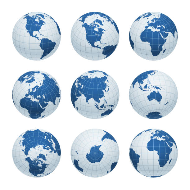
Earth nine views: Directly above, directly bellow, front view on the prime meridian, and different angles focusing on the Americas, Africa, Asia, Europe, Oceania, North and South poles, Antarctica. Carefully layered and grouped for easy editing. You can edit or remove separately the grid, the sea the lands, the light and shadows.

Polar grid of 10 concentric circles and 5 degrees steps. Blank vector polar graph paper.

Matrix chart with 4 rectangular paper white cells arranged in rows and columns. Table with four options to choose. Clean infographic design template. Vector illustration for business presentation.


