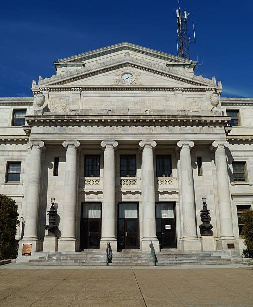
Delaware County Courthouse in Media, Pennsylvania representing a typical American courthouse building
Browse 670+ delaware county stock photos and images available, or search for delaware county pennsylvania or delaware county courthouse to find more great stock photos and pictures.
Delaware County Courthouse in Media, Pennsylvania representing a typical American courthouse building

Media, Pennsylvania, USA - Jan 1, 2023: A SEPTA tram is going through Media historic downtown on the new year day of 2023

Aerial shot of Haverford, a town in Delaware County, Pennsylvania to the west of Philadelphia on an overcast day in fall. The downtown Philadelphia skyline is visible in the distance. Haverford is one of the towns of the Philadelphia Main Line.
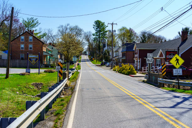
Unionville, PA, USA - April 6, 2021: The main road, known as Route 82, through the community of Unionville in southern Chester County, PA.
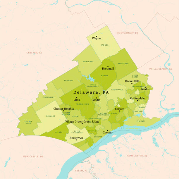
PA Delaware County Vector Map Green. All source data is in the public domain. U.S. Census Bureau Census Tiger. Used Layers: areawater, linearwater, cousub, pointlm.

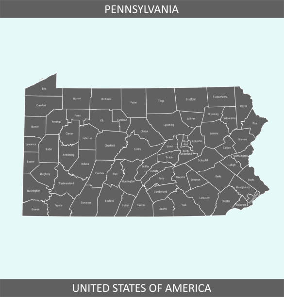
Printable counties map of Pennsylvania state of United States of America. The map is accurately prepared by a map expert.

Delaware County Courthouse in Media, Pennsylvania representing a typical American courthouse building

Port Chester is a village in Westchester County, New York, United States

A cantilever bridge that spans the Delaware River from Chester, Pennsylvania to Bridgeport, in Logan Township, New Jersey

Downloadable county map of New York state of United States of America. The map is accurately prepared by a map expert.

West Chester, PA, USA - August 5, 2020: The entrance to the QVC Studios. QVC shopping channel was founded in 1986, and broadcasts to more than 350 million households in seven countries.

Colorful Autumn sunset on the Pepacton Reservoir seen from the Shaverton Trail in Andes in the Catskills Mountains of New York.

Port Chester is a village in Westchester County, New York, United States. Port Chester is a part of the Greater New York City metropolitan area

Kayaks, canoes and row boats lined up on the shore of Little Pond state campground in the Catskills Mountains of New York.
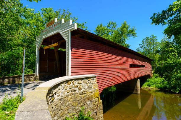
Phoenixville, PA, USA - June 14, 2020: The Sheeder-Hall Bridge is a 100-foot-long covered bridge in Chester County. It crosses French Creek and was constructed in 1850.

Millbrook Bridge, AKA Grant Mills Bridge, is a Town lattice truss design bridge built in 1902, spanning Mill Brook in Delaware County, New York

Map of Delaware County - Pennsylvania, on a blue and red colored background. The blue color represents the Democratic Party and the red color represents the Republican Party. White stars are placed above and below the map. Vector Illustration (EPS file, well layered and grouped). Easy to edit, manipulate, resize or colorize. Vector and Jpeg file of different sizes.

Highly detailed downloadable and printable map of Pennsylvania county state of United States of America for web banner, mobile, smartphone, iPhone, iPad applications and educational use. The map is accurately prepared by a map expert.

Hamden Covered Bridge set against a colorful Autumn hillside in the Catskills Mountains on New York

History of the United States by E. Benjamin Andrews - Charles Scribners Son, New York 1895
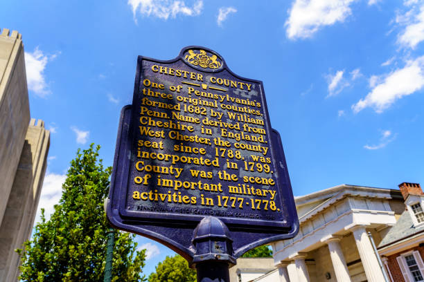
West Chester, PA, USA - August 5, 2020: A Pennsylvania Historical Marker Sign noting the formation of Chester Couty by William Penn.

Aerial shot of Haverford, a town in Delaware County, Pennsylvania to the west of Philadelphia on an overcast day in fall. The downtown Philadelphia skyline is visible in the distance. Haverford is one of the towns of the Philadelphia Main Line.
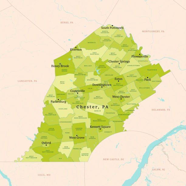
PA Chester County Vector Map Green. All source data is in the public domain. U.S. Census Bureau Census Tiger. Used Layers: areawater, linearwater, cousub, pointlm.

the landmark Dingmans falls in the delaware water gap on a sunny day in Eastern Pennsylvania.

Flag of american state of Pennsylvania, region of the United States, waving at wind
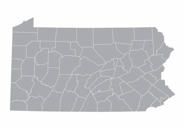
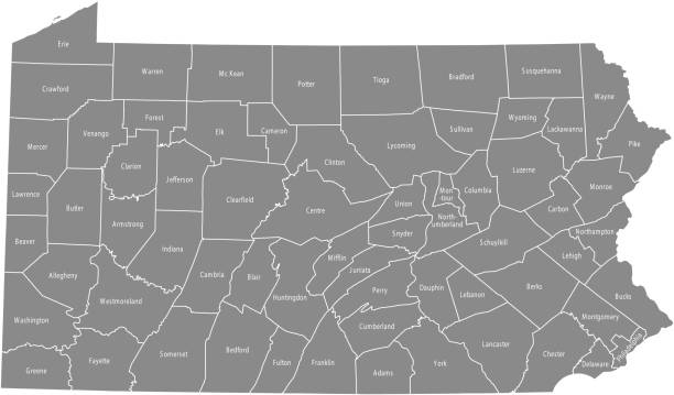
A gray Map of Pennsylvania and its counties

Aerial shot of Haverford, a town in Delaware County, Pennsylvania to the west of Philadelphia on an overcast day in fall. The downtown Philadelphia skyline is visible in the distance. Haverford is one of the towns of the Philadelphia Main Line.

19th century map of Pennsylvania. Published in New Dollar Atlas of the United States and Dominion of Canada. (Rand McNally & Co's, Chicago, 1884).

Bridge in the city of delaware during a cotton candy background

The municipal building of Concord Township in Garnet Valley, west suburb of Philadelphia, Pennsylvania, USA
The map is accurately prepared by a map expert.

Pennsylvania counties, gray political map. Commonwealth of Pennsylvania, a state of the Mid-Atlantic and Northeastern United States, subdivided into 67 counties. Map with boundaries and county names.

Accurate outline vector map in gray background prepared by a map expert.

Close up on an antique map of the county of Delaware, state of Iowa. Published in 1884; Rand McNally and Co; Chicago. Selective focus and Canon EOS 5D Mark II with MP-E 65mm macro lens.

Embreeville, PA, USA - April 6, 2021: A rural country road in springtime near the west branch of the Brandywine Creek in Chester County, PA.

Colorful Autumn trees reflected in calm Snake Pond on the Shaverton Trail near Andes in the Catskills Mountains of New York.
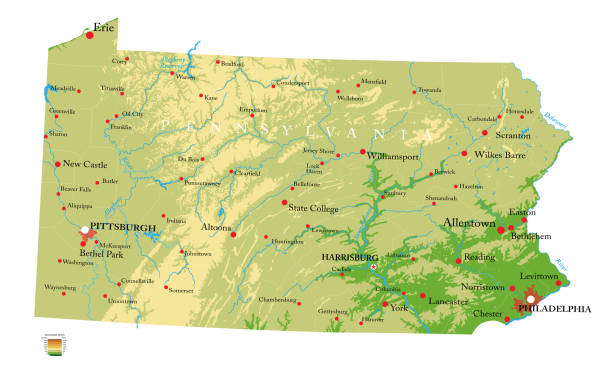
Highly detailed physical map of the Pennsylvania, in vector format,with all the relief forms,regions and big cities.

Exton, PA, USA - May 10, 2022: Rita's Italian Ice is a privately owned quick-service restaurant chain. There are over 500 restaurants in 31 states, most located in the Mid-Atlantic.

Flag of american state of Pennsylvania, region of the United States, waving at wind

The map is accurately prepared by a map expert.

The maps are accurately prepared by a GIS and remote sensing expert.

The maps are accurately prepared by a GIS and remote sensing expert.

Suburban house with snow in Chadds Ford, Delaware County, Pennsylvania

Printable map of Pennsylvania state of United States of America. The map is accurately prepared by a map expert.

Aerial shot of Haverford, a town in Delaware County, Pennsylvania to the west of Philadelphia on an overcast day in fall. The downtown Philadelphia skyline is visible in the distance. Haverford is one of the towns of the Philadelphia Main Line.