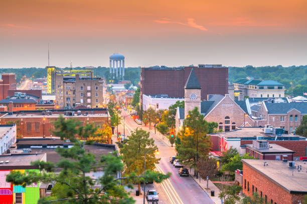
Columbia, Missouri, USA downtown city skyline at twilight.
Browse 60+ downtown columbia mo stock photos and images available, or start a new search to explore more stock photos and images.
Columbia, Missouri, USA downtown city skyline at twilight.

Columbia, Missouri, USA downtown city skyline at twilight.

Columbia, Missouri, USA downtown city skyline at twilight.

Columbia is a city in Missouri, United States. It was founded in 1821 as the county seat of Boone County
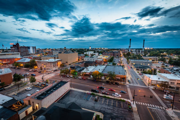
Downtown Columbia, Missouri at Sunset with blue clouds.

View of Midwestern town at sunrise early in spring

View looking westward down Broadway Boulevard with local businesses in Columbia, Missouri

Columbia, Missouri, USA at Boone County Courthouse in the afternoon.

Columbia is a city in Missouri, United States. It was founded in 1821 as the county seat of Boone County

Columbia is a city in Missouri, United States. It was founded in 1821 as the county seat of Boone County

Vancouver's vibrant downtown core as seen from Stanley Park.

Columbia is a city in Missouri, United States. It was founded in 1821 as the county seat of Boone County

A dusk photo of Columbia, Missouri, home of University of Missouri - Mizzou

Columbia, Missouri, USA, March 3, 2018: The Tiger Hotel is a luxary, boutique hotel located in downtown Columbia, Missouri.

Columbia is a city in Missouri, United States. It was founded in 1821 as the county seat of Boone County

Stoplight with Broadway sign in downtown Columbia, Missouri

Historic Mizzou college campus in downtown Columbia, MO

Columbia is a city in Missouri, United States. It was founded in 1821 as the county seat of Boone County

capitol building with green grass and cloudy sky as copy space

Wide drone shot of the Kansas City skyline featuring Union Station in the foreground, with modern buildings and urban sprawl under vibrant skies.

a modern building in front of a nice blue sky

Mackinac city marina on lake Huron shore in Michigan

A dusk photo of Columbia, Missouri, home of University of Missouri - Mizzou

Front of the city hall in Columbia, Missouri, USA, with blue sky reflecting in the windows

Columbia, Missouri - May 4, 2021: Old classic neon sign for the Arrowhead Motel, now abandoned

Vector Illustration of a City Street Map of Columbia, Missouri, USA. Scale 1:60,000. All source data is in the public domain. U.S. Geological Survey, US Topo Used Layers: USGS The National Map: National Hydrography Dataset (NHD) USGS The National Map: National Transportation Dataset (NTD)

A dusk photo of Columbia, Missouri, home of University of Missouri - Mizzou

Downtown Columbia, Missouri at Sunset with blue clouds.

Columbia is a city in Missouri, United States. It was founded in 1821 as the county seat of Boone County

Huge bunches of grapes lie on the counter of a large store in Granville Island Red and green grapes are very appetizing and healthy Natural product for delicious food

At the bazaar in containers appetizing green grapes kishmish shimmers in the sun Appetizing healthy fruit Vegetarian food at the bazaar Granville Island Don not deny yourself anything

Columbia is a city in Missouri, United States. It was founded in 1821 as the county seat of Boone County

Columbia is a city in Missouri, United States. It was founded in 1821 as the county seat of Boone County

Dramatic repetitive clouds and sunset in downtown Columbia, Missouri at Sunset. Photographed from a parking garage in downtown Columbia looking west.

Historic college campus building in Columbia, Missouri

Poster Style Topographic / Road map of Columbia, MO. Map data is public domain via census.gov. All maps are layered and easy to edit. Roads are editable stroke.

washington monument at night with reflection

Huge bunches of grapes lie on the counter of a large store in Granville Island Red and green grapes are very appetizing and healthy Natural product for delicious food

modern building with a blue sky and green trees

Poster Style Topographic / Road map of Columbia, MO. Map data is public domain via census.gov. All maps are layered and easy to edit. Roads are editable stroke.

Poster Style Topographic / Road map of Columbia, MO. Map data is public domain via census.gov. All maps are layered and easy to edit. Roads are editable stroke.

Topographic / Road map of Columbia, MO. Map data is public domain via census.gov. All maps are layered and easy to edit. Roads are editable stroke.

A dusk photo of Columbia, Missouri, home of University of Missouri - Mizzou

Columbia, Missouri, USA downtown city skyline at twilight.


