Images
Browse 6,600+ dublin ireland landscape stock photos and images available, or start a new search to explore more stock photos and images.
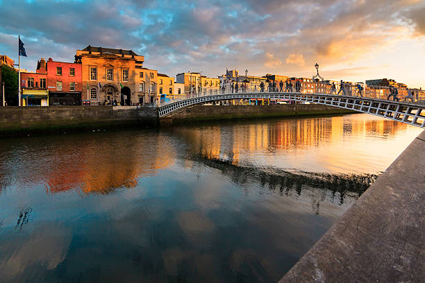

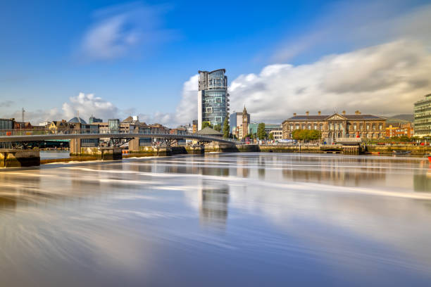
River Liffey in Dublin, Ireland, reflecting colorful evening skies. The Ha'penny Bridge, an iconic white cast-iron pedestrian bridge, crosses the river. Historic buildings line the riverbanks with a mix of traditional facades and modern structures. Streetlights illuminate the scene, enhancing the reflections on the water. Trees with lush foliage are visible along the quay. The sky is painted with pink, orange, and blue hues, creating a picturesque backdrop for this urban landscape.
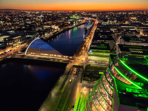
Dublin city at night with lights on and the sunset
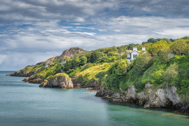
Turquoise coloured Irish Sea, small rocky islands, Howth cliff walk with some residential houses and lush green vegetation, Dublin, Ireland
Our creative library is free of AI-generated contentChoose your visuals with confidence knowing our creative library is free from AI-generated content, so your searches only return safe, high-quality visuals you can trust.

Aerial view of Glendalough ruins in Wicklow Ireland, Aerial view of Glendalough monastery, aerial view of Glendalough upper and lower lakes in Ireland, aerial view of ireland nature, popular tourist destination in IrelandGlendalough is a glacial valley in County Wicklow, Ireland, renowned for an Early Medieval monastic settlement founded in the 6th century by St Kevin. From 1825 to 1957, the head of the Glendalough Valley was the site of a galena lead mine. Glendalough is also a recreational area for picnics, for walking along networks of maintained trails of varying difficulty, and also for rock climbing.

Poolbeg Lighthouse is an active aid to navigation at the mouth of the River Liffey, near Poolbeg in Dublin, Ireland. First established in 1767, it initially operated on candlepower but this was changed to oil in 1786. It was re-designed and re-built into its present form in 1820. Dublin-Ireland

epic sunset at the cliffs of moher in county clare, ireland. beautiful evening scenic view from the wild atlantic way

Aerial view Skerries is a coastal town in Fingal, Ireland. Historically Skerries was a fishing port and later a centre of hand embroidery. Dublin Ireland St. Patrick's colt shenick islands

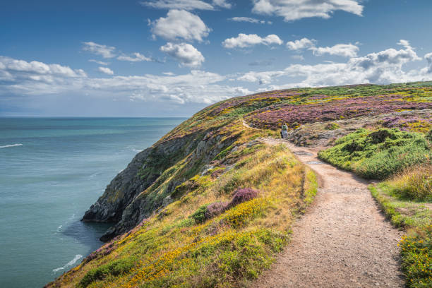
People hiking between colourful heathers, ferns and yellow flowers on Howth cliff walk surrounded by turquoise coloured Irish Sea, Dublin, Ireland

A woman hiker on the wooden path looking towards Lough Tay walk in the Wicklow Mountains National Park
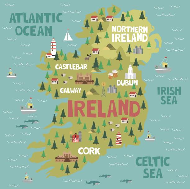
Illustrated map of Ireland with nature and landmarks. Editable vector illustration


Aerial view of cathedral and park from Saint Patrick's Park-Dublin, Aerial view of historic St. Patrick's Cathedral in the heart of Ireland, Christ Church Cathedral, Aerial view of people walking in saint Patrick park, Public park fountainSaint Patrick's Cathedral in Dublin, Ireland, founded in 1191 as a Roman Catholic cathedral, is currently the national cathedral of the Church of Ireland. Christ Church Cathedral, also a Church of Ireland cathedral in Dublin, is designated as the local cathedral of the Diocese of Dublin and Glendalough.

aerial view of wicklow mountain in ireland, aerial view of ireland nature, popular tourist destination in ireland, aerial view of the river flowing through wicklow mountain, Aerial view of beautiful valley and river in the mountainsThe Wicklow Mountains form the largest continuous upland area in Ireland. They occupy the whole centre of County Wicklow and stretch outside its borders into the counties of Dublin, Wexford and Carlow. Where the mountains extend into County Dublin, they are known locally as the Dublin Mountains. The highest peak is Lugnaquilla at 925 metres The mountains are primarily composed of granite surrounded by an envelope of mica-schist and much older rocks such as quartzite. They were pushed up during the Caledonian orogeny at the start of the Devonian period and form part of the Leinster Chain, the largest continuous area of granite in Ireland and Britain. The mountains owe much of their present topography to the effects of the last ice age, which deepened the glens and created corrie and ribbon lakes. Copper and lead have been the main metals mined in the mountains and a brief gold rush occurred in the 18th century. Several major river systems have their source in the mountains, such as the Liffey, Dargle, Slaney and Avoca rivers. Powerscourt Waterfall is the second tallest in Ireland at 121 metres (397 feet). A number of these rivers have been harnessed to create reservoirs for drinking water for Dublin and its surroundings.

Aerial view Hook Head Lighthouse/ Hook Head/ Costal lighthouse at Hook Head in County Wexford - Ireland
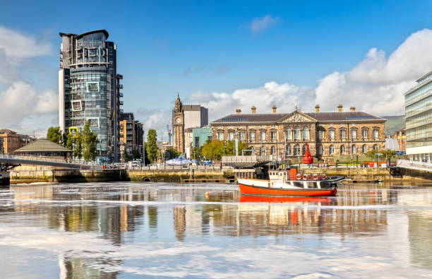
Long Exposure over the Lagan River over to the Custom House in Belfast, Northern Ireland

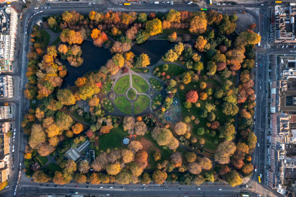
The Wellington Monument or sometimes the Wellington Testimonial, is an obelisk located in the Phoenix Park, Dublin, Ireland.The testimonial is situated at the southeast end of the Park, overlooking Kilmainham and the River Liffey. The structure is 62 metres (203 ft) tall, making it the largest obelisk in Europe.The Phoenix Park is a large urban park in Dublin, Ireland, lying 2–4 kilometres (1.2–2.5 mi) west of the city centre, north of the River Liffey. Its 11 kilometres (6.8 mi) perimeter wall encloses 707 hectares (1,750 acres) of recreational space. It includes large areas of grassland and tree-lined avenues, and since the 17th century has been home to a herd of wild fallow deer. The Irish Government is lobbying UNESCO to have the park designated as a World Heritage Site.

Historical view of Dublin - capital and largest city of Ireland. Left side the Wellington Monument. Steel engraving, published in 1836.

Traveler woman with her backpack admiring the landscape of Dublin Bay, Ireland


Aerial view of the Obelisk on Killiney Hill in Wicklow-Ireland, Killiney Obelisk, popular tourist destinations in ireland, people enjoy the view next to the monument on the hill, view hillThe Killiney Obelisk was built in 1742 to commemorate what is described as ‘the Year of the Slaughter’ or Ireland’s forgotten famine. In 1740 there was an incredibly cold winter which was followed by a severe summer of rain and floods. This wiped out the crops and killed off livestock. The following winter was again BALTIC with temperatures not getting above minus 10 for a month. It was so cold that small vessels were destroyed by icebergs on the River Liffey, street lamps could not be lit plunging towns and villages into darkness and food riots were common throughout the land. Many of the oldest trees were also felled for fuel and sickness was common all over. Reports suggest that up to 480,000 may have people died during this forgotten famine. A small number of rich landlords like John Malpas of Killiney Hill and Kathryn Connolly of Castletown House commissioned famine relief projects like this one to provide employment to destitute families. Ironically this monument now overlooks the wealthiest part of Ireland.

Aerial view of cathedral and park from Saint Patrick's Park-Dublin, Aerial view of historic St. Patrick's Cathedral in the heart of Ireland, Christ Church Cathedral, Aerial view of people walking in saint Patrick park, Public park fountainSaint Patrick's Cathedral in Dublin, Ireland, founded in 1191 as a Roman Catholic cathedral, is currently the national cathedral of the Church of Ireland. Christ Church Cathedral, also a Church of Ireland cathedral in Dublin, is designated as the local cathedral of the Diocese of Dublin and Glendalough.

Hook Head Lighthouse/ Hook Head/ Costal lighthouse at Hook Head in County Wexford - Ireland

A scenic mountainous landscape in the background, the sky is filled with moody clouds, and the overall atmosphere conveys a sense of adventure and appreciation for nature. The wind gently moves her hair, adding a dynamic touch to the peaceful and uplifting moment.

Green Irish skies outside of Dublin


1980s old Positive Film scanned, the view of Dargle river, Dublin, Ireland.


Aerial view of the Obelisk on Killiney Hill in Wicklow-Ireland, Killiney Obelisk, popular tourist destinations in ireland, people enjoy the view next to the monument on the hill, view hillThe Killiney Obelisk was built in 1742 to commemorate what is described as ‘the Year of the Slaughter’ or Ireland’s forgotten famine. In 1740 there was an incredibly cold winter which was followed by a severe summer of rain and floods. This wiped out the crops and killed off livestock. The following winter was again BALTIC with temperatures not getting above minus 10 for a month. It was so cold that small vessels were destroyed by icebergs on the River Liffey, street lamps could not be lit plunging towns and villages into darkness and food riots were common throughout the land. Many of the oldest trees were also felled for fuel and sickness was common all over. Reports suggest that up to 480,000 may have people died during this forgotten famine. A small number of rich landlords like John Malpas of Killiney Hill and Kathryn Connolly of Castletown House commissioned famine relief projects like this one to provide employment to destitute families. Ironically this monument now overlooks the wealthiest part of Ireland.

Newgrange is a prehistoric monument in County Meath in Ireland, located on a rise overlooking the River Boyne, 8 kilometres (5.0 mi) west of the town of Drogheda. It is an exceptionally grand passage tomb built during the Neolithic Period, around 3200 BC, making it older than Stonehenge and the Egyptian pyramids. Newgrange is the main monument in the Brú na Bóinne complex, a World Heritage Site that also includes the passage tombs of Knowth and Dowth, as well as other henges, burial mounds and standing stones.

Aerial view of cathedral and park from Saint Patrick's Park-Dublin, Aerial view of historic St. Patrick's Cathedral in the heart of Ireland, Christ Church Cathedral, Aerial view of people walking in saint Patrick park, Public park fountainSaint Patrick's Cathedral in Dublin, Ireland, founded in 1191 as a Roman Catholic cathedral, is currently the national cathedral of the Church of Ireland. Christ Church Cathedral, also a Church of Ireland cathedral in Dublin, is designated as the local cathedral of the Diocese of Dublin and Glendalough.

The Wellington Monument or sometimes the Wellington Testimonial, is an obelisk located in the Phoenix Park, Dublin, Ireland.The testimonial is situated at the southeast end of the Park, overlooking Kilmainham and the River Liffey. The structure is 62 metres (203 ft) tall, making it the largest obelisk in Europe.The Phoenix Park is a large urban park in Dublin, Ireland, lying 2–4 kilometres (1.2–2.5 mi) west of the city centre, north of the River Liffey. Its 11 kilometres (6.8 mi) perimeter wall encloses 707 hectares (1,750 acres) of recreational space. It includes large areas of grassland and tree-lined avenues, and since the 17th century has been home to a herd of wild fallow deer. The Irish Government is lobbying UNESCO to have the park designated as a World Heritage Site.

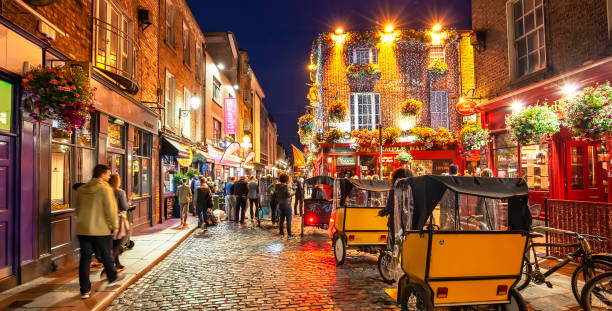
Dublin, Ireland - 15 June, 2021: Panoramic view of night old town in Temple Bar area, young people walking on busy night street with pubs and bars


Young girl feeding multiple Fallow Deer with large antlers, with blurred forest in the background in Phoenix Park, Dublin, Ireland


Aerial view of the Obelisk on Killiney Hill in Wicklow-Ireland, Killiney Obelisk, popular tourist destinations in ireland, people enjoy the view next to the monument on the hill, view hill, The woman watching the view on the pyramidsThe Killiney Obelisk was built in 1742 to commemorate what is described as ‘the Year of the Slaughter’ or Ireland’s forgotten famine. In 1740 there was an incredibly cold winter which was followed by a severe summer of rain and floods. This wiped out the crops and killed off livestock. The following winter was again BALTIC with temperatures not getting above minus 10 for a month. It was so cold that small vessels were destroyed by icebergs on the River Liffey, street lamps could not be lit plunging towns and villages into darkness and food riots were common throughout the land. Many of the oldest trees were also felled for fuel and sickness was common all over. Reports suggest that up to 480,000 may have people died during this forgotten famine. A small number of rich landlords like John Malpas of Killiney Hill and Kathryn Connolly of Castletown House commissioned famine relief projects like this one to provide employment to destitute families. Ironically this monument now overlooks the wealthiest part of Ireland.

St. Patricks Park with St Patrick's Cathedral in Dublin, Ireland.


7th July 2023, Dublin Ireland. Government Buildings (the Irish Dail) on Kildare Street with security barrier raised.

A busy nightlife of the Temple Bar area of Dublin, Ireland. Temple Bar is a very popular historic quarter of Dublin filled with pubs, restaurants and music venues.


Hook Head Lighthouse/ Hook Head/ Costal lighthouse at Hook Head in County Wexford - Ireland

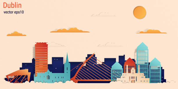
Dublin city colorful paper cut style, vector stock illustration. Cityscape with all famous buildings. Skyline Dublin city composition for design

The Wellington Monument or sometimes the Wellington Testimonial, is an obelisk located in the Phoenix Park, Dublin, Ireland.The testimonial is situated at the southeast end of the Park, overlooking Kilmainham and the River Liffey. The structure is 62 metres (203 ft) tall, making it the largest obelisk in Europe.The Phoenix Park is a large urban park in Dublin, Ireland, lying 2–4 kilometres (1.2–2.5 mi) west of the city centre, north of the River Liffey. Its 11 kilometres (6.8 mi) perimeter wall encloses 707 hectares (1,750 acres) of recreational space. It includes large areas of grassland and tree-lined avenues, and since the 17th century has been home to a herd of wild fallow deer. The Irish Government is lobbying UNESCO to have the park designated as a World Heritage Site.
Long Exposure over the Lagan River over to the Custom House in Belfast, Northern Ireland

a commuter train can be seen on the new railway tunnel and track on coastal railway Wicklow Ireland - the famous coastal railway between Bray and Greystones near Dublin, Ireland. The original coast railway had been badly eroded and was replaced by a new tunnel system devised by Isambard Kingdom Brunel, and hampered by the very tough granite cliffs. The current railway hosts the Dublin Area Rapid Transit (DART) commuter light railway. Dublin Bay and Howth peninsula can be seen in the background. The famous scenic coastal path can be seen on the cliffs above the railway line.

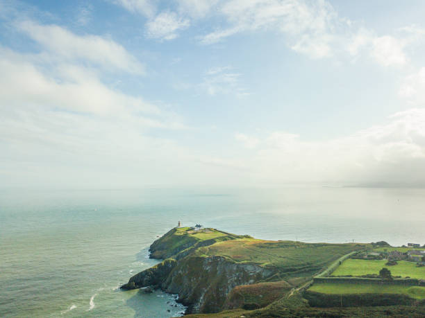
Howth Head with Baily Lighthouse, Dublin, Ireland

Malahide, Ireland - September 15 2022: The Marina suburban housing estates. Malahide is a coastal settlement in Fingal, County Dublin, 14 kilometres north of Dublin city.

Dublin, Ireland - November 8, 2018: Temple Bar area. Traditional irish houses. Brown vintage block walls, reflections in windows, sidewalk along famous Liffey's riverside. Red color signal for vehicles. Romantic scene in fall season.
of100Next