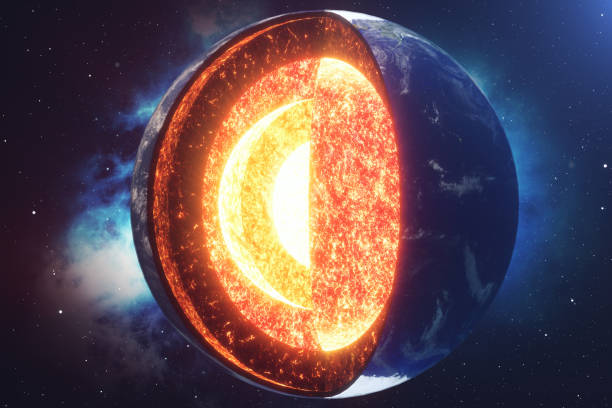
Structure of the Earth, 3d section of the earth. Layers. 3d render. Crust, mantle and core. Cross section, visualization of the composition of the Earth in geological terms
Browse 210+ earth crust mantle stock photos and images available, or start a new search to explore more stock photos and images.
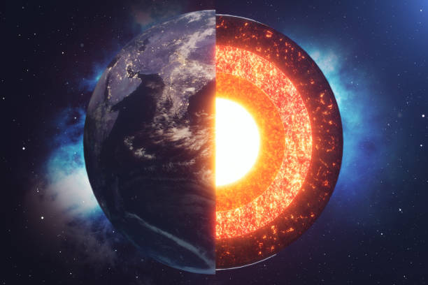
Structure of the Earth, 3d section of the earth. Layers. 3d render. Crust, mantle and core. Cross section, visualization of the composition of the Earth in geological terms
Structure of planet Earth in space, 3D rendering. The source of the map - https://svs.gsfc.nasa.gov/3615

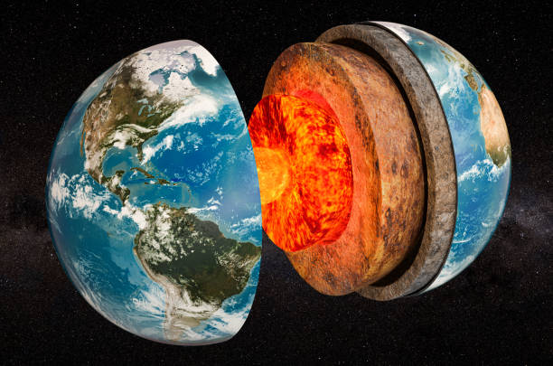
internal geological structure of the earth separated into layers isolated over a white background. 3D rendering

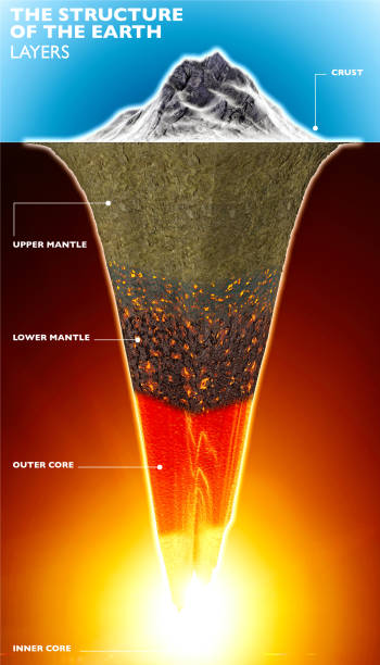
Diagram of the interior layer of Earth. Structure of the Earth infographic.

Structure of earth. Diagram of the interior layer of Earth. Geological of earth structure 3d rendering.

Structure of planet Earth with atmosphere layer concept, 3D rendering isolated on white background. The source of the map - https://svs.gsfc.nasa.gov/3615

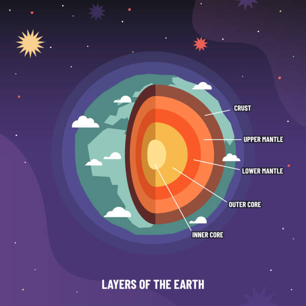
The layers of the earth concept illustration

Lithosphere earth layers structure. Planet geology school scheme. Geography infographics with cross section diagram. Earth inside model, internal mantle level. For education and science use.

Structure of planet Earth concept, 3D rendering isolated on white background. The source of the map - https://svs.gsfc.nasa.gov/3615

Lithosphere earth layers structure. Planet geology school scheme. Geography infographics with cross section diagram. Earth inside model, internal mantle level. For education and science use.

Earth cross section showing its internal structure. Digital illustration, 3D render. Earth texture from Nasa (https://visibleearth.nasa.gov/images/73909/december-blue-marble-next-generation-w-topography-and-bathymetry/73911l)
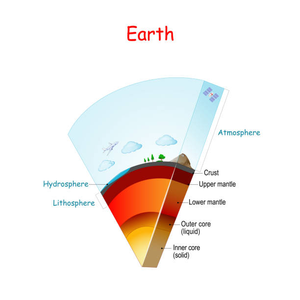
Earth structure and layers. From Lithosphere and Hydrosphere to atmosphere. Earth internal structure: core (solid, liquid), mantle (Lower, Upper) and crust. cross section. Vector diagram
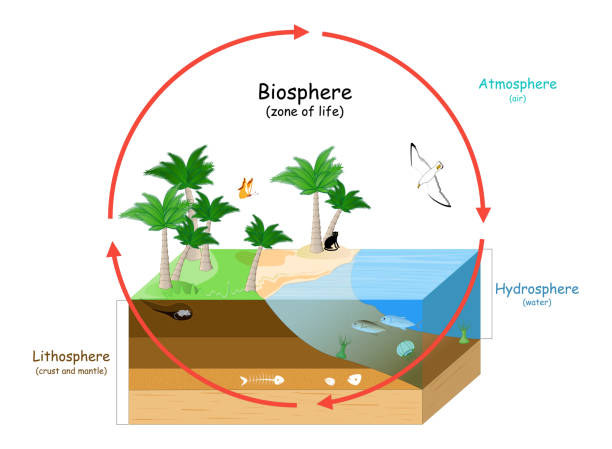
Biosphere is a zone of life on Earth. natural ecosystems with wildlife. Ecosphere (environment), Hydrosphere (water), Atmosphere (air), and Lithosphere (crust and the portion of the upper mantle). vector illustration for education
sphere with cutout core icon. elements of space icon. signs, symbols collection, simple icon for websites, web design, mobile app on sky background
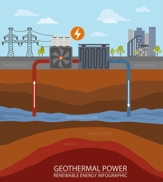
Renewable energy infographic. Geothermal power. Global environmental problems. Vector illustration
Earth geosphere layers structure. Planet geology infographic, asthenosphere school scheme and levels from crust to core vector illustration. Different sections of globe as upper and lower mantle

The structure of the earth's crust. Earth cross section in space view. "Elements of this image furnished by NASA" Earth 1 : https://earthobservatory.nasa.gov/resources/blogs/earthday_day_lrg.jpg Earth 2 : https://earthobservatory.nasa.gov/ContentFeature/NightLights/images/media/BlackMarble_2016_Americas_composite.png Stars : https://esahubble.org/images/heic0910t/ Stars 2 : https://esahubble.org/images/heic1112e/
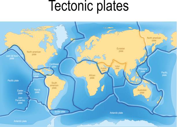
tectonic plates. World map with major an minor plates. Vector illustration.

Tectonic plate. Earth's lithosphere. scientific theory. world map with major an minor plates. Vector illustration.
Map of the principal tectonic plates of the Earth. The sixteen major pieces of crust and uppermost mantle of the Earth, called the lithosphere, and consisting of oceanic and continental crust. Vector

Earth. internal structure, cross section, and layers of the planet. Crust, upper mantle, lower mantle, outer core and inner core. vector illustration for education and science use.

Vector layered paper cut style Earth magnetic or geomagnetic field diagram. Education poster template. Planet Earth surrounded by magnetic field created by rotation of Earth on its axis.

Four layers of the earth illustration

Earth core structure crust vector illustration. Planet inner mantle geology layer background.

Earth I have used http://legacy.lib.utexas.edu/maps/world_maps/world_physical_2015.pdf address as the reference to draw the basic map outlines with Illustrator CS5 software, other themes were created by myself.

Tectonic plate earth map. Continental ocean pacific, volcano lithosphere geography plates.
Vector illustration "Structure of the Earth"

the earth planet section structure science illustration vector design

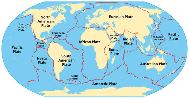
Principal tectonic plates of the Earth, world map. The sixteen major pieces of crust and uppermost mantle of the Earth, called the lithosphere, and consisting of oceanic and continental crust. Vector
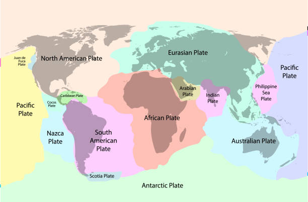
Tectonic plate earth map. Continental ocean pacific, volcano lithosphere geography plates.

Milky Way : https://www.esa.int/ESA_Multimedia/Images/2020/12/The_colour_of_the_sky_from_Gaia_s_Early_Data_Release_3 Stars : https://esahubble.org/images/heic0910t/ Earth : https://www.jpl.nasa.gov/edu/events/2023/4/22/celebrate-earth-day-with-education-resources-from-nasa/ The structure of the earth's crust. Earth cross section in space view. "Elements of this image furnished by NASA"

Plate tectonics map. major an minor plates. Vector illustration.

Earth core structure with geological layers 3d rendering

using a transparent effect and mixed mode.

Different types of plate boundaries: convergent boundaries, terrain section, 3d render. Tectonic plates, side sliding margin, earthquake

Different types of plate boundaries: divergent boundaries, terrain section, 3d render. Tectonic plates, side sliding margin, earthquake
Earth core line outline icon isolated on white. Vector illustration

Earth on space background. internal structure. cross section of layers of the planet. Crust, upper mantle, lower mantle, outer core and inner core. vector illustration for education and science use
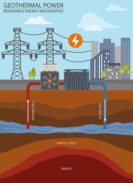
Renewable energy infographic. Geothermal power. Global environmental problems. Vector illustration

In the cross section of the southern hemisphere, the mantle and core can be seen,open an umbrella over it. The umbrella is blue and purple and the background is brown.