Earth realistic sphere with meridians and parallels. 3D vector illustration. Carefully layered and grouped for easy editing. You can edit or remove separately the grid, the sea the lands, the light and shadows.
Browse 710+ earth-globe-north-pole-planet stock photos and images available, or start a new search to explore more stock photos and images.
Earth realistic sphere with meridians and parallels. 3D vector illustration. Carefully layered and grouped for easy editing. You can edit or remove separately the grid, the sea the lands, the light and shadows.
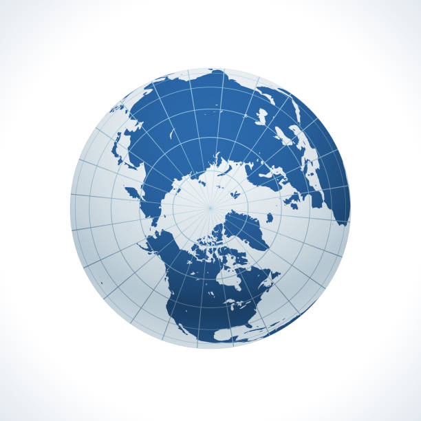
Planet Earth with North Pole in front. The colors in the .eps-file are ready for print (CMYK). Included files are EPS (v10) and Hi-Res JPG (4922 x 4922 px). Made with Natural Earth. The source data is in the public domain. URL of source data: http://www.naturalearthdata.com
Globe Icons - Vector Line Icons. Editable Stroke. Vector Graphic
North Pole 3D Render of the Planet Earth.Made with Natural Earth. URL of source data: http://www.naturalearthdata.com
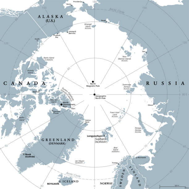
Arctic region, gray political map. Polar region around North Pole of Earth. The Arctic Ocean region, with North Magnetic Pole and North Geomagnetic Pole, longitudes and latitudes. Illustration. Vector

Earth globe with meridians and parallels. 3D vector illustration. Carefully layered and grouped for easy editing. You can edit or remove separately the grid, the sea and the lands.
world globe icon. vector earth logo. flat web global symbol
"3D rendering of blue earth with detailed land illustration. the North Pole, Europe, Asia, and North America view.Made with Natural Earth. Free vector and raster map data @ www.naturalearthdata.com"

Earth realistic shadowed sphere with meridians and parallels. 3D vector illustration. Carefully layered and grouped for easy editing. You can edit or remove separately the grid, the sea, the lands, the light and shadows.

Earth realistic shadowed sphere with meridians and parallels. 3D vector illustration. Carefully layered and grouped for easy editing. You can edit or remove separately the grid, the sea the lands, the light and shadows.

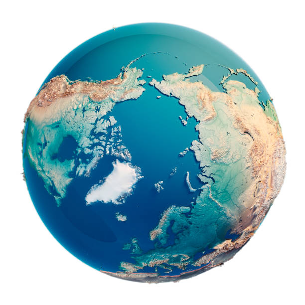
3D Render of an accurate Planet Earth showing the North Pole region. Isolated on white. Very high resolution available! High quality relief structure!

A stark image of a melting ice cap with its jagged edges contrasting sharply. Reminder of the impact of climate change on our planet.
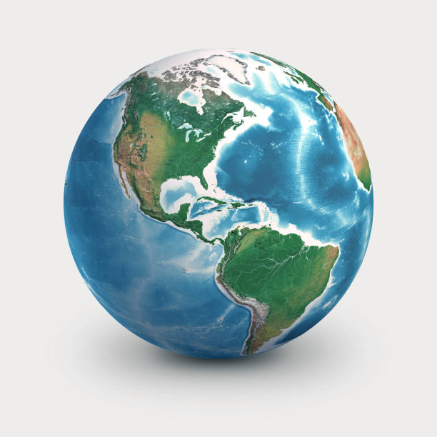
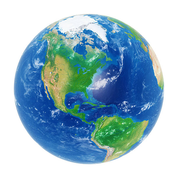
Physical earth globe, focused on North and South America. Planet Earth, isolated on white - 3D illustration (Blender software), elements of this image furnished by NASA (https://eoimages.gsfc.nasa.gov/images/imagerecords/73000/73776/world.topo.bathy.200408.3x5400x2700.jpg)
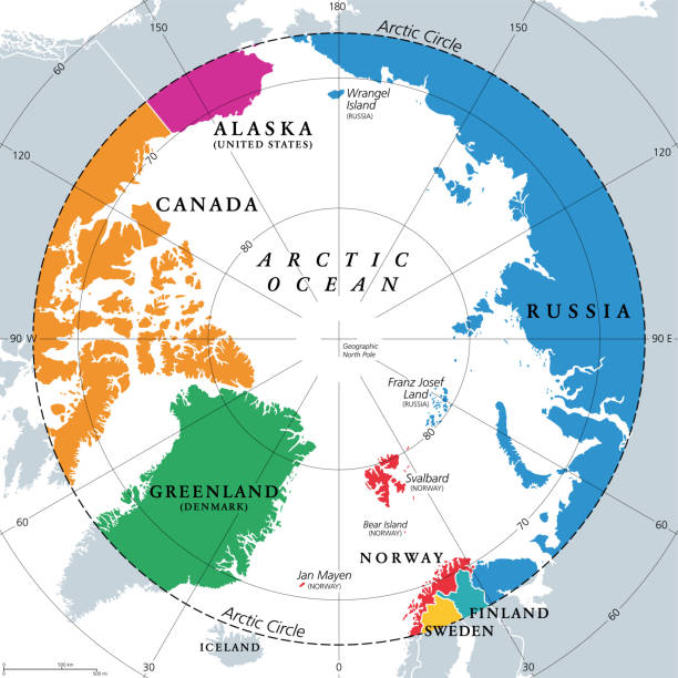
Countries within the Arctic Circle, political map. Countries within about 66 degrees north the Equator and North Pole. Alaska (U.S.), Canada, Finland, Greenland (Denmark), Norway, Sweden and Russia.

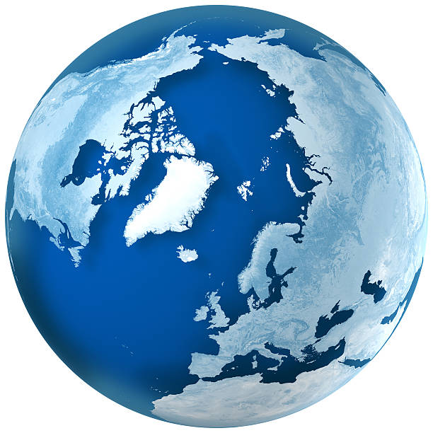
North Pole 3D Render of the Planet Earth with Clouds. Made with Natural Earth. URL of source data: http://www.naturalearthdata.com Relief texture GMTED2010 data courtesy of USGS. URL of source image: https://topotools.cr.usgs.gov/GMTED_viewer/gmted2010_global_grids.php Cloud data courtesy of NASA. URL of source image: https://visibleearth.nasa.gov/view.php?id=57747 The source data is in the public domain.

Planet Earth globe, highly detailed. Satellite view of the world, focused on North and South America - 3D illustration (Blender Software), elements of this image furnished by NASA (https://eoimages.gsfc.nasa.gov/images/imagerecords/73000/73776/world.topo.bathy.200408.3x5400x2700.jpg)
Planet Earth with North Pole in front. The colors in the .eps-file are ready for print (CMYK). Includedfiles are EPS (v10) and Hi-Res JPG (4922 x 4922 px). Made with Natural Earth. The source data is in the public domain. URL of source data: http://www.naturalearthdata.com
Arctic region viewed from a satellite. Physical map of North Pole in winter, February. 3D illustration of planet Earth isolated on white, with high bump effect - Elements of this image furnished by NASA.

Earth realistic sphere with meridians and parallels. 3D vector illustration. Carefully layered and grouped for easy editing. You can edit or remove separately the grid, the sea the lands, the light and shadows.
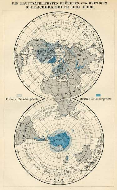
Der Menfch Vol 2 by Johannes Ranke - Leipzig 1894
Earth globe isolated on white background with Americas and north pole visible. Clipping path included.

Image of the Oxford World Globe focused on the North Pole. This globe was sculpted by D.Angus using polyfilla, commissioned by Oxford Cartographers. Photographs taken back in the 1990's and then a few years later the transparencies converted to digital images.

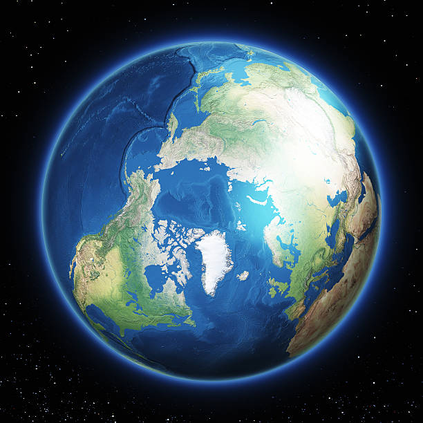
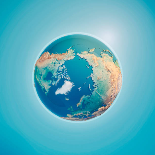
High resolution satellite view of Planet Earth, focused on North Pole, Arctic Ocean and Greenland - 3D illustration (Blender software), elements of this image furnished by NASA (https://eoimages.gsfc.nasa.gov/images/imagerecords/147000/147190/eo_base_2020_clean_3600x1800.png)
Globe, Globe Communication, Global Business, planet earth,
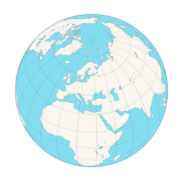
Earth globe with meridians and parallels. 3D vector illustration. Carefully layered and grouped for easy editing. You can edit or remove separately the grid, the sea and the lands.
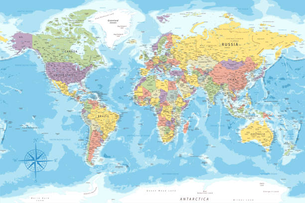
World Map - Highly Detailed Vector Map of the World. Ideally for the Print Posters

Main air travel flight paths on northern hemisphere view from above north pole. Highly detailed planet surface. Elements of this image furnished by NASA.

Earth realistic shadowed sphere with meridians and parallels. 3D vector illustration. Carefully layered and grouped for easy editing. You can edit or remove separately the grid, the sea, the lands, the light and shadows.

Set of 12 globes showing earth rotation in every two hours period

Globe in Russian view from above the North Pole

Arctic Ocean. 3D illustration with detailed planet surface. 3D model of planet created and rendered in Cheetah3D software, 9 Mar 2017. Some layers of planet surface use textures furnished by NASA, Blue Marble collection: http://visibleearth.nasa.gov/view_cat.php?categoryID=1484
Globe icon set. Planet Earth icons for websites. Editable stroke.
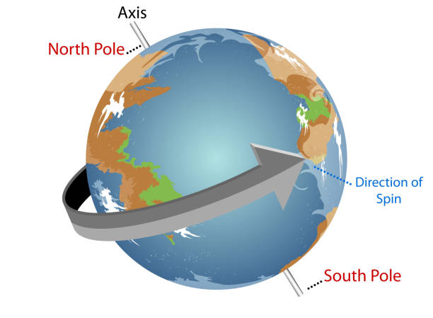
Our planet spins constantly as it orbits the sun,New design vector Earth for education.Gradients used,illustration is an eps10 file and contains transparency effects
Globe, Globe Communication, Global Business, planet earth,
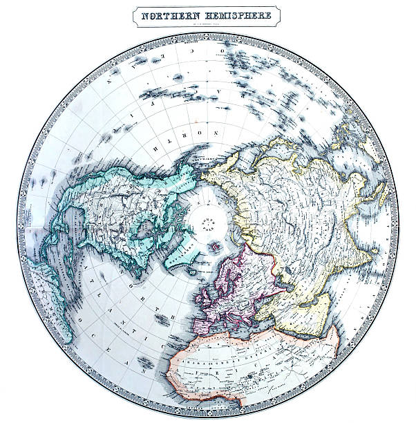
Vintage north circumpolar map. Printed in London, 1858.
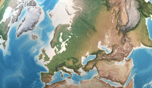
Physical map of Europe, Greenland, Middle East and Asia, with high resolution details. Satellite view of Planet Earth. 3D illustration - Elements of this image furnished by NASA

"High resolution, high quality 3D render (with Cinema 4D)(3 layer of cloud for displacement, 2 layer for earth and water and specular alpha map) of Planet Earth with clipping path. Shaded relief, natural colors, real clouds cover. Ice world.Maps traced from http://www.shadedrelief.com/EARTH Series:"
Starfield and Earth from: shadedrelief.com

High resolution satellite view of Planet Earth, focused on North America, USA, Mexico, Alaska, North pole, Greenland - 3D illustration (Blender software), elements of this image furnished by NASA (https://eoimages.gsfc.nasa.gov/images/imagerecords/147000/147190/eo_base_2020_clean_3600x1800.png)

Planet Earth globe, isolated on white. Geography of the world from space, focused on North Pole, Arctic Ocean and Greenland - 3D illustration (Blender software), elements of this image furnished by NASA (https://eoimages.gsfc.nasa.gov/images/imagerecords/147000/147190/eo_base_2020_clean_3600x1800.png)

Earth realistic shadowed sphere. 3D vector illustration. Carefully layered and grouped for easy editing. You can edit or remove separately the sphere, the lands, the shadows and the background.

Planet Earth with North Pole in front. The colors in the .eps-file are ready for print (CMYK). Included files are EPS (v10) and Hi-Res JPG (4922 x 4922 px). Made with Natural Earth. The source data is in the public domain. URL of source data: http://www.naturalearthdata.com

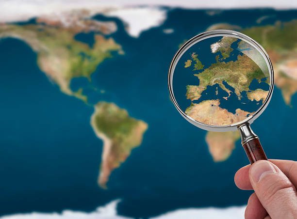
Realistic satellite view of planet Earth in high resolution, focused on Europe, Africa and Asia. 3D illustration (composed with Blender software), isolated on white. Elements of this image furnished by NASA (http://eoimages.gsfc.nasa.gov/images/imagerecords/73000/73655/world.topo.bathy.200404.3x5400x2700.jpg)

Earth realistic shadowed sphere. 3D vector illustration. Carefully layered and grouped for easy editing. You can edit or remove separately the sphere, the lands, the shadows and the background.
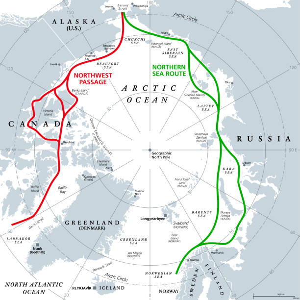
Arctic Ocean sea routes, gray political map. Arctic shipping routes. Northwest Passage and Northern Sea Route. Maritime paths, used by vessels to navigate through the Arctic. Illustration. Vector.

Globe, Artcita. One side of the globe. Multy color. Blue, green, yellow,pink, orange.
Globe, World, Earth, Circle, Vector and Illustration

Named latitudes on the Earth. The equator is the largest of the parallels of significance on Earth. The four others are Arctic Circle, Tropic of Cancer, Tropic of Capricorn and the Antarctic circle.