
Images
4,492 Images and Stock Photos
View flight map of united states videos
Browse 4,400+ flight map of united states stock photos and images available, or start a new search to explore more stock photos and images.

Highly detailed 3d generated globe with glowing connection lines between big cities. Perfectly usable for all kinds of topics related to international business and finance or global data networks. Created from textures by NASA: https://visibleearth.nasa.gov/images/55167/earths-city-lights, https://visibleearth.nasa.gov/images/73934/topography

3d rendered image, created from textures by NASA: https://visibleearth.nasa.gov/images/55167/earths-city-lights, https://visibleearth.nasa.gov/images/73934/topography, https://visibleearth.nasa.gov/images/57747/blue-marble-clouds/77558l


USA United States of America air traffic represented by a Nasa night map of lights and planes with course line network. For this image creation Adobe Photoshop was used, as well as a NASA map. Link https://www.nasa.gov/sites/default/files/images/712129main_8247975848_88635d38a1_o.jpg
Our creative library is free of AI-generated contentChoose your visuals with confidence knowing our creative library is free from AI-generated content, so your searches only return safe, high-quality visuals you can trust.

Vector illustration flat design of USA map with airplane flight paths isolated on a blue background


USA from space at night with city lights showing American cities in United States, global overview of North America, 3d rendering of planet Earth. Some elements from NASA (https://eoimages.gsfc.nasa.gov/images/imagerecords/57000/57752/land_shallow_topo_2048.jpg)

USA continental air travel map concept. EPS 10 file. Transparency used on highlight elements.


The United Stated of America seen from space. High quality 3D rendered image, made from ultra high res 20k textures by NASA: https://visibleearth.nasa.gov/images/55167/earths-city-lights, https://visibleearth.nasa.gov/images/73934/topography, https://visibleearth.nasa.gov/images/57747/blue-marble-clouds/77558l


High quality 3D rendered image, perfectly usable for topics related to big data, global networks, international flight routes or the spread of a pandemic / computer virus. Special focus on Brazil and the USA. Textures courtesy of NASA: https://visibleearth.nasa.gov/images/55167/earths-city-lights, https://visibleearth.nasa.gov/images/73934/topography

Vintage-style concept of U.S. travel, featuring a plane flying over the country from New York to San Francisco. Includes a version without the background texture.

World Travel! A stylized vector cartoon of the earth surrounded by Famous Landmarks,reminiscent of an old screen print poster and suggesting travel, tourism, and Globe trotting. Globe, skyline, Boats, planes, paper texture and background are on different layers for easy editing. Please note: clipping paths have been used, an eps version is included without the path.

Folded map United States of America with airplanes. Vector illustration.

Travel destination concept. International journey. Red pointer on grey world map, with paths to one point. Vector illustration
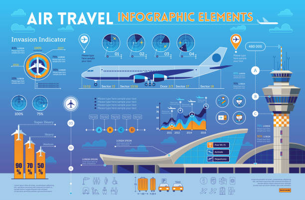
Air travel infographic elements with airplane,airport design elements.


A set of infographic elements with graphs and a map on the topic of geolocation and work with drones on a dark background.
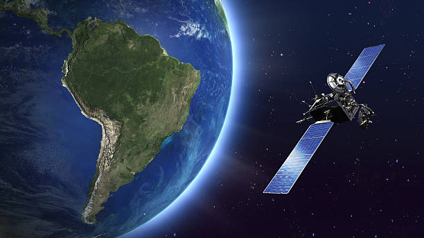
Highly detailed telecommunication satellite orbiting the Earth. Satellite and Earth models based on images courtesy of: NASA http://www.nasa.gov.

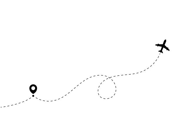
The dotted line in the illustration shows the route of the aircraft, the starting point is marked with a pin.

Planet Earth Night Lights 3D Earth model rendered in Blender. Image map textures source: www.solarsystemscope.com/textures/ licensed under CC By 4.0 (creativecommons.org/licenses/by/4.0/). Textures URLs: https://www.solarsystemscope.com/textures/download/8k_earth_daymap.jpg, https://www.solarsystemscope.com/textures/download/8k_earth_nightmap.jpg

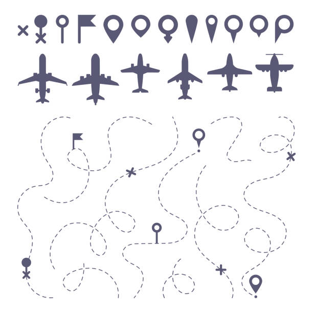
Plane route line. Planes dotted line trail directions, flight pathway direction map builder and airplane. Dot dashes travel flights destination track isolated icons vector set


Map of USA. Floating blue plexus geometric background. Creative abstract vector illustration. High tech, communications and travel. Effect of motion luminous particles and points. Polygonal graphic forms.


Book your flight online illustration set, perfect for banner, mobile app, landing page


Travel to France by airplane from Great Britain concept. I love France vector illustration
Professional icon set in sketch style. Vector artwork is easy to colorize, manipulate, and scales to any size.


Travel and adventure tourism, travel abroad, summer vacation trip set. Hand drawn vector illustration. Perfect for sticker kit, scrapbooking, poster, tags

International landmarks and travel destinations cityscape stencil set for the world travelers. Featuring:

"Commercial airplane on a Dallas, Texas road map. Shallow depth of field."

drawing of vector air tourism advice. Created by Illustrator CS6. This file of transparent.

Gradient and transparent effect used.


Abstract global network world map background. High resolution jpeg file included (300dpi)

Model of a plane over a map with the North American continent


Airplane travel from South Korea to Japan concept. Flags symbol on maps in vector format


USA, Map, American Culture, Three Dimensional, Country - Geographic Area

3D travel essentials including suitcases, airplane, hot air balloon, map, camera, passport, tickets, and clouds. 3d rendering. Vector illustration

USA map cut-out, highly detailed on the edge's shading, with a waving stars & stripes underneath. The Settle thickness on the cut-out border follows the inner shadow's light source.
of75Next