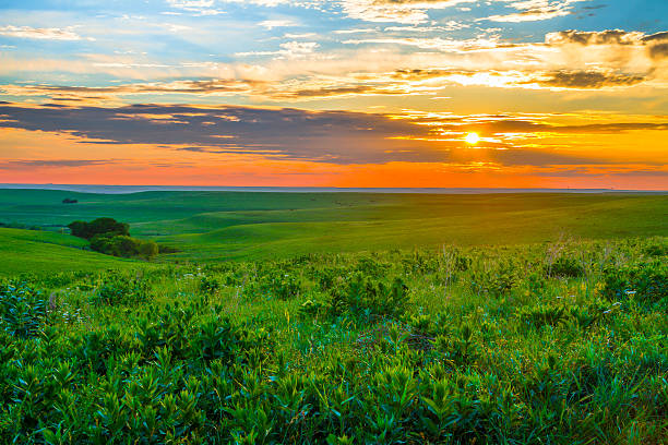
Sunset in the Flint Hills outside of Alma, Kansas with Cattle grazing in the far background.
Browse 100+ flint hills kansas stock photos and images available, or search for badlands national park or wheat field to find more great stock photos and pictures.
Sunset in the Flint Hills outside of Alma, Kansas with Cattle grazing in the far background.

The sun sets on a ranch in the Flint Hills of Kansas

Sunset overlooking the Flint Hills of Kansas.
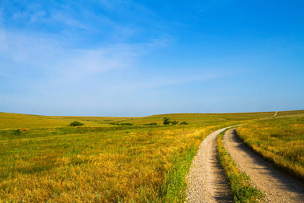
Country Road leading through the Flint Hills of Kansas
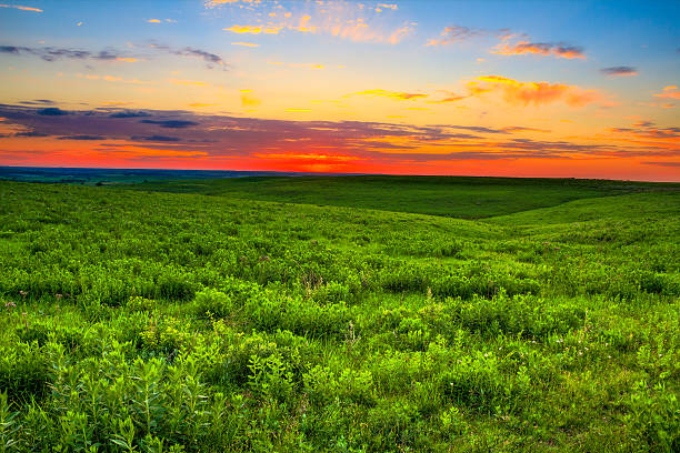
Sunset over the prairie land that is so important to the ranchers in the Flint Hills of Kansas. Kansas is also known to be one of the top 10 places in the world for sunsets.

A herd of bison grazing on a hill on the Kansas prairie. Taken on a sunny, summer morning.

Kansas Tall Grass Prairie at sunset

The sun sets on a ranch in the Flint Hills of Kansas

The sun sets on a ranch in the Flint Hills of Kansas

A lone tree in the prairie of the rolling Flint Hills of Kansas towards late afternoon on a sunny day.

These are the beautiful Flint Hills of Kansas. These rolling prairie hills are best to see during the late spring, summer, and fall, when the grass is lush and a bright green. This is my favorite place in Kansas thus far!

Scenic view of the Flint Hills region in Kansas with green pastures and trees, blue sky with some white clouds.

These are the beautiful Flint Hills of Kansas. These rolling prairie hills are best to see during the late spring, summer, and fall, when the grass is lush and a bright green. This is my favorite place in Kansas thus far!

The Flint Hills of Kansas covered with multicolored wildflowers. Many varieties of wildflowers grow in this area. These are important sources of nectar and pollen for the birds, bees and butterflies living on the prairie.

Evening time on a cloudy overcast eving on Tuttle Creek Lake in Kansas. Tuttle Creek Lake is located just outside of Manhattan, Kansas

A road winds through the Flint Hills in Kansas.

Spring Hill ranch stone wall at Tallgrass Prairie Preserve. Edge of the ranch homestead with the vast grasslands on the flint hills expanding in the distance in easter Kansas.

A herd of North American bison roaming the Kansas Flint hills prairie on a summer day.

Cow grazing on a prairie field in the flint hills of Kansas.

Paddock without animals in the green pastures of the Flint Hills region in Kansas.

Trail leading through the grassland prairie of Kansas leads up shallow hils in the Flint Hills area toward the horizon - blue sky and white clouds

Tall grass blow in the wind at Tallgrass Prairie Preserve in Kansas. Moody skies and the expanse of the American great plains.

Dirt road winds through the grassland at Tallgrass Prairie Preserve Kansas.

Lone windmill on the plains in Flint Hills area of Central Kansas - blue sky - room for text

These purple coneflowers welcome hikers along the trail of the Konza Prairie of the Flint Hills near Manhattan, Kansas.

3D Render of a Topographic Map of the State of Kansas, USA. All source data is in the public domain. Relief texture and Rivers: SRTM data courtesy of USGS. URL of source image: https://e4ftl01.cr.usgs.gov//MODV6_Dal_D/SRTM/SRTMGL1.003/2000.02.11/ Water texture: SRTM Water Body SWDB: https://dds.cr.usgs.gov/srtm/version2_1/SWBD/

A large male American bison roams the spring grasses of Tallgrass Prairie Preserve Kansas. The preserve protects the land and bison herd in the Kansas Flint Hills.

A young "red dog" bison sitting in a field of wildflowers in a central Kansas wildlife refuge. Goldenrod, Snow on the Mountain and Rough Gay Feather wildflowers seen around the bison.

3D Render of a Topographic Map of the State of Kansas, USA. All source data is in the public domain. Relief texture and Rivers: SRTM data courtesy of USGS. URL of source image: https://e4ftl01.cr.usgs.gov//MODV6_Dal_D/SRTM/SRTMGL1.003/2000.02.11/ Water texture: SRTM Water Body SWDB: https://dds.cr.usgs.gov/srtm/version2_1/SWBD/

The sun sets on a ranch in the Flint Hills of Kansas

Looking down a road running through the Flint Hills.

Herd of cattle behind a fence in the Flint Hills region in Kansas.

Moth observed feeding the nectar of a Russian Thistle in the flint Hills of Kansas.

Road signs displaying the maximum speed of 50 mph and that it is a curvy road in the Flint Hills region in Kansas.

A cattle guard along a dirt road at Tallgrass Prairie Preserve. Expansive grass land of the Flint Hills expand into the distance. Cattle guard prevent the bison herd from entering the ranch and homestead.

3D Render of a Topographic Map of the State of Kansas, USA. All source data is in the public domain. Boundaries Level 1: USGS, National Map, National Boundary Data. https://viewer.nationalmap.gov/basic/#productSearch Relief texture and Rivers: SRTM data courtesy of USGS. URL of source image: https://e4ftl01.cr.usgs.gov//MODV6_Dal_D/SRTM/SRTMGL1.003/2000.02.11/ Water texture: SRTM Water Body SWDB: https://dds.cr.usgs.gov/srtm/version2_1/SWBD/

3D Render of a Topographic Map of the State of Kansas, USA. All source data is in the public domain. Boundaries Level 1: USGS, National Map, National Boundary Data. https://viewer.nationalmap.gov/basic/#productSearch Relief texture and Rivers: SRTM data courtesy of USGS. URL of source image: https://e4ftl01.cr.usgs.gov//MODV6_Dal_D/SRTM/SRTMGL1.003/2000.02.11/ Water texture: SRTM Water Body SWDB: https://dds.cr.usgs.gov/srtm/version2_1/SWBD/

Road going through the Flint Hills region in Kansas with green pastures to each side and blue sky with some white clouds.

Native American bison roaming on a wildlife refuge in central Kansas. Fall wildflowers such as Blue Sage and Rough Gay Feather are blooming in the meadow where the bison herd roams.

Wind turbines stand on the prairie at sunset.

Road going through the Flint Hills region in Kansas with green pastures to each side and blue sky with some white clouds.

Purple colored Tall Blazing Star or Tall Gayfeather growing on Kansas prairie. Found growing in Flint Hills wildlife reserve.

A windmill in a field in the Flint Hills of Kansas

2-lane highway cutting through rocky hill, green grasses on both sides. (Kansas Flint Hills)

Mother and young bison standing side by side in wildflowers on the Kansas prairie.

Mother bison nursing young calf. Bison herd seen living on a Flint Hills, Kansas prairie wildlife reserve.


