
Images
Browse 2,200+ geography of jamaica stock photos and images available, or start a new search to explore more stock photos and images.
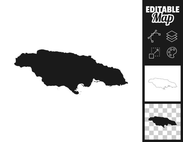
Map of Jamaica for your own design. Three maps with editable stroke included in the bundle: - One black map on a white background. - One line map with only a thin black outline in a line art style (you can adjust the stroke weight as you want). - One map on a blank transparent background (for change background or texture). The layers are named to facilitate your customization. Vector Illustration (EPS file, well layered and grouped). Easy to edit, manipulate, resize or colorize. Vector and Jpeg file of different sizes.
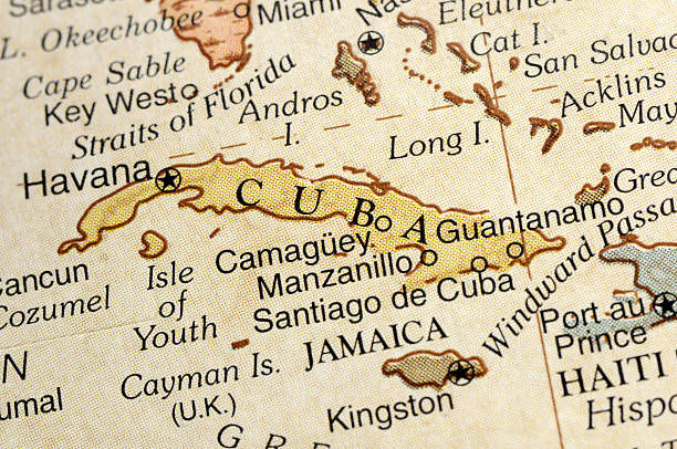
A macro photograph of Cuba from a desktop globe. Adobe RGB color profile.
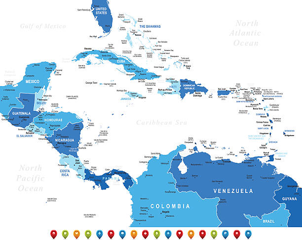
High detailed Map of Central America with national borders, countries and navigational icons

3D Render of a Topographic Map of the Caribbean Sea with the clouds from October 27, 2025. Category 5 Major Hurricane Melissa approaching Jamaica.All source data is in the public domain.Cloud texture: Global Imagery Browse Services (GIBS) courtesy of NASA, GOES data courtesy of NOAA.https://www.earthdata.nasa.gov/eosdis/science-system-description/eosdis-components/gibsColor texture: Made with Natural Earth.http://www.naturalearthdata.com/downloads/10m-raster-data/10m-cross-blend-hypso/Relief texture: GMTED 2010 data courtesy of USGS. URL of source image:https://topotools.cr.usgs.gov/gmted_viewer/viewer.htmWater texture: SRTM Water Body SWDB: https://dds.cr.usgs.gov/srtm/version2_1/SWBD/
Our creative library is free of AI-generated contentChoose your visuals with confidence knowing our creative library is free from AI-generated content, so your searches only return safe, high-quality visuals you can trust.


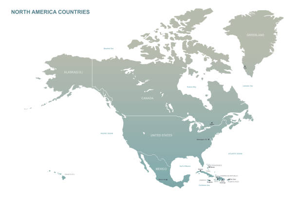
Print map of North America for t-shirt, poster or geographic themes. Hand-drawn colorful map with states and capital names. Vector modern Illustration.Detailed illustration map shape can be use for presentation,chart,template and report.white background.

North and South America map - highly detailed vector illustration
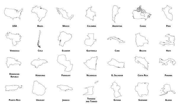
Colored Empty Map of Central America with Country Names and Capital Cities

Jamaica map high detailed with administrative divide by state, capital cities names, outline simplicity style. Vector illustration EPS10

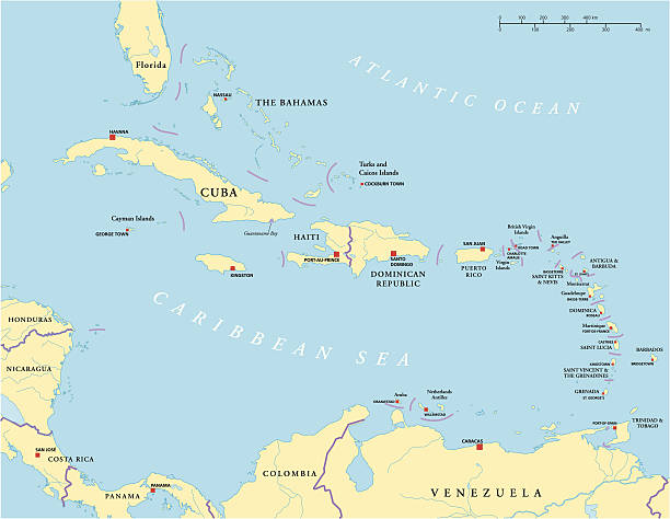
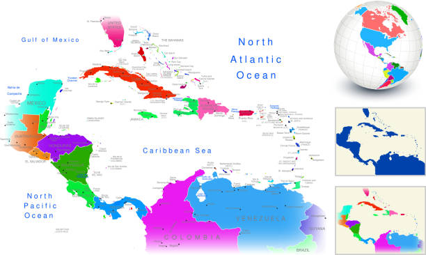
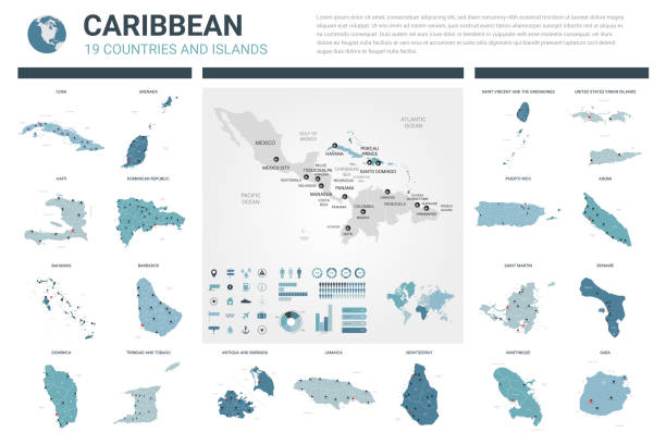
Political map of Caribbean - Large And Lesser Antilles - with capitals, national borders, most important cities, rivers and lakes. Vector illustration with English labeling and scaling.

3D Render of a Topographic Map of Jamaica. All source data is in the public domain. Color and Water texture: Contains modified Copernicus Sentinel data courtesy of ESA. URL of source image: https://dataspace.copernicus.eu/explore-data/data-collections/sentinel-data/sentinel-2 Relief texture: SRTM data courtesy of NASA JPL (2020). URL of source image: https://lpdaac.usgs.gov/products/srtmgl1v003/
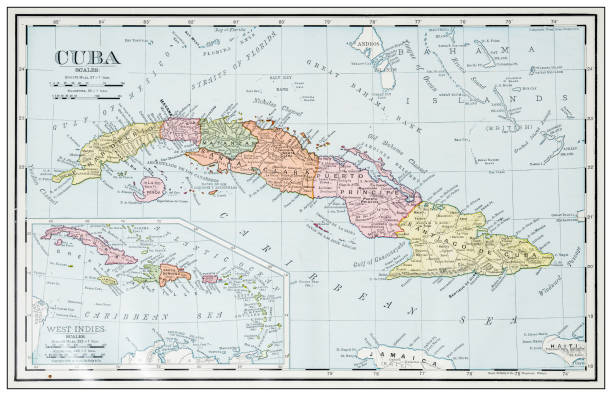
North America Map with United States, Canada, Mexico and Cuba Map was found: http://legacy.lib.utexas.edu/maps/americas/txu-oclc-71353734-north_america_pol_2006.jpg Map was found: http://legacy.lib.utexas.edu/maps/united_states/united_states_pol02.jpg Created with Adobe Illustrator with splines 01-12-2019


Physical map of the world, satellite view of north America and Canada. Globe. Hemisphere. Reliefs and oceans. 3d rendering. Night view, city lights. Elements of this image are furnished by NASA https://visibleearth.nasa.gov/view.php?id=74443

Green grotto caves in Jamaica travel destination scenic

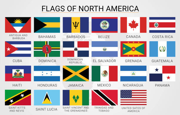

Photo of pinned Kingston on a map of North America. May be used as illustration for traveling theme.


vector illustration of Jamaica flag and map

cuba and jamaica islands old map from 1873
Central America map - highly detailed vector illustration

POLITICAL MAP OF CENTRAL AMERICA

Flags of America - complete set of flags in original colors over white background
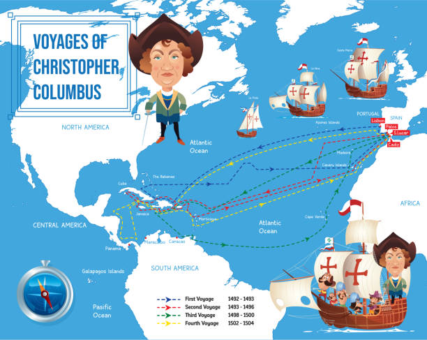
Vector Christopher Columbus I have used http://legacy.lib.utexas.edu/maps/world_maps/world_physical_2015.pdf
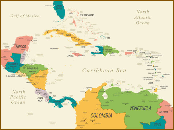
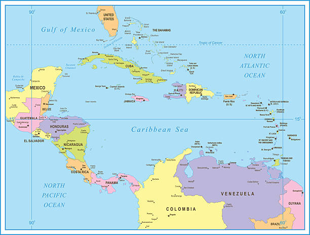
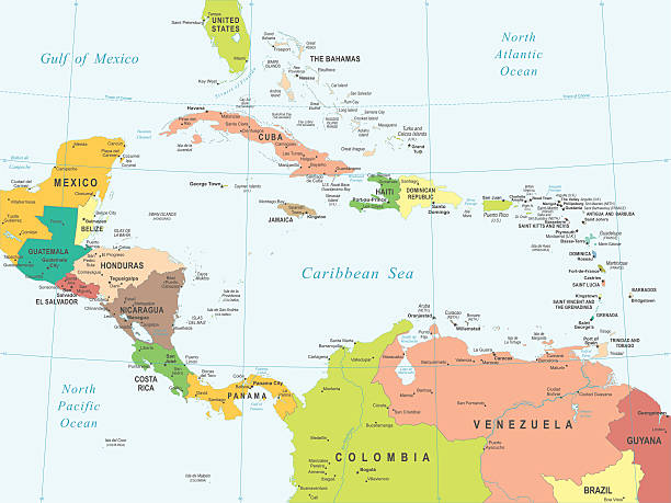
Central America and The Caribbean Map with Geographical Borders

Map of Jamaica in a trendy vintage style. Beautiful retro illustration with old textured paper and light rays in the background (colors used: blue, green, beige and black for the outline). Vector Illustration (EPS10, well layered and grouped). Easy to edit, manipulate, resize or colorize.
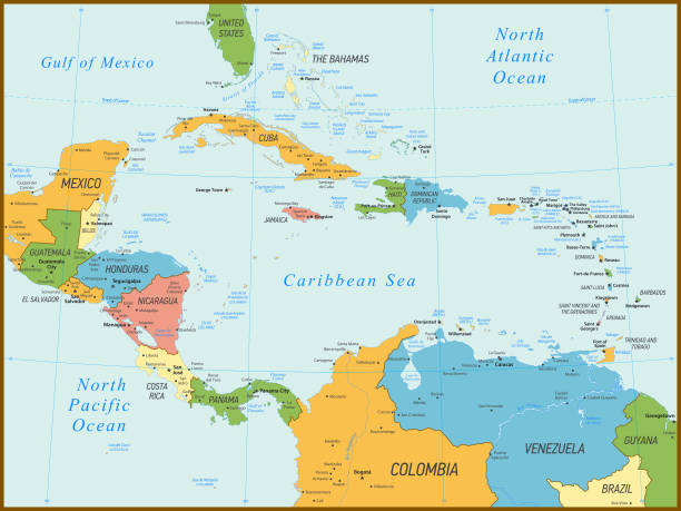
Central America and The Caribbean Map with Geographical Borders


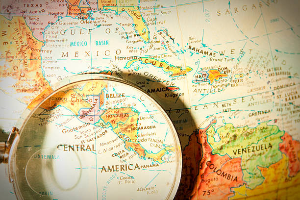
Studying Geography - Photograph of Central America on retro globe underneath a magnifying glass.

Vector illustration. Country flags collection
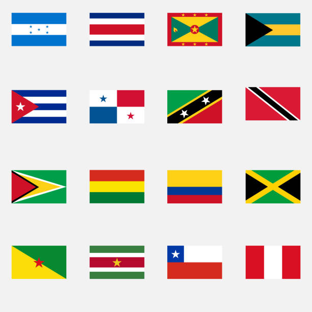
Flags of the states of Latin America. Flat design, vector illustration, vector.
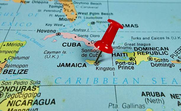
Pushpin marking on Jamaica map


3D Render of a Topographic Map of the Caribbean Sea, Central America. All source data is in the public domain. Color texture and Rivers: Made with Natural Earth. http://www.naturalearthdata.com/downloads/10m-raster-data/10m-cross-blend-hypso/ http://www.naturalearthdata.com/downloads/10m-physical-vectors/ Relief texture: SRTM data courtesy of USGS. URL of source image: https://e4ftl01.cr.usgs.gov//MODV6_Dal_D/SRTM/SRTMGL1.003/2000.02.11/ Water texture: HIU World Water Body Limits: http://geonode.state.gov/layers/?limit=100&offset=0&title__icontains=World%20Water%20Body%20Limits%20Detailed%202017Mar30


Simple white Jamaica map on gray background, vector, illustration, eps 10 file
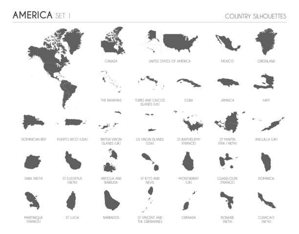
Vector Illustration of North American Continent

3D map of Jamaica isolated on a blank blueprint, with a dropshadow (color used: blue and white). Vector Illustration (EPS10, well layered and grouped). Easy to edit, manipulate, resize or colorize.
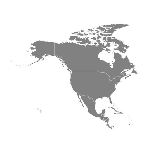
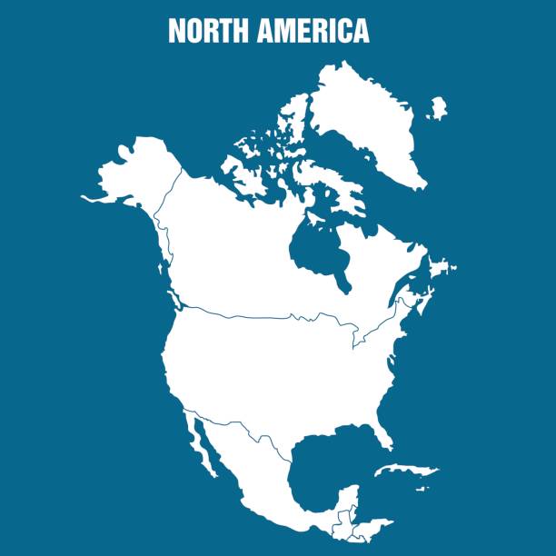
Vector illustration with map of North America continent. Grey silhouettes, white background.
Bahamas Map with National Bahamian Flag and geographical borders

Map of Central America. Detail from the World Atlas (Webster's Concise.)
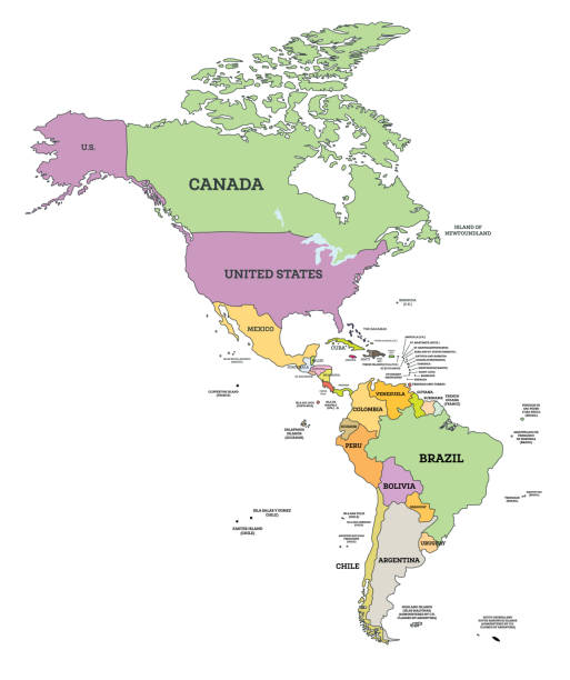
South and North America Political Map in Mercator Projection. Vector Illustration. Map with Name of Countries Isolated on White.


Marcus Ward’s Home Atlas - London , 1894
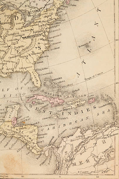
Vintage 1800's map with Carribean sea and Atlantic ocean and more.

Map of Jamaica on a blue sticker and a blue rubber stamp. They are composed of the map in the middle with the names around, separated by stars. The stamp at the top right is created in a vintage style, a grunge texture is added to create a vintage and realistic effect. Vector Illustration (EPS10, well layered and grouped). Easy to edit, manipulate, resize or colorize. Please do not hesitate to contact me if you have any questions, or need to customise the illustration. http://www.istockphoto.com/portfolio/bgblue