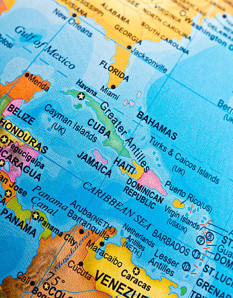
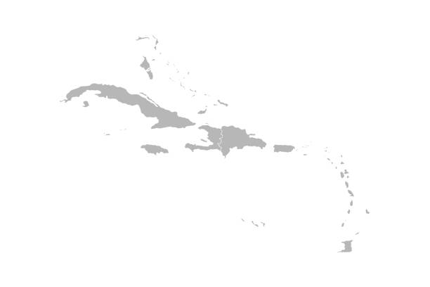
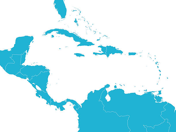
Greater Antilles in the Caribbean, multicolored political map. Grouping of larger islands in the Caribbean Sea, including Cuba, Hispaniola, Puerto Rico, Jamaica, Navassa Island and the Cayman Islands.
Browse 2,200+ geography of jamaica stock photos and images available, or start a new search to explore more stock photos and images.
Greater Antilles in the Caribbean, multicolored political map. Grouping of larger islands in the Caribbean Sea, including Cuba, Hispaniola, Puerto Rico, Jamaica, Navassa Island and the Cayman Islands.
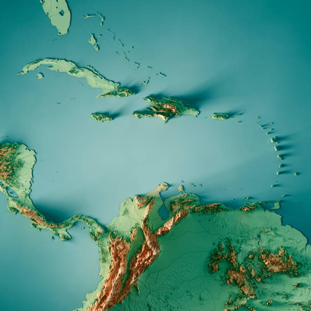
3D Render of a Topographic Map of the Caribbean Sea, Central America. All source data is in the public domain. Color texture and Rivers: Made with Natural Earth. http://www.naturalearthdata.com/downloads/10m-raster-data/10m-cross-blend-hypso/ http://www.naturalearthdata.com/downloads/10m-physical-vectors/ Relief texture: SRTM data courtesy of USGS. URL of source image: https://e4ftl01.cr.usgs.gov//MODV6_Dal_D/SRTM/SRTMGL1.003/2000.02.11/ Water texture: HIU World Water Body Limits: http://geonode.state.gov/layers/?limit=100&offset=0&title__icontains=World%20Water%20Body%20Limits%20Detailed%202017Mar30

3D Render of a Topographic Map of Jamaica. All source data is in the public domain. Color texture: Made with Natural Earth. http://www.naturalearthdata.com/downloads/10m-raster-data/10m-cross-blend-hypso/ Relief texture and Rivers: SRTM data courtesy of USGS. URLs of source images: https://e4ftl01.cr.usgs.gov//MODV6_Dal_D/SRTM/SRTMGL1.003/2000.02.11/N36E120.SRTMGL1.2.jpg https://e4ftl01.cr.usgs.gov//MODV6_Dal_D/SRTM/SRTMGL1.003/2000.02.11/N35E119.SRTMGL1.2.jpg https://e4ftl01.cr.usgs.gov//MODV6_Dal_D/SRTM/SRTMGL1.003/2000.02.11/N35E118.SRTMGL1.2.jpg Water texture: SRTM Water Body SWDB: https://dds.cr.usgs.gov/srtm/version2_1/SWBD/
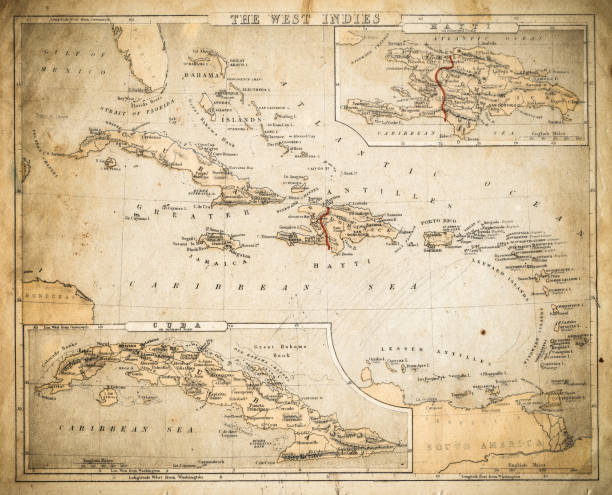
Cornell's Grammar School Geography By S.S. Cornell - New York 1869
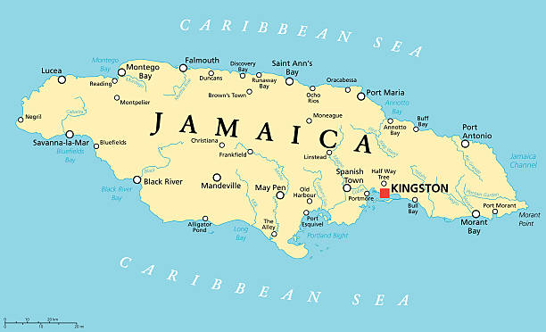
Jamaica Political Map with capital Kingston, important cities and rivers. English labeling and scaling. Illustration.

Photo of pinned Montego Bay on a map of North America. May be used as illustration for traveling theme.

Highly detailed physical map of the Jamaica,in vector format,with all the relief forms,regions and big cities.

map of Jamaica through magnifying glass

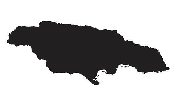
vector illustration of Jamaica map
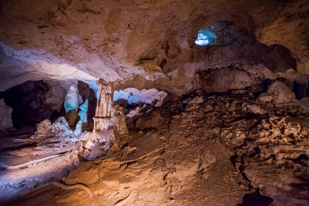
Green grotto caves in Jamaica travel destination scenic
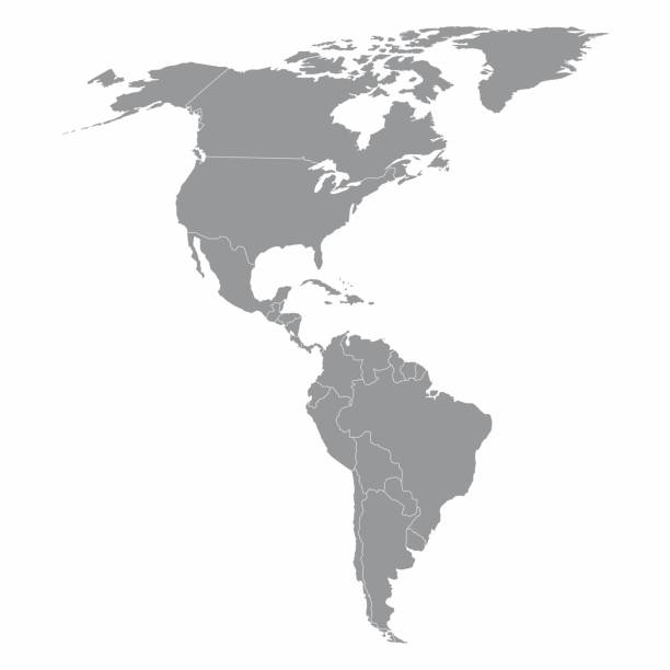
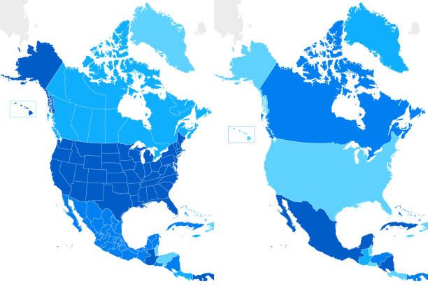
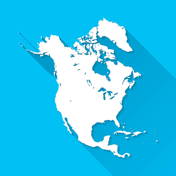
Illustration of a gray North and South America map

Jamaica map. Source: "World reference atlas"
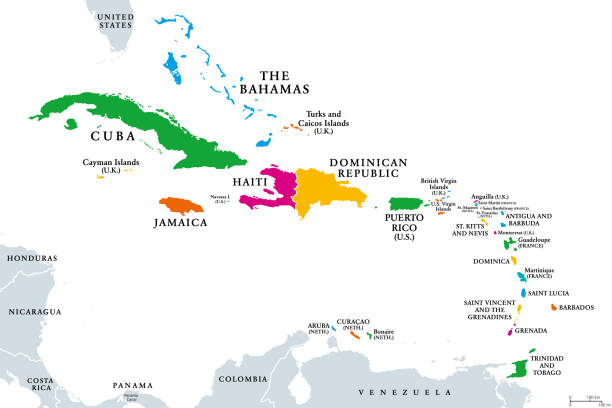
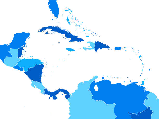
The Caribbean, colored political map. Subregion of the Americas in the Caribbean Sea with its islands and English names. The Greater Antilles and the Lesser Antilles. Isolated illustration over white.

Vector illustration of the map of Jamaica
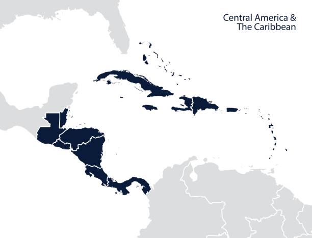
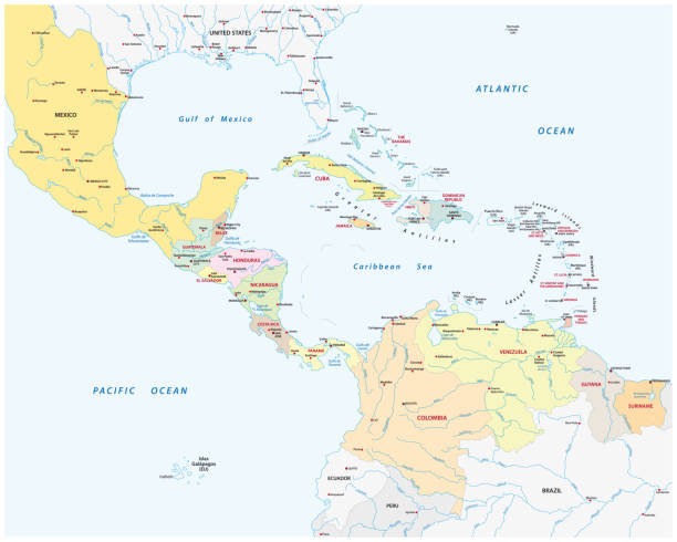
Central America and the Caribbean map. Vector
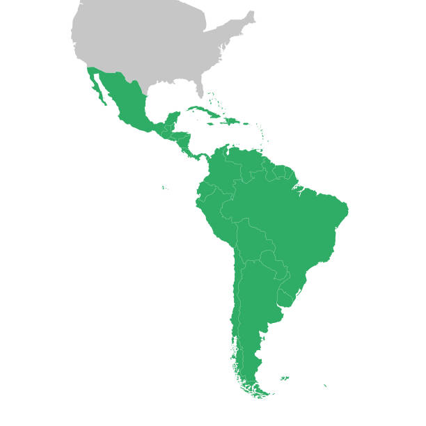
Map of South America and Central America. Vector illustration in HD very easy to make edits.

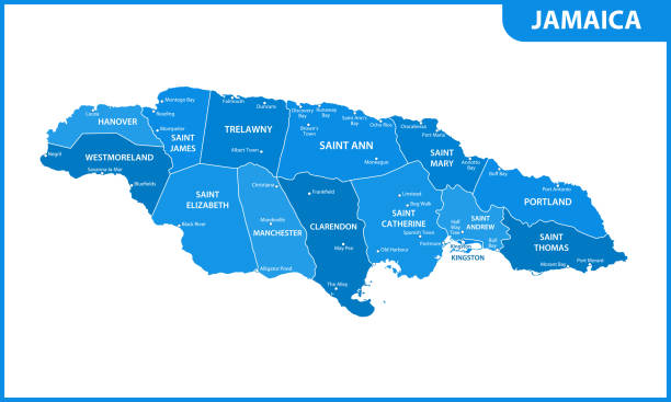
Jamaica map with borders, cities, capital and administrative divisions. Infographic vector map. Editable layers clearly labeled.

Flag of Jamaica, background with fabric texture
Caribbean island map vector graphics design. Gray background. Perfect for business concepts, backgrounds, backdrop, banner, poster, sticker, label and wallpapers.
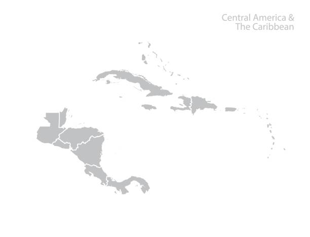
Central America and the Caribbean map. Vector
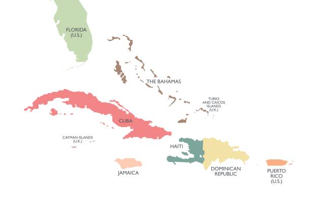
Greater Antilles political map. Caribbean islands. Cuba, Jamaica, Haiti, Dominican Republic, Puerto Rico, Cayman Islands, The Bahamas, Turks And Caicos Islands. Illustration. English labeling. Vector.
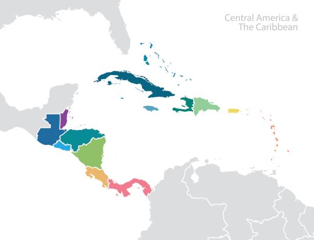
Central America and the Caribbean map. Vector
Empty Blue Map of Central America

vector illustration of Jamaica map
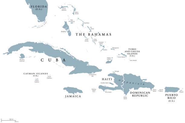
Greater Antilles political map with English labeling. Grouping of the larger islands in the Caribbean Sea with Cuba, Hispaniola, Puerto Rico, Jamaica and the Cayman Islands. Gray illustration. Vector.

New york city, 5 boroughs vector map

Queens NY City Vector Road Map Blue Text. All source data is in the public domain. U.S. Census Bureau Census Tiger. Used Layers: areawater, linearwater, roads.

The National flag of Jamaica blowing in the wind in front of a clear blue sky

Political Map of North and South America
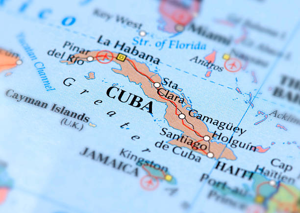
Map of Cuba. Selective Focus.

Hurricane Melissa 2025 vector illustration. Storm map - Jamaica, Cuba, The Bahamas, Haiti, Dominican Republic

vector illustration of Jamaica map
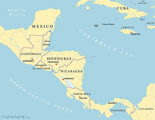
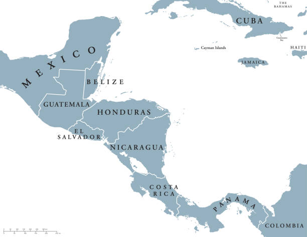
Political map of Central America with capitals, national borders, rivers and lakes. Vector illustration with English labeling and scaling.
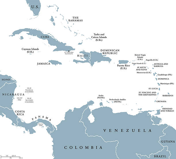
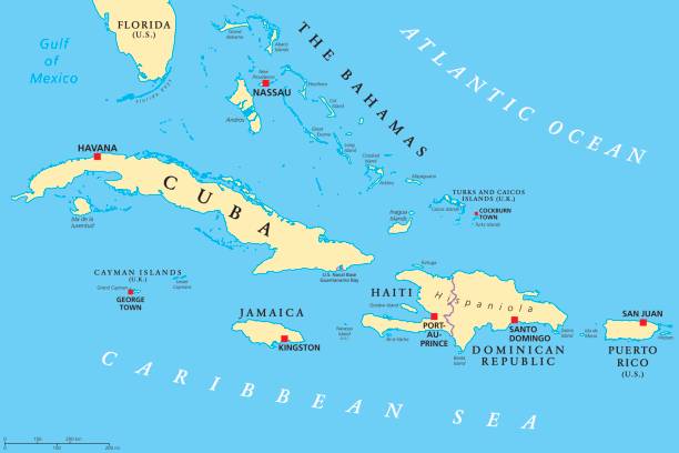
The Caribbean countries political map with national borders. The Caribbean Sea with Greater, Lesser and Leeward Antilles, with West Indies and parts of Central and South America. English labeling.
Greater Antilles political map. Vector illustration
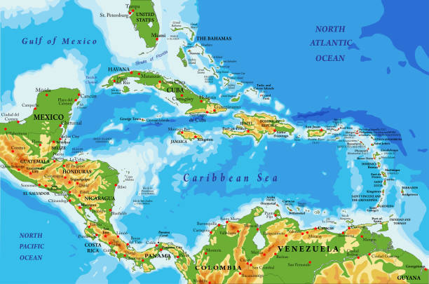
Highly detailed physical map of Central America and Caribbean Islands,in vector format,with all the relief forms,regions and big cities.

gulf of mexico road vector map

Map of Central America with names of countries, capitals and cities. Vector illustration
Central America countries political map with national borders, from Mexico to Colombia, connecting North and South America, Caribbean Sea to the east and Pacific Ocean to the west. English labeling.
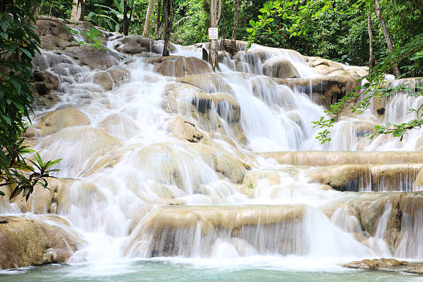
Dunn's River Falls is a 600 feet (180 m) high waterfall near Ocho Rios, Jamaica. It is a major Caribbean tourist destination attracting tourists who climb up the terraced waterfalls.

an old map of Jamaica from 1824

Central America map - green hue colored on dark background. High detailed political map Central American and Caribbean region with country, capital, ocean and sea names labeling.
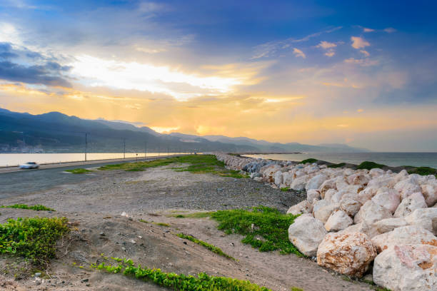
A section of The Palisadoes peninsula in Kingston, Jamaica with large rock boulders to help prevent flooding on the strip of land