Vector illustration with simplified map of Asian countries. East region. States borders of China, Japan, South and North Korea, Taiwan, Mongoloia. Grey silhouette. White background
Browse 490+ grey map of south korea stock photos and images available, or start a new search to explore more stock photos and images.
Vector illustration with simplified map of Asian countries. East region. States borders of China, Japan, South and North Korea, Taiwan, Mongoloia. Grey silhouette. White background

Grey world map vector flat design, Asia in center

Seamless city map pattern. Urban planning - road plan of European city. Simple grey background.
Map of the Korean peninsula including North and South Korea and major cities.

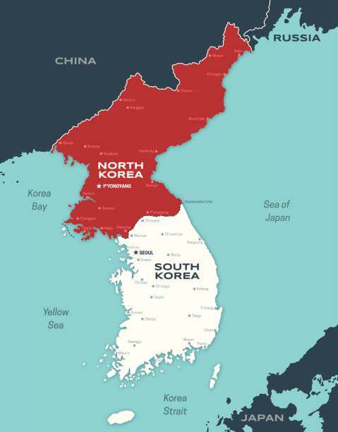
Korean Peninsula region, gray political map. Peninsular region Korea in East Asia, divided between North and South Korea, bordered by China and Russia, and separated from Japan by the Korea Strait.

City road plan graphic print. Seamless vector texture with simple city map. City map vector pattern in grey.

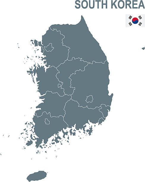
South Korea map with borders, cities, capital and administrative divisions. Infographic vector map. Editable layers clearly labeled.
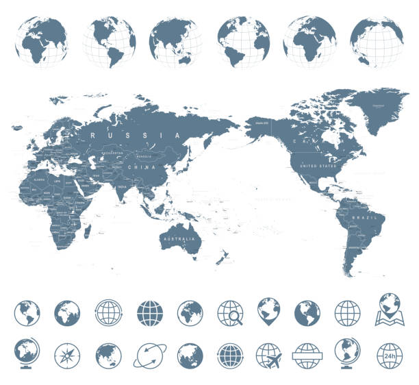
World Map Gray - Asia in Center- vector

Political Physical Topographic Colored World Map Vector illustration

World Map Vintage Old Retro - Asia in Center- vector
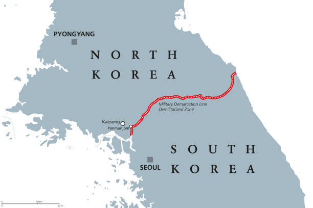
Korean Peninsula, Demilitarized Zone Area, political map. North and South Korea with red Military Demarcation Line, capitals and borders. English labeling. Gray illustration, white background. Vector.

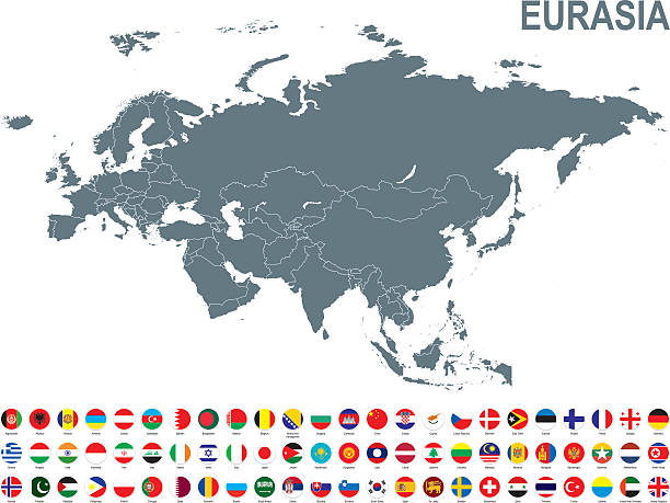
Grey map of Eurasia with flag against white background. The url of the reference to political map is: http://www.lib.utexas.edu/maps/world_maps/united_states_foreign_service_posts-september_2011.pdf

Map of East Asia - illustration
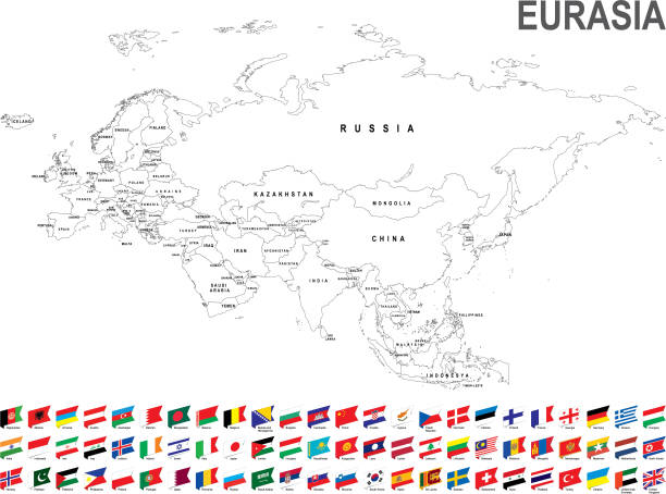
White map of Eurasia with flag against white background. The url of the reference to political map is: http://www.lib.utexas.edu/maps/world_maps/united_states_foreign_service_posts-september_2011.pdf

3D map of Korea South isolated on a blank and gray background, with a dropshadow. Vector Illustration (EPS10, well layered and grouped). Easy to edit, manipulate, resize or colorize.

Map of South Korea - Infographic Vector illustration

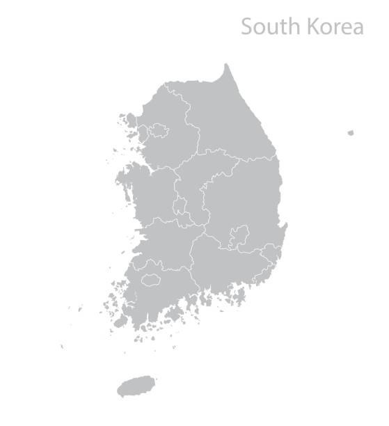
detailed vector map of korea provinces. korea city, province map.

Map of Asia with countries and borders. Vector illustration.

3D Render of a Country Map of South Korea with the Administrative Divisions. Made with Natural Earth. https://www.naturalearthdata.com/downloads/10m-cultural-vectors/ All source data is in the public domain.
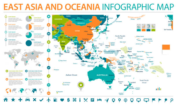
East Asia and Oceania Map - Detailed Info Graphic Vector Illustration

Asia Green Map with national borders Map was found: http://legacy.lib.utexas.edu/maps/middle_east_and_asia/txu-oclc-247232986-asia_pol_2008.jpg Created with Adobe Illustrator with splines 24-12-2019

Political World Map Pacific Centered - vector

"Blank globe of Asia and Australia with national borders, clipping paths providedClick"

World Map Physical White - vector illustration
Grey South Korea map icon isolated on white background. Vector.

Korean peninsula countries political map with North and South Korea and national borders. Gray illustration with English labeling and scaling on white background.

detailed vector map of korea provinces. korea city, province map.

detailed vector map of korea provinces. korea city, province map.

Map of north and south Korea. Vector

East Asia and Oceania Map - Detailed Info Graphic Vector Illustration

Map of Japan - Infographic Vector illustration

Map of South Korea sketched and isolated on a blank background. The map is gray with a black outline. Vector Illustration (EPS file, well layered and grouped). Easy to edit, manipulate, resize or colorize. Vector and Jpeg file of different sizes.

South Korea political map with capital Seoul and national borders. Republic in East Asia constituting the southern part of Korean Peninsula. Gray illustration with English labeling over white. Vector.

Grey map of Eurasia with flag against white background. The url of the reference to political map is: http://www.lib.utexas.edu/maps/world_maps/united_states_foreign_service_posts-september_2011.pdf

Vector maps of Indochina with variable specification and icons

Map of Japan - Infographic Vector illustration

south korea administrative and political vector map.

Detailed vector map of South Korea, including main cities, roads, rivers and lakes. The colors in the .eps-file are ready for print (CMYK). Included files are EPS (v10) and Hi-Res JPG (4922 x 4922 px).

Black and white Korea South map in trendy vintage style, isolated on a dusty white background. A grunge texture is used to have a retro and worn effect. His name is written on the bottom of the image. Vector Illustration (EPS10, well layered and grouped). Easy to edit, manipulate, resize or colorize.

Dark Gray Map of East Asia - illustration

detailed vector map of korea provinces. korea city, province map.

East Asia and Oceania Map - Detailed Vector Illustration

Map of Korea South with a realistic paper cut effect isolated on white background. Vector Illustration (EPS10, well layered and grouped). Easy to edit, manipulate, resize or colorize. Please do not hesitate to contact me if you have any questions, or need to customise the illustration. http://www.istockphoto.com/bgblue/

Vector illustration with simplified map of Asian countries. East region. States borders and names of China, Japan, South and North Korea, Taiwan, Mongoloia. Grey silhouette. White background

World Map Physical White - Asia in Center - China, Korea, Japan - vector

Empty Dark Gray Map of East Asia - illustration

Map of Japan on grey model of Earth. 3D illustration.

Map of Japan - Vector illustration

Political World Map Pacific Centered - vector

Asia Map with national borders Map was found: http://legacy.lib.utexas.edu/maps/middle_east_and_asia/txu-oclc-247232986-asia_pol_2008.jpg Created with Adobe Illustrator with splines 24-12-2019