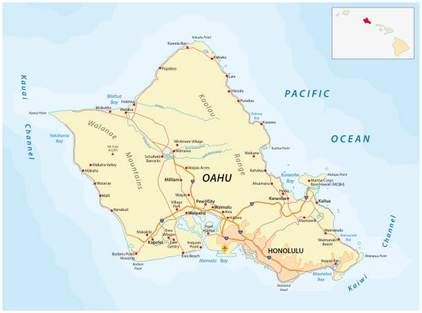
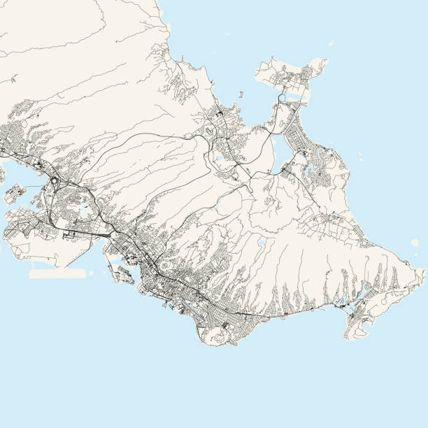
Oahu road vector map, Hawaii, USA
Browse 270+ hawaii highway map stock photos and images available, or start a new search to explore more stock photos and images.
Oahu road vector map, Hawaii, USA

Big Island, hawaii, vector map, USA
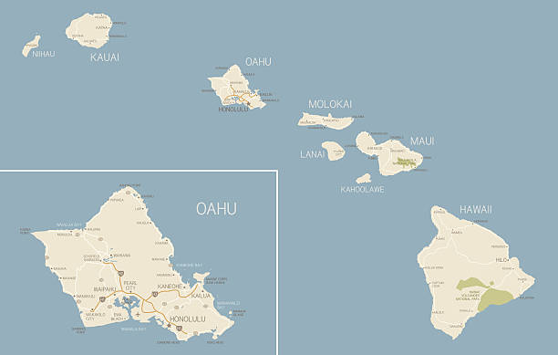
A map of Hawaii with cities, highways, and national parks with a detailed map of Oahu. Includes a vector map and JPG of just the islands (no inset of Oahu) as well as just Oahu.
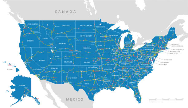
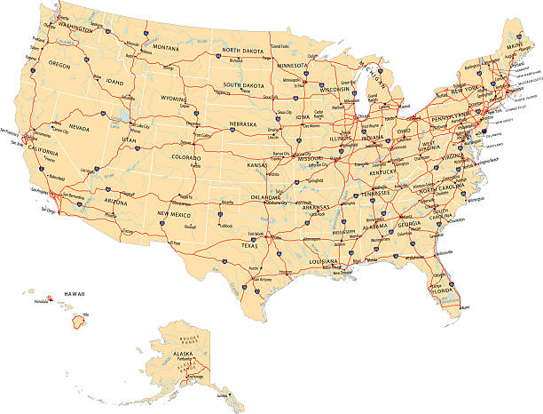
High detailed USA interstate road map vector
High detailed USA interstate road map vector
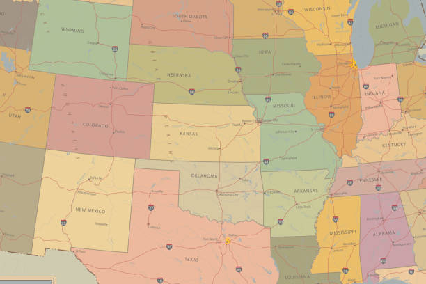
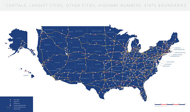
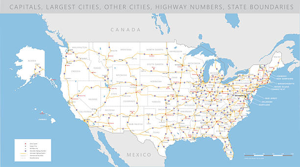
Highly detailed map of United States with roads, states, state capitals, important cities, rivers and major lakes.

Highly Detailed Map of United States. With cities, roads, lakes, rivers, states, Alaska and Hawaii.
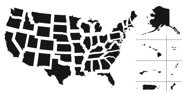
Set of separated American states. Divided USA map. All the countries are named in the layer panel

A vintage-style map of Hawaii with freeways, highways and major cities. Includes an EPS and JPG of the map without roads and cities. Texture, compass, cities, etc. are on separate layers for easy removal or changes.

Outline Political US Map with titles of the states. All USA regions are separated and named in a layer panel.

Honululu downtown vector map
Vector illustration of United States map with most famous travel landmarks and icons representing American culture. US east coast to west coast road trip map.
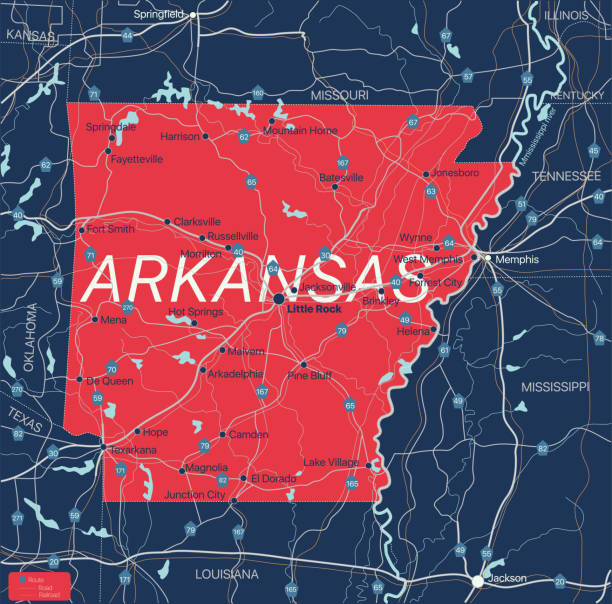
Arkanzas state detailed editable map with with cities and towns, geographic sites, roads, railways, interstates and U.S. highways. Vector EPS-10 file, trending color scheme

Colored Political US Map with titles of the states. All USA regions are separated and named in a layer panel
Topographic / Road map of Honolulu, Hawaii . USA United States of America. Original map data is open data via © OpenStreetMap contributors. All maps are layered and easy to edit. Roads are editable stroke.

Outline United States Of America map. US background template. Map of America with separated countries and interstate borders. All states and regions are named in the layer panel.

USA map and flag - highly detailed vector illustration

Maui map on road sign. Square poster with Maui island map on yellow rhomb road sign. Vector illustration.
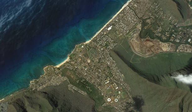
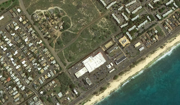
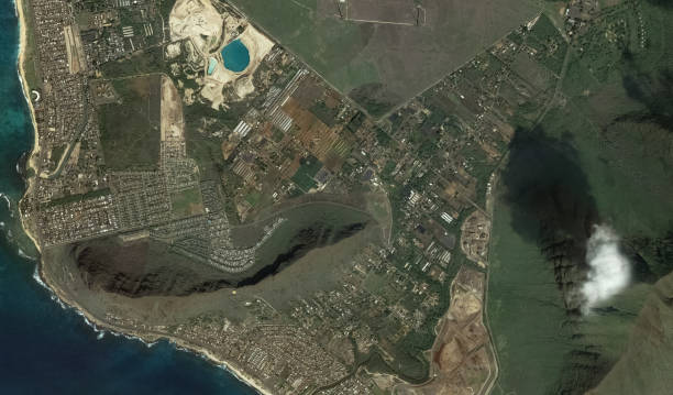
Pacific coast and infrastructure of Honolulu Hawaii USA from the height of the drone flight

Pacific coast and infrastructure of Honolulu Hawaii USA from the height of the drone flight
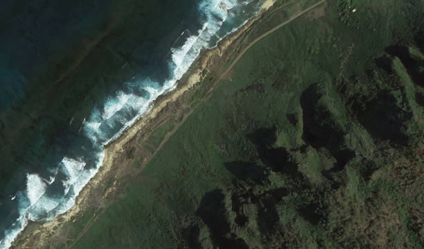
Pacific coast and infrastructure of Honolulu Hawaii USA from the height of the drone flight

Pacific coast and infrastructure of Honolulu Hawaii USA from the height of the drone flight

Large and detailed map of Honolulu county in Hawaii, USA.

Highly Detailed Map of United States. With cities, roads, lakes, rivers, states, Alaska and Hawaii.

Vehicle Registration Number Plates Set Include of California, Virginia, Hawaii and Delaware. Vector illustration of Transportation Information Signs

Map of America. United States Political map. US blueprint with the titles of states and regions. All countries are named in the layer panel

A red pushpin on a map pointing to Honolulu, Hawaii.

Honolulu USA City Map in Retro Style. Outline Map. Vector Illustration.

Topographic / Road map of Hilo, Hawaii, USA. Map data is public domain via census.gov. All maps are layered and easy to edit. Roads are editable stroke.

USA map and flag - highly detailed vector illustration

Pacific coast and infrastructure of Honolulu Hawaii USA from the height of the drone flight

Kauai map on road sign. Wide poster with Kauai island map on yellow rhomb road sign. Vector illustration.
Pacific coast and infrastructure of Honolulu Hawaii USA from the height of the drone flight
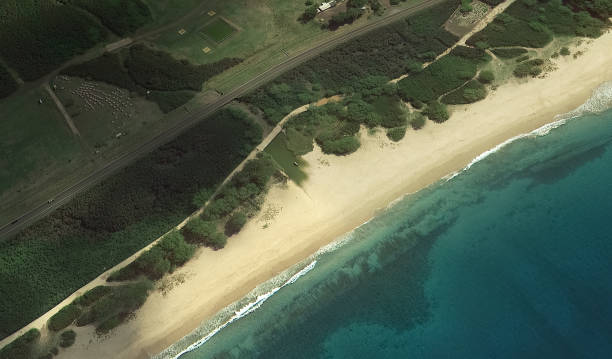
Pacific coast and infrastructure of Honolulu Hawaii USA from the height of the drone flight

Vector illustration of a red, white and blue Hawaii map road sign.

Oahu road vector map, Hawaii, USA

Outline Political US Map with titles of the states. All USA regions are separated and named in a layer panel

Poster Style Topographic / Road map of Honolulu, Hawaii . USA United States of America. Original map data is open data via © OpenStreetMap contributors. All maps are layered and easy to edit. Roads are editable stroke.

Pacific coast and infrastructure of Honolulu Hawaii USA from the height of the drone flight
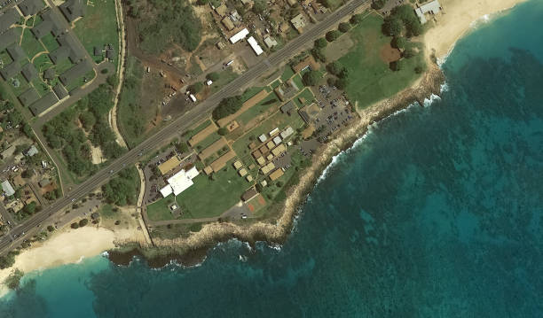
Pacific coast and infrastructure of Honolulu Hawaii USA from the height of the drone flight

Topographic / Road map of Honolulu, Hawaii . USA United States of America. Original map data is open data via © OpenStreetMap contributors. All maps are layered and easy to edit. Roads are editable stroke.

Pacific coast and infrastructure of Honolulu Hawaii USA from the height of the drone flight
Pacific coast and infrastructure of Honolulu Hawaii USA from the height of the drone flight

USA map and flag - highly detailed vector illustration

Honolulu USA City Map in Retro Style in Golden Color. Outline Map. Vector Illustration.

Poster Style Topographic / Road map of Honolulu, Hawaii . USA United States of America. Original map data is open data via © OpenStreetMap contributors. All maps are layered and easy to edit. Roads are editable stroke.
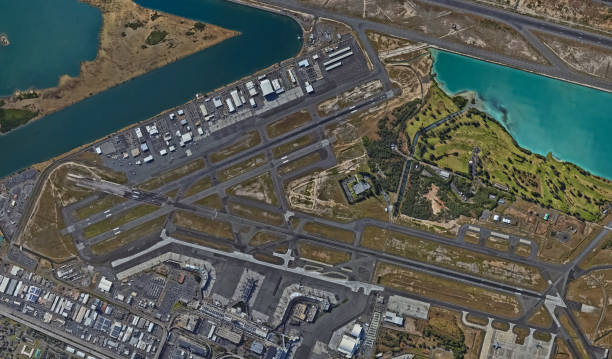
Pacific coast and infrastructure of Honolulu Hawaii USA from the height of the drone flight

Topographic / Road map of Hilo, Hawaii, USA. Map data is public domain via census.gov. All maps are layered and easy to edit. Roads are editable stroke.

Highly detailed map of Hawaii, island American state. USA region political map with territory borders and counties English labeling realistic vector illustration