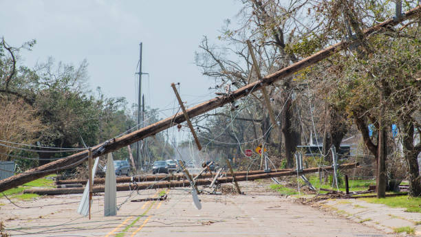
Telephone poles toppled over after Hurricane Laura
Browse 40+ hurricane laura stock photos and images available, or search for hurricane laura map or hurricane laura relief to find more great stock photos and pictures.
Telephone poles toppled over after Hurricane Laura

A church that's been damaged by wind after Hurricane Laura
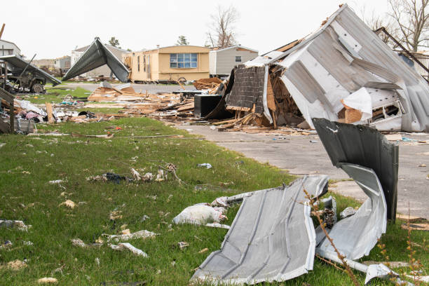
Mobile home park destroyed after Hurricane Laura

Property destroyed after Hurricane Laura

Debris piled up on a power line after Hurricane Laura

Lake Charles, Louisiana is still cleaning up debris and filing insurance claims from the damage caused by Hurricane Laura.
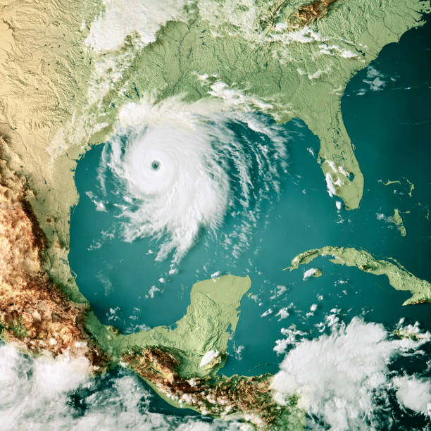
3D Render of a Topographic Map of the Gulf of Mexico with the clouds from August 26, 2020. Category 4 Major Hurricane Laura near the US State of Louisiana. All source data is in the public domain. Cloud texture: VIIRS, SNPP courtesy of NASA. https://neo.gsfc.nasa.gov/view.php?datasetId=VIIRS_543D Color texture: Made with Natural Earth. http://www.naturalearthdata.com/downloads/10m-raster-data/10m-cross-blend-hypso/ Relief texture: SRTM data courtesy of NASA JPL (2020). https://e4ftl01.cr.usgs.gov//DP133/SRTM/SRTMGL3.003/2000.02.11 Water texture: SRTM Water Body SWDB: https://dds.cr.usgs.gov/srtm/version2_1/SWBD/

Georgetown Harbour in Grand Cayman as Hurricane Laura passes by

A boat that has been torn from its mooring by Hurricane Laura

Lake Charles, Louisiana is still cleaning up debris and filing insurance claims from the damage caused by Hurricane Laura.

Lake Charles, Louisiana is still cleaning up debris and filing insurance claims from the damage caused by Hurricane Laura.

3D Render of a Topographic Map of the Gulf of Mexico with the clouds from August 26, 2020. Category 4 Hurricane Laura over the Gulf of Mexico, approaching Louisiana. All source data is in the public domain. Cloud texture: Global Imagery Browse Services (GIBS) courtesy of NASA, VIIRS data courtesy of NOAA. https://www.earthdata.nasa.gov/eosdis/science-system-description/eosdis-components/gibs Color texture: Made with Natural Earth. http://www.naturalearthdata.com/downloads/10m-raster-data/10m-cross-blend-hypso/ Relief texture: GMTED 2010 data courtesy of USGS. URL of source image: https://topotools.cr.usgs.gov/gmted_viewer/viewer.htm Water texture: SRTM Water Body SWDB: https://dds.cr.usgs.gov/srtm/version2_1/SWBD/

Building destroyed after Hurricane Laura

Debris piled up on the street after Hurricane Laura

Telephone poles and lines toppled over after Hurricane Laura
A shot of a dock in Grand Cayman as Hurricane Laura passes by

A tree being blown around as Hurricane Laura passes by

Aerial shot of Lake Charles in Calcasieu Parish, Louisiana. The shot includes the Capital One Tower, the tallest building in the city, which is still visibly damaged after Hurricane Laura. Authorization was obtained from the FAA for this operation in restricted airspace.

3D Render of a Topographic Map of the Gulf of Mexico with the clouds from August 26, 2020. Category 4 Hurricane Laura over the Gulf of Mexico, approaching Louisiana. All source data is in the public domain. Cloud texture: Global Imagery Browse Services (GIBS) courtesy of NASA, VIIRS data courtesy of NOAA. https://www.earthdata.nasa.gov/eosdis/science-system-description/eosdis-components/gibs Color texture: Made with Natural Earth. http://www.naturalearthdata.com/downloads/10m-raster-data/10m-cross-blend-hypso/ Relief texture: GMTED 2010 data courtesy of USGS. URL of source image: https://topotools.cr.usgs.gov/gmted_viewer/viewer.htm Water texture: SRTM Water Body SWDB: https://dds.cr.usgs.gov/srtm/version2_1/SWBD/

A shot of a dock in Grand Cayman as Hurricane Laura passes by

Debris piled up on a power line after Hurricane Laura

Illustration idea of hurricane symbol made to look like a target over the location affected.

A tree being blown around as Hurricane Laura passes by

On Seven Mile Beach in Grand Cayman in the Cayman Islands on 08/24/20 A small pleasure boat has been torn from its mooring by Hurricane Laura and washed ashore

Georgetown Harbour in Grand Cayman as Hurricane Laura passes by

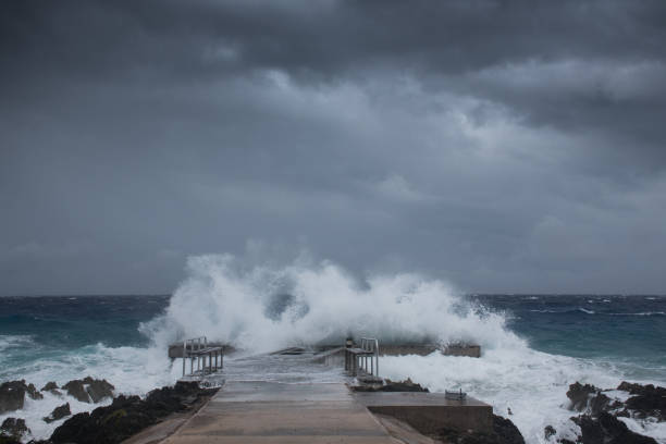
Laura, hurricane, extreme weather, natural disaster, storm

Seattle, WA, USA October 3, 2024 A drill rig operating on a street

A shot of a dock in Grand Cayman as Hurricane Laura passes by

Laura, hurricane, extreme weather, natural disaster, storm

Aerial shot of Lake Charles, a city in Calcasieu Parish, Louisiana. The shot includes the Capital One Tower, the tallest building in the city, which is still visibly damaged after Hurricane Laura. Authorization was obtained from the FAA for this operation in restricted airspace.

Seattle, WA, USA October 2, 2024 A drill rig on a street

A shot of a dock in Grand Cayman as Hurricane Laura passes by

Laura, hurricane, extreme weather, natural disaster, storm

Seattle, WA, USA October 3, 2024 A drill rig operating on a street

A shot of a dock in Grand Cayman as Hurricane Laura passes by

Aerial shot of Lake Charles in Calcasieu Parish, Louisiana. The shot includes the Capital One Tower, the tallest building in the city, which is still visibly damaged after Hurricane Laura. Authorization was obtained from the FAA for this operation in restricted airspace.

3D Render of a Topographic Map of the Gulf of Mexico with the clouds from August 26, 2020. Category 4 Major Hurricane Laura near the US State of Louisiana. All source data is in the public domain. Cloud texture: VIIRS, SNPP courtesy of NASA. https://neo.gsfc.nasa.gov/view.php?datasetId=VIIRS_543D Color texture: Made with Natural Earth. http://www.naturalearthdata.com/downloads/10m-raster-data/10m-cross-blend-hypso/ Relief texture: SRTM data courtesy of NASA JPL (2020). https://e4ftl01.cr.usgs.gov//DP133/SRTM/SRTMGL3.003/2000.02.11 Water texture: SRTM Water Body SWDB: https://dds.cr.usgs.gov/srtm/version2_1/SWBD/


