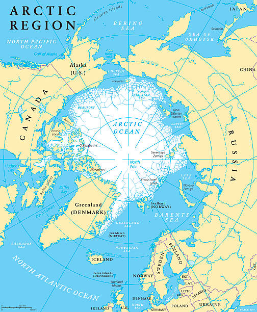
Arctic region map with countries, capitals, national borders, rivers and lakes. Arctic Ocean with average minimum extent of sea ice. English labeling and scaling. Illustration.
Browse 9,200+ ice map stock photos and images available, or search for arctic ice map to find more great stock photos and pictures.
Arctic region map with countries, capitals, national borders, rivers and lakes. Arctic Ocean with average minimum extent of sea ice. English labeling and scaling. Illustration.

3D Render of a Topographic Map of the Antarctica. All source data is in the public domain. Color texture: Made with Natural Earth. http://www.naturalearthdata.com/downloads/10m-raster-data/10m-cross-blend-hypso/ Relief texture: GMTED2010 data courtesy of USGS. URL of source image: https://topotools.cr.usgs.gov/gmted_viewer/viewer.htm Water texture lakes: Made with Natural Earth. https://www.naturalearthdata.com/downloads/10m-physical-vectors/ Water texture: HIU World Water Body Limits: http://geonode.state.gov/layers/?limit=100&offset=0&title__icontains=World%20Water%20Body%20Limits%20Detailed%202017Mar30

http://dl.dropbox.com/u/38654718/istockphoto/Media/download.gif
Vector Icons - Adjust stroke weight - Expand to any size - Change to any colour
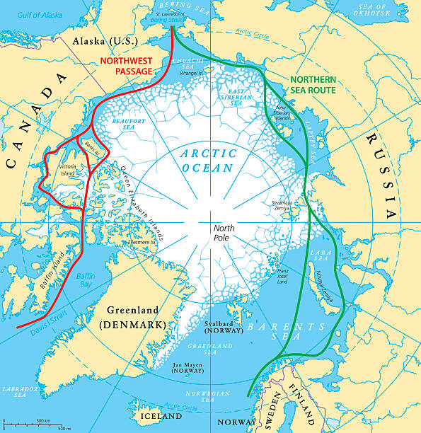
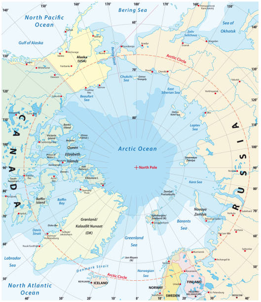
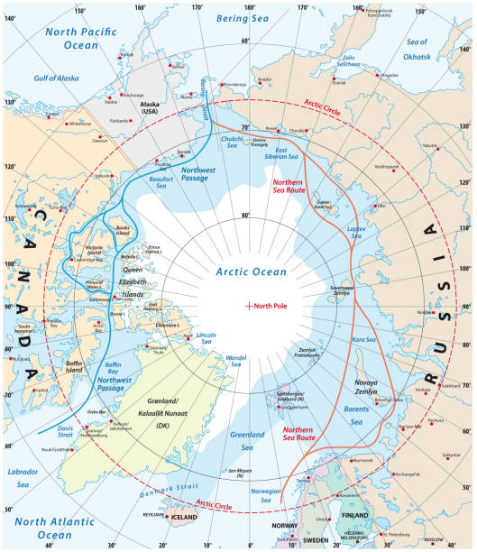
Arctic Ocean sea routes map with Northwest Passage and Northern Sea Route. Arctic Region map with countries, national borders, rivers, lakes and average minimum extent of sea ice. English labeling and scaling.
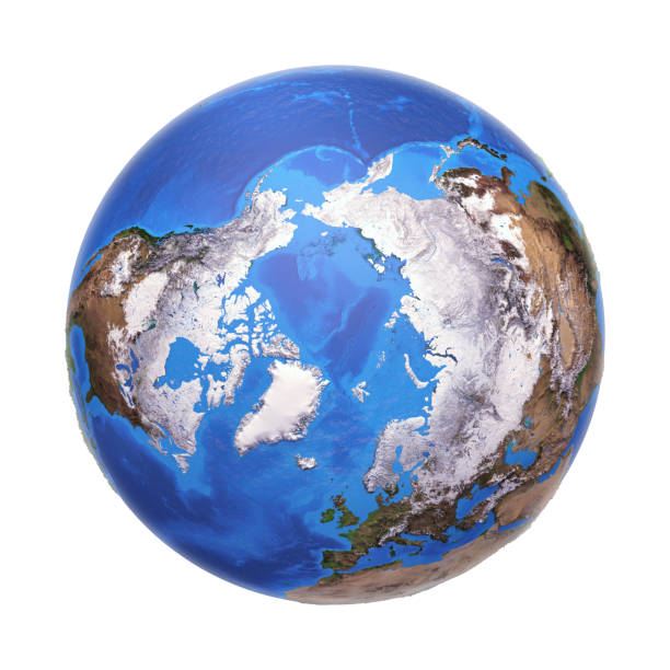
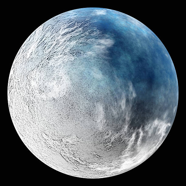
Arctic region viewed from a satellite. Physical map of North Pole in winter, February. 3D illustration of planet Earth isolated on white, with high bump effect - Elements of this image furnished by NASA.

Extremely detailed image including elements furnished by NASA. Other orientations available.
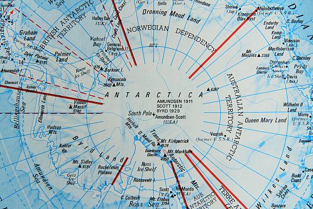
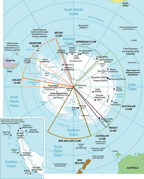
A map of Antarctica, centred on the South Pole and noting all the mountains and their heights and as far out as the ice shelf and surrounding seas.
Topographic map blue 3d paper abstract background pattern.
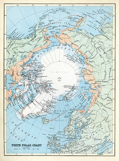
Map of the North Polar Region from 1891

Compass on topographic maps.Similar photographs from my portfolio:
one earth planet after ecology catastrophe. nuclear winter. This is no nasa photo, this is render image

Arcade north frozen world game level map interface. Glaciers, ice platforms and stairs, bonuses and gems on game app world or environment background, platform videogame level design cartoon interface
Fantasy Adventure map builder with simple icon elements in vector illustration format

Iceland cartoon vector map. Travel illustration with landmarks, animals and nature places. Image with all main tourist attractions

Flying platform waterfall, penguin, summer tropical scene sand dune. Exotic nature game island kit
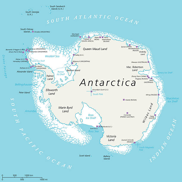
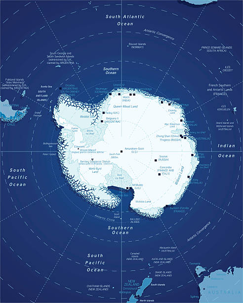
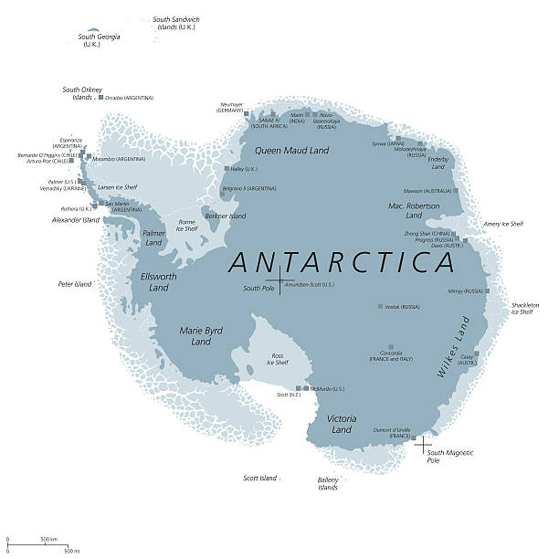
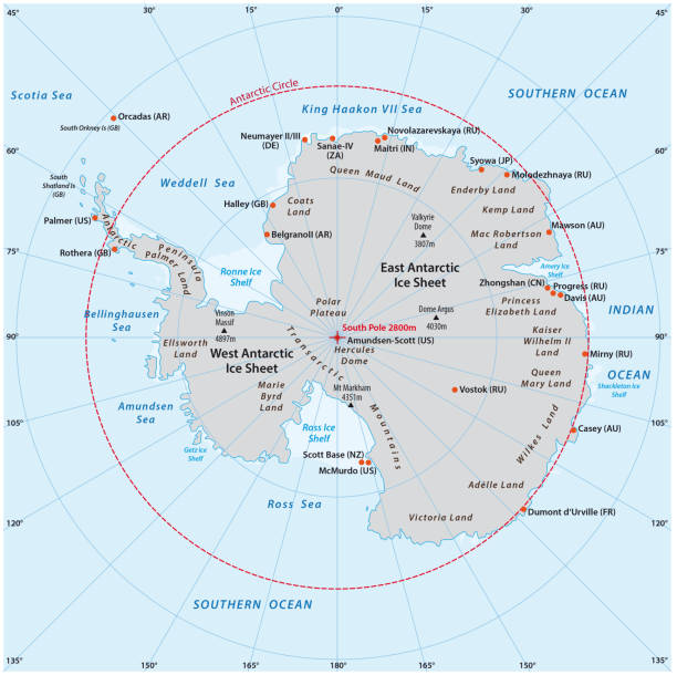
Antarctica Political Map with south pole, scientific research stations and ice shelfs. English labeling and scaling. Illustration.
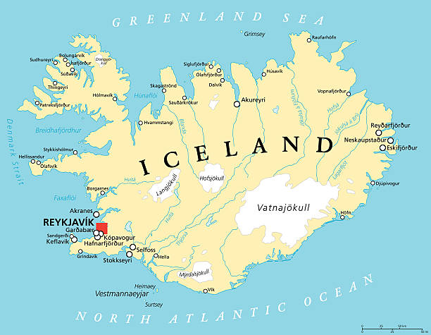
Iceland Political Map with capital Reykjavik, national borders, important cities, rivers, lakes and glaciers. English labeling and scaling. Illustration.
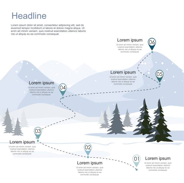
Winter ski resort, route infographic. Layers of mountain landscape with fir forest. Vector illustration.
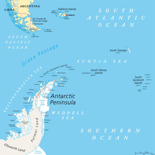
Antarctic Peninsula area, political map. From southern Patagonia and Falkland Islands, to South Georgia and the South Sandwich Islands, South Orkney Islands, and Drake Passage, to Antarctic Peninsula.
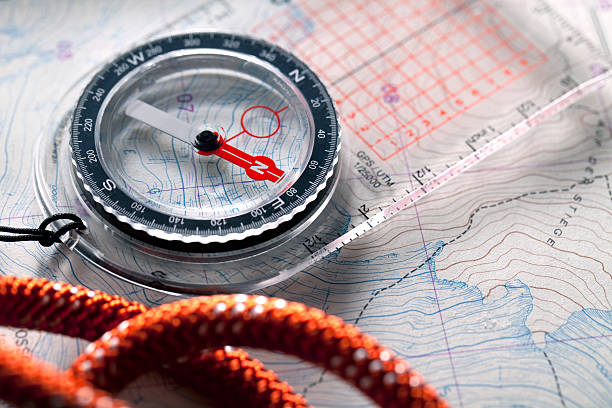
Compass on topographic maps with rope climbing.Similar photographs from my portfolio:
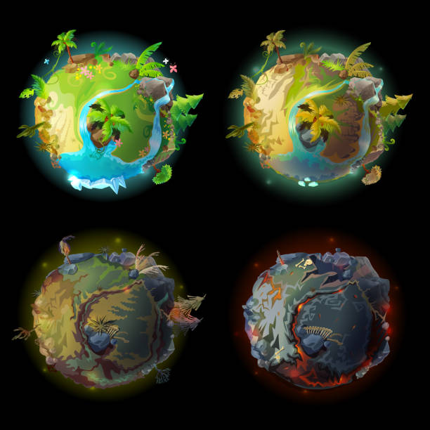
Vector cartoon fantastic planet Earth, world evolution set. Cosmic, space element for game, timeline infographic design. Illustration from burned ground with lava bones to green tropical plants rivers
Vector illustration of precise map of Antarctic region.
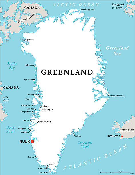
Greenland Political Map with capital Nuuk and important cities. Autonomous country within the Kingdom of Denmark. English labeling and scaling. Illustration.

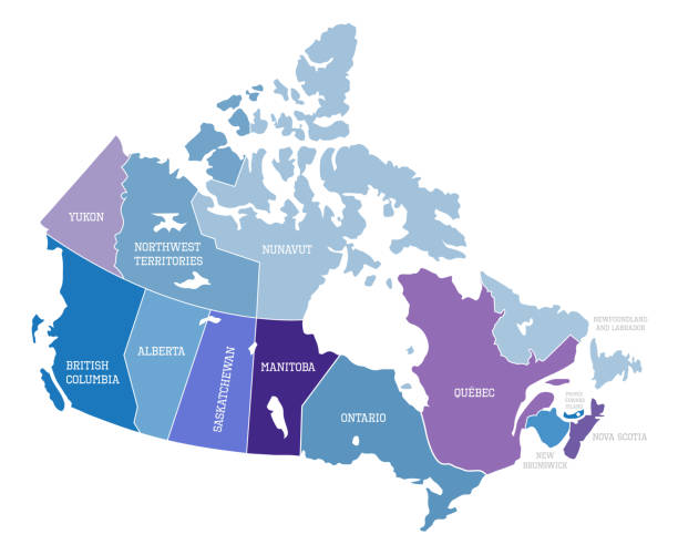
Illustrated map of Canada. Travel map. Vector illustration
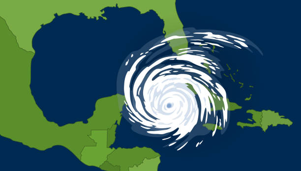
Tropical cyclone in the gulf of Mexican. Huge hurricane, view from space.
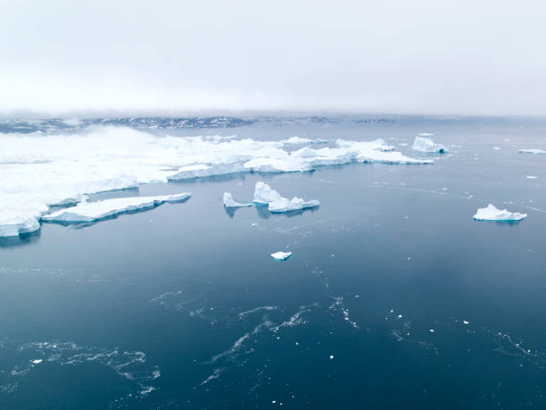
Arctic Pole in Greenland. Icebergs on arctic ocean in Ilulissat disco bay.

Blue Florida map ice with dark and light effect vector on light background
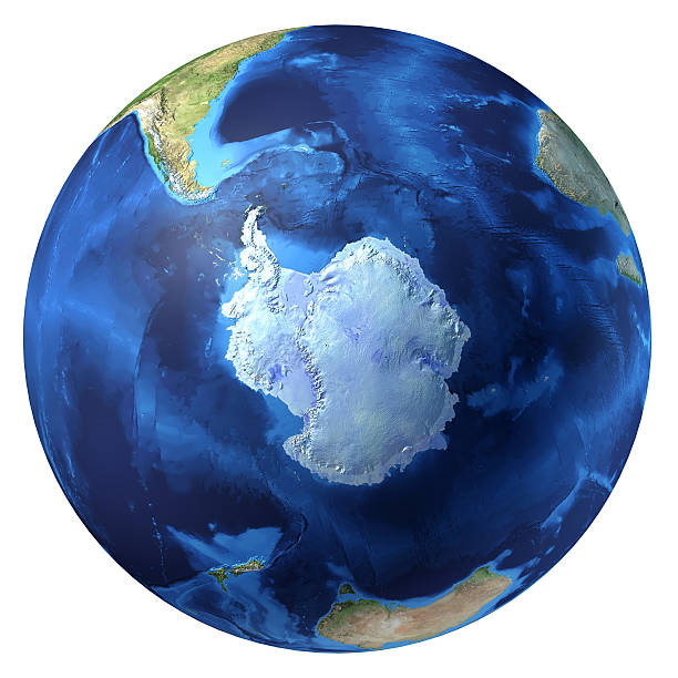
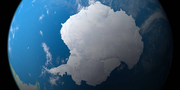
Earth globe, realistic 3D rendering. Antarctic (south pole) view. At white background.

Abstract prism blue AI artificial intelligence terrain pattern matrix background pattern design with space for your copy.
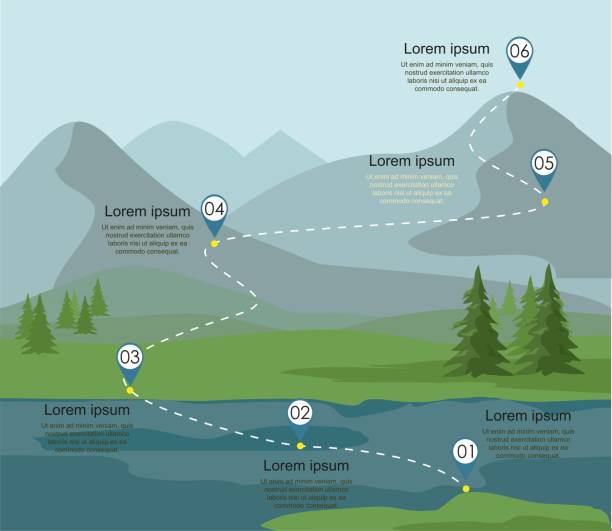
Tourism route infographic. Layers of mountain landscape with fir forest and river. Vector illustration.
Antarctica political map with Geographic and Magnetic South pole, scientific research stations and ice shelfs. English labeling and scaling. Gray colored illustration on white background. Vector.

High resolution, high quality 3D render of Planet Earth with clipping path. Shaded relief, natural colors, realistic clouds cover. Pacific Ocean, australia, indonesia, Japan, China.
Storm on Rader shallow focus on storm visible RGB cells.
Orthographic view of the South Pole, antarctic vector map
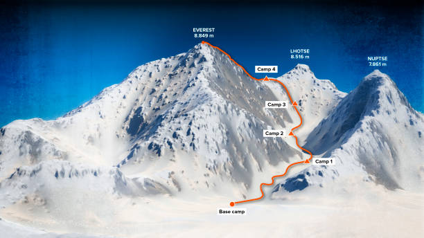
Base camp and path to climb to the top of Mount Everest, relief height, mountains. Lhotse, Nuptse. Himalaya map. The highest mountain in the world. 3d render
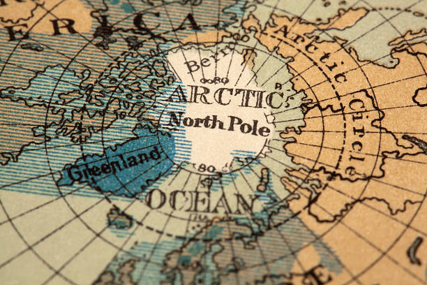
antique map of the north pole region. original map dated 1887. shaded blue areas represent former glacier region

Antarctic Peninsula area, gray political map. From southern Patagonia and Falkland Islands, to South Georgia, and the South Sandwich Islands, and to South Orkney Islands, and Antarctic Peninsula.
http://dl.dropbox.com/u/38654718/istockphoto/Media/download.gif
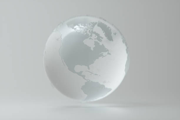
Clear glass ball 3D illustration on white background

Arctic Ocean region north of mainland Europe, political map. From the eastern part of Greenland to Svalbard to Franz Josef Land, with parts of the countries Iceland, Norway Sweden, Finland and Russia.

Highly detailed physical map of Alaska,in vector format,with all the relief forms,regions and big cities.
Set of summer vacation, travel or tourism outline icons isolated on white background. Vector illustration.
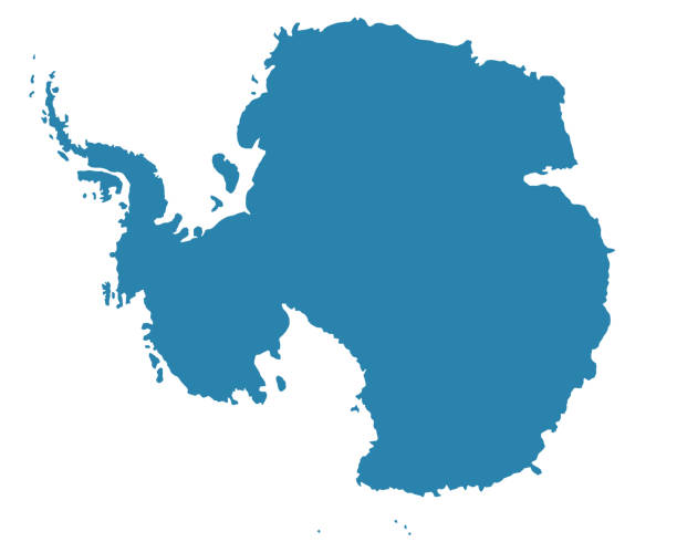
Illustration of Antarctica silhouette map. Source of map: http://legacy.lib.utexas.edu/maps/islands_oceans_poles/antarctic_region_pol02.jpg