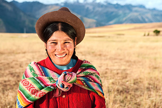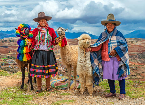
A rural portrait of Quechua Indigenous Women in traditional clothes with their domestic animals, two llama and one alpaca, Sacred Valley of the Inca, Cusco, Peru.
Browse 15,700+ inca people stock photos and images available, or search for lima peru to find more great stock photos and pictures.
A rural portrait of Quechua Indigenous Women in traditional clothes with their domestic animals, two llama and one alpaca, Sacred Valley of the Inca, Cusco, Peru.
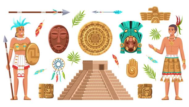
Maya civilization culture. Incas and aztec ancient art, ethnic artifacts and sign collection, indian people, historical heritage and landmarks, religion masks and pyramid vector cartoon isolated set

Maya civilization item set. Tribal rituals, feathers, decoration, Aztecs. History concept. Vector illustrations can be used for tribe, ethnicity, culture
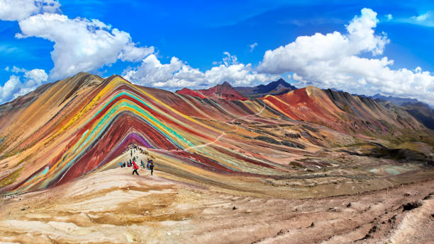
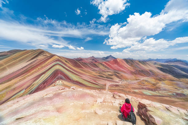
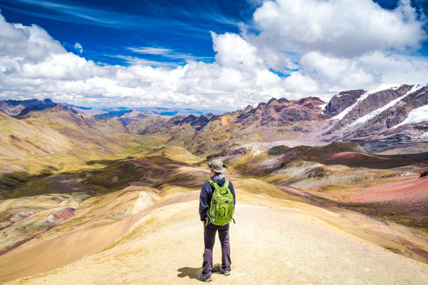
Unidentified tourists walking on the Rainbow Mountain (Vinicunca Montana de Siete Colores - Spanish) in Cusco, Peru.
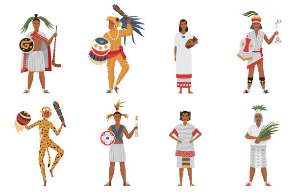
Aztec tribe people of ancient civilization set vector illustration. Cartoon man woman characters in traditional clothes and headgear holding weapon or ritual objects collection isolated on white

Aztec Man Warriors in Traditional Clothes and Feathered Headgear with Weapon and Shield Vector Set. Male Aboriginal Concept
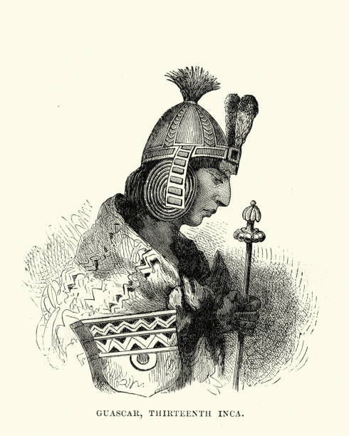
Vintage engraving of Huascar, Sapa Inca of the Inca Empire from 1527 to 1532 AD
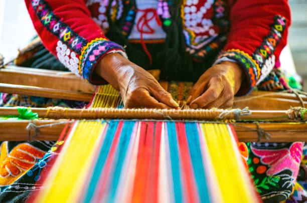
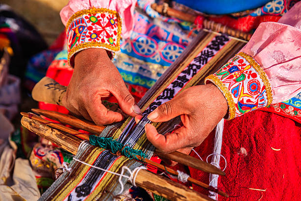
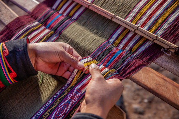
Peruvian indigenous Quechua woman weaving a textile with the traditional techniques in Cusco, Peru.

Maya tribal leader, warrior with weapon and locals women in traditional ethnic costume near the pyramid. Cartoon vector illustration isolated on white. Maya ancient civilization culture and traditions
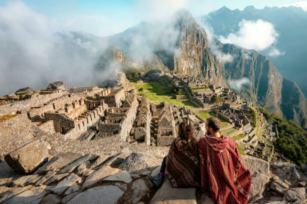
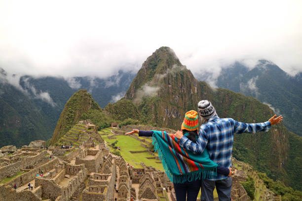
Couple dressed in ponchos watching the ruins of Machu Picchu

Portrait of a chinchero indigenous women on a mountain, in Moray

Aztec and Maya symbols set. Ancient pyramid, inca warrior, ethnic masks, gods and idols artifacts. Flat vector illustrations for Mexican culture, traditional decorations concept

Cusco, Peru: 27th February 2020. In the morning the light was nice in the house. An Inca woman is wearing traditional clothes and is preparing for a day of traditional textile work. Her child stands aside and looks at her hoping can help his mother.
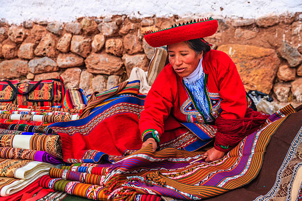
Peruvian woman selling souvenirs at Inca ruins. The Sacred Valley of the Incas or Urubamba Valley is a valley in the Andes of Peru, close to the Inca capital of Cusco and below the ancient sacred city of Machu Picchu. The valley is generally understood to include everything between Pisac and Ollantaytambo, parallel to the Urubamba River, or Vilcanota River or Wilcamayu, as this Sacred river is called when passing through the valley. It is fed by numerous rivers which descend through adjoining valleys and gorges, and contains numerous archaeological remains and villages. The valley was appreciated by the Incas due to its special geographical and climatic qualities. It was one of the empire's main points for the extraction of natural wealth, and the best place for maize production in Peru.http://bhphoto.pl/IS/peru_380.jpg

A close up of a woman weaving in Peru with bright traditional clothes.
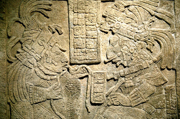
Ancient Maya limestone lintel from Yachilan, Mexico dating from about AD725. The scene is of a blood-letting ritual.

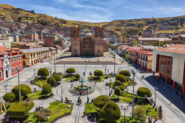
An old town in the city of Cusco.

The Sacred Valley of the Incas or Urubamba Valley is a valley in the Andes of Peru, close to the Inca capital of Cusco and below the ancient sacred city of Machu Picchu. The valley is generally understood to include everything between Pisac and Ollantaytambo, parallel to the Urubamba River, or Vilcanota River or Wilcamayu, as this Sacred river is called when passing through the valley. It is fed by numerous rivers which descend through adjoining valleys and gorges, and contains numerous archaeological remains and villages. The valley was appreciated by the Incas due to its special geographical and climatic qualities. It was one of the empire's main points for the extraction of natural wealth, and the best place for maize production in Peru.

Peruvian woman selling souvenirs in her shop near Colca Canyon, Peru. Colca Canyon is a canyon of the Colca River in southern Peru. It is located about 100 miles (160 kilometers) northwest of Arequipa. It is more than twice as deep as the Grand Canyon in the United States at 4,160 m. However, the canyon's walls are not as vertical as those of the Grand Canyon. The Colca Valley is a colorful Andean valley with towns founded in Spanish Colonial times and formerly inhabited by the Collaguas and the Cabanas. The local people still maintain ancestral traditions and continue to cultivate the pre-Inca stepped terraces.
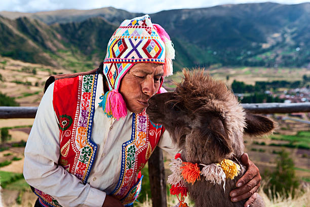
Peruvian man kissing llama near Pisac. The Sacred Valley of the Incas or Urubamba Valley is a valley in the Andes of Peru, close to the Inca capital of Cusco and below the ancient sacred city of Machu Picchu. The valley is generally understood to include everything between PÃsac and Ollantaytambo, parallel to the Urubamba River, or Vilcanota River or Wilcamayu, as this Sacred river is called when passing through the valley. It is fed by numerous rivers which descend through adjoining valleys and gorges, and contains numerous archaeological remains and villages. The valley was appreciated by the Incas due to its special geographical and climatic qualities. It was one of the empire's main points for the extraction of natural wealth, and the best place for maize production in Peru.

Set of Multiethnic People. Male and Female Characters Viking, African Tribes, Indian American Persons in Traditional Clothes with Weapon and Armor. Cartoon Vector Illustration

The Sacred Valley of the Incas or Urubamba Valley is a valley in the Andes of Peru, close to the Inca capital of Cusco and below the ancient sacred city of Machu Picchu. The valley is generally understood to include everything between Pisac and Ollantaytambo, parallel to the Urubamba River, or Vilcanota River or Wilcamayu, as this Sacred river is called when passing through the valley. It is fed by numerous rivers which descend through adjoining valleys and gorges, and contains numerous archaeological remains and villages. The valley was appreciated by the Incas due to its special geographical and climatic qualities. It was one of the empire's main points for the extraction of natural wealth, and the best place for maize production in Peru.

Colca Canyon is a canyon of the Colca River in southern Peru. It is located about 100 miles (160 kilometers) northwest of Arequipa. It is more than twice as deep as the Grand Canyon in the United States at 4,160 m. However, the canyon's walls are not as vertical as those of the Grand Canyon. The Colca Valley is a colorful Andean valley with towns founded in Spanish Colonial times and formerly inhabited by the Collaguas and the Cabanas. The local people still maintain ancestral traditions and continue to cultivate the pre-Inca stepped terraces.http://bem.2be.pl/IS/peru_380.jpg

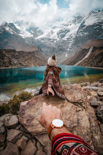
Beautiful couple admiring Machu Picchu mountain, Sacred Valley, and the surrounding peaks from above

Sacsayhuaman, the former capital of the Inca empire, UNESCO World Heritage Site, Cuzco, Peru, South America

Convoy across Inca road. The Inca road system was the most extensive and advanced transportation system in pre-Columbian South America. It was at least 40,000 kilometres (25,000 mi).In modern times the roads see heavy use from tourism. Wood engraving, published in 1888.
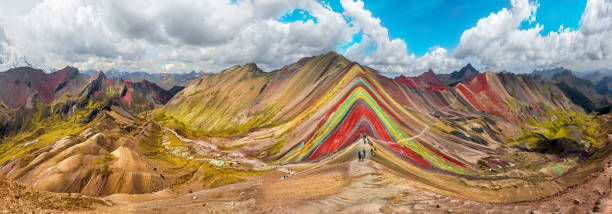
Hiking scene in Vinicunca, Cusco Region, Peru. Rainbow Mountain (Montana de Siete Colores).

The inca ruins of the lost city Machu Picchu during daytime with tourists visiting the site near the city of Cusco, Peru, South America.

A young beautiful indigenous female portrait, dressed in her traditional attire clothes dancing with her tribu while shooting in her village. Tribu Quichua / Kichwa napuruna.
Colca Canyon is a canyon of the Colca River in southern Peru. It is located about 100 miles (160 kilometers) northwest of Arequipa. It is more than twice as deep as the Grand Canyon in the United States at 4,160 m. However, the canyon's walls are not as vertical as those of the Grand Canyon. The Colca Valley is a colorful Andean valley with towns founded in Spanish Colonial times and formerly inhabited by the Collaguas and the Cabanas. The local people still maintain ancestral traditions and continue to cultivate the pre-Inca stepped terraces.http://bem.2be.pl/IS/peru_380.jpg
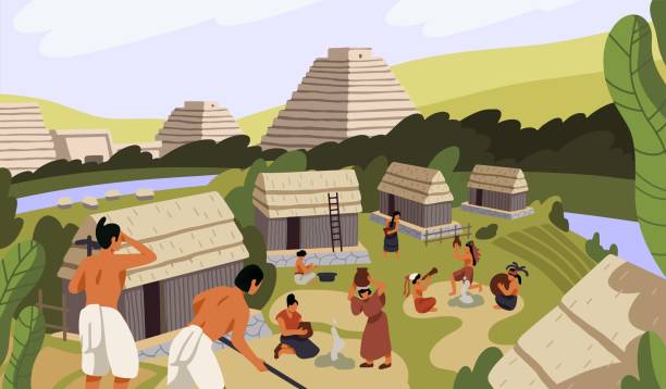
Ancient Mayan village with huts. Maya civilization life. Native American, Indian tribe cooking, working. Aztec pyramids, religion. Mexican landscape with tribal buildings. Flat vector illustration.

An indigenous woman with baby alpaca in traditional clothing next to her handicraft stall and in front of the Colca Canyon near the city of Arequipa, Peru.

Peruvian woman sailing between Uros floating islands. Uros are a pre-Incan people that live on forty-two self-fashioned floating island in Lake Titicaca Puno, Peru and Bolivia. They form three main groups: Uru-Chipayas, Uru-Muratos and the Uru-Iruitos. The latter are still located on the Bolivian side of Lake Titicaca and Desaguadero River. The Uros use bundles of dried totora reeds to make reed boats (balsas mats), and to make the islands themselves. The Uros islands at 3810 meters above sea level are just five kilometers west from Puno port.
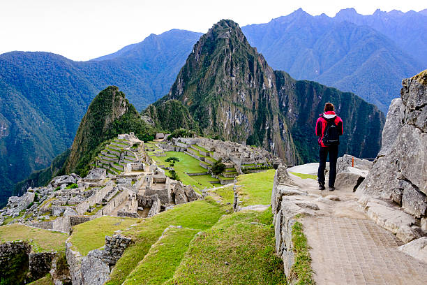
Woman standing on a ledge and overlooking the Inca ruins of the city of Machu Picchu seen in the background.

Potrait of a beautiful girl in ethnic jewelry on the beach

A young beautiful indigenous female portrait, dressed in her traditional attire clothes while playing with a little parakeet / bird shooting in her tribu village. Tribu Quichua / Kichwa napuruna. On back, the Amazon rainforest on sunny day. Tribu Quichua / Kichwa napuruna.

Medium shot side view of young Peruvian woman taking a selfie while hiking on trail to Sacred City of Machu Picchu, Peru
The Sacred Valley of the Incas or Urubamba Valley is a valley in the Andes of Peru, close to the Inca capital of Cusco and below the ancient sacred city of Machu Picchu. The valley is generally understood to include everything between Pisac and Ollantaytambo, parallel to the Urubamba River, or Vilcanota River or Wilcamayu, as this Sacred river is called when passing through the valley. It is fed by numerous rivers which descend through adjoining valleys and gorges, and contains numerous archaeological remains and villages. The valley was appreciated by the Incas due to its special geographical and climatic qualities. It was one of the empire's main points for the extraction of natural wealth, and the best place for maize production in Peru.http://bem.2be.pl/IS/peru_380.jpg

Huayna Capac, Huayna Cápac, Guayna Capac or Wayna Qhapaq ( 1464/1468 - 1527 ) was the third Sapa Inca of the Inca Empire, born in Tomebamba sixth of the Hanan dynasty, and eleventh of the Inca civilization. His original name was Tito Husi Hualpa. He was the successor to Topa Inca Yupanqui. Original edition from my own archives Source : Illustrierte Welt 1870
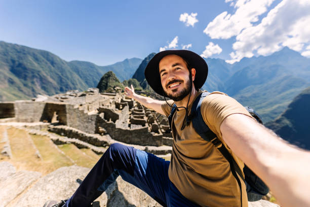
Happy young adult man taking selfie portrait in Machu Picchu. Joyful traveler enjoying vacation visiting Peru. South american travel holidays concept.

http://farm2.static.flickr.com/1359/5135885055_69a03dfd95.jpg

Peruvian woman selling souvenirs at Inca ruins, Sacred Valley, Peru

Illustration from Harper's Magazine Volume XLV -June to November 1872 :- The Brocken, also sometimes referred to as the Blocksberg, is the highest peak in the Harz mountain range and also the highest peak in Northern Germany; ...
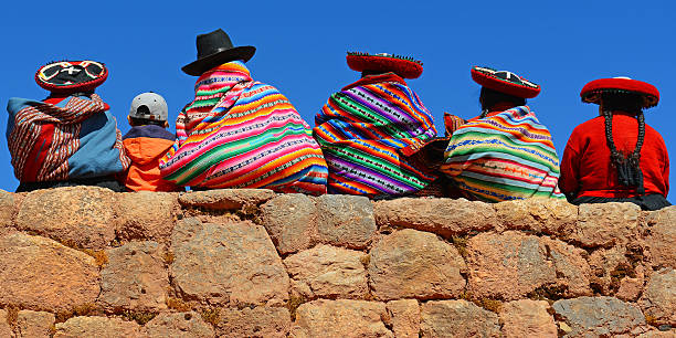
Chincheros, Peru - June 23, 2013: Quechua ladies with colorful textiles and hats sitting on an ancient Inca Wall together with a young boy with modern clothing.

Girl traveller interact with lama animal on sunny day light in Peru Machu Picchu

Two Bolivian women in traditional clothes. Vector illustration.
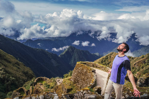
High angle view of a man breathing the air with eyes closed and open arms, with huge valley behind, on Phuyupatamarca ruins. Inca trail to Machu Picchu in Peru. South America