"High quality surface map, natural colors, clouds cover.Clouds map comes from earthobservatory/nasa.The software to createA!Photoshop CS5"
Browse 580+ india topographic map stock photos and images available, or start a new search to explore more stock photos and images.
"High quality surface map, natural colors, clouds cover.Clouds map comes from earthobservatory/nasa.The software to createA!Photoshop CS5"
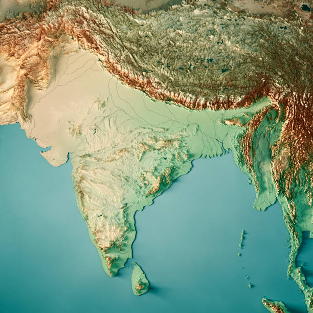
3D Render of a Topographic Map of India. All source data is in the public domain. Color texture and Rivers: Made with Natural Earth. http://www.naturalearthdata.com/downloads/10m-raster-data/10m-cross-blend-hypso/ http://www.naturalearthdata.com/downloads/10m-physical-vectors/ Relief texture: SRTM data courtesy of USGS. URL of source image: https://e4ftl01.cr.usgs.gov//MODV6_Dal_D/SRTM/SRTMGL1.003/2000.02.11/ Water texture: HIU World Water Body Limits: http://geonode.state.gov/layers/?limit=100&offset=0&title__icontains=World%20Water%20Body%20Limits%20Detailed%202017Mar30
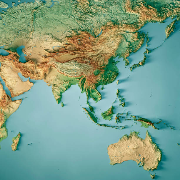
3D Render of a Topographic Map of Asia and Australia. All source data is in the public domain. Color texture: Made with Natural Earth. http://www.naturalearthdata.com/downloads/10m-raster-data/10m-cross-blend-hypso/ Relief texture: GMTED 2010 data courtesy of USGS. URL of source image: https://topotools.cr.usgs.gov/gmted_viewer/viewer.htm Water texture: SRTM Water Body SWDB: https://dds.cr.usgs.gov/srtm/version2_1/SWBD/

3D render of a topographic map of India. All source data is in the public domain. SRTM data courtesy of the U.S. Geological Survey.
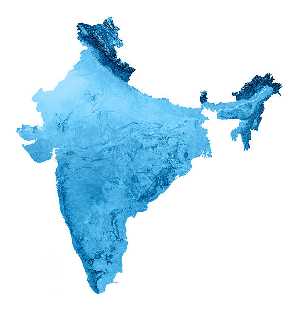
3D render and image composing: Topographic Map of India. Isolated on White. High resolution available! High quality relief structure!

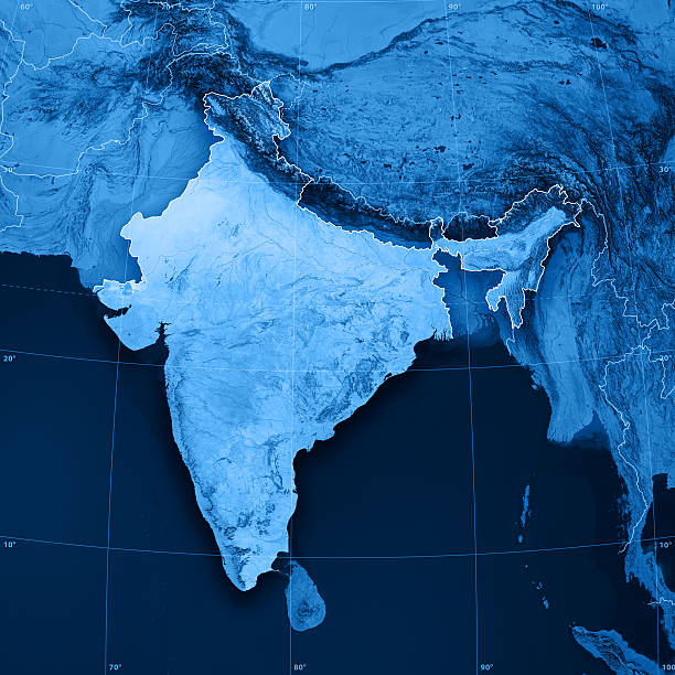
3D Render of a Topographic Map of the India and Southeast Asia. All source data is in the public domain. Color texture: Made with Natural Earth. http://www.naturalearthdata.com/downloads/10m-raster-data/10m-cross-blend-hypso/ Relief texture: GMTED 2010 data courtesy of USGS. URL of source image: https://topotools.cr.usgs.gov/gmted_viewer/viewer.htm Water texture: SRTM Water Body SWDB: https://dds.cr.usgs.gov/srtm/version2_1/SWBD/

3D Render of a Topographic Map of the India and Southeast Asia. All source data is in the public domain. Color texture: Made with Natural Earth. http://www.naturalearthdata.com/downloads/10m-raster-data/10m-cross-blend-hypso/ Relief texture: GMTED 2010 data courtesy of USGS. URL of source image: https://topotools.cr.usgs.gov/gmted_viewer/viewer.htm Water texture: SRTM Water Body SWDB: https://dds.cr.usgs.gov/srtm/version2_1/SWBD/

India Globe 3D Render of the Planet Earth, Depth of field effect. Made with Natural Earth. URL of source data: http://www.naturalearthdata.com Relief texture SRTM data courtesy of NASA. URL of source image: http://reverb.echo.nasa.gov The source data is in the public domain.

3D Render of a Topographic Map of India. All source data is in the public domain. Color texture and Rivers: Made with Natural Earth. http://www.naturalearthdata.com/downloads/10m-raster-data/10m-cross-blend-hypso/ http://www.naturalearthdata.com/downloads/10m-physical-vectors/ Relief texture: SRTM data courtesy of USGS. URL of source image: https://e4ftl01.cr.usgs.gov//MODV6_Dal_D/SRTM/SRTMGL1.003/2000.02.11/ Water texture: HIU World Water Body Limits: http://geonode.state.gov/layers/?limit=100&offset=0&title__icontains=World%20Water%20Body%20Limits%20Detailed%202017Mar30

3D Render of a Topographic Map of the India and Southeast Asia. All source data is in the public domain. Color texture: Made with Natural Earth. http://www.naturalearthdata.com/downloads/10m-raster-data/10m-cross-blend-hypso/ Relief texture: GMTED 2010 data courtesy of USGS. URL of source image: https://topotools.cr.usgs.gov/gmted_viewer/viewer.htm Water texture: SRTM Water Body SWDB: https://dds.cr.usgs.gov/srtm/version2_1/SWBD/

Historical map of East India. Lithograph, published in 1897.

3D render and image composing: Topographic Map of Pakistan. Isolated on White. Very high resolution available! High quality relief structure!

Map of the territorial development of the British Empire from the 17th century to the end of the 19th century. Lithograph, published in 1897.
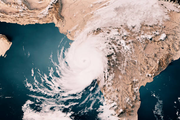
3D Render of a Topographic Map of the Arabian Sea with the clouds from May 17, 2021. Cyclone Tauktae approaching the west coast of India, Gujarat state.All source data is in the public domain.Cloud texture: Global Imagery Browse Services (GIBS) courtesy of NASA, VIIRS data courtesy of NOAA.https://www.earthdata.nasa.gov/eosdis/science-system-description/eosdis-components/gibsColor texture: Made with Natural Earth.http://www.naturalearthdata.com/downloads/10m-raster-data/10m-cross-blend-hypso/Relief texture: GMTED 2010 data courtesy of USGS. URL of source image:https://topotools.cr.usgs.gov/gmted_viewer/viewer.htmWater texture: SRTM Water Body SWDB: https://dds.cr.usgs.gov/srtm/version2_1/SWBD/

3D Render of a Topographic Map of the Bay of Bengal with the clouds from May 18, 2020. Cyclone Amphan east of India, approaching West Bengal and Bangladesh.All source data is in the public domain.Cloud texture: Global Imagery Browse Services (GIBS) courtesy of NASA, VIIRS data courtesy of NOAA.https://www.earthdata.nasa.gov/eosdis/science-system-description/eosdis-components/gibsColor texture: Made with Natural Earth.http://www.naturalearthdata.com/downloads/10m-raster-data/10m-cross-blend-hypso/Relief texture: GMTED 2010 data courtesy of USGS. URL of source image:https://topotools.cr.usgs.gov/gmted_viewer/viewer.htmWater texture: SRTM Water Body SWDB: https://dds.cr.usgs.gov/srtm/version2_1/SWBD/
Hand drawn vector illustration.
3D render and image composing: Topographic Map of India. Including country borders, rivers and accurate longitude/latitude lines. High resolution available! High quality relief structure!

"3D render and image composing: Topographic Map of Pakistan. Including country borders, rivers and accurate longitude/latitude lines. Very high resolution available! High quality relief structure!Relief texture and satellite images courtesy of NASA. Further data source courtesy of CIA World Data Bank II database.Related images:"
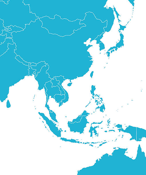
Empty Blue Map of East Asia
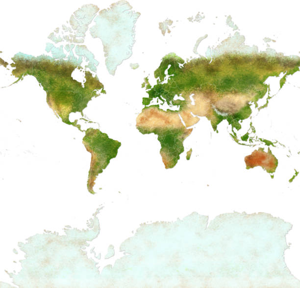
Planisphere of the world ultra defined with Antarctica, paper effect and peeling plaster. Physical map of the world with borders of nations. Hand drawn Source of the map: https://eoimages.gsfc.nasa.gov/images/imagerecords/74000/74092/world.200407.3x5400x2700.jpg Application: Adobe photoshop

3D Render of a Topographic Map of India. All source data is in the public domain. Color texture and Rivers: Made with Natural Earth. http://www.naturalearthdata.com/downloads/10m-raster-data/10m-cross-blend-hypso/ http://www.naturalearthdata.com/downloads/10m-physical-vectors/ Relief texture: SRTM data courtesy of USGS. URL of source image: https://e4ftl01.cr.usgs.gov//MODV6_Dal_D/SRTM/SRTMGL1.003/2000.02.11/ Water texture: HIU World Water Body Limits: http://geonode.state.gov/layers/?limit=100&offset=0&title__icontains=World%20Water%20Body%20Limits%20Detailed%202017Mar30

Spinning globe model in motion isolated on white background. Empty space for copy, room for text. Minimalist style long exposure travel concept.

3D Render of a Topographic Map of Asia and Australia. All source data is in the public domain. Color texture: Made with Natural Earth. http://www.naturalearthdata.com/downloads/10m-raster-data/10m-cross-blend-hypso/ Relief texture: GMTED 2010 data courtesy of USGS. URL of source image: https://topotools.cr.usgs.gov/gmted_viewer/viewer.htm Water texture: Made with Natural Earth. https://www.naturalearthdata.com/downloads/10m-physical-vectors/

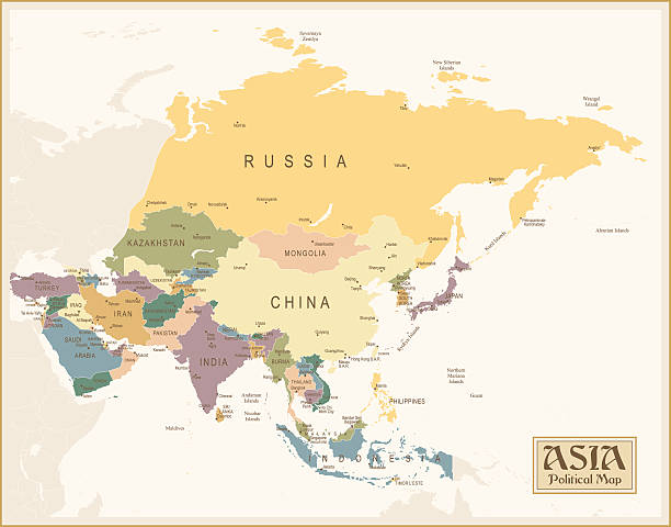
Map of Asia with names of countries, capitals and cities. Vector illustration
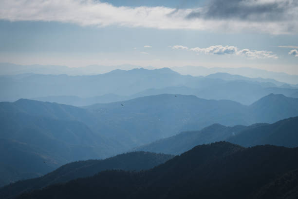
Endless layers of mountains. A mountain valley landscape view from Jhandi top at 11,500 ft on the Brahmatal trek.

Map of East Asia - illustration
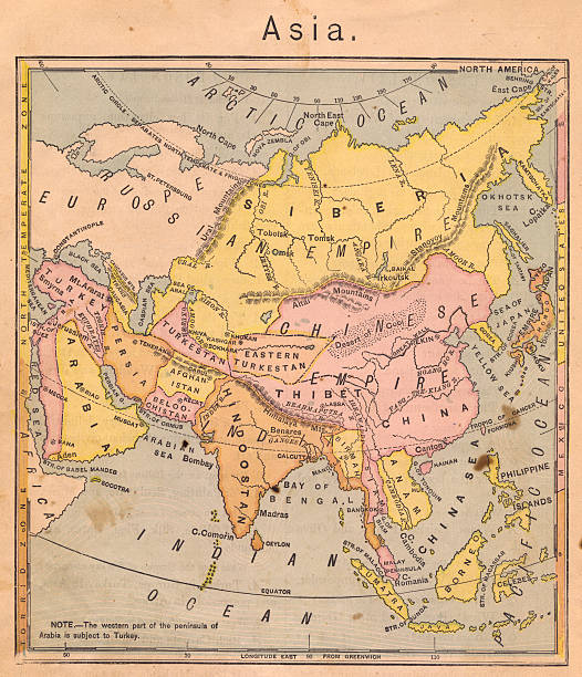
Color image of an old map of Asia, from the 1800's.

Vector maps of Pakistan with variable specification and icons

Realistic weather map of the India showing isobars and weather fronts. Meteorological forecast. Topography and physical map of India. Vector illustration. EPS 10.

Beige Sea Blue Map of East Asia - illustration

Asia Green Map with national borders Map was found: http://legacy.lib.utexas.edu/maps/middle_east_and_asia/txu-oclc-247232986-asia_pol_2008.jpg Created with Adobe Illustrator with splines 24-12-2019

Colored Eurasia Map with Country Names and Capital Cities

Empty Blue Eurasia Map

Chhattisgarh, India - high detailed physical map. Vector map. Dem map. Vector template for website, design, cover, infographics. Vector illustration.

Striped Map of India. Vector abstract India map with gray diagonal lines. Vector illustration EPS10

Vector maps of the East Asia with variable specification and icons

3D Render of a Topographic Map of the India and Southeast Asia. All source data is in the public domain. Color texture: Made with Natural Earth. http://www.naturalearthdata.com/downloads/10m-raster-data/10m-cross-blend-hypso/ Relief texture: GMTED 2010 data courtesy of USGS. URL of source image: https://topotools.cr.usgs.gov/gmted_viewer/viewer.htm Water texture: SRTM Water Body SWDB: https://dds.cr.usgs.gov/srtm/version2_1/SWBD/

3D Render of a Topographic Map of India. All source data is in the public domain. Color texture and Rivers: Made with Natural Earth. http://www.naturalearthdata.com/downloads/10m-raster-data/10m-cross-blend-hypso/ http://www.naturalearthdata.com/downloads/10m-physical-vectors/ Relief texture: SRTM data courtesy of USGS. URL of source image: https://e4ftl01.cr.usgs.gov//MODV6_Dal_D/SRTM/SRTMGL1.003/2000.02.11/ Water texture: HIU World Water Body Limits: http://geonode.state.gov/layers/?limit=100&offset=0&title__icontains=World%20Water%20Body%20Limits%20Detailed%202017Mar30

Weather map of the India. Meteorological forecast on a dark background. Editable of a generic weather map showing isobars and weather fronts. Vector illustration EPS 10

Very Detailed Physical Map Of Asia From 1884 Available Up To XXXL Size.

California, Ukraine, 1980, Abstract, Blue

Andhra Pradesh, India - high detailed physical map. Vector map. Dem map. Vector template for website, design, cover, infographics. Vector illustration.

Color image of an old map of Asia, from 1800's.

Vector maps of Indochina with variable specification and icons

3D Render of a Topographic Map of the Indian Ocean with the clouds from November 27, 2025. Cyclone Ditwah approaching Sri Lanka and Southern India.All source data is in the public domain.Cloud texture: Global Imagery Browse Services (GIBS) courtesy of NASA, VIIRS data courtesy of NOAA.https://www.earthdata.nasa.gov/eosdis/science-system-description/eosdis-components/gibsColor texture: Made with Natural Earth.http://www.naturalearthdata.com/downloads/10m-raster-data/10m-cross-blend-hypso/Relief texture: GMTED 2010 data courtesy of USGS. URL of source image:https://topotools.cr.usgs.gov/gmted_viewer/viewer.htmWater texture: SRTM Water Body SWDB: https://dds.cr.usgs.gov/srtm/version2_1/SWBD/

Vector Eurasia Map with infographic elements

Planisphere of the world ultra defined with Antarctica, paper effect and peeling plaster. Physical map of the world. Hand drawn. Source of the map: https://eoimages.gsfc.nasa.gov/images/imagerecords/74000/74092/world.200407.3x5400x2700.jpg Application: Adobe photoshop

Dark Gray Map of East Asia - illustration

India. Realistic synoptic map of the India showing isobars and weather fronts. Meteorological forecast on a dark background. Editable vector illustration of a generic weather map. Vector EPS 10

Map of Asia - Borders and Contours - illustration The url of the reference to map is: http://www.lib.utexas.edu/maps/world_maps/time_zones_ref_2011.pdf. In addition - some city locations were taken from: http://www.lib.utexas.edu/maps/world_maps/txu-oclc-264266980-world_pol_2008-2.jpg. The illustration completed August 17, 2015 and created in Corel Draw 1 layer of data used for the detailed outline of the land

Eurasia Map - illustration