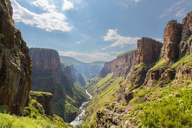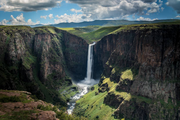
Maletsunyane Falls Lesotho Africa
Browse 7,200+ lesotho africa stock photos and images available, or start a new search to explore more stock photos and images.
Maletsunyane Falls Lesotho Africa

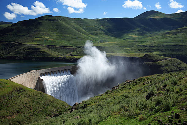
Katse Dam, Lesotho, South Africa
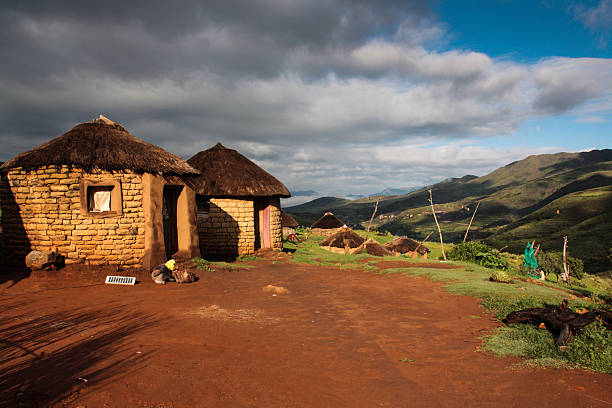
A small village near Malealea, in central Lesotho.

3D Render of a Topographic Map of South Africa. All source data is in the public domain. Color texture: Made with Natural Earth. http://www.naturalearthdata.com/downloads/10m-raster-data/10m-cross-blend-hypso/ Relief texture and Rivers: SRTM data courtesy of USGS. URL of source image: https://e4ftl01.cr.usgs.gov//MODV6_Dal_D/SRTM/SRTMGL1.003/2000.02.11/ Water texture: HIU World Water Body Limits: http://geonode.state.gov/layers/?limit=100&offset=0&title__icontains=World%20Water%20Body%20Limits%20Detailed%202017Mar30

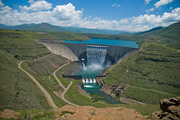
Mohale Dam, Lesotho: embankment rock-fill dam - switchback road on the wall - the reservoir has a surface area of 22 square kilometers - photo by M.Torres

African children writing exams in rural school classroom, Malealea Lesotho
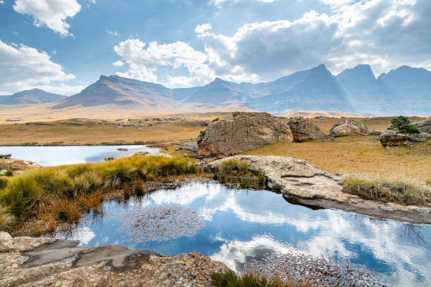
Ponds, grassland and rock formations and hills of Sehlabathebe National Park

South Africa, gray political map with nine provinces, with largest cities, and borders. Republic and southernmost country in Africa, with the three capitals Pretoria, Cape Town and Bloemfontein.
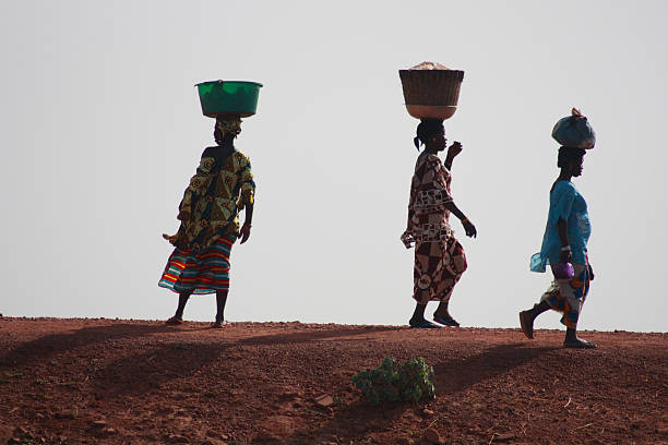
Sanga, Mali - September 29, 2008: Unidentified women from village in Dogon country on september 29, 2008, Sanga, Mali

The winding Sani Pass dirt road between South Africa and Lesotho

The sun rising in the direction of Durban over the Sani Pass bordering South Africa and Lesotho

Senior African woman working with traditional hoe in corn maize field in rural African setting, Malealea, Lesotho

Female Teacher teaching a class of high school students in uniform in a rural school in Africa Malealea, Lesotho. Rear view of the learners with their hands raised.

A car driving the hairpin turns of the Sani Pass on the border of South Africa and Lesotho.

Road leading down Sani pass, Lesotha, Southern Africa.

Close-up South African Zulu spears, warrior shields and assegai. Traditional tribal ethnic weapon.

"Katse, Lesotho - February 16, 2012: Lesotho woman on the road in rural Lesotho, Katse dam. Carrying plants to dry to use as feeding for animals."
Set of typography African countries. Handwritten design modern brush lettering isolated vector.
Ethnic adobe mud wall decorated with Old style village art work in white paint.
Vector modern illustration. Simplified geographical map of Republic of South Africa and borders with neighboring countries (Lesotho, Namibia, Botswana, Zimbabwe, Mozambique, Eswatini). Blue background of Indian Ocean. Names of cities and provinces of South Africa

Smiling Senior African woman standing with traditional hoe in corn maize field in rural African setting, Malealea, Lesotho

Scenery from Sani Pass on the way from South Africa to Lesotho

An aerial panorama of Ficksburg in the Free State Province of South Africa with Maputsoe in Lesotho accross the river one third from the top

Maseru, Lesotho - November 28, 2007 The capital city central business and government district.

Wooden ethnic tribal ritual mask decorated beards. Local market. South Africa. Craftsmanship. Souvenir.
![South Africa under loupe South Africa map. Source: "World reference atlas"
[url=/search/lightbox/5890567][IMG]http://farm4.static.flickr.com/3574/3366761342_e502f57f15.jpg?v=0[/IMG][/url] lesotho africa stock pictures, royalty-free photos & images](https://media.istockphoto.com/id/112802481/photo/south-africa-under-loupe.jpg?s=612x612&w=0&k=20&c=QcXs1DZ29o2fGGlH3FXqFYC9P7U1Sx3jk62sk4ObJJk=)
South Africa map. Source: "World reference atlas" [url=/search/lightbox/5890567][IMG]http://farm4.static.flickr.com/3574/3366761342_e502f57f15.jpg?v=0[/IMG][/url]

Studying Geography - South Africa on retro globe.
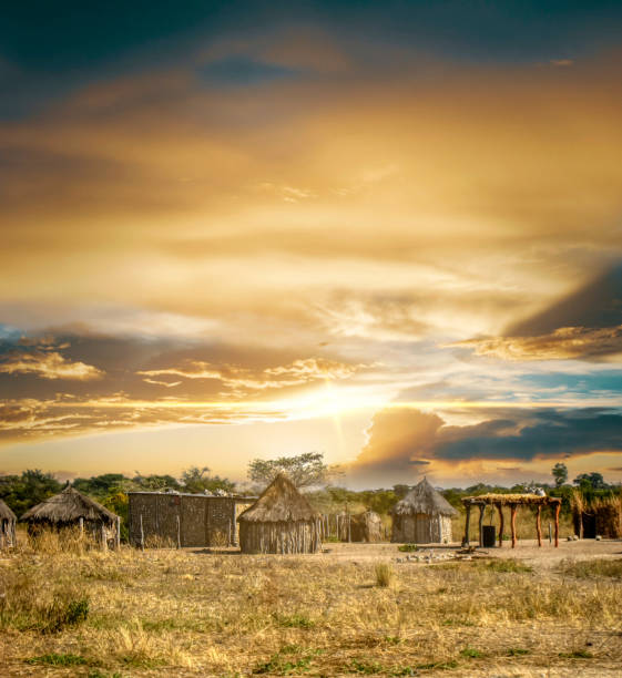
African village at sunset, mud houses with thatched roofs

Senior African woman standing with traditional hoe in corn maize field in rural African setting, Malealea, Lesotho

Senior African woman working with traditional hoe in corn maize field in rural African setting, Malealea, Lesotho

Senior African woman walking with traditional hoe in corn maize field in rural African setting, Malealea, Lesotho
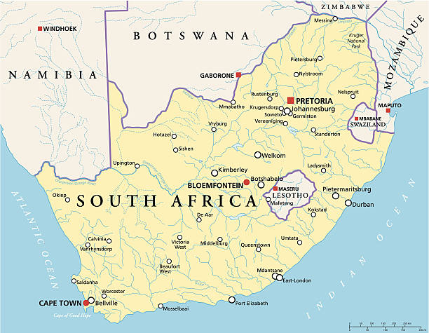
Political map of South Africa with the capitals Pretoria, Bloemfontein and Cape Town, with national borders, most important cities, rivers and lakes. Vector illustration with English labeling and scaling.
![South Africa South Africa map. Source: "World reference atlas"
[url=/search/lightbox/5890567][IMG]http://farm4.static.flickr.com/3574/3366761342_e502f57f15.jpg?v=0[/IMG][/url] lesotho africa stock pictures, royalty-free photos & images](https://media.istockphoto.com/id/110925055/photo/south-africa.jpg?s=612x612&w=0&k=20&c=-Ko356XP8VmHqzo-mHrkWf3MhNaotF-jIU3LNfoA9E8=)
South Africa map. Source: "World reference atlas" [url=/search/lightbox/5890567][IMG]http://farm4.static.flickr.com/3574/3366761342_e502f57f15.jpg?v=0[/IMG][/url]

Woman collecting water in a bucket at an outdoor community water tap faucet water point in a rural setting, Malealea, Lesotho.

Senior African woman working with traditional hoe in corn maize field in rural African setting, Malealea, Lesotho

Female Teacher teaching a class of high school students in uniform in a rural school in Africa Malealea, Lesotho. The image allows for copy space.

Lesotho highlands: circular thatched roof stone hut - rondavel hut, locally known as a mokhoro - village house.

Senior African woman working with traditional hoe in corn maize field in rural African setting, Malealea, Lesotho
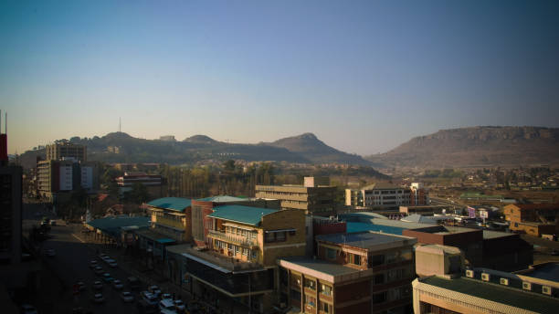
Aerial panorama view to Maseru, the capital of Lesotho
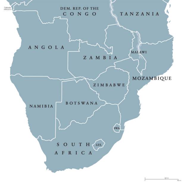
Southern Africa political map with borders of the countries and English labeling. The southernmost region of the African continent. Gray illustration on white background. Vector.

Maseru, Lesotho: Parliament of Lesotho building on Mpilo Hill - paid by a Chinese grant and built by the Chinese construction company Yanjian Group - photo by M.Torres

Erosion canyon forming drone shot from the air in rural Lesotho Highlands

Photo taken at Maletsunyane Falls near Semonkong (Place of Smoke) in the Kingdom in the Sky - Lesotho.

A Cute Male African learner student sitting in a rural school classroom on a wooden desk keen to be educated. He is looking at the camera smiling. Positive emotion. Lifestyle Portrait. Beautiful people. Malealea, Lesotho.

All round World Flags with country names (part2)

Lesedi Cultural Village, SOUTH AFRICA - 4 November 2016: Portrait of a young male Basotho tribesman. The Basotho, or Bantu tribe are mountain people originating from Lesotho.