The layers of the earth concept illustration
Browse 3,600+ lithosphere stock photos and images available, or search for earth or plate tectonics to find more great stock photos and pictures.
The layers of the earth concept illustration

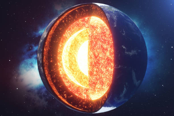
Lithosphere earth layers structure. Planet geology school scheme. Geography infographics with cross section diagram. Earth inside model, internal mantle level. For education and science use.

Biosphere vector illustration. Labeled all natural ecosystems with wildlife. Educational example with atmosphere, hydrosphere and lithosphere. Sustainable biodiversity and animal friendly environment.

The layers of the earth concept illustration

Earth biosphere with atmosphere, hydrosphere and lithosphere outline diagram. Labeled educational scheme with nature water cycle and biological precipitation cycle in ecosystem vector illustration.
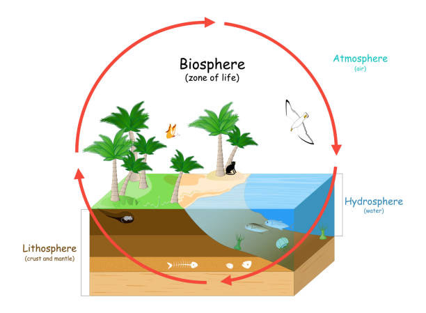
Biosphere is a zone of life on Earth. natural ecosystems with wildlife. Ecosphere (environment), Hydrosphere (water), Atmosphere (air), and Lithosphere (crust and the portion of the upper mantle). vector illustration for education
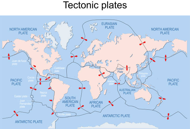
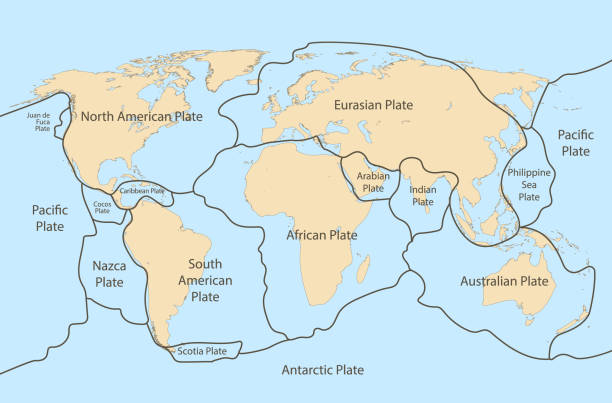
Map of Earth's principal tectonic plates. Earth's lithosphere. Major and minor plates. arrows indicate direction of movement at plate boundaries. Vector illustration

A graphic illustration that demonstrates the different areas that make up the planet Earth. At the bottom left of the image is the lithosphere. It is colored tan and labeled "Lithosphere" and "Crust" with white lettering. The image's bottom right contains the hydrosphere. It is pictured as blue water. The atmosphere is at the top labeled with black letters. It consists of a light blue sky. A cow eats grass on top of the lithosphere next to a black and gray mountain capped with white snow. Blue and white clouds float past, and fish swim in the water.
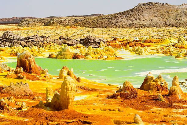
The volcanic explosion crater of Dallol in the Danakil Depresseion in Nothern Ethiopia. The Dallol crater was formed during a phreatic eruption in 1926. This crater is known as the lowest subaerial vulcanic vents in the world. The surreal colours are caused by green acid ponds and iron oxides and sulfur.

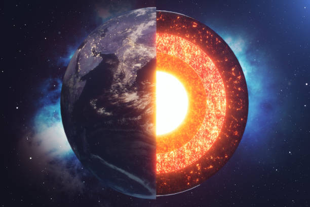
Earth. internal structure, cross section, and layers of the planet. Crust, upper mantle, lower mantle, outer core and inner core. vector illustration for education and science use.
Tectonic plate earth map. Continental ocean pacific, volcano lithosphere geography plates.

3D model illustrating layers of earth. Isolated on white with clipping path.World map's obtained from the Nasa public domain archive and then has been modified for required diffuse and bump maps.Link: http://veimages.gsfc.nasa.gov/7100/world.topo.bathy.200401.3x5400x2700.jpgSimilar images:

Earthquake magnitude levels vector illustration diagram, Richter scale seismic activity diagram with shaking intensity, from moving furniture to crashing buildings.

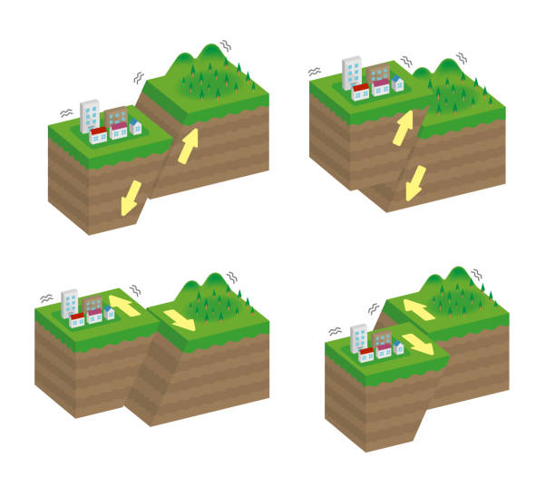
Convergent plate boundary created by two continental plates that slide towards each other. Digital illustration.
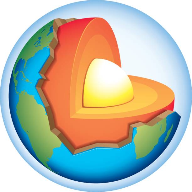
Earth cross section that shows the internal structure with crust, mantle and core.
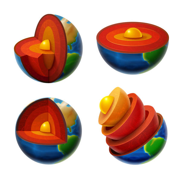
Cross section planet Earth. Structure of the Earth. Vector illustration Set.

Lithosphere vector illustration. Labeled educational earth outer shell scheme. Explanation cross section diagram with asthenosphere, mantle and core structure. Detailed world parts explanation graphic
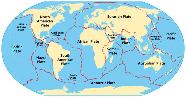
Map of the principal tectonic plates of the Earth. The sixteen major pieces of crust and uppermost mantle of the Earth, called the lithosphere, and consisting of oceanic and continental crust. Vector
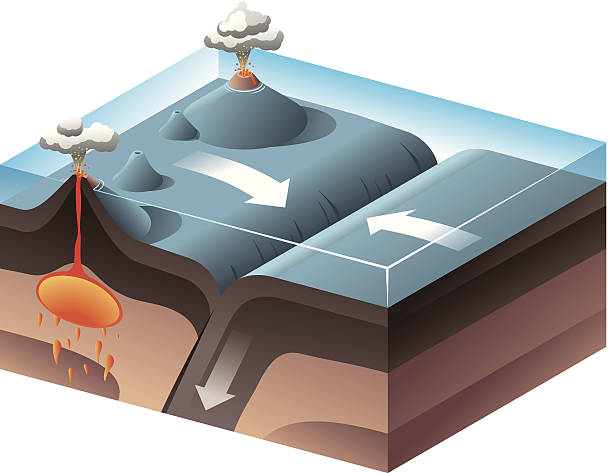
Two tectonic convergent plates boundaries move toward one another and collide.
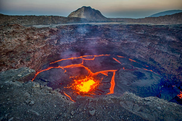
View from the crater rim of Erta Ale - one of the most active vulancoes in the world - into the active, red glowing lava lake. Erta Ale is a continuously active basaltic shield volcano in the Afar Region of northeastern Ethiopia, only some kilometers from the border to Eritrea. The Afar Depression (or Danakil Depression) in the border-triangle between Ethiopia, Eritrea and Djibouti is one of the most remote and most extreme regions of the world - it is the lowest point in Africa (- 155 metres/-550 ft below sea level) and one of the hottest places on Earth. The Danakil/Afar Depression is the product of a tectonic triple junction, where the spreading ridges that form the Red Sea and the Gulf of Aden emerge on land and meet the East African Rift. Here the Earth's crust is slowly rifting apart at a rate of 1–2 centimetres (0.3–0.8 in) per year. Erta ale is ond of the most dangerous places on earth - the lat major eruptions took place in September 2005, August 2007 and November 2008.
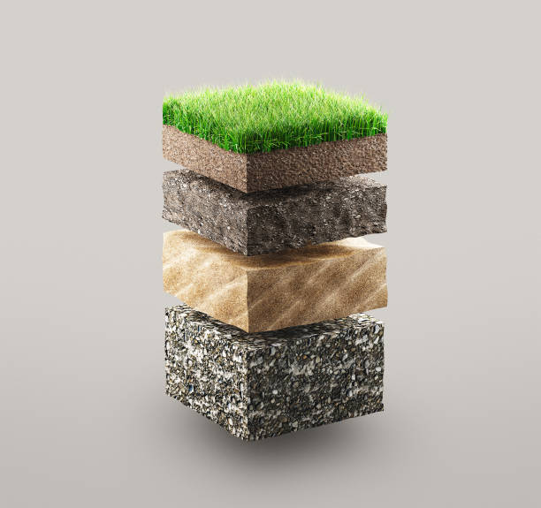
Layers of ground with grass, illustration concept
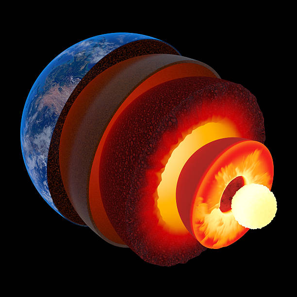
Earth core structure illustrated with geological layers according to scale - isolated on black (Elements of this 3d image furnished by NASA - texture maps from http://visibleearth.nasa.gov/)
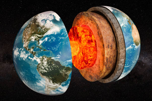
Structure of planet Earth in space, 3D rendering. The source of the map - https://svs.gsfc.nasa.gov/3615

Earth core structure illustrated with geological layers according to scale - isolated on black (Elements of this 3d image furnished by NASA - source maps from http://visibleearth.nasa.gov/)

Structure of planet Earth with atmosphere layer concept, 3D rendering isolated on white background. The source of the map - https://svs.gsfc.nasa.gov/3615

an illustration of earth crust

World globe structure 3d illustration. Earth core structure. Core world crust vector. Geography concept. Inner core outer core mantle crust illustration. Vector graphic EPS 10

Diagram showing layers of the Earth lithosphere illustration
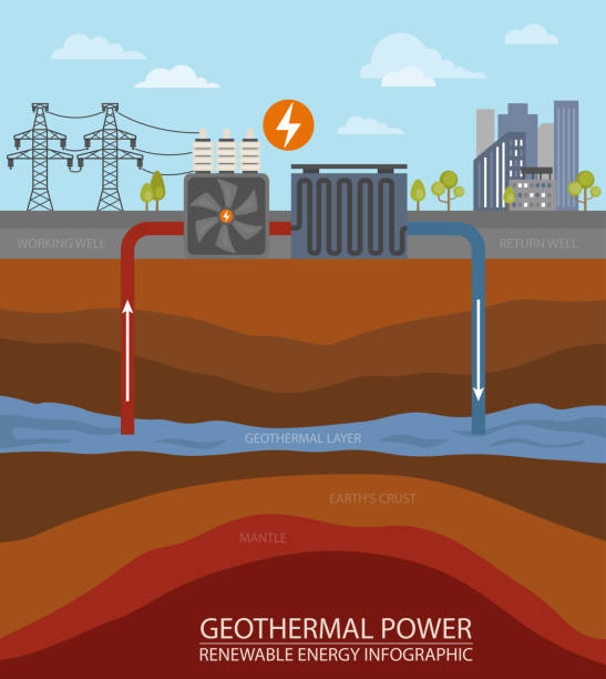
Renewable energy infographic. Geothermal power. Global environmental problems. Vector illustration

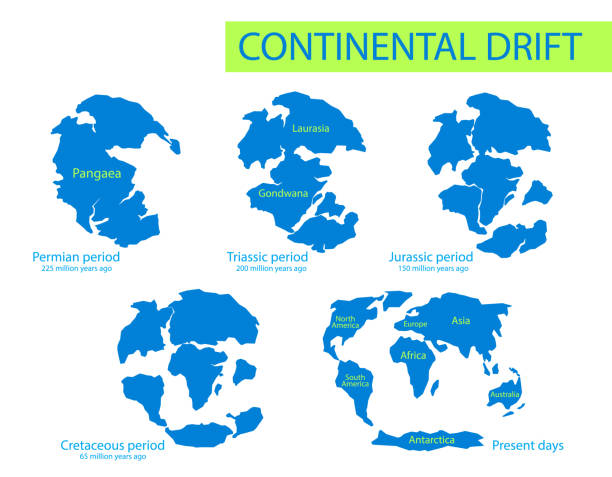
Pangaea or Pangea. Vector illustration of supercontinent that existed during the late Paleozoic and early Mesozoic eras. Map of green ancient continent and ocean in flat style. Poster. Education.
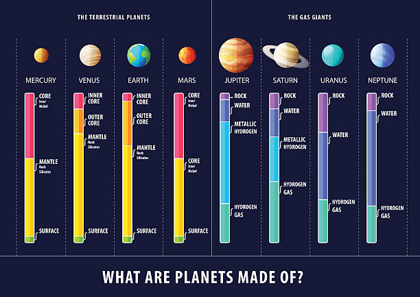
Geological structure of planets vector inforgaphic poster

Diagram showing layers of the Earth lithosphere illustration

Earth I have used http://legacy.lib.utexas.edu/maps/world_maps/world_physical_2015.pdf address as the reference to draw the basic map outlines with Illustrator CS5 software, other themes were created by myself.

Structure of earth. Diagram of the interior layer of Earth. Geological of earth structure 3d rendering.

Types of plate boundaries. Divergent boundaries (Constructive) occur where two plates slide apart from each other. At zones of continent-to-continent rifting, divergent boundaries may cause new ocean basin to form as the continent splits, spreads, the central rift collapses, and ocean fills the basin. 3d rendering

3D image showing the segments of the world on black background. The structure of planet earth’s mantle layer under the earth's crust and the core beneath it.. / You can see the animation movie of this image from my iStock video portfolio. Video number: 1460594656 I re-drawed the map with reference to the Nasa map on the link below: https://earthobservatory.nasa.gov/images/9101/carbon-monoxide-from-alaska-fires

Diagram showing layers of the Earth lithosphere illustration
Vector illustration in modern thin line style of Earth related icons: ecology, care, location, and more. Isolated on white background.
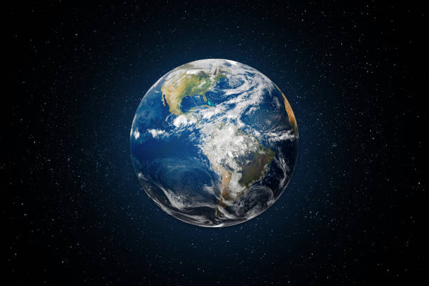
Planet Earth globe view from space with North and South America. This image elements furnished by NASA. https://images.nasa.gov/details-GSFC_20171208_Archive_e002012

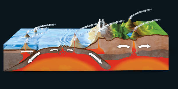
Tectonic plates move constantly, and can change our planet’s features, depending on how they meet. Where they push together, mountains and volcanoes form. Where they pull apart, new ocean floor is created. 3d rendering with cinema 4dSource Nasa: https://visibleearth.nasa.gov/view.php?id=73963https://visibleearth.nasa.gov/view.php?id=74443

12 April 1969, International day of human space flight, Cosmonautics Day concept with ISS astronaut in spacesuit against background of the Earth planet. Spaceman in outer space 3D science illustration

Soil layers with geological ground structure and materials outline diagram. Labeled educational scheme with land cross section vector illustration. Humus, topsoil, subsoil, rock fragments and bedrock
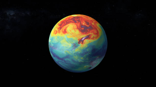
Carbon dioxide emission on Earth. Massive CG graphics created using VC orb plug-in mixed with NASA imagery. Texture map used from: https://svs.gsfc.nasa.gov/11683