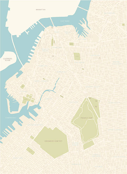
Black simple detailed street roads map on vintage beige background of the Brooklyn borough of New York City, USA
Browse 670+ map of brooklyn stock photos and images available, or search for map of brooklyn new york to find more great stock photos and pictures.
Black simple detailed street roads map on vintage beige background of the Brooklyn borough of New York City, USA

Poster Style Topographic / Road map of Brooklyn, NYC. Map data is public domain via census.gov. All maps are layered and easy to edit. Roads are editable stroke.
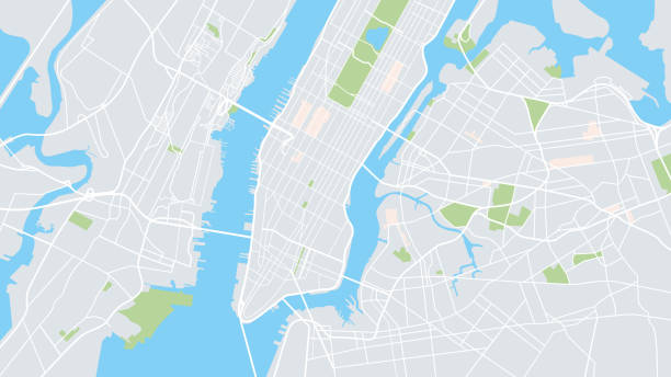
Illustration vector of New York city map. Eps 10 file

Brooklyn NY City Vector Road Map Blue Text. All source data is in the public domain. U.S. Census Bureau Census Tiger. Used Layers: areawater, linearwater, roads.

An illustration that shows the various neighborhoods of Brooklyn. Shoreline is highly detailed. Each neighborhood is on a separate layer as is the text.

3D Render of a Topographic Map of Brooklyn, New York, USA. All source data is in the public domain. Contains modified Copernicus Sentinel data (Apr 2019) courtesy of ESA. URL of source image: https://scihub.copernicus.eu/dhus/#/home. Relief texture SRTM data courtesy of NASA. URL of source image: https://search.earthdata.nasa.gov/search/granules/collection-details?p=C1000000240-LPDAAC_ECS&q=srtm%201%20arc&ok=srtm%201%20arc

Brooklyn neighborhoods in New York, United States. Vector image

Black simple detailed street roads map on vintage beige background of the quarter Bronx borough of New York City, USA
A detailed map of the northwest area of Brooklyn in New York City. Includes all roads and highways. Also includes parks, neighborhoods and points of interest.
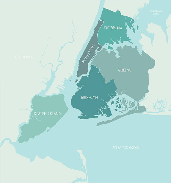
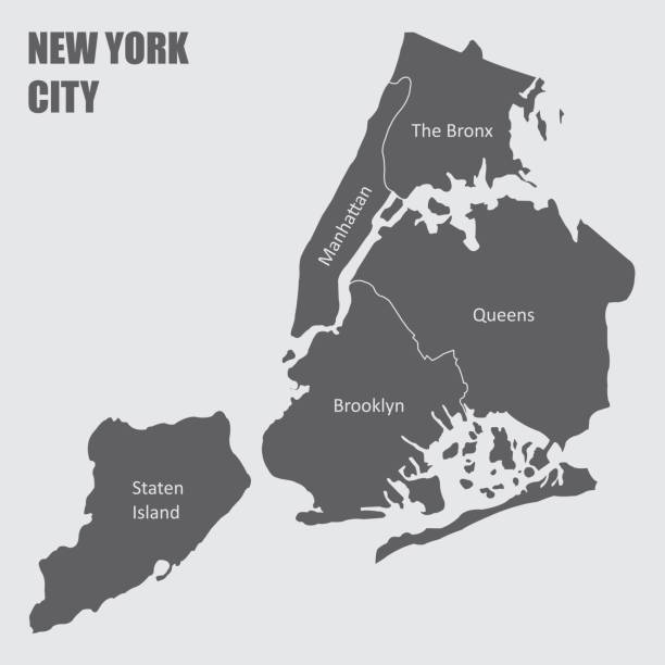
A detailed map of the five boroughs of New York City. Shoreline is highly detailed. Each borough is on a separate layer so colors can be easily changed. Text is hand-drawn.

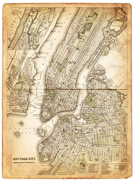
very old map showing new york city and Brooklyn 1886

High resolution outline map of New York City with NYC boroughs. Each boroughs placed on a separate layer.

Brooklyn NY City Vector Road Map Blue Horizontal. All source data is in the public domain. U.S. Census Bureau Census Tiger. Used Layers: areawater, linearwater, roads.

New York City, political map. Most populous city in the United States, located in the state of New York. Manhattan, Bronx, Queens, Brooklyn and Staten Island. English labeling. Illustration. Vector.

very old map showing new york city 1834

Vector highly detailed political map of New York with all regions, roads and rivers. All elements are separated in editable layers clearly labeled.EPS 10

Detailed map of New York City and the

Colorful New York City administrative and political vector map, united states
Vector poster map city New York detailed plan of the city, rivers and streets

Yellow and blue abstract New York map background

Map of New York city and surroundings 1895

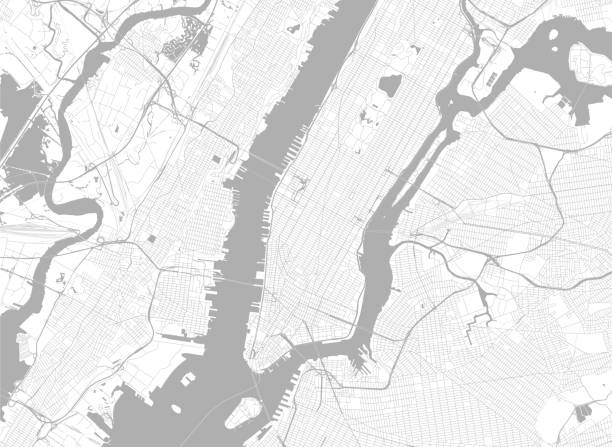
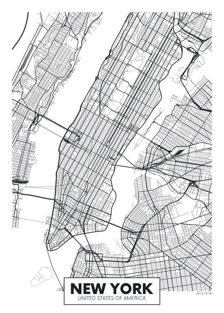
Vector Illustration of a City Street Map of New York City, New York, USA. Scale 1:60,000. All source data is in the public domain. U.S. Geological Survey, US Topo Used Layers: USGS The National Map: National Hydrography Dataset (NHD) USGS The National Map: National Transportation Dataset (NTD)
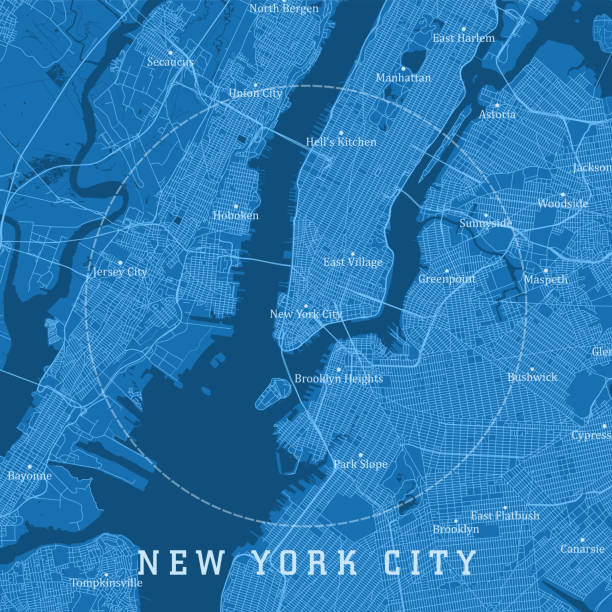
New York City NY City Vector Road Map Blue Text. All source data is in the public domain. U.S. Census Bureau Census Tiger. Used Layers: areawater, linearwater, roads.

Queens NY City Vector Road Map Blue Text. All source data is in the public domain. U.S. Census Bureau Census Tiger. Used Layers: areawater, linearwater, roads.

Johnson’s Universal Cyclopedia - Charles Kendall - New York 1893

Map from the Complete Handy Atlas of the World - 1898

New york city, 5 boroughs vector map
very old map showing new york city, new jersey,and hoboken) 1874 - composite with grunge sepia paper.

New york city, boroughs, districts, neighborhoods vector map

Poster Style Topographic / Road map of Brooklyn, NYC. Map data is public domain via census.gov. All maps are layered and easy to edit. Roads are editable stroke.

3D Render of a Topographic Map of Queens, New York, USA. All source data is in the public domain. Contains modified Copernicus Sentinel data (Apr 2019) courtesy of ESA. URL of source image: https://scihub.copernicus.eu/dhus/#/home. Relief texture SRTM data courtesy of NASA. URL of source image: https://search.earthdata.nasa.gov/search/granules/collection-details?p=C1000000240-LPDAAC_ECS&q=srtm%201%20arc&ok=srtm%201%20arc

Detailed editable and scalable urban New York City map. Map of NYC, NY, USA with borders. Vector light stroke version on dark background including streets.

Ilustration of a Map of New York city 1896

A detailed map of the Coney Island in New York City's Brooklyn Borough. Includes all roads and highways. Also includes parks and points of interest.
Map of New York city, with borders of the regions and labels

Vector Manhattan Guide Map, You are Here

Topographic / Road map of Brooklyn, NYC. Map data is public domain via census.gov. All maps are layered and easy to edit. Roads are editable stroke.

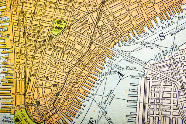
very old map showing the central portions of the cities of new york and brooklyn 1873

Brooklyn, New York t-shirt design with World globe. Sport tee shirt with Earth globe. Brooklyn apparel print in college style. Vector illustration.

Satellite view of New York city, map, 3d buildings. Streets and skyscraper of Manhattan. 3d rendering Cinema 4d it was the software, smart osm

New York City NY City Vector Road Map Blue Horizontal. All source data is in the public domain. U.S. Census Bureau Census Tiger. Used Layers: areawater, linearwater, roads.

Poster Style Topographic / Road map of Brooklyn, NYC. Map data is public domain via census.gov. All maps are layered and easy to edit. Roads are editable stroke.

The 5 community districts of New York City, USA

Topographic / Road map of New York City - Poster Style. Original map data is public domain sourced from www.census.gov/