
Images
Browse 670+ map of manchester uk stock photos and images available, or start a new search to explore more stock photos and images.


Our creative library is free of AI-generated contentChoose your visuals with confidence knowing our creative library is free from AI-generated content, so your searches only return safe, high-quality visuals you can trust.

Detailed vector map of England, UK, including main cities, roads, rivers and lakes. The colors in the .eps-file are ready for print (CMYK). Included files are EPS (v10) and Hi-Res JPG (4922 x 4922 px).

United Kingdom map shape. UK silhouette vector illustration isolated on white.


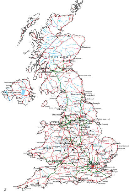
United Kingdom road and highway map. Organized vector illustration on seprated layers.

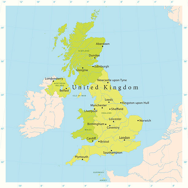
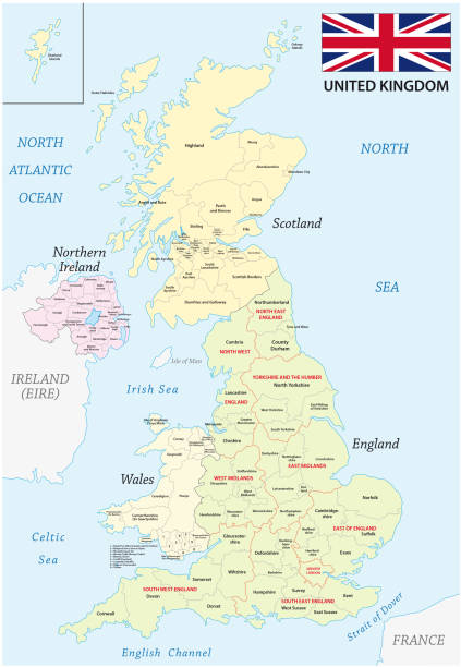
Political map of United Kingdom with capital London, national borders, most important cities, rivers and lakes. Vector illustration with English labeling and scaling.


A simple UK map with roads and major towns and cities named. There is a very slight grunge texture on sea and land, this is on separate layers and are easy to remove. 11 layers in all.

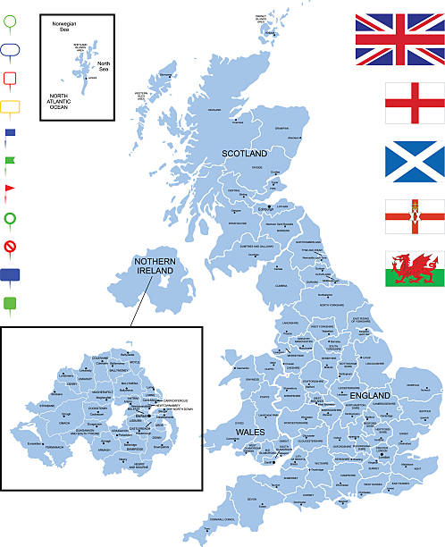
Detailed map of United Kingdom with pointers.

Macro image of a map showing Manchester city centre. The map is marked with a drawing pin. Narrow depth of field. Horizontal colour image with copy space.


"Highly detailed vector map of the United Kingdom. File was created on November 2, 2011. The colors in the .eps-file are ready for print (CMYK). Included files: EPS (v8) and Hi-Res JPG."

Vintage Antquie Map of Manchester, Salfiord and Environs, England in 1880.

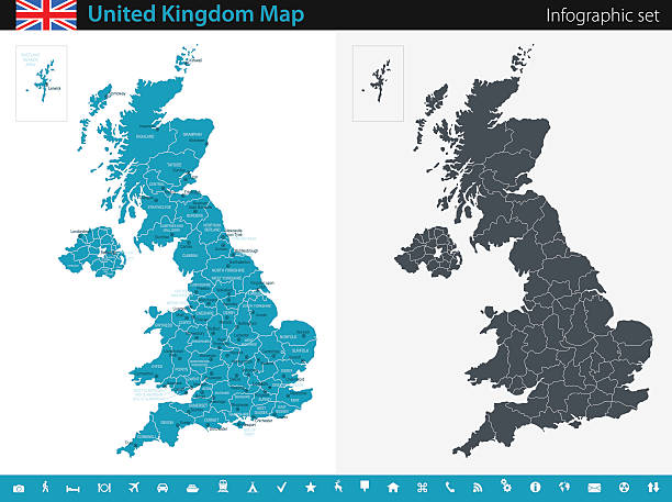
Vector maps of the United Kingdom with variable specification and icons The urls of the reference files are (country, continent, world map and globe): http://www.lib.utexas.edu/maps/europe/united_kingdom_pol87.jpg http://www.lib.utexas.edu/maps/world_maps/time_zones_ref_2011.pdf - The illustration was completed March 23, 2016 and created in Corel Draw - 1 layer of data used for the detailed outline of the land

Black and white engraved map of Lancashire from a book about Manchester dated 1795.


NH Hillsborough Manchester Vector Road Map. All source data is in the public domain. U.S. Census Bureau Census Tiger. Used Layers: areawater, linearwater, roads, rails, cousub, pointlm, uac10.

More than fifty years old map guide showing Manchester city under cheap magnifier

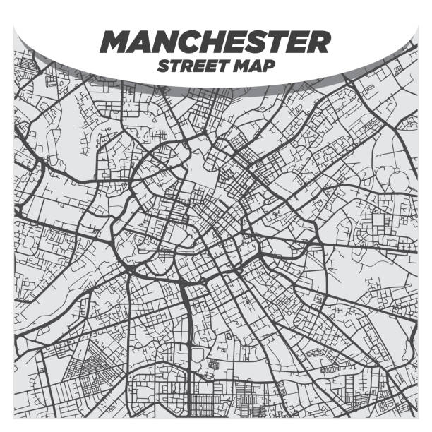
Map Photography: Manchester City on a Road Map

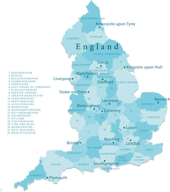
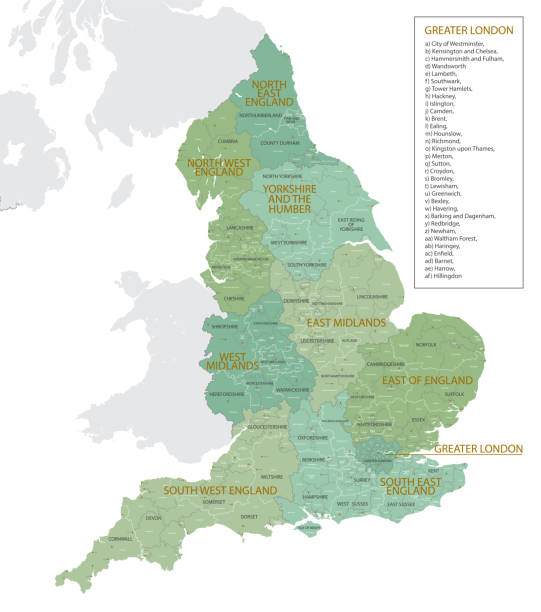
"Detailed vector map of England with administrative divisions. File was created on October 18, 2012. The colors in the .eps-file are ready for print (CMYK). Included files: EPS (v8) and Hi-Res JPG (4962aa aaa 5600 px)."

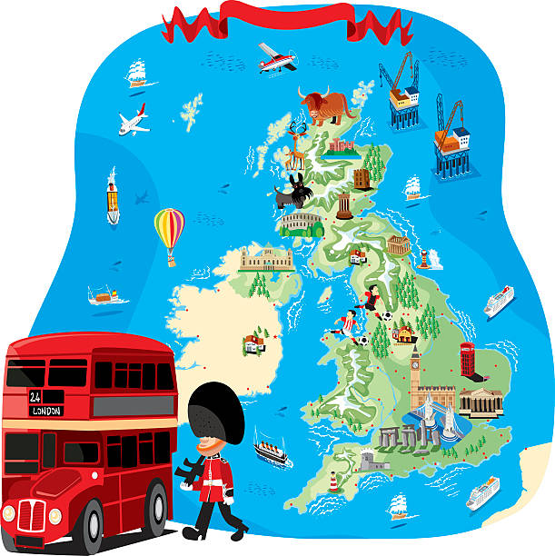
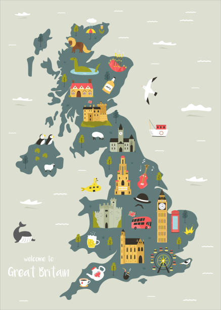
Map of Great Britain and flag - highly detailed vector illustration

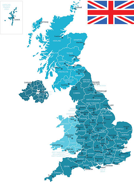
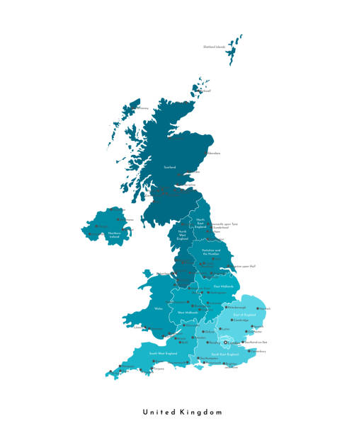
Blue Map of United Kingdom The urls of the reference files are (country, continent, world map and globe): http://www.lib.utexas.edu/maps/europe/united_kingdom_pol87.jpg http://www.lib.utexas.edu/maps/world_maps/time_zones_ref_2011.pdf - The illustration was completed March 20, 2016 and created in Corel Draw - 1 layer of data used for the detailed outline of the land

Source: "World reference atlas"Source: "World reference atlas"
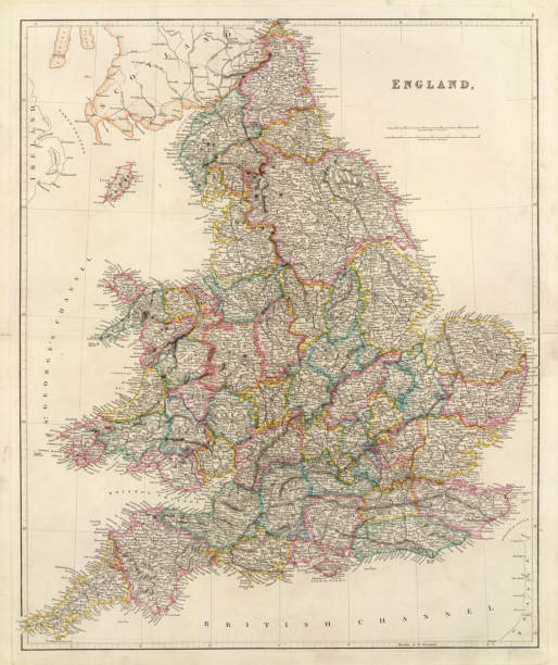
Antique map of EnglandSee more antique maps scanned from my collection of antique maps and engravings on iStockphoto:


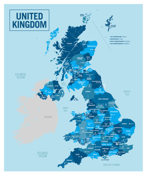
High detailed United Kingdom physical map with labeling. Organized vector illustration on seprated layers.

England political map divide by state colorful outline simplicity style. Vector illustration.
united kingdom administrative and political vector map with flag


Manchester map big data visualization. Futuristic map infographic of city in England. Visual map data complexity in modern blue and orange colors.

Map of United Kingdom. Detail from the World Atlas. Selective Focus.

Vintage engraving of a Antique map, Manchester, England, 19th Century


Black And White Satellite Image of Manchester, UK. Digital Composite. Contains modified Copernicus Sentinel data (2016) courtesy of ESA. URL of source image: https://scihub.copernicus.eu/dhus/#/home. The source data is in the public domain.


3D Render of a Map of the United Kingdom with Straight Pins at the Position of important Cities. Vintage Color Style. Very high resolution available!


Illuminating the beauty of Manchester, the aerial photograph reveals vibrant city lights, towering buildings, winding roads as the urban landscape shines under a tranquil night sky.
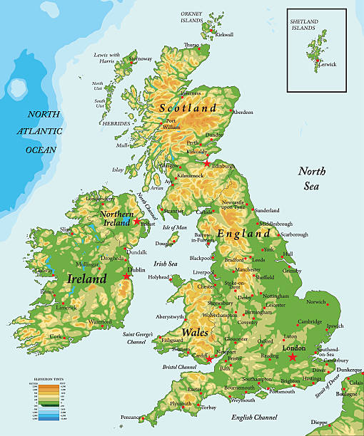
Highly detailed physical map of United Kingdom

of12Next