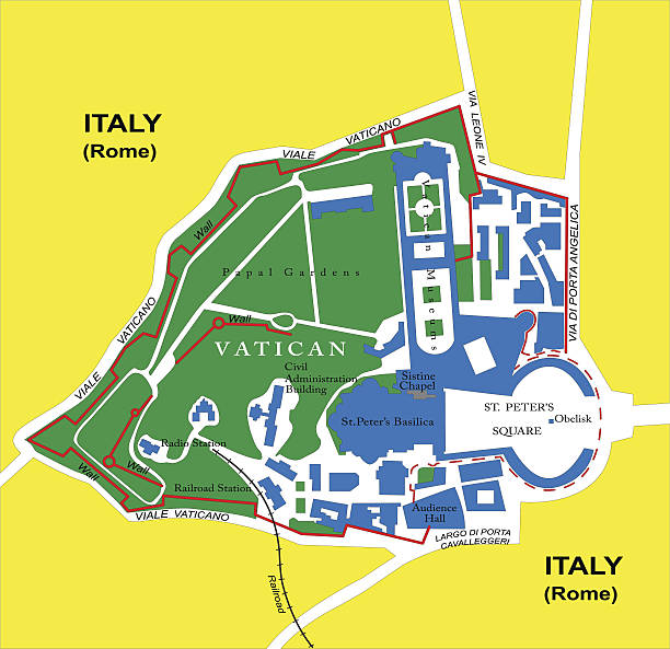
Detailed map of Vatican.
Browse 1,000+ map of vatican city stock photos and images available, or start a new search to explore more stock photos and images.
Detailed map of Vatican.

Antique Italian map from Italy Handbook for Travellers by K. Baedeker, 1893.
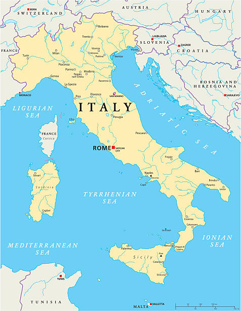
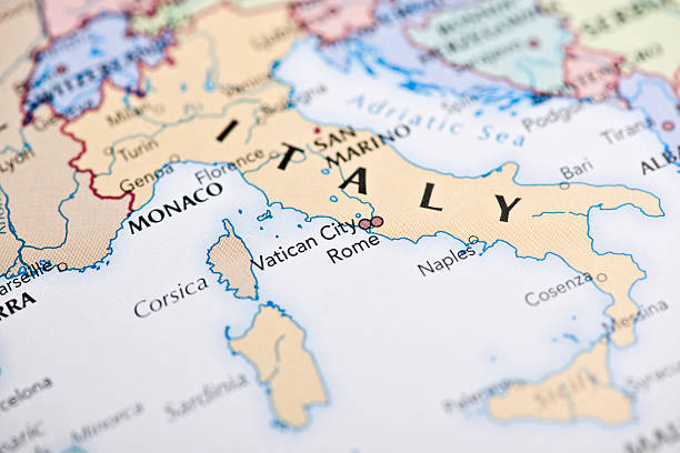
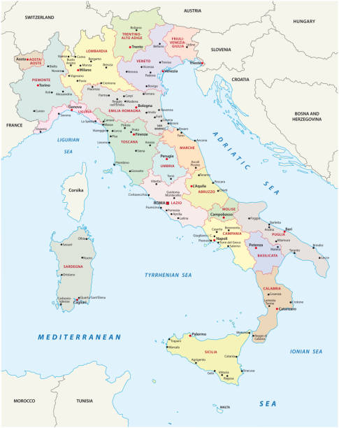
Political map of Italy with capital Rome, the Vatican and San Marino, with national borders, most important cities, rivers and lakes. Vector illustration with English labeling and scaling.

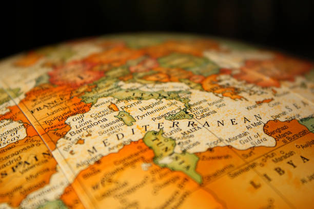
"A red pushpin on a map pointing to Rome, Italy."
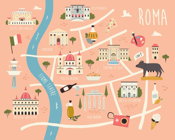
Illustrated map of Rome with famous symbols, landmarks, buildings. Vector design for tourist books, posters, placards, leaflets, books, souvenirs.
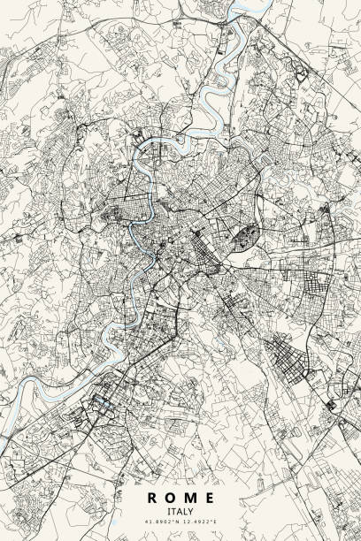
Poster Style Topographic / Road map of Rome, Italy. Original map data is open data via © OpenStreetMap contributors

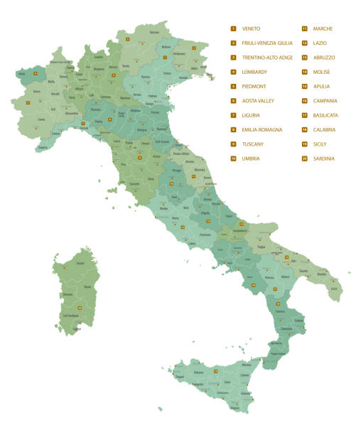
The regions of Italy, a country in Europe, political map. First-level administrative divisions of the Italian Republic. Twenty regions with its borders and capitals. Isolated illustration. Vector.

vector illustration of Vatican map

vector illustration of Vatican map

Italy detailed map with regions and cities of the country. Vector illustration

Map of Italy - Vintage Vector illustration

Italy map - highly detailed vector illustration

Italy, political map, administrative divisions. Italian Republic with capital Rome, 20 regions and their capitals, international borders and neighbor countries. English labeling. Illustration. Vector.

A red pushpin on a map pointing to Rome, Italy.

A highly decorative and finely engraved map of Northern Italy which appeared in John Tallis & co.'s The Illustrated Atlas 1851.

BLACK CMYK color detailed flat stencil map of the European country of VATICAN on transparent background

Map of Vatican (Holy See) in a speech bubble with a realistic three-dimensional effect, isolated on a white background. Vector Illustration (EPS10, well layered and grouped). Easy to edit, manipulate, resize or colorize.

Italy political map with capital Rome, with national borders and neighbor countries. Gray illustration with English labeling and scaling on white background. Illustration.

Tourist family is visiting Rome and Vatican. They are standing in Piazza Papa Pio XII and checking directions on smartphone. St. Peter's Square and St. Peter's Basilica is visible in the background.

Topographic / Road map of Rome, Italy. Original map data is open data via © OpenStreetMap contributors

Map of Italy vector colorful, with countries, borders, High detailed, editable,

Italy tourist map. Tourist and travel landmarks.

Italy - detailed map with administrative divisions country. Vector illustration

Map of Italy - Vector illustration

Rome in the bird's eye view with the known historic buildings and places. Wood engraving, published in 1878.

Male finger pointing and god hand touch earth planet globe. Vector black vintage engraving illustration isolated on a white background. For web, poster, info graphic

This detailed map illustration using dots is an ideal design element for your project. Easy to color and customize if required, it can be scaled to any size without loss of quality.

Italy map - highly detailed vector illustration

Map of Holy See on a red rubber stamp in vintage style. The stamp is composed of the map in the middle with the names around, separated by stars. A grunge texture is added to create a vintage and realistic effect. Vector Illustration (EPS10, well layered and grouped). Easy to edit, manipulate, resize or colorize.

Map of Holy See on a blue sticker and a blue rubber stamp. They are composed of the map in the middle with the names around, separated by stars. The stamp at the top right is created in a vintage style, a grunge texture is added to create a vintage and realistic effect. Vector Illustration (EPS10, well layered and grouped). Easy to edit, manipulate, resize or colorize. Please do not hesitate to contact me if you have any questions, or need to customise the illustration. http://www.istockphoto.com/portfolio/bgblue

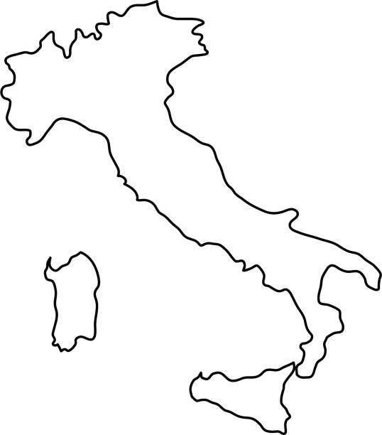
Vector isolated illustration of simplified political map of South Europe state - Vatican City State. Black line silhouette. White background

Pretty young female tourist studying a map at St. Peter's square in the Vatican City in Rome

Map of Italy and Travel Icons.Italy Travel Seamless Pattern. Vector Illustration.

Antique map of the Rome area in medieval times. Published by the Dutch cartographer Willem Blaeu in Atlas Novus (Amsterdam 1635). Photo by N. Staykov (2007)

Highly detailed physical map of Italy in vector format,
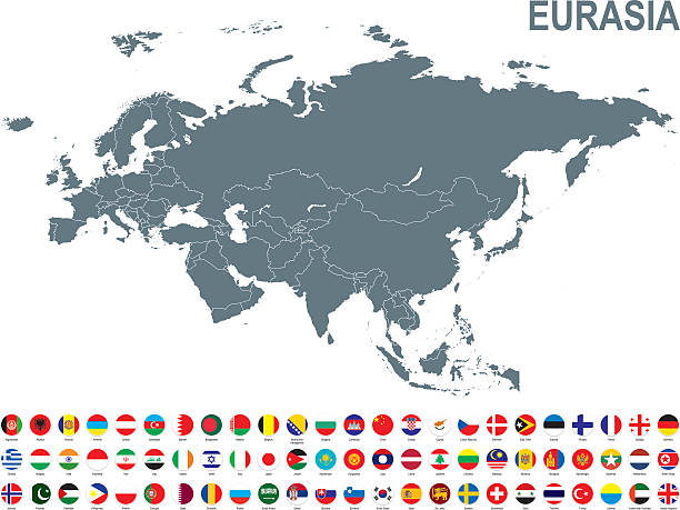
All round World Flags with country names (part4)
Italy administrative, political and vector map