Maryland Map Pictures, Images and Stock Photos
Browse 2,900+ maryland map stock photos and images available, or search for ocean city maryland map or maryland map vector to find more great stock photos and pictures.


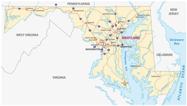
A detailed map of Maryland state with cities, roads, major rivers, and lakes. Includes neighboring states and surrounding water.
Maryland, MD, political map. State in the Mid-Atlantic region of the United States of America. Capital Annapolis. Old Line State. Free State. Little America. America in Miniature. Illustration. Vector
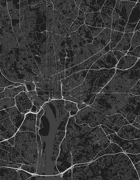
Map of Washington D.C. in USA. Detail from the World Map.


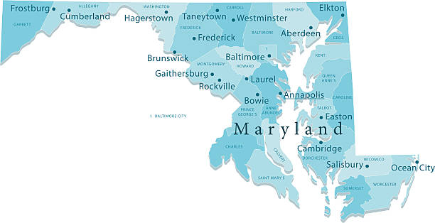
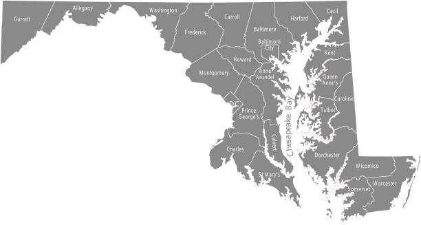
Detailed state-county map of Maryland. This file is part of a series of state/county maps. Each file is constructed using multiple layers including county borders, county names, and a highly detailed state silhouette. Each file is fully customizable with the ability to change the color of individual counties to suit your needs. Zip contains both .AI_CS2 and .ESP_8.0 as well as a large JPEG file. Map generated using data from the public domain. (http://www.census.gov/geo/www/tiger/) Traced using Adobe Illustrator CS2 on 7/28/2006. 3 data layers.
maryland road vector map
"Detailed vector map of Maryland with administrative divisions. File was created on December 5, 2012. The colors in the .eps-file are ready for print (CMYK). Included files: EPS (v8) and Hi-Res JPG (5600aa aaa 3121 px)."
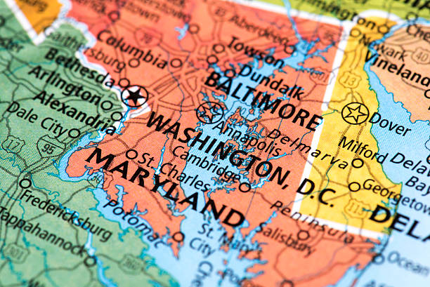
Map of Washington, D.C. in USA. Detail from the World Map.
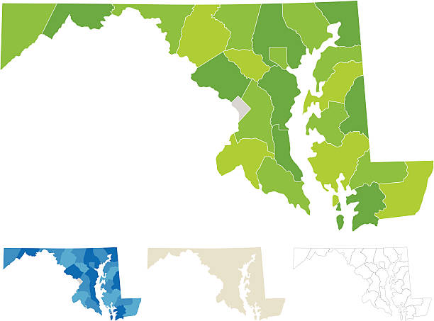
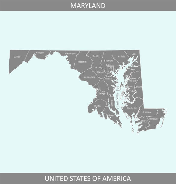
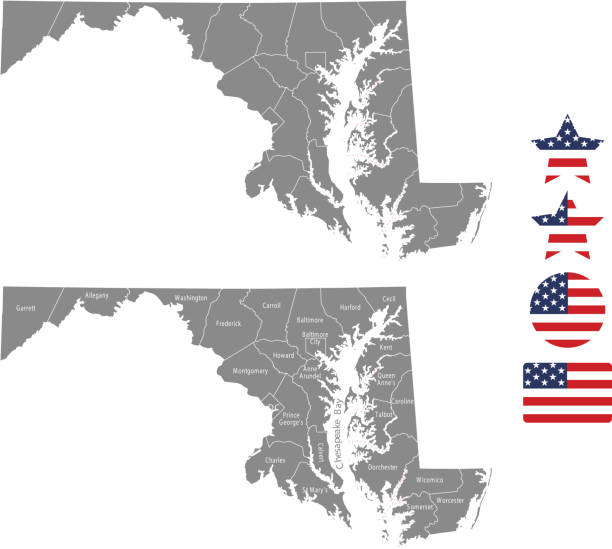
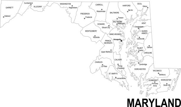
"Highly-detailed Maryland county map (including D.C). Each county shape is in a separate labeled layer. All layers have been alphabetized for easy manipulation, recoloring or other use. (see image below -- note: labels only available in AICS2 and AI10 files)"
Vector illustration of a blue Maryland state icon with shadow.

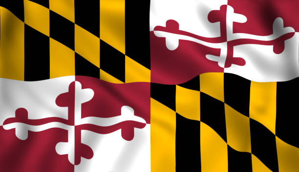
Map of Maryland is a state USA with flag. Vector Illustration
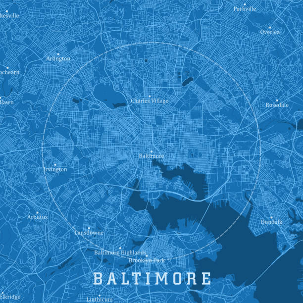
Baltimore MD City Vector Road Map Blue Text. All source data is in the public domain. U.S. Census Bureau Census Tiger. Used Layers: areawater, linearwater, roads.

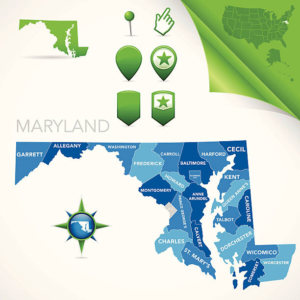
Maryland map. Blank vector map of the Us State with counties. Borders of Maryland for your infographic. Vector illustration.
Highly-detailed Maryland county map. Each county is in it's own separate labeled layer. County names are in a separate layer and can be easily adjusted or removed as well. All layers have been alphabetized for easy manipulation, recoloring or other use.
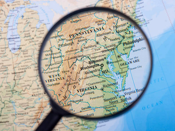
Magnifier centred on the East Coast.
map of the U.S. state of Maryland

Illustrated map of the state of Maryland in United States with cities and landmarks. Editable vector illustration
The map is accurately prepared by a map expert.

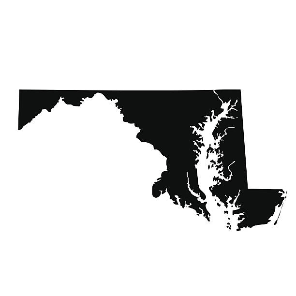
Maryland, state of USA - solid black outline map of country area. Simple flat vector illustration.

Focus on America on the Map. Source: "World reference atlas"

vector map of the Maryland.
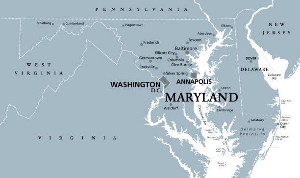
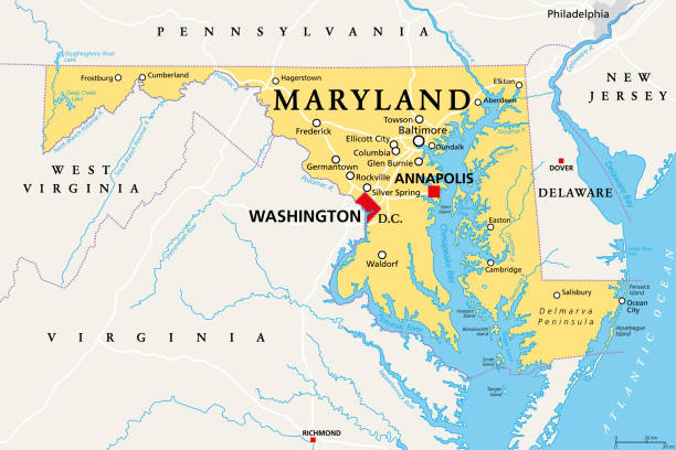
Maryland, MD, gray political map. State in Mid-Atlantic region of United States of America. Capital Annapolis. Old Line State. Free State. Little America. America in Miniature. Illustration. Vector.

The maps are accurately prepared by a GIS and remote sensing expert.

vector illustration of Maryland map

Highway map of the state of Maryland with Interstates and US Routes. It also has lines for state and county routes (but not labeled) and many cities on it as well. All cities are the County Seats and the Capitol (and some others).
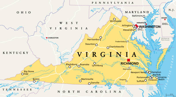
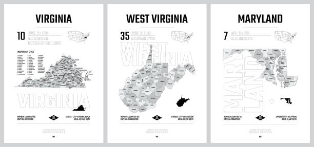
Virginia, VA, political map. Commonwealth of Virginia. State in Southeastern and Mid-Atlantic region of the United States. Capital Richmond. Old Dominion. Mother of Presidents. Illustration. Vector.

illustration of Maryland state map with road map for your design and products.


"Map of DC, Maryland and Delaware scanned from an 1881 original. Photo by N. Staykov (2007) CLICK ON THE LINKS BELOW FOR HUNDREDS OF SIMILAR IMAGES:"

Vector Illustration of a City Street Map of Baltimore, Maryland, USA. Scale 1:60,000. All source data is in the public domain. U.S. Geological Survey, US Topo Used Layers: USGS The National Map: National Hydrography Dataset (NHD) USGS The National Map: National Transportation Dataset (NTD)

Maryland state detailed editable map with cities and towns, geographic sites, roads, railways, interstates and U.S. highways. Vector EPS-10 file, trending color scheme

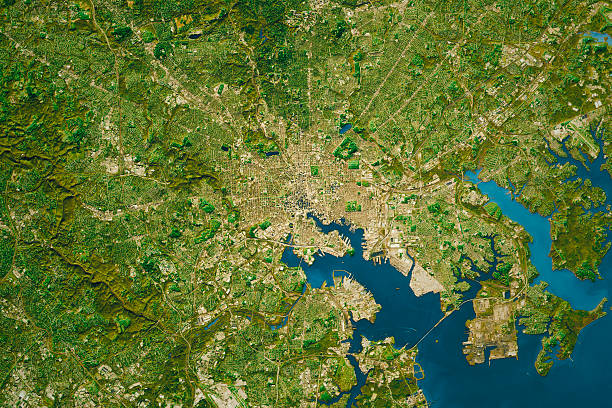
Digital composite image: Topographic Map of the City of Baltimore, Maryland, USA.

USA 3d render, State of Maryland
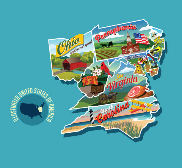
Illustrated pictorial map of eastern United States. Includes Pennsylvania, New Jersey, West Virginia, Virginia, North Carolina, Delaware and Maryland. Vector Illustration.

Map of the state of Maryland

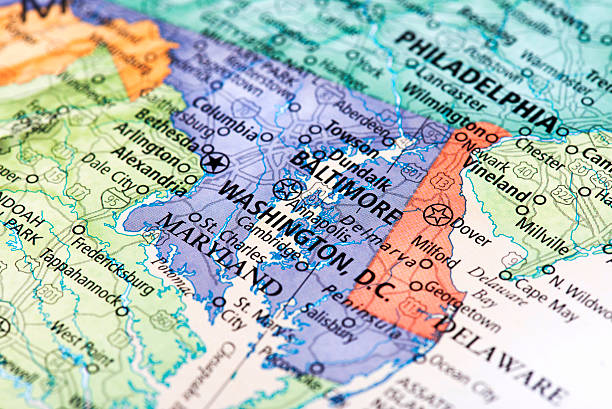
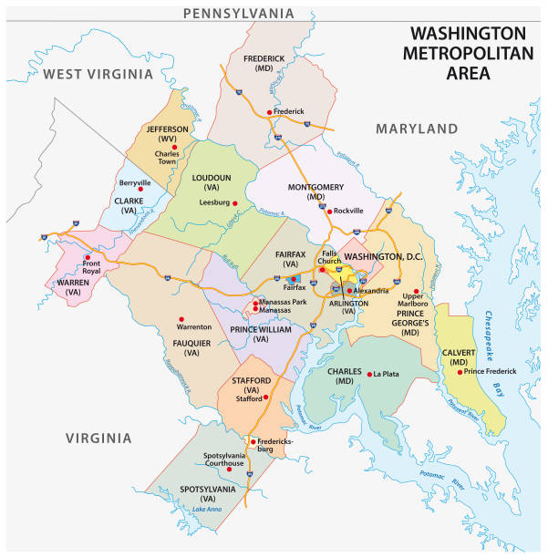
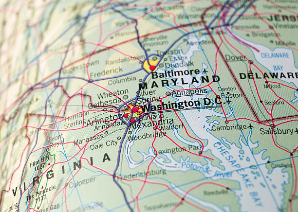
A map of Chesapeake Bay and the surrounding area, including Washington D.C. and Baltimore. Elements are grouped and separate for easy changes and removal. Includes an extra-large JPG so you can crop in to the area you need.

A detailed map of downtown Baltimore, Maryland. Includes neighborhoods, highways, freeways, streets, docks, parks, and points of interest, all on separate layers. Includes an extra-large JPG so you can crop in to the area you need and a CS5 file.

Detailed map of Maryland with surroundings, provinces and capital

USA map vector illustration art


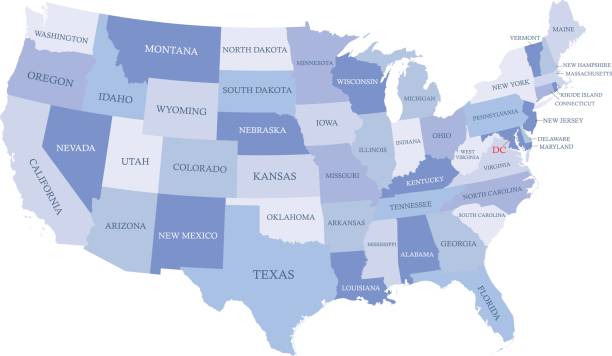
illustration of highly detailed U.S.A map with all state for your design , products and print.

Virginia, VA, gray political map. Commonwealth of Virginia. State in Southeastern and Mid-Atlantic region of United States. Capital Richmond. Old Dominion. Mother of Presidents. Illustration. Vector.

Detailed map of Maryland state,in vector format,with county borders,roads and major cities.

Detailed outline map of Maryland with capital