Bladen street over Maryland State House capitol building and site of many historic events build in 1779 Annapolis MA, USA
Browse 280+ maryland state capital stock photos and images available, or search for welcome to maryland or michigan state capitol to find more great stock photos and pictures.
Bladen street over Maryland State House capitol building and site of many historic events build in 1779 Annapolis MA, USA

Maryland State Capital building in Annapolis, Maryland.
The Naval Academy Dome and the Maryland Statehouse buildings show up centered in the Annapolis Skyline

Maryland State Capital Building in Annapolis, Maryland

The US Capitol building in the background of a bush of flowers in Washington, D.C., Maryland, USA

The Maryland State House is located in Annapolis, MD, USA.

"The State House in Annapolis, Maryland, at mid-day light"
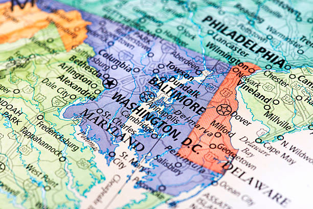
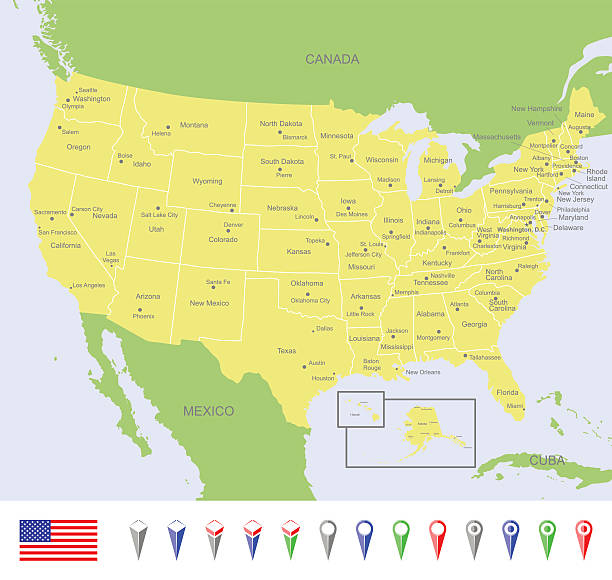
Map of Washington D.C. in USA. Detail from the World Map.

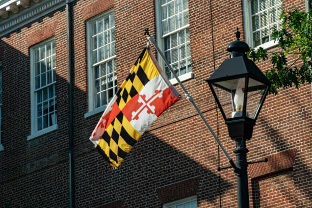
Detailed vector map of the State and Flag. PDF file included.

Annapolis, Maryland, USA downtown view over Main Street with the State House.

Night at the Maryland State Capitol Building in Annapolis, Maryland
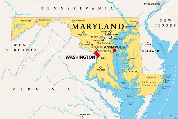
Maryland, MD, political map. State in the Mid-Atlantic region of the United States of America. Capital Annapolis. Old Line State. Free State. Little America. America in Miniature. Illustration. Vector

Maryland State Capital Building in Annapolis, Maryland
The state capitol building of Maryland on a bright summer day - Annapolis, MD

Maryland State Capital Building in Annapolis, Maryland

Maryland US state map red outline border. Vector illustration isolated on white. Two-letter state abbreviation. Editable stroke. Adjust line weight.

An Aerial photo of the Maryland State House in downtown Annapolis Maryland during sunset.
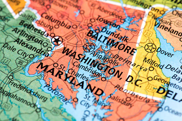
Map of Washington, D.C. in USA. Detail from the World Map.
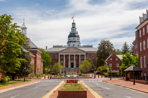
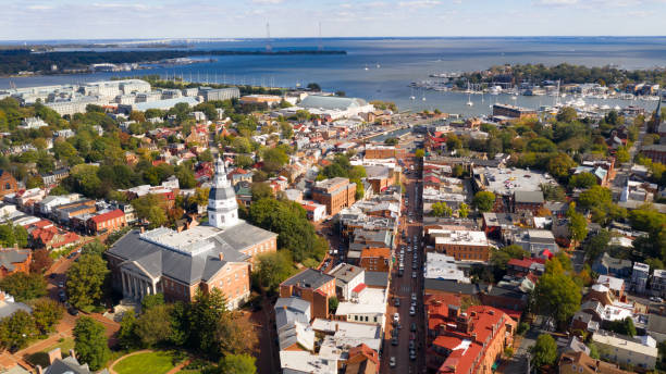
Historical Maryland State Capitol building in Annapolis, the oldest state house that is still in use. Other state government buildings such as court of appeal and senate are seen on each side.

Spring time view of Bladen street towards Maryland State House capitol building, Annapolis MA, USA
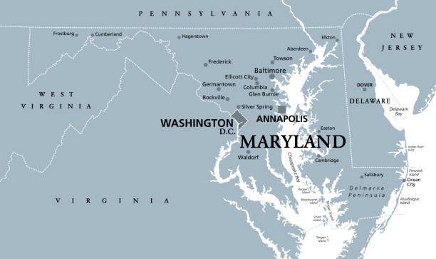
Maryland, MD, gray political map. State in Mid-Atlantic region of United States of America. Capital Annapolis. Old Line State. Free State. Little America. America in Miniature. Illustration. Vector.
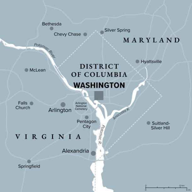
Washington, D.C., gray political map. District of Columbia, capital city and federal district of the United States. Located on Potomac River, across from Virginia, sharing land borders with Maryland.

The Capitol of Maryland at sunrise, Annapolis, Maryland, USA

Maryland State Capital Dome in Annapolis, Maryland
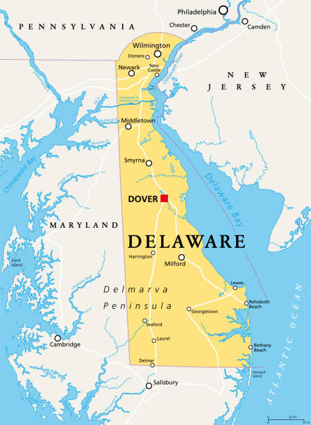
Delaware, DE, political map. State in the Mid-Atlantic region of the United States of America. Capital Dover. The First State, The Small Wonder, Blue Hen State, The Diamond State. Illustration. Vector.

Virginia, VA, gray political map. Commonwealth of Virginia. State in Southeastern and Mid-Atlantic region of United States. Capital Richmond. Old Dominion. Mother of Presidents. Illustration. Vector.

A vertical shot of the famous United States Capitol Building in Washington, D.C., United States
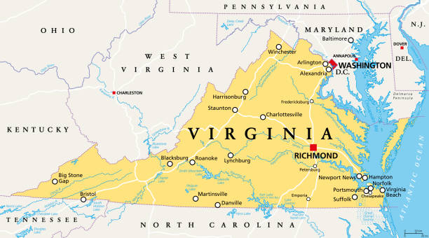
Virginia, VA, political map. Commonwealth of Virginia. State in Southeastern and Mid-Atlantic region of the United States. Capital Richmond. Old Dominion. Mother of Presidents. Illustration. Vector.
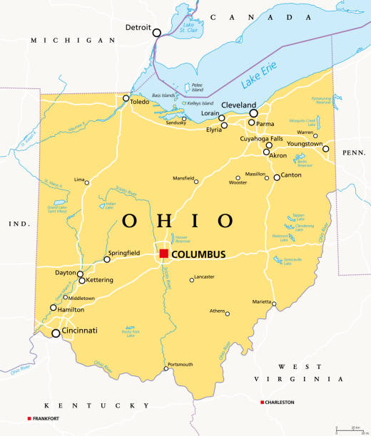
Ohio, OH, political map. State in East North Central region of Midwestern United States of America. Capital Columbus. The Buckeye State. Birthplace of Aviation. Heart of It All. Illustration. Vector.
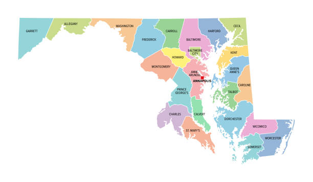
Maryland, U.S. state, colored political map with county names and capital Annapolis. State in the New England region of Northeastern USA, subdivided into 23 counties and independent City of Baltimore.

3d isometric map South Atlantic Region of United States, isolated with shadow

Annapolis, Maryland, USA view of the Maryland State House.

Mid-Atlantic region of the United States, political map. Located in the overlap between Northeastern and Southeastern states, including Delaware, D.C., Maryland, New Jersey, New York and Pennsylvania.
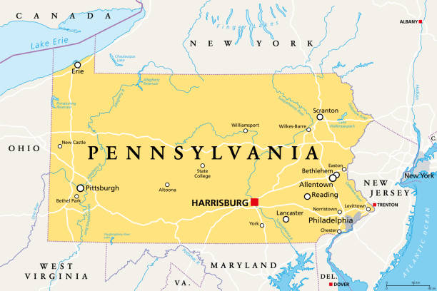
Pennsylvania, PA, political map. Officially the Commonwealth of Pennsylvania. State in the northeastern United States of America. Capital Harrisburg. Keystone State. Quaker State. Illustration. Vector

West Virginia, WV, political map. State in the Appalachian region of Southern United States of America. Part of Mid-Atlantic Southeast Region. Capital Charleston. Mountain State. Illustration. Vector.
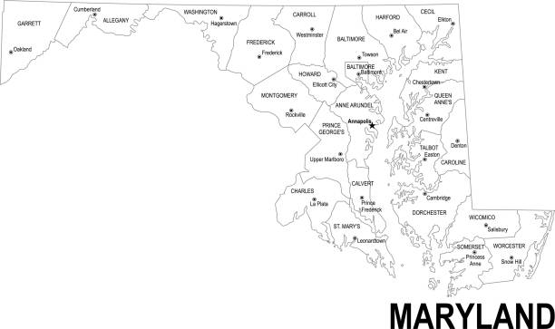
Detailed outline map of Maryland with capital

Baltimore, Maryland, USA cityscape at Mt. Vernon and the Washington Monument.
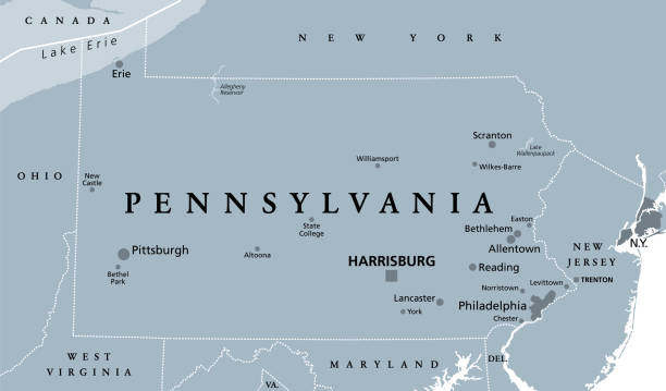
Pennsylvania, PA, gray political map. The Commonwealth of Pennsylvania, a state in the Northeastern United States of America with capital Harrisburg. Keystone State. Quaker State. Illustration. Vector
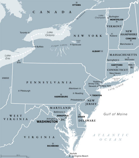
Mid-Atlantic region of the United States, gray political map. The overlap between the Northeastern and Southeastern states, including Delaware, D.C., Maryland, New Jersey, New York and Pennsylvania.

The Naval Academy Dome and the Maryland Statehouse buildings show up left in the Annapolis Skyline

Detailed map of Maryland with surroundings, provinces and capital

Annapolis, MD, USA 07.12.2021 - Supreme Court Building of Maryland

Annapolis, MD, USA 05-02-2021: Street view of Annapolis, Maryland with people walking in historic town and people dining outdoor sitting on tables put on street by local restaurants.

Annapolis, MD, USA 05-02-2021: Historical Maryland State Capitol building in Annapolis, the oldest state house that is still in use. Other state government buildings such as court of appeal and senate are seen on each side.

Welcome sign at the entrance of Annapolis, Maryland which has the coat of arms of the city, the foundation date 1649 and the text that reads, Annapolis, Maryland's capital

Road map of Maryland, US American federal state. Editable highly detailed transportation map of Maryland with highways and interstate roads, rivers and cities realistic vector illustration

The Maryland State House in downtown Annapolis Maryland.

The Virginias, political map. The two Virginias, two states in the Southeastern and Mid-Atlantic regions of the United States. Virginia with capital Richmond and West Virginia with capital Charleston.