Travel and tourism background. Vector flat illustration
Browse 70+ mongolia kazakhstan border stock photos and images available, or start a new search to explore more stock photos and images.
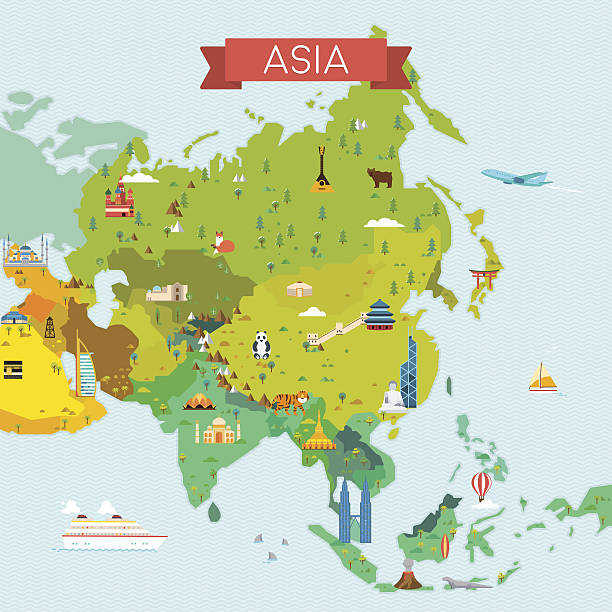
Travel and tourism background. Vector flat illustration

Central Asia, political map with capitals. Subregion of Asia, consisting of former Soviet republics stretching from Caspian Sea to China and Mongolia, and from Afghanistan and Iran to south of Russia.
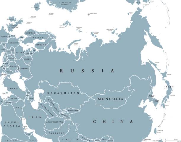
Eurasia political map with countries and borders. Combined continental landmass of Europe and Asia located in Northern and Eastern Hemispheres. Gray illustration over white. English labeling. Vector.

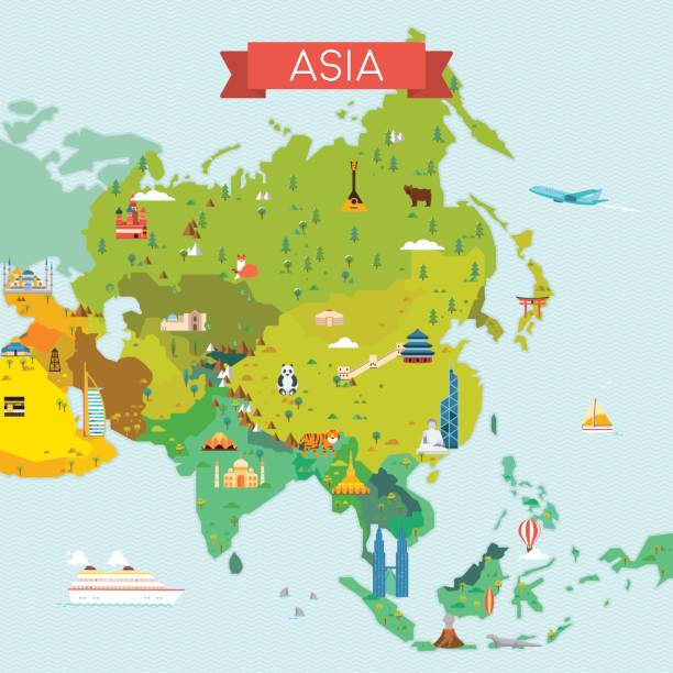
Highly detailed physical map of Asia in vector

Asia political map with borders and countries. Largest and most populous continent. Gray illustration on white background. English labeling. Vector.
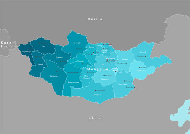
Vector modern illustration. Simplified geographical map of Mongolia and nearest state (Russia, China, Kazakhstan). Names of Mongolian cities and provinces (aimags).

Central Asia, gray political map. Subregion of Asia, consisting of former Soviet republics, stretching from the Caspian Sea to China and Mongolia, and from south of Russia to Afghanistan and Iran.

Mongolia on the world map. Shot with light depth of field focusing on the country.

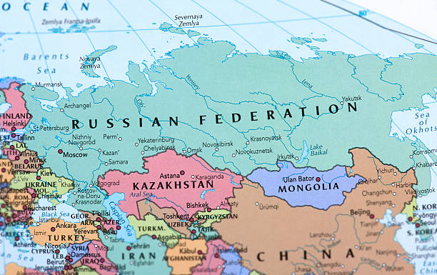
Detailed vector map of Russian Federation with border states and main cities.

Detailed map of Mongolia with country flag and location on world map. Vector illustration

Closeup view of asian side of cheap plastic globe. Shallow depth of fieldRelated lightboxes:

Empty Dark Gray Map of East Asia - illustration
Travel and tourism background. Vector flat illustration

http://dikobraz.org/map_2.jpg

Black Map of East Asia - illustration

Vector illustration of detailed map of Asia. Every country is on separate layer so it makes it easy to edit or select.

Vector illustration of detailed map of Asia. Every country is on separate layer so it makes it easy to edit or select.

Map of Asia with names of countries, capitals and cities. Vector illustration

Asia continent political map. Tapestry of Asia with country borders and names isolated vector infographic illustration. Detailed cartography with boundaries. Geography word wild contours

Map of Asia isolated on white background.

Inner Asia, political map, historical region highlighted in green, and sometimes included regions in lighter green. Spanning North, Central, and East Asia, including parts of China and Siberia. Vector

vector illustration of Asia Continent map

vector illustration of Asia Continent map

vector illustration of Asia Continent map

vector illustration of Asia Continent map

Black Map of East Asia - illustration

Map of East Asia - Borders and Contours - illustration

vector illustration of Asia Continent map

Blue-gray detailed map of Mongolia administrative divisions and location on the globe. Vector illustration

Blue-green detailed map of Mongolia administrative divisions with country flag and location on the globe. Vector illustration

Map of Mongolia, sign silhouette. World Map Globe. Vector Illustration isolated on white background. Asian continent.

Map of Mongolia, sign silhouette. World Map Globe. Vector Illustration isolated on white background. Asian continent.

Map of asia with countries in linear view. Stylized map of Asia in minimalistic modern style

Map of asia with countries. Stylized map of Asia in minimalistic modern style

Map of Mongolia, sign silhouette. World Map Globe. Vector Illustration isolated on white background. Asian continent.

Map of Mongolia, sign silhouette. World Map Globe. Vector Illustration isolated on white background. Asian continent.

3D map of Asia continent - white, gold, blue and yellow - vector illustration

Map of asia with countries in color. Stylized map of Asia in minimalistic modern style

Map of Turkmenistan, Filled with the National Flag.

Map of Kazakhstan, Filled with the National Flag.

Map of Kyrgyzstan, Filled with the National Flag.

Map of Uzbekistan, Filled with the National Flag.

Mongolia 3D map. Stylized neon simple digital isometric striped vector Map of Mongolia is in violet colors on black background

http://dikobraz.org/map_2.jpg

A bright ethnic vector pattern with Central Asian nomadic symbols in blue, white and chocolate brown, ideal for scarves, wool shawls, felt carpets and cultural textile design

Map link URL: https://legacy.lib.utexas.edu/maps/world_maps/united_states_foreign_service_posts-september_2011.pdf. Some urban locations were taken from: https://legacy.lib.utexas.edu/maps/world_maps/txu-oclc-264266980-world_pol_2008-2.jpg. The image was created in Adobe Illustrator in eps10 format

Map of Mongolia, sign silhouette. World Map Globe. Vector Illustration isolated on white background. Asian continent.

Vector creative digital neon flat line art abstract simple map of Mongolia with green, mint, turquoise striped texture on dark blue background. Educational banner, poster about Mongolia

Salmon fish soup isolated on wooden background, top view, copy space. Traditional homemade soup with red salmon and vegetables.

Map of Mongolia, sign silhouette. World Map Globe. Vector Illustration isolated on white background. Asian continent.

3D map of Asia continent - black, red, blue and green - vector illustration

Map of Mongolia, sign silhouette. World Map Globe. Vector Illustration isolated on white background. Asian continent.

Detailed Mongolia administrative map with country flag and location on a blue globe. Vector illustration