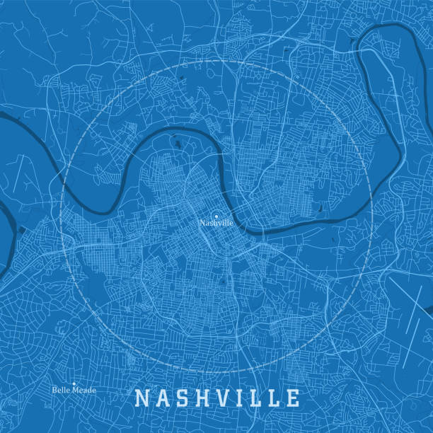
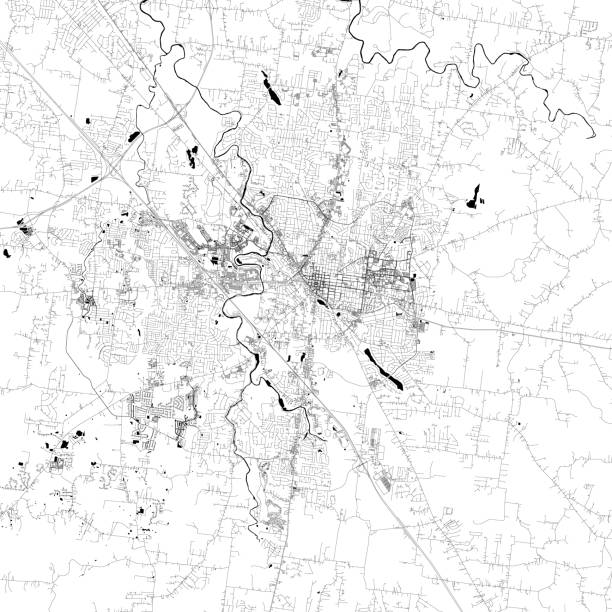
Nashville TN City Vector Road Map Blue Text. All source data is in the public domain. U.S. Census Bureau Census Tiger. Used Layers: areawater, linearwater, roads.
Browse 820+ nashville map stock photos and images available, or search for nashville map vector to find more great stock photos and pictures.
Nashville TN City Vector Road Map Blue Text. All source data is in the public domain. U.S. Census Bureau Census Tiger. Used Layers: areawater, linearwater, roads.
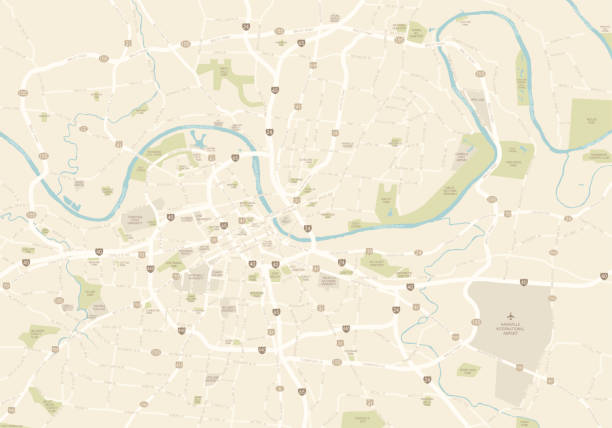
A map of the main part of Nashville, TN. Includes highways, freeways and the main roads, as well as parks and points of interest, all on separate layers.

Vector Illustration of a City Street Map of Nashville, Tennessee, USA. Scale 1:60,000. All source data is in the public domain. U.S. Geological Survey, US Topo Used Layers: USGS The National Map: National Hydrography Dataset (NHD) USGS The National Map: National Transportation Dataset (NTD)
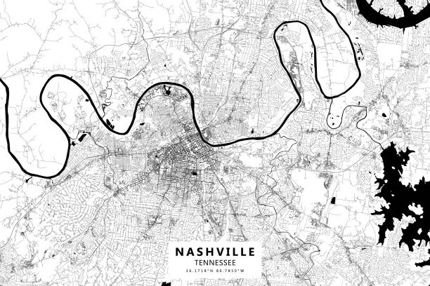
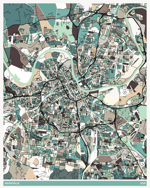
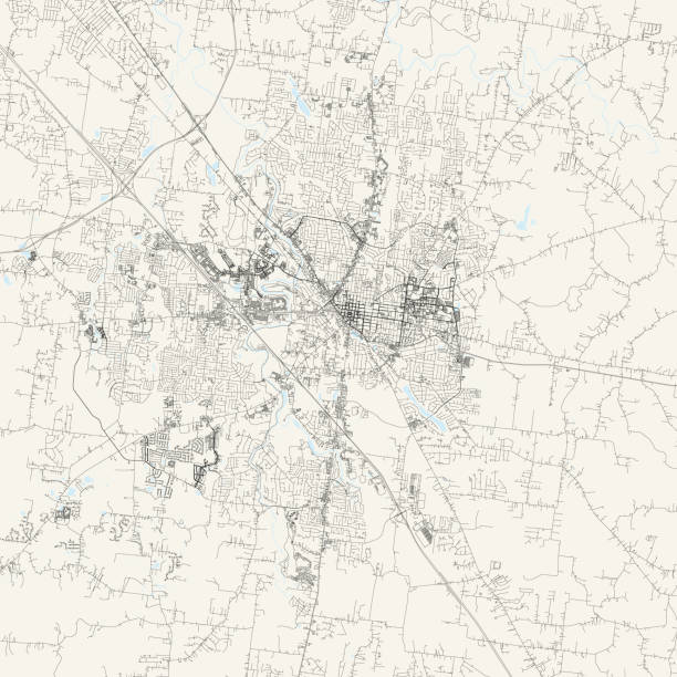
Poster Style Topographic / Road map of Nashville, TN, United States USA. All maps are layered and easy to edit.
![US capital cities on map series: Nashville, TN [url=/file_search.php?action=file&lightboxID=11838152#e650b4d][img]http://farm8.staticflickr.com/7189/6818724910_54c206caf8.jpg[/img][/url] nashville map stock pictures, royalty-free photos & images](https://media.istockphoto.com/id/181852125/photo/us-capital-cities-on-map-series-nashville-tn.jpg?s=612x612&w=0&k=20&c=cLMSuVgdB-JtxgT7XlqcFe_HpbjGKNMpaJyloYTWU8w=)
[url=/file_search.php?action=file&lightboxID=11838152#e650b4d][img]http://farm8.staticflickr.com/7189/6818724910_54c206caf8.jpg[/img][/url]

Nashville, Tennessee, the way we looked at it in 1949.
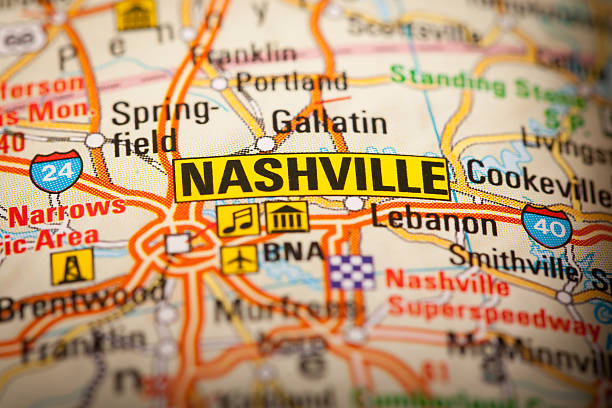
Map Photography: Nashville City on a Road Map
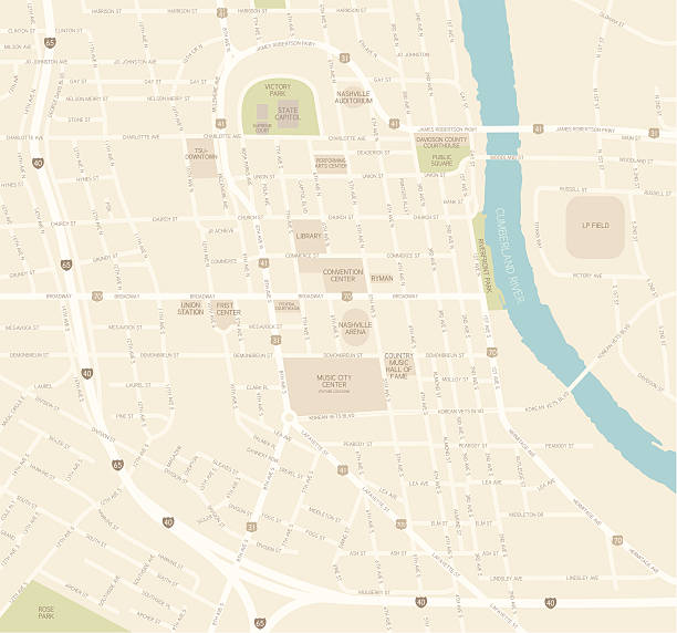
A detailed map of downtown Nashville, TN. Includes roads, highways, parks and points of interest, all on separate layers. An extra-large JPG is included so you can crop in to the area you need.

Poster Style Topographic / Road map of Nashville, TN, United States USA. All maps are layered and easy to edit.

"Nashville, TN map. Source: ""World reference atlas"""

Maury’s Geographical Series Manual of Geography - New York 1899

Topographic / Road map of Nashville, TN, United States USA. All maps are layered and easy to edit.

3d isometric map of Nashville is a city of United States, vector illustration

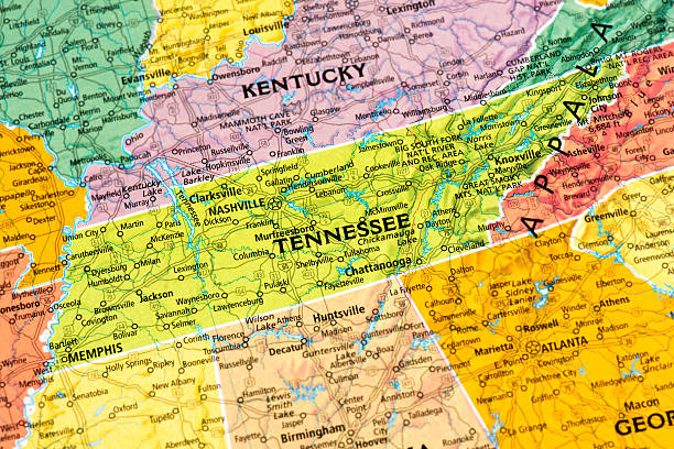
vintage map macro of state of Tennessee. From an antique map of America by engraver and publisher Geo.F.Cram.

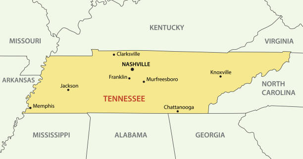
Area of Nashville (Tennessee) on a map

Doodle vector map of Nashville state of USA. With legends of state and capital

Map of Tennessee folded with design elements, isolated on white background.
Tennessee map shape, united states of america. Flat concept icon symbol vector illustration .

Pushpin on Nashville map background. 3d illustration.
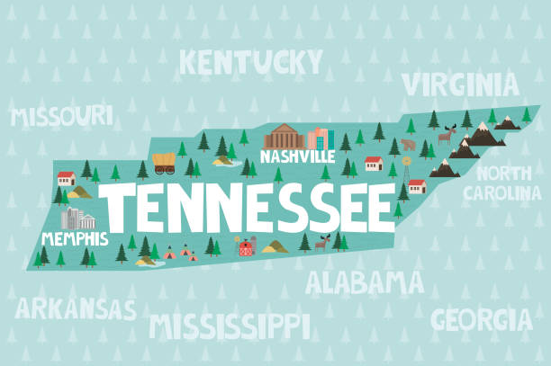
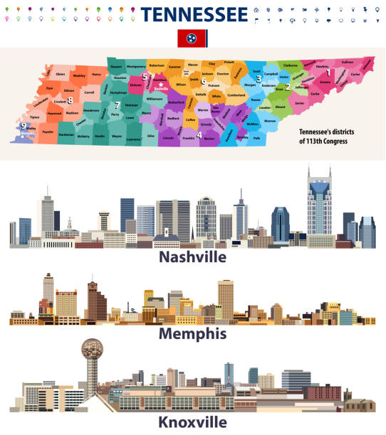
Illustrated map of the state of Tennessee in United States with cities and landmarks. Editable vector illustration
Topographic / Road map of Murfreesboro, TN. Map data is public domain via census.gov. All maps are layered and easy to edit. Roads are editable stroke.
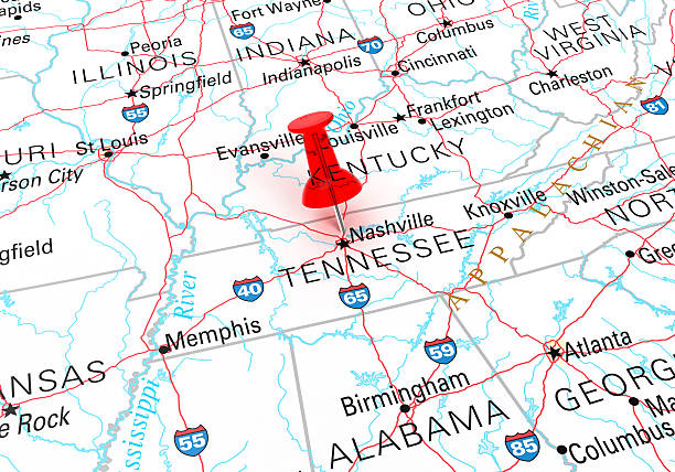
Red Thumbtack Over Tennessee State USA Map. 3D rendering
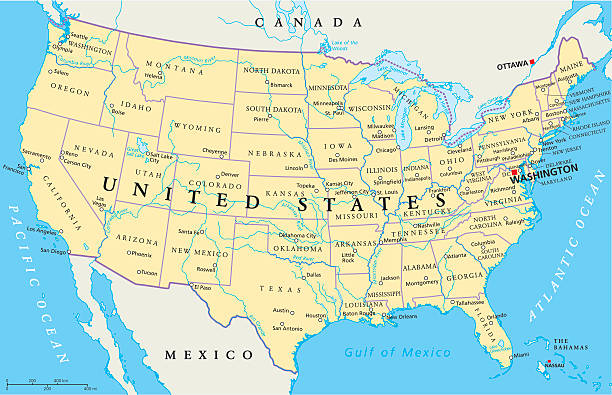
United States of America Political Map with capital Washington, national borders, most important cities, rivers and lakes. Map with single states, their borders and capitals, except Hawaii and Alaska. English labeling and scaling.

Photo of pinned Nashville on a map of USA. May be used as illustration for traveling theme.
Topographic / Road map of Murfreesboro, TN. Map data is public domain via census.gov. All maps are layered and easy to edit. Roads are editable stroke.

Label or sign with name of Nashville, Tennessee, USA, vector illustration

Tennessee Map Flag Vector illustration Eps 10.

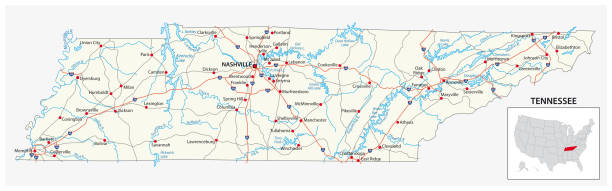
A vintage-style map of Tennessee with freeways, highways and major cities. Shoreline, lakes and rivers are very detailed. Includes an EPS and JPG of the map without roads and cities. Texture, compass, cities, etc. are on separate layers for easy removal or changes.

vector illustration of Tennessee map
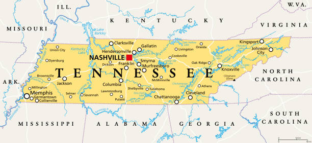
Tennessee, TN, political map, with capital Nashville, largest cities, lakes and rivers. State of Tennessee. Landlocked state in Southeastern region of the United States, nicknamed The Volunteer State.

Map of Tennessee with a retro style, a vintage effect on an old textured paper.

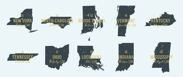
Tennessee. Vector silhouette state. Tennessee map with text script. Tennessee shape state map for poster, t-shirt, tee, souvenir. Vector outline Isolated illustratuon on a white background.
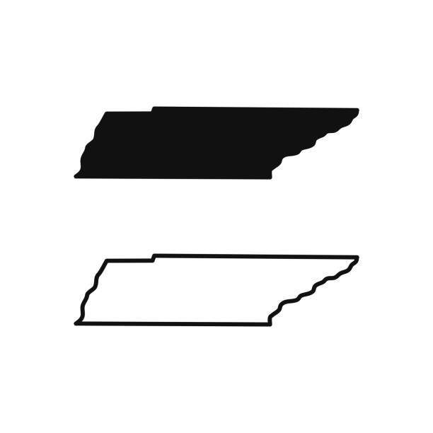
Tennessee outline state of USA. Map in black and white color options. Vector Illustration.
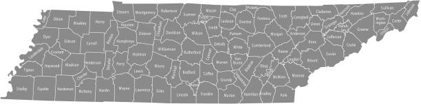
All counties have separate and accurate borders that can be selected and easily edited.

TN Davidson County Vector Map Green. All source data is in the public domain. U.S. Census Bureau Census Tiger. Used Layers: areawater, linearwater, cousub, pointlm.

Red pushpin pointing to Nashville city in more than fifty years old map

Detailed map of Tennessee state,in vector format,with county borders,roads and major cities.

Map of Tennessee draw with the stippling technique. Beautiful and trendy illustration created only with dots and isolated on a blank background. White map with dotted black outline and dark shadow. White background with a stippled circular gradient. (colors used: black and white). Vector Illustration (EPS10, well layered and grouped). Easy to edit, manipulate, resize or colorize. Vector and Jpeg file of different sizes.

Map of Tennessee with design elements, isolated on white background.