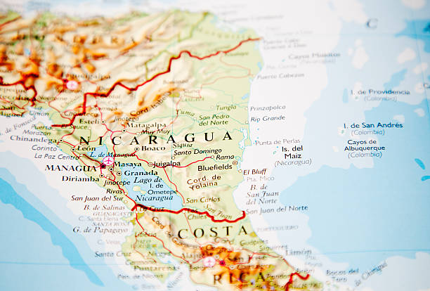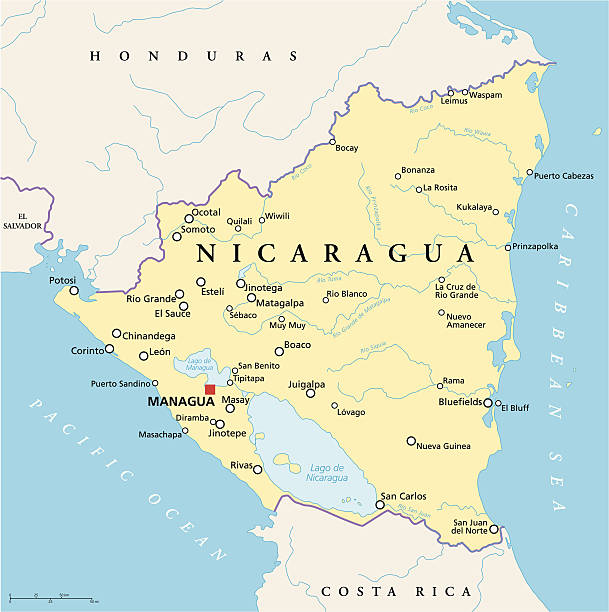
Political map of Nicaragua with capital Managua, with national borders, most important cities, rivers and lakes. Illustration with English labeling and scaling.
Browse 3,000+ nicaragua map stock photos and images available, or search for earth or classmates to find more great stock photos and pictures.
Political map of Nicaragua with capital Managua, with national borders, most important cities, rivers and lakes. Illustration with English labeling and scaling.
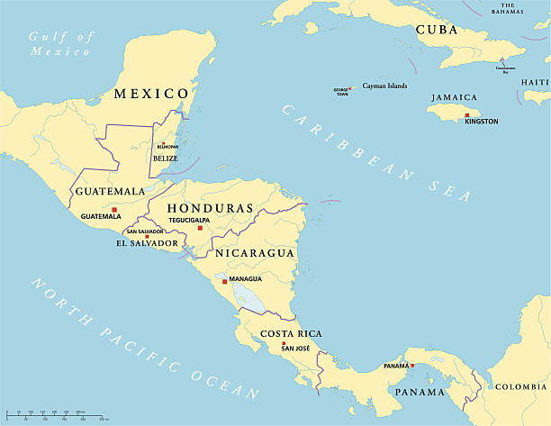
Political map of Central America with capitals, national borders, rivers and lakes. Vector illustration with English labeling and scaling.
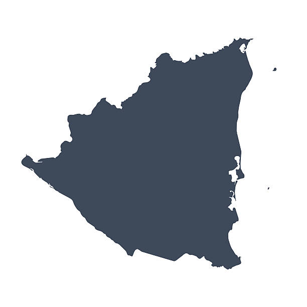
A graphic illustrated vector image showing the outline of the country Nicaragua. The outline of the country is filled with a dark navy blue colour and is on a plain white background. The border of the country is a detailed path.

http://dikobraz.org/map_2.jpg

Black location map of the Nicaraguan Boaco department inside gray map of Nicaragua

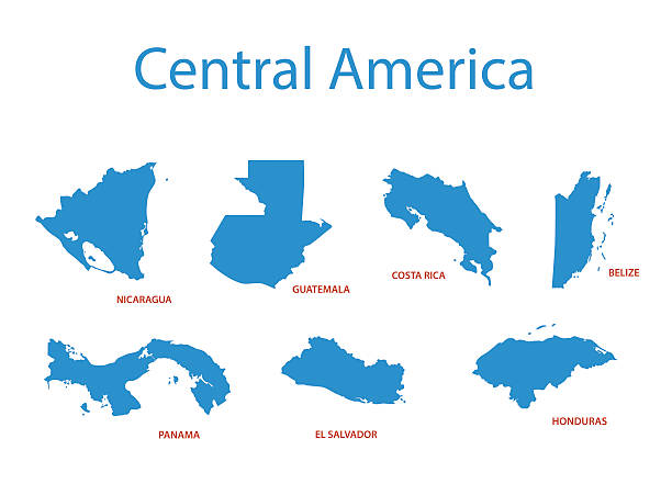
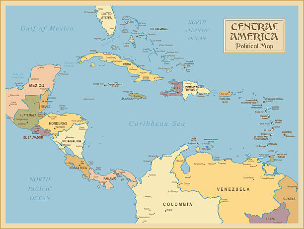
Central America countries, colored political map. Subregion of the Americas, between Mexico and Colombia, consisting of Belize, Guatemala, Honduras, El Salvador, Nicaragua, Costa Rica and Panama.

Vector illustration with simplified map of Central America region with blue contour of Nicaragua. Grey silhouettes, white outline of states' border.
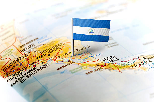
The flag of Nicaragua pinned on the map. Horizontal orientation. Macro photography.

Stylized vector Nicaragua map showing big cities, capital Managua, administrative divisions.

Nicaragua. Map with masked flag. Detailed silhouette. Waving flag. Vector illustration isolated on white.

Nicaragua vector map with infographic elements, pointer marks. Editable template with regions, cities and capital Managua.
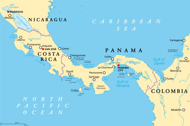
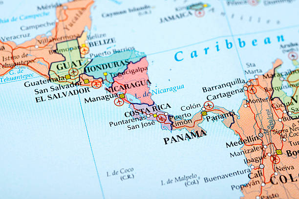
Costa Rica and Panama, political map, with the Isthmus of Panama and the Darien Gap. Narrow strip of land and region between the Caribbean Sea and the Pacific Ocean, linking North and South America.

Map of Nicaragua in a trendy vintage style. Beautiful retro illustration of an antique map with light rays in the background and on old textured paper. Included: Realistic texture of an old parchment (colors used: sepia, beige, brown). Vector illustration (EPS10, well superimposed and grouped). Easy to edit, manipulate, resize or colorize.

Nicaragua map with waving flag isolated on white background. Vector illustration EPS10

map of Republic of Nicaragua through magnifying glass

Nicaragua detailed map with regions and cities of the country. Vector illustration

Nicaragua - highly detailed blue map. Vector illustration

Vector illustration of the map of Nicaragua. Cut out design element on a transparent background on the vector file.

Map of Nicaragua for your own design. With space for your text and your background. Four maps included in the bundle: - One black map. - One blank map with only a thin black outline (in a line art style). - One mosaic map. - One white map with a thin black outline. The 4 maps are isolated on a blank background (for easy change background or texture).The layers are named to facilitate your customization. Vector Illustration (EPS10, well layered and grouped). Easy to edit, manipulate, resize or colorize.

Nicaragua Map radial dotted pattern in futuristic style, design blue circle glowing outline made of stars. concept of communication on dark blue background. Vector illustration EPS10
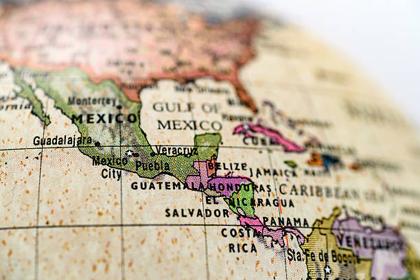
Close-up of Mexico in the colorful world map.

Map of Central America, the Antilles and the Caribbean written with misspellings. It comes from a Spanish school. Published 1969.

Map of Nicaragua in vintage style. Beautiful illustration of antique map on an old textured paper of sepia color. Old realistic parchment with a compass rose, lines indicating the different directions (North, South, East, West) and a frame used as scale of measurement. Vector Illustration (EPS10, well layered and grouped). Easy to edit, manipulate, resize or colorize. Please do not hesitate to contact me if you have any questions, or need to customise the illustration. http://www.istockphoto.com/portfolio/bgblue
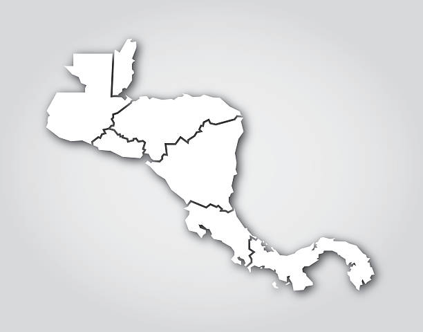
Vector silhouette of Central America in white with a drop shadow.

Detailed map of Nicaragua with country flag and location on world map. Vector illustration

+++ Note to Inspector: URL of source images: http://earthobservatory.nasa.gov/Features/BlueMarble/BlueMarble_monthlies.php +++

Old, vintage grunge paper nicaragua map.

Map of Nicaragua on political globe with embedded flag. 3D illustration.

Mesoamerica, political map. Historical region and cultural area in southern North America and most of Central America, from Mexico to Costa Rica. Within this region pre Columbian societies flourished.

Detailed map of Nicaragua with surroundings, provinces, capital and flag.

Map link URL: https://legacy.lib.utexas.edu/maps/world_maps/united_states_foreign_service_posts-september_2011.pdf. Some urban locations were taken from: https://legacy.lib.utexas.edu/maps/world_maps/txu-oclc-264266980-world_pol_2008-2.jpg. The image was created in Adobe Illustrator in eps10 format

Antique map of Central America,1864

3D Render of a Topographic Map of Nicaragua, Central America. All source data is in the public domain. Color texture: Made with Natural Earth. http://www.naturalearthdata.com/downloads/10m-raster-data/10m-cross-blend-hypso/ Boundaries Level 0: Humanitarian Information Unit HIU, U.S. Department of State (database: LSIB) http://geonode.state.gov/layers/geonode%3ALSIB7a_Gen Relief texture and Rivers: SRTM data courtesy of USGS. URL of source image: https://e4ftl01.cr.usgs.gov//MODV6_Dal_D/SRTM/SRTMGL1.003/2000.02.11/ Water texture: SRTM Water Body SWDB: https://dds.cr.usgs.gov/srtm/version2_1/SWBD/

"3D render and image composing: Topographic Map of Nicaragua. Including country borders, rivers and accurate longitude/latitude lines. High quality relief structure!Relief texture and satellite images courtesy of NASA. Further data source courtesy of CIA World Data Bank II database.Related images:"
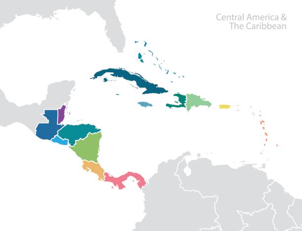
Central America and the Caribbean map. Vector

3D map of Nicaragua isolated on a blank blueprint, with a dropshadow (color used: blue and white). Vector Illustration (EPS10, well layered and grouped). Easy to edit, manipulate, resize or colorize.

Nicaragua political map of administrative divisions - departments and autonomous regions. 3D colorful vector map with name labels.

Map, country shape and borders of Nicaragua
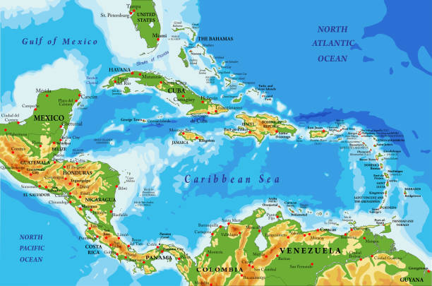
Highly detailed physical map of Central America and Caribbean Islands,in vector format,with all the relief forms,regions and big cities.

White map of Nicaragua isolated on a gray background with a long shadow effect and in a flat design style. Vector Illustration (EPS10, well layered and grouped). Easy to edit, manipulate, resize or colorize.

Vintage map of Central America covered by a background of roasted coffee beans. Guatemala, Honduras, Nicaragua, El Salvador and Costa Rica are between the main producers and exporters of coffee.

Nicaragua - detailed blue country map with cities and regions. Vector illustration.

Destinations. Guatemala on the map shown by pin
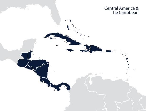
Central America and the Caribbean map. Vector

A Nicaragua flag map on white background with clipping path 3d illustration

Political color map of South Asia with borders of the states.
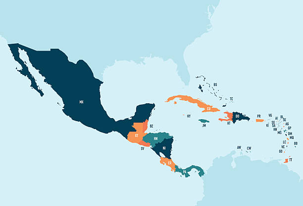
Colorful stylized vector map of Central America & the Caribbean with country name abbreviation labels. Countries can be individually selected.