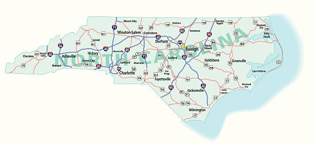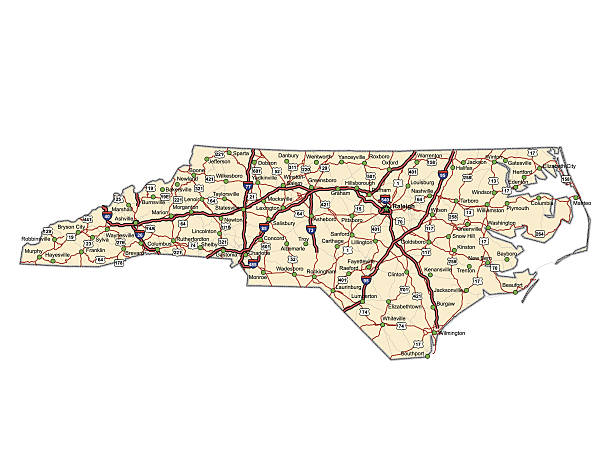
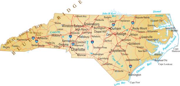
Highway map of the state of North Carolina with Interstates and US Routes. It also has lines for state and county routes (but not labeled/named) and many cities on it as well.
Browse 150+ north carolina highway map stock photos and images available, or start a new search to explore more stock photos and images.
Highway map of the state of North Carolina with Interstates and US Routes. It also has lines for state and county routes (but not labeled/named) and many cities on it as well.

Road map of North Carolina, US American federal state. Editable highly detailed transportation map of North Carolina with highways and interstate roads, rivers, lakes and cities vector illustration

set of United State street sign. (carolina,oklahoma,albama,kansas,new york,ohio,dallas,florida,brooklyn,missouri). easy to modify
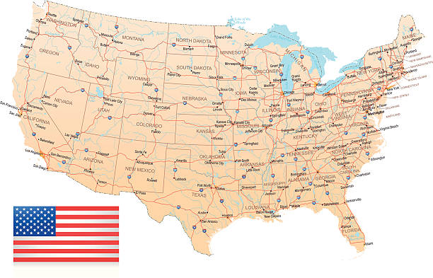
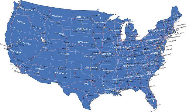
Highly detailed map of United States with roads, states, big cities, rivers and some other objects
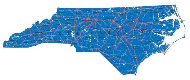
Detailed map of North Carolina state,in vector format,with county borders,roads and major cities.
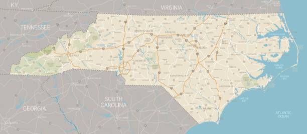
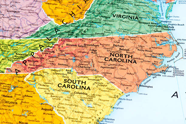
A detailed map of North Carolina state with cities, roads, major rivers, and lakes. Includes neighboring states and surrounding water.

North Carolina state detailed editable map with cities and towns, geographic sites, roads, railways, interstates and U.S. highways. Vector EPS-10 file, trending color scheme
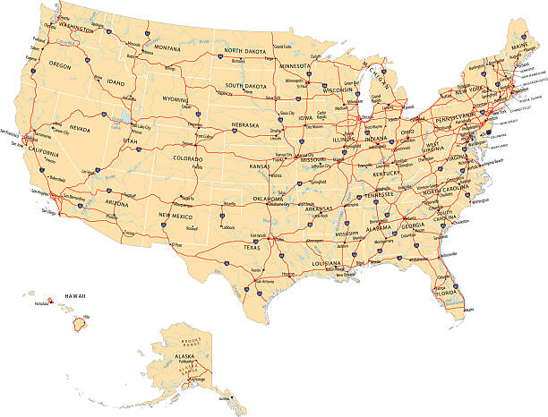
Highly detailed map of United States with roads, states, state capitals, important cities, rivers and major lakes.
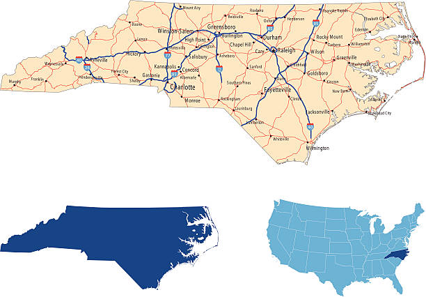
illustration of North Carolina state road map for your design and products.
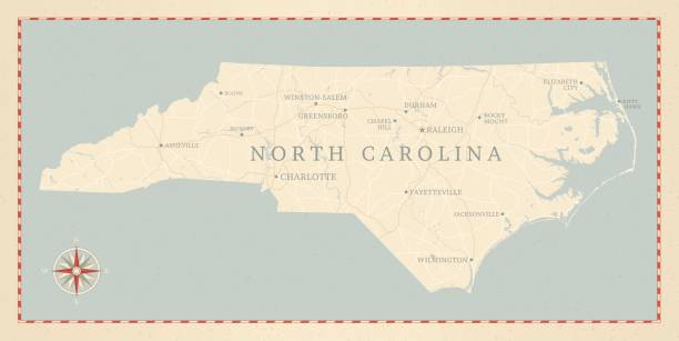
A vintage-style map of North Carolina with freeways, highways and major cities. Shoreline, lakes and rivers are very detailed. Includes an EPS and JPG of the map without roads and cities. Texture, compass, cities, etc. are on separate layers for easy removal or changes.
Detailed map of United States of America.
Vector illustration of map of North Carolina with major roads, rivers and lakes.

illustration of North Carolina state map with road map for your design and products.
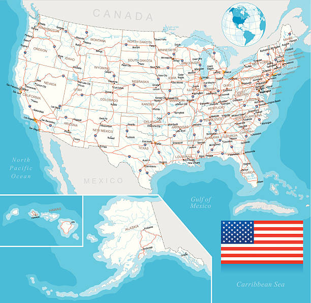
Highly detailed map of United States with roads, states, big cities, rivers and some other objects

Charlotte map poster. Decorative design street map of Charlotte city. Cityscape aria panorama silhouette aerial view, typography style. Land, river, highways. Round circular vector illustration.

Topographic / Road map of Charlotte, NC, USA.

Outline Political US Map with titles of the states. All USA regions are separated and named in a layer panel.

Colored Political US Map with titles of the states. All USA regions are separated and named in a layer panel

Cherohala Skyway, North Carolina, USA - August 8, 2020: Warning sign to motorcycles on the Cherohala Skyway in the Appalachian Mountains of North Carolina.

Topographic / Road map of Asheville, NC. Map data is public domain via census.gov. All maps are layered and easy to edit. Roads are editable stroke.

Topographic / Road map of Greensboro, NC. Map data is public domain via census.gov. All maps are layered and easy to edit. Roads are editable stroke.

Poster Style Topographic / Road map of Asheville, NC. Map data is public domain via census.gov. All maps are layered and easy to edit. Roads are editable stroke.

Poster Style Topographic / Road map of Charlotte, NC, USA.

Vector illustration of map of North Carolina with major roads, rivers and lakes.

Poster Style Topographic / Road map of Durham, NC. Map data is public domain via census.gov. All maps are layered and easy to edit. Roads are editable stroke.
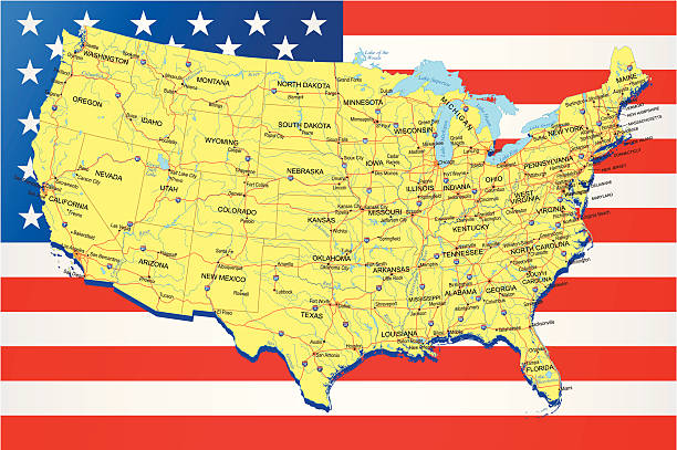
Highly detailed map of United States with roads, states, big cities, rivers and some other objects on american flag background

Poster Style Topographic / Road map of Winston-Salem, NC. Map data is public domain via census.gov. All maps are layered and easy to edit. Roads are editable stroke.

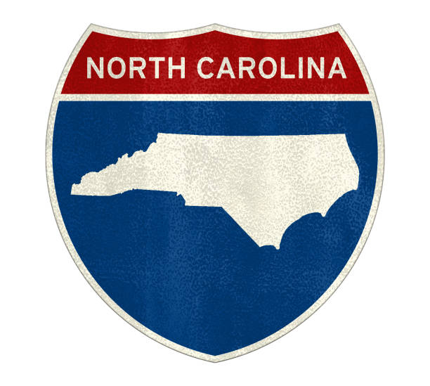
Vector illustration of a red, white and blue North Carolina map road sign.

Outline United States Of America map. US background template. Map of America with separated countries and interstate borders. All states and regions are named in the layer panel.

Topographic / Road map of Asheville, NC. Map data is public domain via census.gov. All maps are layered and easy to edit. Roads are editable stroke.

High-quality vector illustration of the state of North Carolina. Features a smooth gradient color fill with a clean outline, perfect for infographics, presentations, educational materials, travel guides, and digital design projects. Fully scalable and editable vector format. Ideal for maps, geographic visualizations, and creative design uses.

Map of America. United States Political map. US blueprint with the titles of states and regions. All countries are named in the layer panel

Topographic / Road map of Asheville, NC. Map data is public domain via census.gov. All maps are layered and easy to edit. Roads are editable stroke.

Topographic / Road map of Charlotte, NC, USA.

Poster Style Topographic / Road map of Winston-Salem, NC. Map data is public domain via census.gov. All maps are layered and easy to edit. Roads are editable stroke.

A highway sign leads to the way to Chapel Hill, NC, USA.

Poster Style Topographic / Road map of Wilmington, NC. Map data is public domain via census.gov. All maps are layered and easy to edit. Roads are editable stroke.

Close Up Of Wilmington With A Thumbtack Pointing To The City

Topographic / Road map of Wilmington, NC. Map data is public domain via census.gov. All maps are layered and easy to edit. Roads are editable stroke.

Topographic / Road map of Wilmington, NC. Map data is public domain via census.gov. All maps are layered and easy to edit. Roads are editable stroke.

Outline Political US Map with titles of the states. All USA regions are separated and named in a layer panel