Images
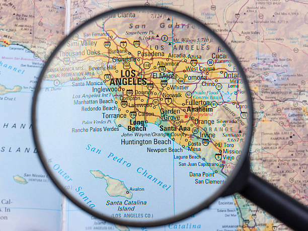
Browse 890+ orange county map stock photos and images available, or search for southern california map to find more great stock photos and pictures.

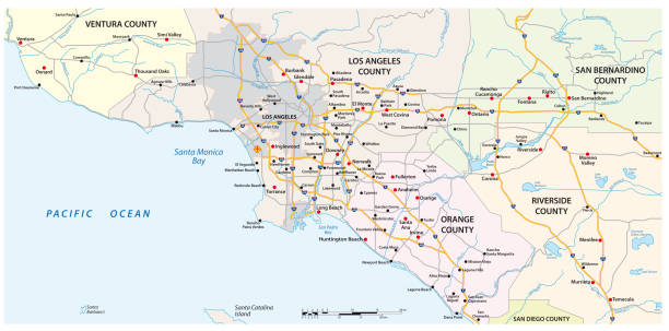
Large and detailed map of California - Orange county
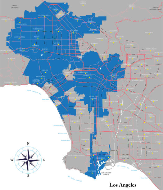
Highly detailed vector map of Los Angeles with all the boroughs, metropolitan area and main roads.

Irvine CA City Vector Road Map Blue Text. All source data is in the public domain. U.S. Census Bureau Census Tiger. Used Layers: areawater, linearwater, roads.
Our creative library is free of AI-generated contentChoose your visuals with confidence knowing our creative library is free from AI-generated content, so your searches only return safe, high-quality visuals you can trust.

A red pushpin pinpointing Los Angeles, the City of Angels, on a map.

Orange CA City Vector Road Map Blue Horizontal. All source data is in the public domain. U.S. Census Bureau Census Tiger. Used Layers: areawater, linearwater, roads.

Orange CA City Vector Road Map Blue Text. All source data is in the public domain. U.S. Census Bureau Census Tiger. Used Layers: areawater, linearwater, roads.

Costa Mesa CA City Vector Road Map Blue Text. All source data is in the public domain. U.S. Census Bureau Census Tiger. Used Layers: areawater, linearwater, roads.

Counties map of California state of United States of America. The map is accurately prepared by a map expert.

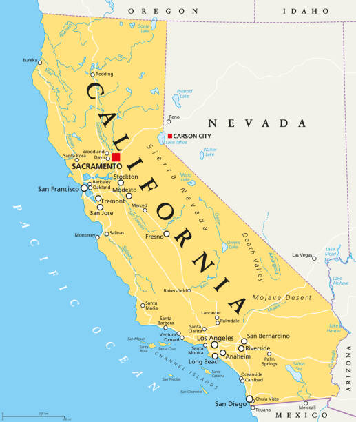
California political map with capital Sacramento, important cities, rivers, lakes. State in the Pacific Region of the United States. Los Angeles, San Francisco. English labeling. Illustration. Vector.
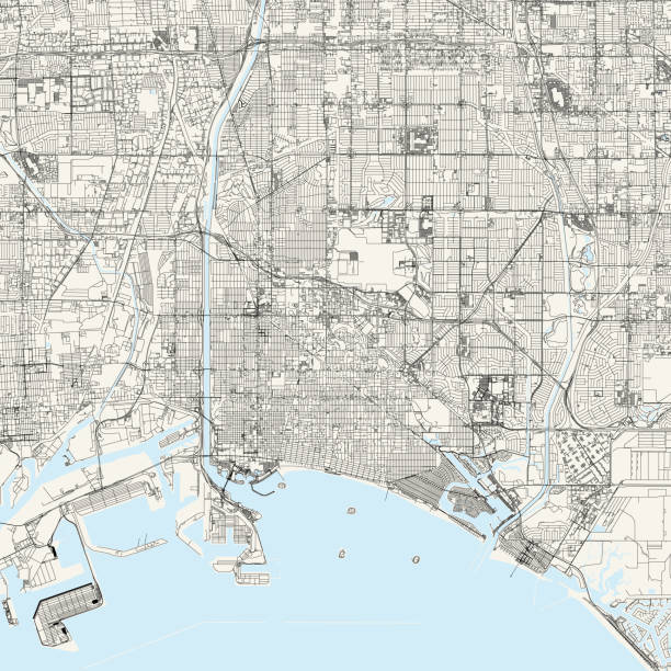
Topographic / Road map of Long Beach, California CA. USA United States of America. Original map data is open data via © OpenStreetMap contributors. All maps are layered and easy to edit. Roads are editable stroke.
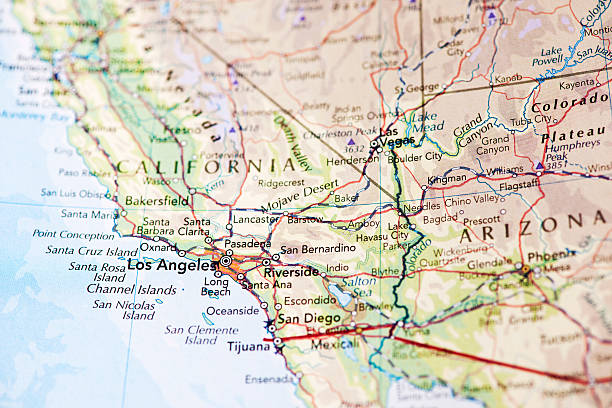
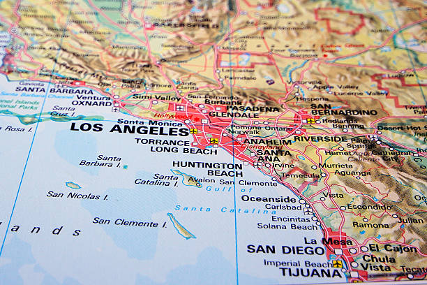
Photo map of Los Angeles California. Shallow depth of field, focus on the Los Angeles city of the map and the area nears it.

Orange County, California (Counties in California, United States of America,USA, U.S., US) map vector illustration, scribble sketch Orange map

Map of Orange County - California, isolated on a blank background and with his name on a red ribbon. Vector Illustration (EPS file, well layered and grouped). Easy to edit, manipulate, resize or colorize. Vector and Jpeg file of different sizes.
![Anaheim, CA Anaheim, CA .Source: "World reference atlas"
[url=/search/lightbox/5890567][IMG]http://farm4.static.flickr.com/3574/3366761342_e502f57f15.jpg?v=0[/IMG][/url] orange county map stock pictures, royalty-free photos & images](https://media.istockphoto.com/id/110925868/photo/anaheim-ca.jpg?s=612x612&w=0&k=20&c=nbeFGhdNmMxDCiMKd_813ykw9S2lz-hTC6eG4ult-Qc=)
Anaheim, CA .Source: "World reference atlas" [url=/search/lightbox/5890567][IMG]http://farm4.static.flickr.com/3574/3366761342_e502f57f15.jpg?v=0[/IMG][/url]
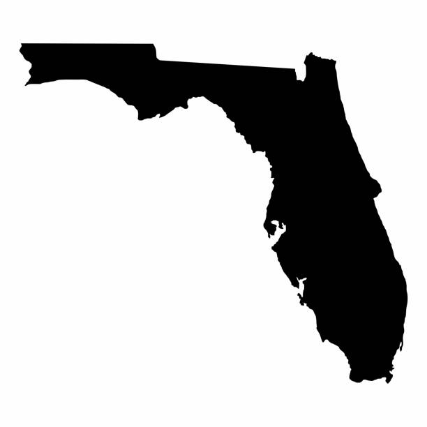
Florida map dark silhouette isolated on white background

San Diego California Area Vector Map. All source data is in the public domain. Made with Natural Earth. http://www.naturalearthdata.com/about/terms-of-use/


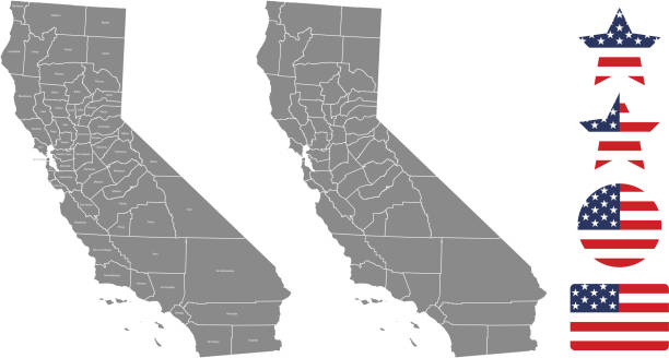
Highly-detailed California county map. Each county is in it's own separate labeled layer. County names are in a separate layer and can be easily adjusted or removed as well. All layers have been alphabetized for easy manipulation, recoloring or other use.

NY Orange Vector Map Green. All source data is in the public domain. U.S. Census Bureau Census Tiger. Used Layers: areawater, linearwater, cousub, pointlm.

Photo of pinned Anaheim on a map of USA. May be used as illustration for traveling theme.

Orlando FL City Vector Road Map Blue Text. All source data is in the public domain. U.S. Census Bureau Census Tiger. Used Layers: areawater, linearwater, roads.

Channel Islands of California, political map. Eight-island archipelago in the Pacific, southwest of Los Angeles metropolitan area, administered by the counties Santa Barbara, Ventura and Los Angeles.

3D Render of a Topographic Map of Irvine, California, USA. All source data is in the public domain. Contains modified Copernicus Sentinel data (Jul 2019) courtesy of ESA. URL of source image: https://scihub.copernicus.eu/dhus/#/home. Relief texture SRTM data courtesy of NASA. URL of source image: https://search.earthdata.nasa.gov/search/granules/collection-details?p=C1000000240-LPDAAC_ECS&q=srtm%201%20arc&ok=srtm%201%20arc

Vector Illustration of a City Street Map of Huntington Beach, California, USA. Scale 1:60,000. All source data is in the public domain. U.S. Geological Survey, US Topo Used Layers: USGS The National Map: National Hydrography Dataset (NHD) USGS The National Map: National Transportation Dataset (NTD)


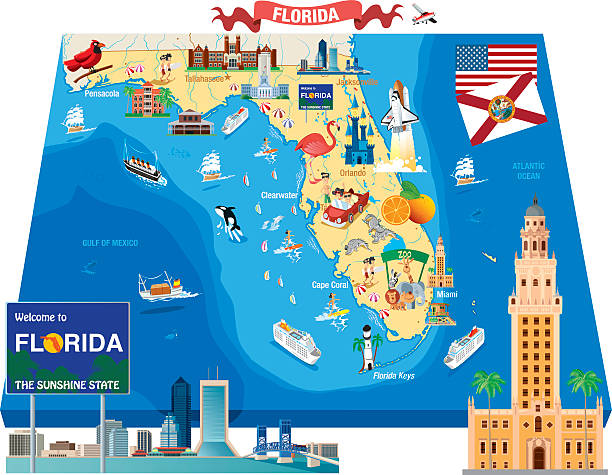
Colorful illustrated map of Florida state, USA, with animals, famous symbols, landmarks. Vector illustration for travel banners, posters, books, graphic prints
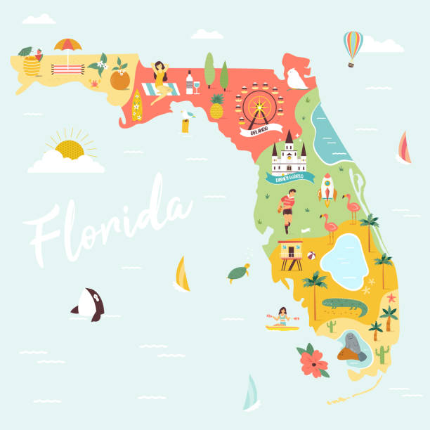
Illustrated map of Florida with monuments, fauna, flora. American state with symbols, cities and destinations. Bright design, banner, poster

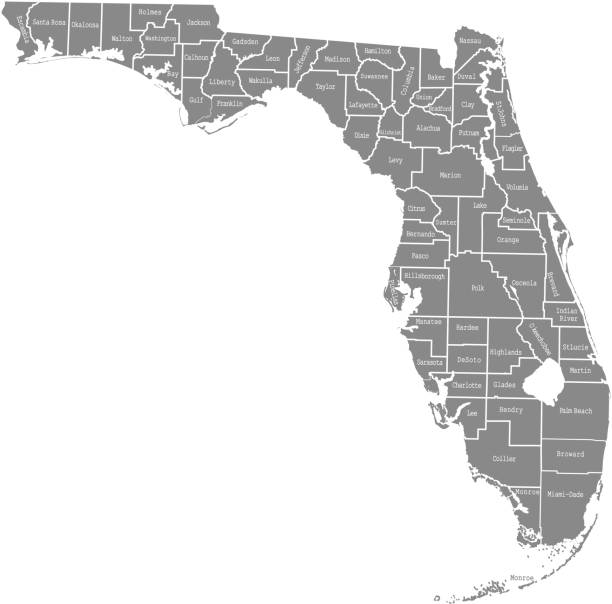
Vector outline map of Florida state divided into counties

Anaheim CA City Vector Road Map Blue Text. All source data is in the public domain. U.S. Census Bureau Census Tiger. Used Layers: areawater, linearwater, roads.

Channel Islands of California, gray political map. Eight-island archipelago in the Pacific, southwest of Los Angeles metropolitan area, administered by counties Santa Barbara, Ventura and Los Angeles.

3D Render of a Topographic Map of Los Angeles, California. All source data is in the public domain.Color and Water texture: Contains modified Copernicus Sentinel data courtesy of ESA.URL of source image: https://dataspace.copernicus.eu/explore-data/data-collections/sentinel-data/sentinel-2Relief texture: 3DEP data courtesy of USGS. URL of source image:https://apps.nationalmap.gov/downloader/#/
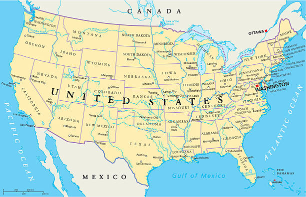
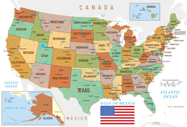
United States of America Political Map with capital Washington, national borders, most important cities, rivers and lakes. Map with single states, their borders and capitals, except Hawaii and Alaska. English labeling and scaling.


Orange County, California blank outline map set

Macro shot of stick pin on map of San Bernardino, California USA. Many other smaller towns are also visible. Travel and vacation destination.
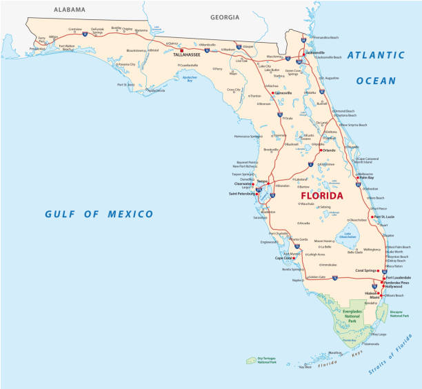
florida road vector map with national parks

Regions of U.S. state Florida, multi colored map showing travel regions, subregions, cities, and major destinations. State in Southeastern United States with capital Tallahassee. Isolated illustration


Florida administrative and political vector map with flag
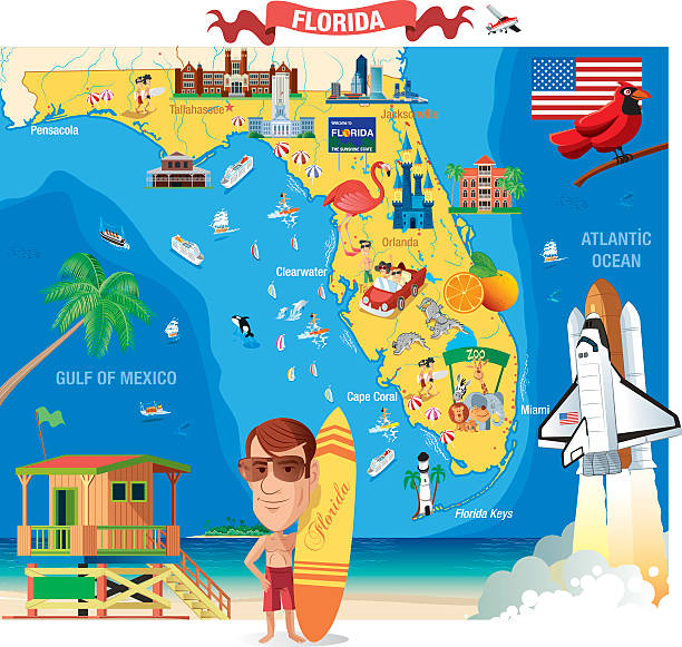


Photo of pinned Anaheim on a map of USA. May be used as illustration for travelling theme.

Counties map of California state of United Sates of America with county names in blue backgrounds


Vector Illustration of a City Street Map of Orange, California, USA. Scale 1:60,000. All source data is in the public domain. U.S. Geological Survey, US Topo Used Layers: USGS The National Map: National Hydrography Dataset (NHD) USGS The National Map: National Transportation Dataset (NTD)

"3D render and image composing: Topographic Map of California, USA. Including state borders, cities, rivers and accurate longitude/latitude lines. Very high resolution available! High quality relief structure!Relief texture and satellite images courtesy of NASA. Further data source courtesy of CIA World Data Bank II database.Note: This image is perfectly congruent to the image"


California political map with capital Sacramento, the largest cities and borders. State in the Pacific Region of the United States. The Golden State. Gray illustration on white background. Vector.
USA vintage map with Hawaii, Texas, Florida and California states
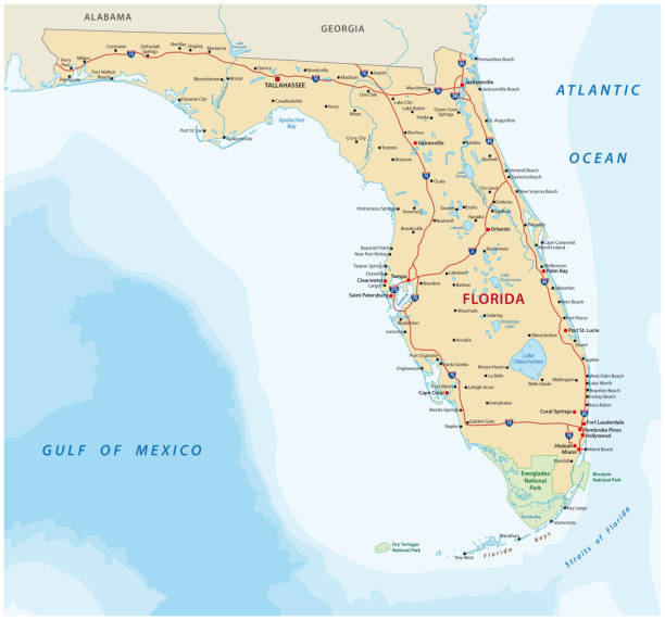
Florida vector road map with national parks

Topographic / Road map of Orlando, FL. Original map data is public domain sourced from www.census.gov/

of15Next