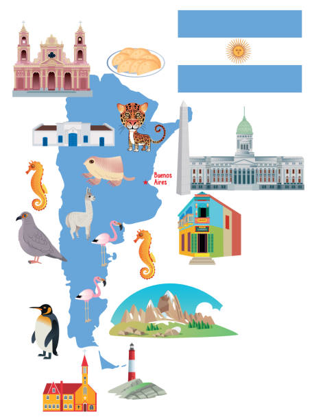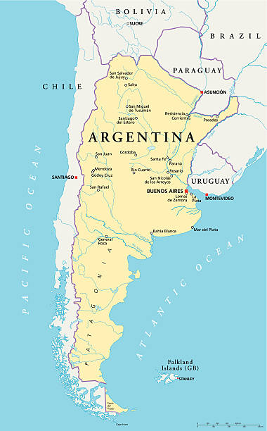
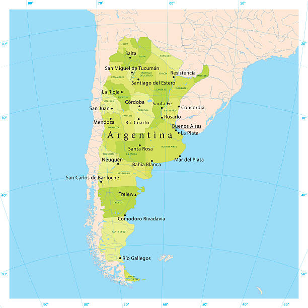
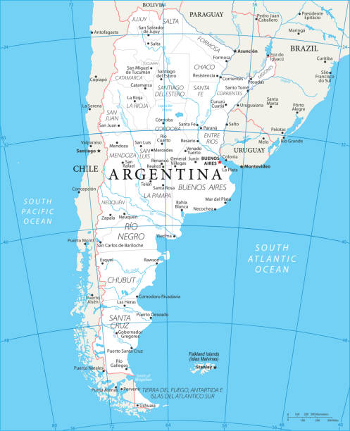
Political map of Argentina with capital Buenos Aires, national borders, most important cities, rivers and lakes. Vector illustration with English labeling and scaling.
Browse 880+ patagonia map stock photos and images available, or search for south america map or torres del paine map to find more great stock photos and pictures.
Political map of Argentina with capital Buenos Aires, national borders, most important cities, rivers and lakes. Vector illustration with English labeling and scaling.
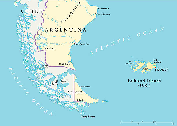
Political map of the Falkland Islands and a part of South America with national borders, most important cities, rivers and lakes. Vector illustration with English labeling and scaling.
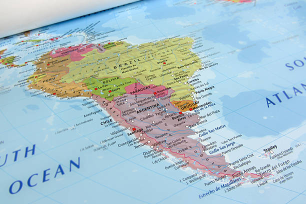
Globe map of South America, geographical map, physics. Cartography, atlas. Map with reliefs and mountains. Argentina, Chile. Satellite view. Element of this images are furnished by Nasa https://visibleearth.nasa.gov/images/73801/september-blue-marble-next-generation-w-topography-and-bathymetry/73812l
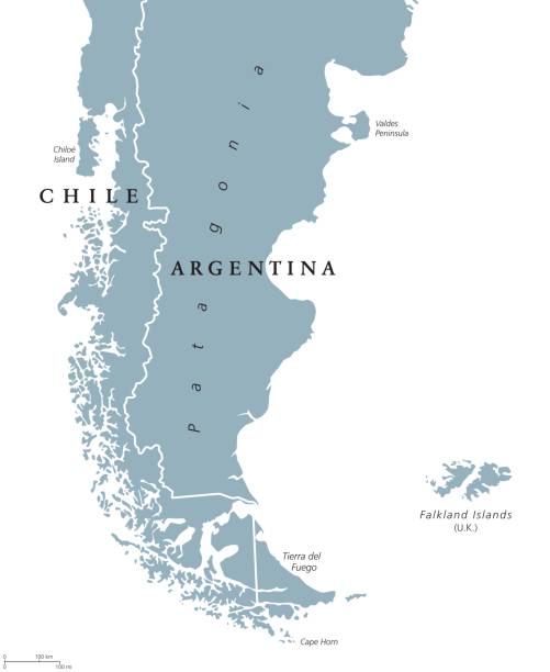
Patagonia political map. The southern end of continent South America, shared by Chile and Argentina. With Falkland Islands, a British overseas territory. English labeling. Gray illustration. Vector.

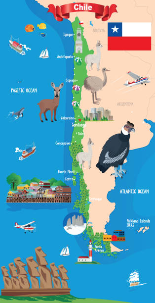
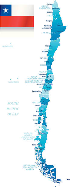
Political map of Chile with capital Santiago, with national borders, most important cities, rivers and lakes. Vector illustration with English labeling and scaling.

Globe map of South America, geographical map, physics. Cartography, atlas. Map with reliefs and mountains. Argentina, Chile. Satellite view. Element of this images are furnished by Nasahttps://visibleearth.nasa.gov/images/73801/september-blue-marble-next-generation-w-topography-and-bathymetry/73812l
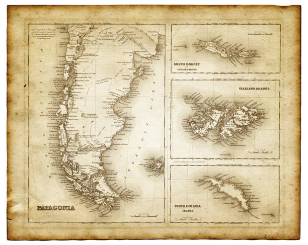
map of Patagonia 1856 - insets of Falkland island, south Orkney and South Georgia island.

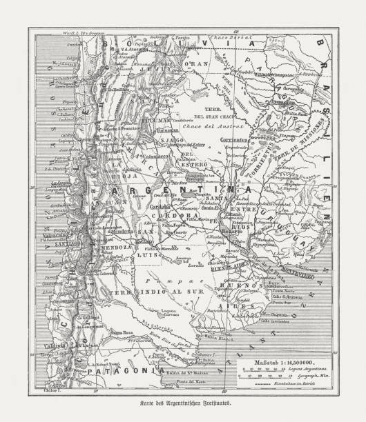
The World-Wide Atlas of Modern Geography, Political and Physical W. & A.K. Johnston - London 1897
Historical map of Argentina. Wood engraving, published in 1893.

Map of Patagonia - Scanned 1880 Engraving
Patagonia hand drawn modern brush lettering. Vector illustration logo text for webpage, print and advertising

Southern part of Argentina map close up in an small world globe showing the falkland Islands (this picture has been shot with a High Definition Hasselblad H3D II 31 megapixels camera and 120 mm f4H Hasselblad macro lens)
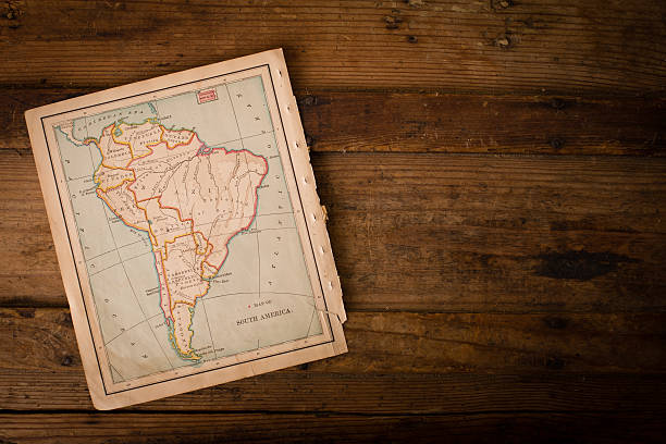
Color image of an old color map of South America, from the 1800's, sitting an angle on wood background, with copy space.

Color image of an old color map of South America, from the 1800's.

Chile political map with capital Santiago, national borders and neighbors. Republic and country in South America. Long, narrow strip of land. Gray illustration over white. English labeling. Vector.
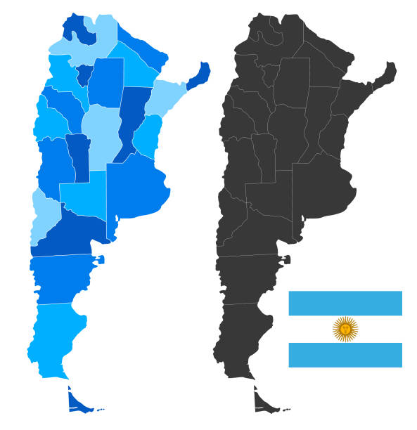
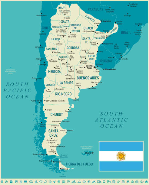
Detailed vector map of Argentina with administrative divisions. Including main rivers and lakes. File was created on October 23, 2013. The colors in the .eps-file are ready for print (CMYK). Included files: EPS (v10) and Hi-Res JPG (5600 × 5600 px).

Antique Map of the East Coast of Patagonia in the 16th Century

Color image of an old color map of South America, from the 1800's.

3D Render of a Map of Argentina with Straight Pins at the Position of important Cities. Vintage Color Style. Very high resolution available!
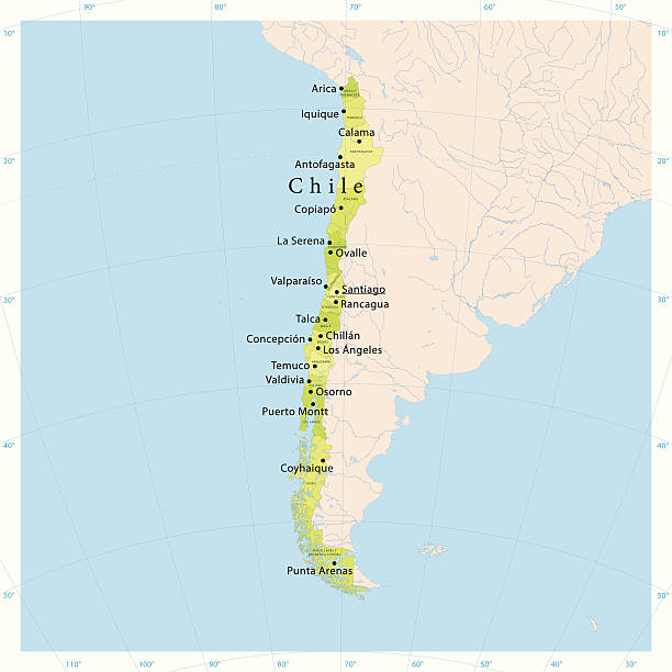
Highly detailed vector map of Chile with states, capitals and big cities.
Argentina vector map with Mendoza, Buenos Aires, La Pampa and Cordoba states Provinces

Andes - Patagonia. 3D Rendering. Stars my own photo. Elements of this image furnished by NASA

Map of Argentina - Vintage Vector illustration

Map showing Argentina and the Drake Passage, the strait between Puerto Willians (Argentina) and the Antarctica Peninsula

Illustration of a Jan van Riebeeck arrives in Table Bay in April 1652

A steel engraving of a map from the early 19th century of Brazil and Paraguay in South America, from “A System of Geography, Popular and Scientific, or A Physical, Political, and Statistical Account of the World and its Various Divisions. Volume VI, Part II” by James Bell and published by A. Fullarton & Co., Glasgow, in 1838.
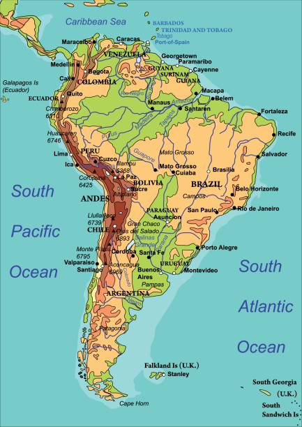
Map of South America. The names of countries, cities and rivers are on the isolated layer. Vector illustration

Navigation over sea with compass and map at Chile Fiords
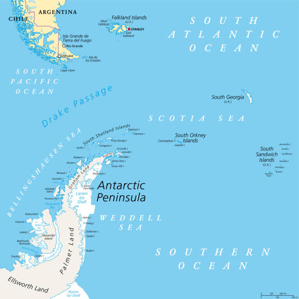
Antarctic Peninsula area, political map. From southern Patagonia and Falkland Islands, to South Georgia and the South Sandwich Islands, South Orkney Islands, and Drake Passage, to Antarctic Peninsula.
Map of Argentina - Vector illustration

Argentina political map with capital Buenos Aires, national borders and neighbor countries. Republic in South America. Gray illustration isolated on white background. English labeling. Vector.
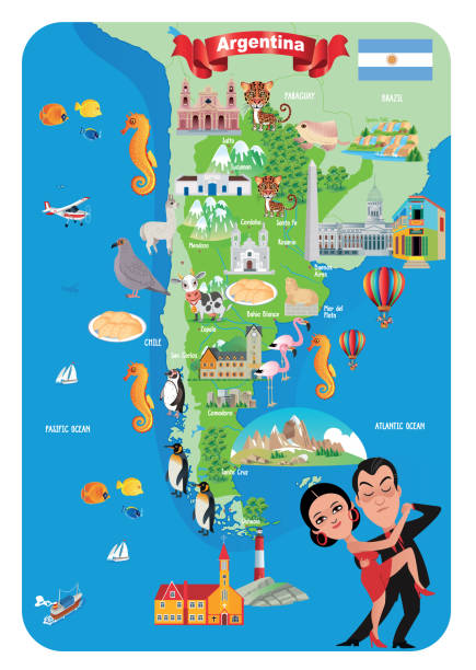
Vector Cartoon Map of Argentina

"3D render and image composing: Topographic Map of Argentina. Including country borders, rivers and accurate longitude/latitude lines. High resolution available! High quality relief structure!Relief texture and satellite images courtesy of NASA. Further data source courtesy of CIA World Data Bank II database.Related images:"

Drake Passage, Mar de Hoces, or Hoces Sea, gray political map. Body of water between Cape Horn and Antarctic Peninsula, connecting South Atlantic with South Pacific and extending into Southern Ocean.
Highly detailed vector map of Chile with states, capitals and big cities.

Map in the Los Glaciares national park in Patagonia, in Argentina

La Leona, Argentina - November 29, 2015: Wooden map showing the Viedma Lake district of Patagonia in Argentina.

Pampa on 3D model of Earth. 3D illustration with plastic planet surface and ocean floor. 3D model of planet created and rendered in Cheetah3D software, 9 Mar 2017. Some layers of planet surface use textures furnished by NASA, Blue Marble collection: http://visibleearth.nasa.gov/view_cat.php?categoryID=1484

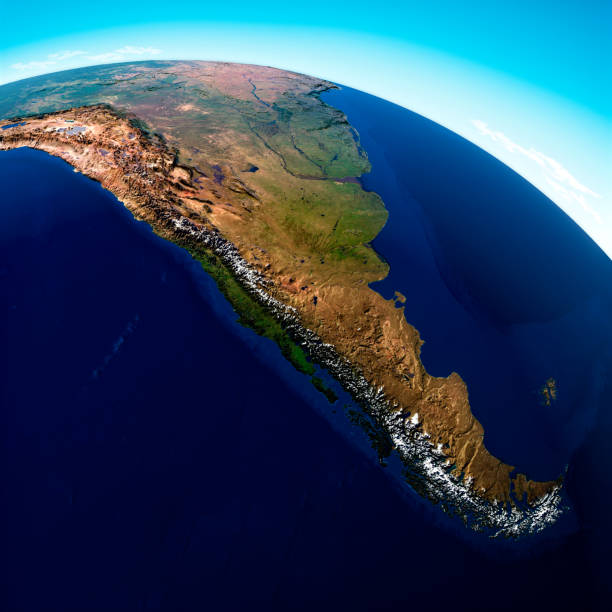
Patagonia. 3D illustration with detailed planet surface. 3D model of planet created and rendered in Cheetah3D software, 9 Mar 2017. Some layers of planet surface use textures furnished by NASA, Blue Marble collection: http://visibleearth.nasa.gov/view_cat.php?categoryID=1484

Vector Map of Chile with Major Cities – Editable Illustration