Philadelphia airport at sunset, Pennsylvania, USA
Browse 280+ philadelphia airport stock photos and images available, or search for philadelphia international airport or atlanta airport to find more great stock photos and pictures.
Philadelphia airport at sunset, Pennsylvania, USA
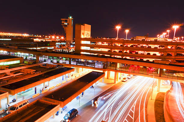
Airport is busy even in the night. Philadelphia airport garage and pick up islands.

Aerial shot of an airport terminal in Philadelphia, Pennsylvania. Shot in USA.
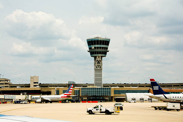
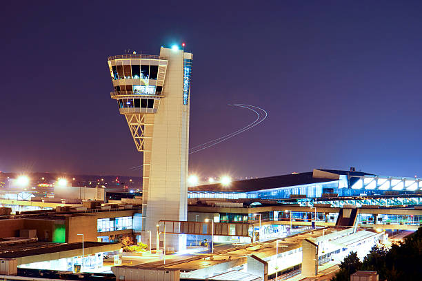
Philadelphia, PA, USA - June 23, 2014: Service vehicles speed across the tarmac under the control tower of the Philadelphia International Airport.

Philadelphia, Pennsylvania, USA - 11th April 2025: Clouds and rain over Philadelphia International Airport in Pennsylvania, USA

Philadelphia International Airport, Philadelphia, Pennsylvania, USA: Aerial photograph of Philadelphia International Airport PHL showing runways, terminals parking structures and the Delaware River

Philadelphia International Airport Road indicator plate.
Philadelphia, USA - June 16, 2018. Passengers walking with their luggages at the terminal of Philadelphia International Airport which is the air transportation hub serving metropolitan Philadelphia area, Pennsylvania, USA.

Very useful for travel backgrounds and commercial films

Philadelphia, USA - March 6, 2016. A TSA officer walking on moving walkway at the terminal of Philadelphia International Airport. Philadelphia International Airport or PHL is the major airway hub for domestic and international travels from Philadelphia, the only World Heritage City in the United States with a rich history and the largest city in Pennsylvania.

Close-up of an airport departure board to usa cities destinations, with environment reflection.Part of a series.

Philadelphia, USA - September 27, 2015. A female traveler stopped at staffed information desk at Philadelphia International Airport with other people nearby . Philadelphia is the largest city in Pennsylvania with lots of historic sites like Independence Hall and a popular destination for tourists.

Philadelphia, USA - February 5 205: Plane about to land at Philadelphia International Airport passes over the stadium district of Philadelphia.

Stamp or tag with text Welcome to Philadelphia, Pennsylvania, vector illustration

Philadelphia, USA - September 4, 2021. Travelers walking inside the terminal of Philadelphia International Airport, Philadelphia, USA

Philadelphia, USA - September 27, 2017. Travelers walking or dining at the terminal of Philadelphia International Airport which is the one of the busiest air transportation hubs on east coast of United States.

Philadelphia, USA - June 16, 2018. Passengers walking at the terminal of Philadelphia International Airport which is the air transportation hub serving metropolitan Philadelphia area, Pennsylvania, USA.

John Heinz National Wildlife Refuge is adjacent to the Philadelphia International Airport. It's great place for birdwatching.

Philadelphia, Pennsylvania, USA - May 25, 2013: an US Airways aircraft is pushed back from the gate at Philadelphia International Airport
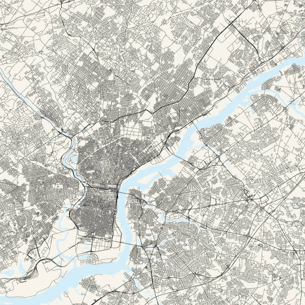
Topographic / Road map of Philadelphia, Pennsylvania. Original map data is public domain sourced from www.census.gov/

Philadelphia, USA - June 22, 2018. Passengers resting at International Arrival area in the Philadelphia International Airport which is the air transportation hub serving metropolitan Philadelphia area, Pennsylvania, USA.

Qatar Airways Airbus A350-941 Aircraft with registration A7-ALY parked at Gate A16 at Philadelphia International Airport in March 2022

Aerial shot of an airport terminal in Philadelphia, Pennsylvania. Shot in USA.

Dublin, Ireland - September 16, 2021: Tourists just disembarked at Dublin International Airport

Airport departure for Philadelphia information board sign. Close-up. Roof construction in the background. Blue color. Horizontal orientation.

Philadelphia, USA - September 4, 2021. Travelers dining at Love Grill inside the terminal of Philadelphia International Airport, Philadelphia, USA

Philadelphia Pennsylvania, USA - Aerial view of PHL the Philadelphia International Airport

Houston, TX, USA- November 29, 2011: Here is the aerial view of Bush Intercontinental Airport, Houston.

Philadelphia, USA - September 23, 2022. Travelers dining at the terminal of Philadelphia International Airport, Pennsylvania, USA

Road sign indicating direction to the city of Philadelphia.

Philadelphia, USA - September 4, 2021. Travelers dining at food court inside the terminal of Philadelphia International Airport, Philadelphia, USA

Philadelphia, USA - September 4, 2021. Travelers shopping at SGR convenient store inside the terminal of Philadelphia International Airport, Philadelphia, USA

Dublin, Ireland - September 16, 2021: Interior of Dublin International Airport

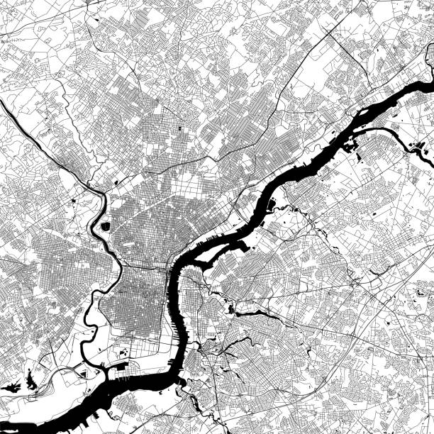
3D Render of a Topographic Map of Philadelphia, Pennsylvania , USA.All source data is in the public domain.Contains modified Copernicus Sentinel data (Apr 2019) courtesy of ESA. URL of source image: https://scihub.copernicus.eu/dhus/#/home.Relief texture SRTM data courtesy of NASA. URL of source image: https://search.earthdata.nasa.gov/search/granules/collection-details?p=C1000000240-LPDAAC_ECS&q=srtm%201%20arc&ok=srtm%201%20arcBuilding footprint data courtesy of Microsoft. URL of source data: https://github.com/Microsoft/USBuildingFootprintsNational Transportation Dataset courtesy of US Geological Survey. URL of source data: https://viewer.nationalmap.gov/basic/

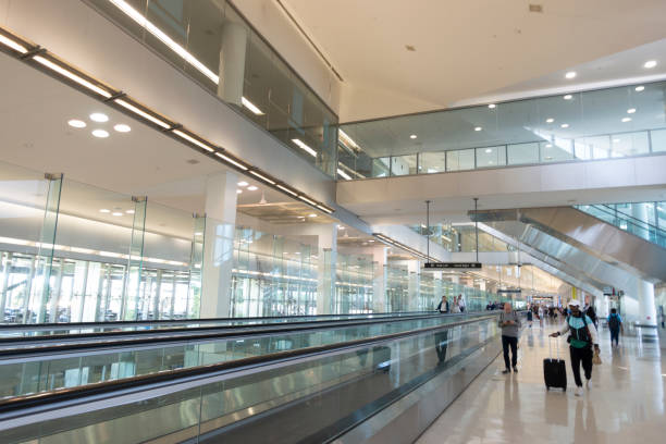
Philadelphia, USA - February 2, 2020. Passengers on moving walkway at terminal in Philadelphia International Airport, Pennsylvania, USA

Philadelphia, USA - September 4, 2021. Passengers walking at the terminal of Philadelphia International Airport, Philadelphia, USA

Philadelphia, USA - September 4, 2021. Passengers shopping at SRG store inside the terminal of Philadelphia International Airport, Philadelphia, USA

Name of American Cities on airport flip board style. Vector font design.

Aerial shot of the runway at an airport. Shot in USA.

Aerial shot of an airport terminal in Philadelphia, Pennsylvania. Shot in USA.
Airplane is taking off behind the control tower remaining the its flying trak in dusk.

An analog "flip" departure board showing destinations at Frankfurt Airport

Philadelphia: Road and street highway in Pennsylvania with many cars in traffic, sign for international airport

Passport travel stamps. USA cities. United States trip, immigration visa, plane international flight vector ink label with New York, Philadelphia, Boston and Cleveland, Pittsburgh, Anchorage stamps

philadelphia usa realistically looking airport luggage tag illustration
Topographic / Road map of Philadelphia, Pennsylvania. Original map data is public domain sourced from www.census.gov/

The southwest airplane departing for takeoff after pushback from the gate

Philadelphia, United States – December 17, 2020: Philadelphia, Pennsylvania-December 16, 2020: at the Philadelphia airport waiting for flight.

The wing of a southwest aircraft prior to takeoff

The southwest airplane being pushed back from the gate in preparation for departure from the airport

Philadelphia, USA - February 2, 2020. Passengers on moving walkway at terminal in Philadelphia International Airport, Pennsylvania, USA

3D Render of a Topographic Map of Philadelphia, Pennsylvania , USA.All source data is in the public domain.Contains modified Copernicus Sentinel data (Apr 2019) courtesy of ESA. URL of source image: https://scihub.copernicus.eu/dhus/#/home.Relief texture SRTM data courtesy of NASA. URL of source image: https://search.earthdata.nasa.gov/search/granules/collection-details?p=C1000000240-LPDAAC_ECS&q=srtm%201%20arc&ok=srtm%201%20arc
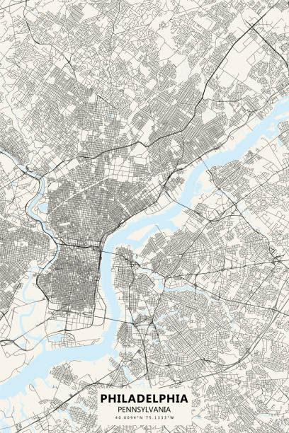
Poster Style Topographic / Road map of Philadelphia, Pennsylvania. Original map data is public domain sourced from www.census.gov/

Philadelphia, USA - September 4, 2021. Travelers dining at food court inside the terminal of Philadelphia International Airport, Philadelphia, USA