Republic Of Kiribati Images and Stock Photos

Browse 3,500+ republic of kiribati stock photos and images available, or start a new search to explore more stock photos and images.

Kiribati from the air - main atoll, Tarawa and its lagoon - view west from Bonriki Tarawa Atoll, Kiribati: aerial view from the eastern end (Bikenibeu, Bonriki) with the south on the left and north on the right, surrounded by the coral reef barrier - Tarawa is an atoll in the Gilbert Islands, the most populous archipelago in Kiribati. Tarawa is the former capital of the British colony of Gilbert and Ellice Islands. Part of the atoll is occupied by the country's capital, South Tarawa. Tarawa has a largely Micronesian population. During World War II, Tarawa was occupied by the Japanese Empire and in 1943 it was the site of the bloody Battle of Tarawa. republic of kiribati stock pictures, royalty-free photos & images

Tarawa Atoll, Kiribati: aerial view from the eastern end (Bikenibeu, Bonriki) with the south on the left and north on the right, surrounded by the coral reef barrier - Tarawa is an atoll in the Gilbert Islands, the most populous archipelago in Kiribati. Tarawa is the former capital of the British colony of Gilbert and Ellice Islands. Part of the atoll is occupied by the country's capital, South Tarawa. Tarawa has a largely Micronesian population. During World War II, Tarawa was occupied by the Japanese Empire and in 1943 it was the site of the bloody Battle of Tarawa.

Our creative library is free of AI-generated contentChoose your visuals with confidence knowing our creative library is free from AI-generated content, so your searches only return safe, high-quality visuals you can trust.
Tarawa Atoll from the air, Kiribati Tarawa Atoll, Kiribati: aerial view from the eastern end (Bonriki) with the south on the left and north on the right - Tarawa / Tarowa (formerly Cook Island) is an atoll in the Pacific Ocean with 70,000 inhabitants, mainly from the Micronesian ethnic group. The atoll was formerly the main atoll of the British colony of the Gilbert and Ellice Islands, then that of the Gilbert Islands. Today it is the main atoll of the Republic of Kiribati with the capital at South Tarawa. republic of kiribati stock pictures, royalty-free photos & images
Tarawa Atoll, Kiribati: aerial view from the eastern end (Bonriki) with the south on the left and north on the right - Tarawa / Tarowa (formerly Cook Island) is an atoll in the Pacific Ocean with 70,000 inhabitants, mainly from the Micronesian ethnic group. The atoll was formerly the main atoll of the British colony of the Gilbert and Ellice Islands, then that of the Gilbert Islands. Today it is the main atoll of the Republic of Kiribati with the capital at South Tarawa.
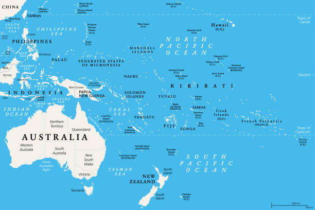
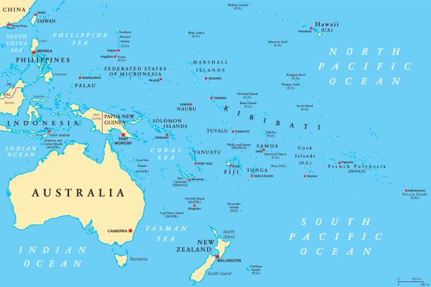
Kiribati Political Map Kiribati political map with capital Tarawa. Republic and island nation in central Pacific Ocean. Archipelago with three main groups, Gilbert, Phoenix and Line Islands. English labeling. Illustration. republic of kiribati stock illustrations
Kiribati political map with capital Tarawa. Republic and island nation in central Pacific Ocean. Archipelago with three main groups, Gilbert, Phoenix and Line Islands. English labeling. Illustration.
Sea level rise protection - Stewart Causeway - links Eita to Ambo, South Tarawa, Kiribati South Tarawa Atoll, Gilbert Island, Kiribati: sea level rise and erosion barrier on the Stewart Causeway, links Eita motu to Banraeaba on Ambo motu on the southern arm of Tarawa Atoll - the low-lying atoll is vulnerable to sea level rise due to climate change - Global warming is causing glaciers and ice sheets to melt. The average sea level has risen 3.2 mm/year since 1993, due to its low atolls Kiribati seems destined to become the first country that will be swallowed up by the sea as a result of climate change. republic of kiribati stock pictures, royalty-free photos & images

South Tarawa Atoll, Gilbert Island, Kiribati: sea level rise and erosion barrier on the Stewart Causeway, links Eita motu to Banraeaba on Ambo motu on the southern arm of Tarawa Atoll - the low-lying atoll is vulnerable to sea level rise due to climate change - Global warming is causing glaciers and ice sheets to melt. The average sea level has risen 3.2 mm/year since 1993, due to its low atolls Kiribati seems destined to become the first country that will be swallowed up by the sea as a result of climate change.

Christmas Island, Kiribati "Christmas Island, Kiribati - November 30th, 2005: Children in their local dresses standing at the beach in Christmas Island, Kiribati. The island in the Indian Ocean is a part of Kiribati atolls and was used as a testing area for atomic bombs in the 50's." republic of kiribati stock pictures, royalty-free photos & images

"Christmas Island, Kiribati - November 30th, 2005: Children in their local dresses standing at the beach in Christmas Island, Kiribati. The island in the Indian Ocean is a part of Kiribati atolls and was used as a testing area for atomic bombs in the 50's."

Kiribati map on white background with red banner Map of Kiribati isolated on a blank background and with his name on a red ribbon. Vector Illustration (EPS10, well layered and grouped). Easy to edit, manipulate, resize or colorize. Please do not hesitate to contact me if you have any questions, or need to customise the illustration. http://www.istockphoto.com/portfolio/bgblue republic of kiribati stock illustrations

Map of Kiribati isolated on a blank background and with his name on a red ribbon. Vector Illustration (EPS10, well layered and grouped). Easy to edit, manipulate, resize or colorize. Please do not hesitate to contact me if you have any questions, or need to customise the illustration. http://www.istockphoto.com/portfolio/bgblue

Tarawa Atoll from the air, capital of Kiribati South Tarawa Atoll, Kiribati: aerial view of the eastern end, with Bonriki and the airport at the top and Temwaiku with its beaches and coral reef at the bottom - Tarawa / Tarowa (former name Cook Island) is an atoll in the Pacific Ocean with 70,000 inhabitants, mainly from the Micronesian ethnic group. The atoll was formerly the main atoll of the British colony of the Gilbert and Ellice Islands, then that of the Gilbert Islands. Today it is the main atoll of the Republic of Kiribati with the capital at South Tarawa. republic of kiribati stock pictures, royalty-free photos & images
South Tarawa Atoll, Kiribati: aerial view of the eastern end, with Bonriki and the airport at the top and Temwaiku with its beaches and coral reef at the bottom - Tarawa / Tarowa (former name Cook Island) is an atoll in the Pacific Ocean with 70,000 inhabitants, mainly from the Micronesian ethnic group. The atoll was formerly the main atoll of the British colony of the Gilbert and Ellice Islands, then that of the Gilbert Islands. Today it is the main atoll of the Republic of Kiribati with the capital at South Tarawa.

of60Next
Take any image from "not quite" to "just right"See how you can modify existing images — or generate entirely new ones — to your exact needs.
Discover Unlimited AI