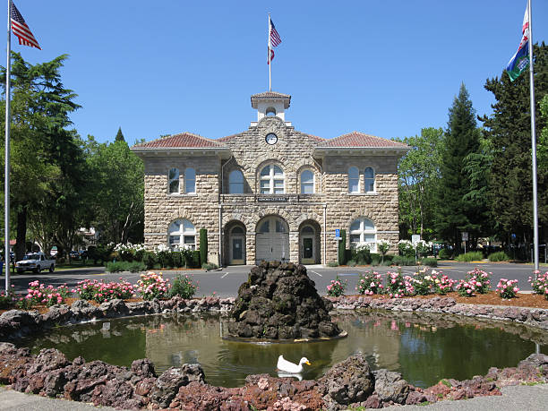
City Hall of Sonoma at the centre of Sonoma Plaza, California, USA
Browse 220+ sonoma square stock photos and images available, or search for wine country or sonoma valley to find more great stock photos and pictures.
City Hall of Sonoma at the centre of Sonoma Plaza, California, USA

Sonoma California,USA March 20 2021: Sonoma's City Hall is located in the center of The Plaza Sonoma CA.

Sonoma, California, United States - October 19, 2015: City Hall Sonoma, California, set within the town Plaza, El Pueblo de Sonoma, on a sunny autumn day. The town is the wine hub for Sonoma Valley, running parallel to, and in rivalry with, its more famous neighbour, Napa Valley.

Sonoma California, USA March 20 2021: Sonoma Plaza has plenty of wine tasting rooms, restaurants, shopping centers, a park for picnics, events, food and wine tours, and a historic tourist destination.
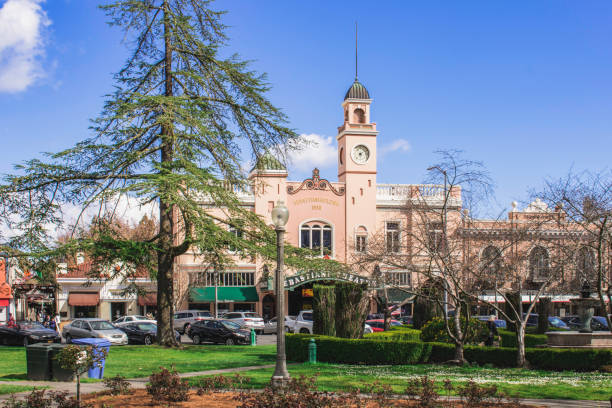
Sonoma California, USA March 20 2021: Historic theater "Sebastiani Theater", at Sonoma Plaza in Sonoma Country, was built by Samuele Sebastiani in 1933

parkland surround the sonoma city hall in sonoma california
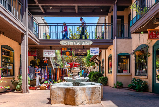
Sonoma, CA USA - July 15 2015: The courtyard of El Paseo de Sonoma, a shopping centre on First street Napa, with various shops, located off the historic plaza.

Bear Flag Monument (aka Raising of the Bear Flag), a public artwork located at the Sonoma Plaza in Sonoma, CA, in the US. The bronze sculpture is the work of John A. MacQuarrie, in 1914.

Sonoma California, USA March 20 2021: Sonoma Plaza has plenty of wine tasting rooms, restaurants, shopping centers, a park for picnics, events, food and wine tours, and a historic tourist destination.

parkland surround the sonoma city hall in sonoma california

Sonoma California,USA March 20 2021:Sonoma Plaza has plenty of wine tasting rooms, restaurants, shopping centers, a park for picnics, events, food and wine tours, and a historic tourist destination.

Sonoma California, USA March 20 2021: Historic theater "Sebastiani Theater", at Sonoma Plaza in Sonoma Country, was built by Samuele Sebastiani in 1933

Building of the main Orthodox Cathedral Sevastopol St. Vladimir's Cathedral in Crimea Chersonesos
Landmarks of Crimea & Sevastopol. Set of flat color icons in Metro style. Editable vector illustration.

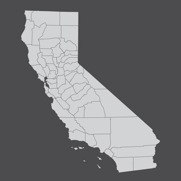
Map of the state of California and its counties

Sonoma, California, USA - May 14, 2013: These Visitors to Sonoma are typical of any day, this is the location of the Bear Flag revolt that led to California State Hood. Sonoma Plaza is a very popular tourist location and great on this beautiful day.

parkland surround the sonoma city hall in sonoma california

Sonoma California,USA March 20 2021:Sonoma Plaza has plenty of wine tasting rooms, restaurants, shopping centers, a park for picnics, events, food and wine tours, and a historic tourist destination.

"Sonoma, California, USA - February 1, 2012: This official Sonoma City Hall was erected in 1906, located in the city plaza, the location of the Bear Flag Revolt in 1846 which led to eventual Statehood for California in 1850. It is still in use today as the official Center of City Government."

Vintage style Sonoma California Stamp
California counties map isolated on dark background

San Francisco Bay Area, a region of the U.S. state California, political map with counties and largest cities. An area that surrounds and include the San Francisco Bay, which is a large tidal estuary.

parkland surround the sonoma city hall in sonoma california

San Francisco Bay Area, region of the U.S. state California, gray political map with counties and largest cities. Area that surrounds and include the San Francisco Bay, which is a large tidal estuary.

Sonoma California, USA March 20 2021: Sonoma Plaza has plenty of wine tasting rooms, restaurants, shopping centers, a park for picnics, events, food and wine tours, and a historic tourist destination.

Sunny day in Sonoma plaza, park, summer theater, music

Sonoma California,USA March 20 2021:Sonoma Plaza has plenty of wine tasting rooms, restaurants, shopping centers, a park for picnics, events, food and wine tours, and a historic tourist destination.

Map of the state of California and its counties

Shot of Sonoma City Hall in the evening. Sonoma, CA.

Sonoma California,USA March 20 2021: Sonoma's City Hall is located in the center of The Plaza Sonoma CA.

Subregions of the San Francisco Bay Area, divided by counties, political map. Area of the U.S. state of California, that surrounds and includes the San Francisco Bay, which is a large tidal estuary.

3D Render of a Topographic Map of the San Francisco Bay Area, USA. All source data is in the public domain. Color texture: Made with Natural Earth. http://www.naturalearthdata.com/downloads/10m-raster-data/10m-cross-blend-hypso/ Relief texture and Rivers: SRTM data courtesy of USGS. URLs of source images: https://e4ftl01.cr.usgs.gov//MODV6_Dal_D/SRTM/SRTMGL1.003/2000.02.11/N37W121.SRTMGL1.2.jpg https://e4ftl01.cr.usgs.gov//MODV6_Dal_D/SRTM/SRTMGL1.003/2000.02.11/N38W120.SRTMGL1.2.jpg https://e4ftl01.cr.usgs.gov//MODV6_Dal_D/SRTM/SRTMGL1.003/2000.02.11/N38W121.SRTMGL1.2.jpg Water texture: SRTM Water Body SWDB: https://dds.cr.usgs.gov/srtm/version2_1/SWBD/

Healdsburg, United States - September 15, 2018: People walk through performance pavilion in the central square in the Sonoma County wine country town of Healdsburg, California, September 15, 2018

Stamp or label with text Santa Rosa, California written inside, vector illustration
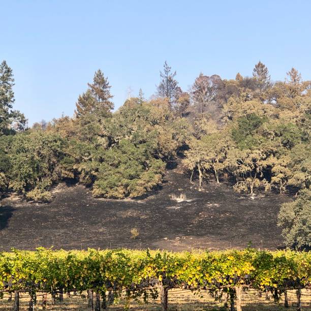
The wind-whipped Kincade Fire scorched parts of vineyards in Alexander Valley, part of Sonoma County’s wine country.

3D Render of a Topographic Map of the San Francisco Bay Area, USA. All source data is in the public domain. Color texture: Made with Natural Earth. http://www.naturalearthdata.com/downloads/10m-raster-data/10m-cross-blend-hypso/ Boundaries: USGS, National Map, National Boundary Data. https://viewer.nationalmap.gov/basic/#productSearch Relief texture and Rivers: SRTM data courtesy of USGS. URLs of source images: https://e4ftl01.cr.usgs.gov//MODV6_Dal_D/SRTM/SRTMGL1.003/2000.02.11/N37W121.SRTMGL1.2.jpg https://e4ftl01.cr.usgs.gov//MODV6_Dal_D/SRTM/SRTMGL1.003/2000.02.11/N38W120.SRTMGL1.2.jpg https://e4ftl01.cr.usgs.gov//MODV6_Dal_D/SRTM/SRTMGL1.003/2000.02.11/N38W121.SRTMGL1.2.jpg Water texture: SRTM Water Body SWDB: https://dds.cr.usgs.gov/srtm/version2_1/SWBD/

Sonoma California, USA March 20 2021: Sonoma Plaza has plenty of wine tasting rooms, restaurants, shopping centers, a park for picnics, events, food and wine tours, and a historic tourist destination.

3D Render of a Topographic Map of the San Francisco Bay Area, USA. All source data is in the public domain. Boundaries: USGS, National Map, National Boundary Data. https://viewer.nationalmap.gov/basic/#productSearch Relief texture and Rivers: SRTM data courtesy of USGS. URLs of source images: https://e4ftl01.cr.usgs.gov//MODV6_Dal_D/SRTM/SRTMGL1.003/2000.02.11/N37W121.SRTMGL1.2.jpg https://e4ftl01.cr.usgs.gov//MODV6_Dal_D/SRTM/SRTMGL1.003/2000.02.11/N38W120.SRTMGL1.2.jpg https://e4ftl01.cr.usgs.gov//MODV6_Dal_D/SRTM/SRTMGL1.003/2000.02.11/N38W121.SRTMGL1.2.jpg Water texture: SRTM Water Body SWDB: https://dds.cr.usgs.gov/srtm/version2_1/SWBD/

Orobanche fasciculata is a species of broomrape known by the common name clustered broomrape. It is native to much of western and central North America from Alaska to northern Mexico to the Great Lakes region, where it grows in many types of habitat. It is a parasite growing attached to the roots of other plants, usually members of the Asteraceae such as Artemisia; and other genres such as Eriodictyon and Eriogonum.

Single orange chrysanthemum flower head isolated on white background

The wine grape growing season begins with bud break, this on an old vine. Sonoma County, California, USA

a pair of cast concrete lounge chairs at a luxury resort.

Cows relax and enjoy the view of the flooded Laguna near their home in Sebastopol, California. An atmospheric river dropped nearly a foot of rain on Sonoma County over the past two days.

Aquilegia formosa, the crimson columbine, western columbine, or (ambiguously) red columbine, is a common wildflower native to western North America, from Alaska to Baja California, and eastward to Montana and Wyoming. Ranunculaceae.

3D Render of a Topographic Map of the San Francisco Bay Area, USA. All source data is in the public domain. Relief texture and Rivers: SRTM data courtesy of USGS. URLs of source images: https://e4ftl01.cr.usgs.gov//MODV6_Dal_D/SRTM/SRTMGL1.003/2000.02.11/N37W121.SRTMGL1.2.jpg https://e4ftl01.cr.usgs.gov//MODV6_Dal_D/SRTM/SRTMGL1.003/2000.02.11/N38W120.SRTMGL1.2.jpg https://e4ftl01.cr.usgs.gov//MODV6_Dal_D/SRTM/SRTMGL1.003/2000.02.11/N38W121.SRTMGL1.2.jpg Water texture: SRTM Water Body SWDB: https://dds.cr.usgs.gov/srtm/version2_1/SWBD/

Sonoma City Hall in Downtown Sonoma, California, a popular tourist destination of the California Wine Country.

Lake Sonoma tasting room at Sonoma Plaza, Sonoma California

3D Render of a Topographic Map of the region of Mendocino County, Lake County and Sonoma County, California, United States. All source data is in the public domain. Color and Water texture: Contains modified Copernicus Sentinel data (2021) courtesy of ESA. URL of source image: https://dataspace.copernicus.eu/explore-data/data-collections/sentinel-data/sentinel-2 Relief texture: SRTM data courtesy of NASA JPL (2020). URL of source image: https://lpdaac.usgs.gov/products/srtmgl1v003/

3D Render of a Topographic Map of the San Francisco Bay Area, USA. All source data is in the public domain. Boundaries: USGS, National Map, National Boundary Data. https://viewer.nationalmap.gov/basic/#productSearch Relief texture and Rivers: SRTM data courtesy of USGS. URLs of source images: https://e4ftl01.cr.usgs.gov//MODV6_Dal_D/SRTM/SRTMGL1.003/2000.02.11/N37W121.SRTMGL1.2.jpg https://e4ftl01.cr.usgs.gov//MODV6_Dal_D/SRTM/SRTMGL1.003/2000.02.11/N38W120.SRTMGL1.2.jpg https://e4ftl01.cr.usgs.gov//MODV6_Dal_D/SRTM/SRTMGL1.003/2000.02.11/N38W121.SRTMGL1.2.jpg Water texture: SRTM Water Body SWDB: https://dds.cr.usgs.gov/srtm/version2_1/SWBD/

Vector Illustration of a City Street Map of Santa Rosa, California, USA. Scale 1:60,000. All source data is in the public domain. U.S. Geological Survey, US Topo Used Layers: USGS The National Map: National Hydrography Dataset (NHD) USGS The National Map: National Transportation Dataset (NTD)

3D Render of a Topographic Map of the region of Sonoma County, California, United States. All source data is in the public domain. Color and Water texture: Contains modified Copernicus Sentinel data (2021) courtesy of ESA. URL of source image: https://dataspace.copernicus.eu/explore-data/data-collections/sentinel-data/sentinel-2 Relief texture: SRTM data courtesy of NASA JPL (2020). URL of source image: https://lpdaac.usgs.gov/products/srtmgl1v003/


