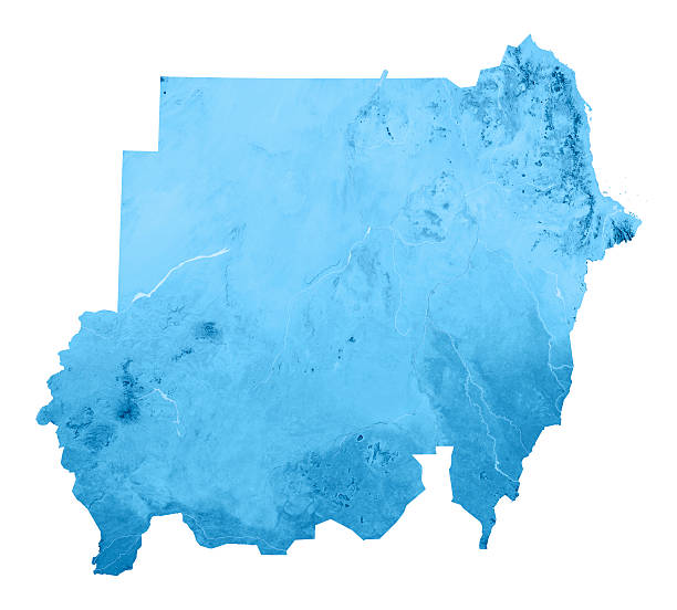
3D render and image composing: Topographic Map of the Republic of the Sudan. This map is showing the recent borders, since South Sudan became an independent country on 9th of July 2011. Isolated on White. High quality relief structure!
Browse 140+ sudan-map stock photos and images available, or start a new search to explore more stock photos and images.
3D render and image composing: Topographic Map of the Republic of the Sudan. This map is showing the recent borders, since South Sudan became an independent country on 9th of July 2011. Isolated on White. High quality relief structure!

"Topographic Map of the Republic of the Sudan. This map is showing the recent borders, since South Sudan became an independent country on 9th of July 2011. Including country borders, rivers and accurate longitude/latitude lines. High quality relief structure!Relief texture and satellite images courtesy of NASA. Further data source courtesy of CIA World Data Bank II database.Related images:"

"3D render and image composing: Topographic Map of the The Republic of South Sudan. South Sudan became an independent country on 9th of July 2011. Including country borders, rivers and accurate longitude/latitude lines. High quality relief structure!Relief texture and satellite images courtesy of NASA. Further data source courtesy of CIA World Data Bank II database.Related images:"

3D Render of a Topographic Map of South Sudan. Version with Country Boundaries. All source data is in the public domain. Color texture: Made with Natural Earth. http://www.naturalearthdata.com/downloads/10m-raster-data/10m-cross-blend-hypso/ Relief texture: SRTM data courtesy of NASA JPL (2020). URL of source image: https://e4ftl01.cr.usgs.gov//DP133/SRTM/SRTMGL3.003/2000.02.11 Water texture: SRTM Water Body SWDB: https://dds.cr.usgs.gov/srtm/version2_1/SWBD/ Boundaries Level 0: Humanitarian Information Unit HIU, U.S. Department of State (database: LSIB) http://geonode.state.gov/layers/geonode%3ALSIB7a_Gen

19th century map of the White Nile and Blue Nile converging into the Nile River in Sudan.

Topographic military radar tactical map of the Republic of Sudan with emerald green contour lines on dark green background

3D render and image composing: Topographic Map of the Republic of Sudan. This map is showing the old borders, which changed on 9th of July 2011. The country was divided, South Sudan became an independent country . Including country borders, rivers and accurate longitude/latitude lines. High quality relief structure!
Empty Dark Gray Map of Middle East Asia - illustration

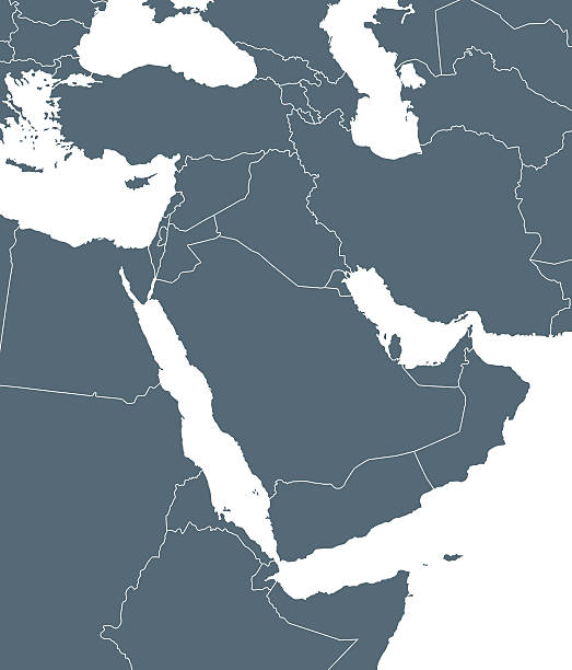
3D Render of a Topographic Map of the Red Sea, North Africa, Middle East. All source data is in the public domain. Color texture and Rivers: Made with Natural Earth. http://www.naturalearthdata.com/downloads/10m-raster-data/10m-cross-blend-hypso/ http://www.naturalearthdata.com/downloads/10m-physical-vectors/ Relief texture: SRTM data courtesy of USGS. URL of source image: https://e4ftl01.cr.usgs.gov//MODV6_Dal_D/SRTM/SRTMGL1.003/2000.02.11/ Water texture: HIU World Water Body Limits: http://geonode.state.gov/layers/?limit=100&offset=0&title__icontains=World%20Water%20Body%20Limits%20Detailed%202017Mar30

3D render of a topographic map of South Sudan. All source data is in the public domain. Relief texture: NASADEM data courtesy of NASA JPL (2020). URL of source image: https://doi.org/10.5067/MEaSUREs/SRTM/SRTMGL3.003. Color texture: Made with the free and open-source software Blender. URL of Blender software: http://www.blender.org.

3D Render of a Topographic Map of Sudan. Version with Country Boundaries. All source data is in the public domain. Color texture: Made with Natural Earth. http://www.naturalearthdata.com/downloads/10m-raster-data/10m-cross-blend-hypso/ Relief texture: SRTM data courtesy of NASA JPL (2020). URL of source image: https://e4ftl01.cr.usgs.gov//DP133/SRTM/SRTMGL3.003/2000.02.11 Water texture: SRTM Water Body SWDB: https://dds.cr.usgs.gov/srtm/version2_1/SWBD/ Boundaries Level 0: Humanitarian Information Unit HIU, U.S. Department of State (database: LSIB) http://geonode.state.gov/layers/geonode%3ALSIB7a_Gen

3D Render of a Topographic Map of the Red Sea, North Africa, Middle East. All source data is in the public domain. Color texture and Rivers: Made with Natural Earth. http://www.naturalearthdata.com/downloads/10m-raster-data/10m-cross-blend-hypso/ http://www.naturalearthdata.com/downloads/10m-physical-vectors/ Relief texture: SRTM data courtesy of USGS. URL of source image: https://e4ftl01.cr.usgs.gov//MODV6_Dal_D/SRTM/SRTMGL1.003/2000.02.11/ Water texture: HIU World Water Body Limits: http://geonode.state.gov/layers/?limit=100&offset=0&title__icontains=World%20Water%20Body%20Limits%20Detailed%202017Mar30

Historical map of Egypt, Nile Delta and Sudan. Description in German. Lithograph, published in 1893.

Map of Middle East Asia - illustration

Dark Gray Map of Middle East Asia - illustration
Blue Map of Middle East Asia and Navigation Icons

Middle East Asia - Retro Map

Beige Sea Blue Map of Middle East Asia - illustration

3D render and image composing: Topographic Map of the Republic of South Sudan. South Sudan became an independent country on 9th of July 2011. Isolated on White. High quality relief structure!

Official current vector coat of arms of the Republic of South Sudan

Infographic Blue Map of Middle East Asia

Vector map of Middle East Asia with infographic elements

Color image of an old map of Africa, from the 1800's, on wood background.

Infographic Map of Middle East Asia - illustration

Vector maps of Middle East Asia with variable specification and icons

Red Sea region country detailed editable map with countries capitals and cities. Vector EPS-10 file

Historical map of Upper-, Lower-Guinea and West Suadn, West Africa. Lithograph, published in 1897.

Historical map of the course of the Nile river from the source areal to the mouth. Wood engraving, published in 1879.

3D Render of a Topographic Map of Sudan. Version with Country Boundaries. All source data is in the public domain. Color texture: Made with Natural Earth. http://www.naturalearthdata.com/downloads/10m-raster-data/10m-cross-blend-hypso/ Relief texture: SRTM data courtesy of NASA JPL (2020). URL of source image: https://e4ftl01.cr.usgs.gov//DP133/SRTM/SRTMGL3.003/2000.02.11 Water texture: SRTM Water Body SWDB: https://dds.cr.usgs.gov/srtm/version2_1/SWBD/ Boundaries Level 0: Humanitarian Information Unit HIU, U.S. Department of State (database: LSIB) http://geonode.state.gov/layers/geonode%3ALSIB7a_Gen

Empty Blue Map of Middle East Asia

3D Render of a Topographic Map of South Sudan. Version with Country Boundaries. All source data is in the public domain. Color texture: Made with Natural Earth. http://www.naturalearthdata.com/downloads/10m-raster-data/10m-cross-blend-hypso/ Relief texture: SRTM data courtesy of NASA JPL (2020). URL of source image: https://e4ftl01.cr.usgs.gov//DP133/SRTM/SRTMGL3.003/2000.02.11 Water texture: SRTM Water Body SWDB: https://dds.cr.usgs.gov/srtm/version2_1/SWBD/ Boundaries Level 0: Humanitarian Information Unit HIU, U.S. Department of State (database: LSIB) http://geonode.state.gov/layers/geonode%3ALSIB7a_Gen

Colored Map of Middle East Asia with Country Names and Capital Cities

Colored Map of Middle East Asia with Country Names and Capital Cities

Blue Map of Middle East Asia

3D Render of a Topographic Map of South Sudan. All source data is in the public domain. Color texture: Made with Natural Earth. http://www.naturalearthdata.com/downloads/10m-raster-data/10m-cross-blend-hypso/ Relief texture: SRTM data courtesy of NASA JPL (2020). URL of source image: https://e4ftl01.cr.usgs.gov//DP133/SRTM/SRTMGL3.003/2000.02.11 Water texture: SRTM Water Body SWDB: https://dds.cr.usgs.gov/srtm/version2_1/SWBD/ Boundaries Level 0: Humanitarian Information Unit HIU, U.S. Department of State (database: LSIB) http://geonode.state.gov/layers/geonode%3ALSIB7a_Gen

Map of Egypt, Darfur, and Abyssinia with separate map of the Nile Delta and Suez Canal. Lithograph, published in 1897.
Blue and Green Map of Middle East Asia

3D Render of a Topographic Map of Sudan. All source data is in the public domain. Color texture: Made with Natural Earth. http://www.naturalearthdata.com/downloads/10m-raster-data/10m-cross-blend-hypso/ Relief texture: SRTM data courtesy of NASA JPL (2020). URL of source image: https://e4ftl01.cr.usgs.gov//DP133/SRTM/SRTMGL3.003/2000.02.11 Water texture: SRTM Water Body SWDB: https://dds.cr.usgs.gov/srtm/version2_1/SWBD/ Boundaries Level 0: Humanitarian Information Unit HIU, U.S. Department of State (database: LSIB) http://geonode.state.gov/layers/geonode%3ALSIB7a_Gen

3D Render of a Topographic Map of South Sudan. All source data is in the public domain. Color texture: Made with Natural Earth. http://www.naturalearthdata.com/downloads/10m-raster-data/10m-cross-blend-hypso/ Relief texture: SRTM data courtesy of NASA JPL (2020). URL of source image: https://e4ftl01.cr.usgs.gov//DP133/SRTM/SRTMGL3.003/2000.02.11 Water texture: SRTM Water Body SWDB: https://dds.cr.usgs.gov/srtm/version2_1/SWBD/ Boundaries Level 0: Humanitarian Information Unit HIU, U.S. Department of State (database: LSIB) http://geonode.state.gov/layers/geonode%3ALSIB7a_Gen

South Sudan striped map template made from blue diagonal lines on dark background. Vector illustration EPS10

Sudan striped map template made from blue diagonal lines on dark background. Vector illustration EPS10

3D render of a topographic map of Sudan. All source data is in the public domain. Relief texture: NASADEM data courtesy of NASA JPL (2020). URL of source image: https://doi.org/10.5067/MEaSUREs/SRTM/SRTMGL3.003. Color texture: Made with the free and open-source software Blender. URL of Blender software: http://www.blender.org.

Vintage map of Sudan vector stock illustration. Vector EPS 10.
Isolated Blue Map of Middle East Asia

Black highlighted location map of the South Sudanese Lakes state inside gray map of the Republic of South Sudan

Black highlighted location map of the South Sudanese Jonglei state inside gray map of the Republic of South Sudan

Simple black vector map of the Republic of South Sudan

Gray vector map of the Republic of South Sudan with white borders of its states

Black highlighted location map of the South Sudanese Eastern Equatoria state inside gray map of the Republic of South Sudan

Pastel vector map of the Republic of South Sudan with black borders and names of its states

White blank vector map of the Republic of South Sudan with black borders and names of its states

Black highlighted location map of the South Sudanese Western Bahr el Ghazal state inside gray map of the Republic of South Sudan

Black highlighted location map of the South Sudanese Warrap (Warab) state inside gray map of the Republic of South Sudan

Light topographic map of the Republic of South Sudan with black contour lines on beige background

Black highlighted location map of the South Sudanese Western Equatoria state inside gray map of the Republic of South Sudan

Black highlighted location map of the South Sudanese Unity (Western Upper Nile) state inside gray map of the Republic of South Sudan

Black highlighted location map of the South Sudanese Central Equatoria state inside gray map of the Republic of South Sudan
