00:16
World map set of all countries, Map resolution: 22000 x 11000 pixel, Epic photo real animation, World Map Credits To NASA : https://visibleearth.nasa.gov/images/57752/blue-marble-land-surface-shallow-water-and-shaded-topography
Browse 390+ sudan-map stock videos and clips available to use in your projects, or start a new search to explore more stock footage and b-roll video clips.
World map set of all countries, Map resolution: 22000 x 11000 pixel, Epic photo real animation, World Map Credits To NASA : https://visibleearth.nasa.gov/images/57752/blue-marble-land-surface-shallow-water-and-shaded-topography
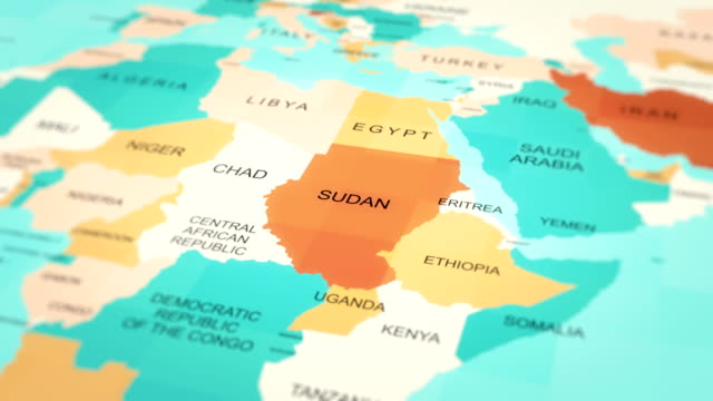
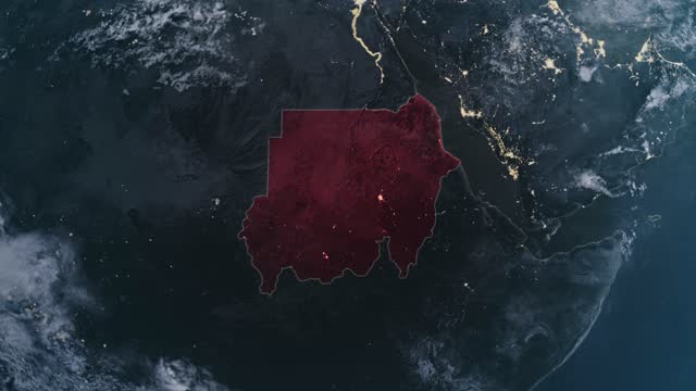
tracking to SUDAN from World MAP
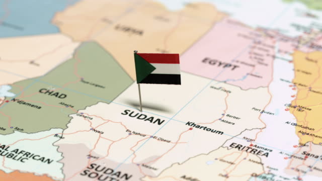
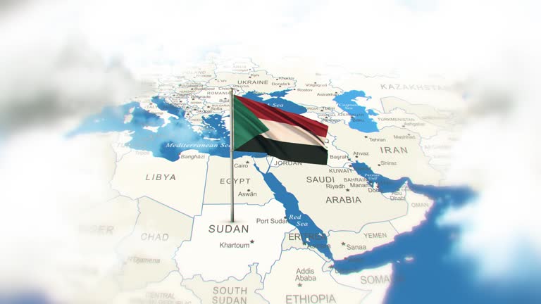
tracking to Sudan with National Flag

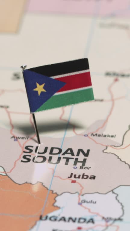
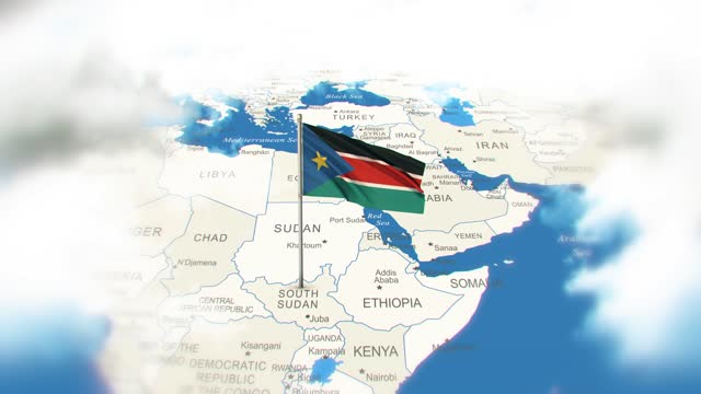
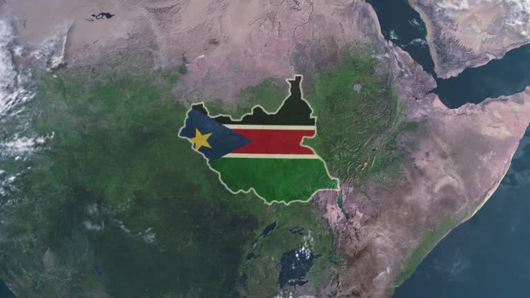
tracking to South Sudan with National Flag

Zoom in on a monochrome map , 4K highly quality, dark theme world map, night and monochromatic styling
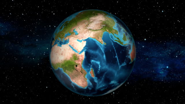
Highlighted dark map of countries, zooming in from the space through a 4K photo real animated globe, with a panoramic view consisting of Africa, West Europe and USA. Epic spinning world animation, Realistic planet earth, highlight, satellite, aerial

East Africa or Eastern Africa is the easterly region of the African continent, variably defined by geography or geopolitics. 20 territories constitute Eastern Africa: Tanzania, Kenya, Uganda, Rwanda and Burundi, Djibouti, Eritrea, Ethiopia and Somalia, Horn of Africa, Comoros, Mauritius and Seychelles, Réunion, Mayotte, Mozambique, Madagascar, Egypt, Sudan, South Sudan

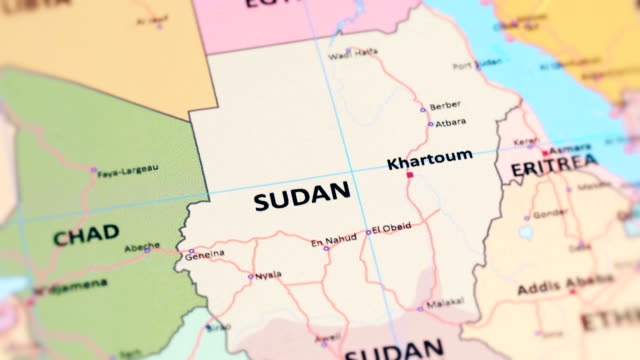
Credit: https://www.nasa.gov/topics/earth/images Take a virtual trip to Sudan today and enhance your understanding of this beautiful land. Get ready to be captivated by the geography, history, and culture of Sudan.
South Sudan, South Sudan flag, South Sudan map, Clouds, South Sudan abstrack
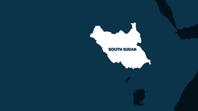
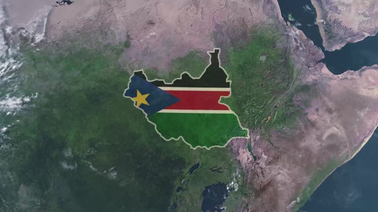
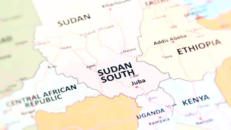
Seamless looping animation of the earth zooming in to the 3d map of South Sudan with the capital and the biggest cites in 4K resolution

The Nile is a major north-flowing river in northeastern Africa, generally regarded as the longest river in the world. It is 6,853 km long. The Nile is an "international" river as its water resources are shared by eleven countries, namely, Tanzania, Uganda, Rwanda, Burundi, Democratic Republic of the Congo, Kenya, Ethiopia, Eritrea, South Sudan, Sudan and Egypt.

tracking to Chad with National Flag
World map set of all countries, Map resolution: 22000 x 11000 pixel, Epic photo real animation, World Map Credits To NASA : https://visibleearth.nasa.gov

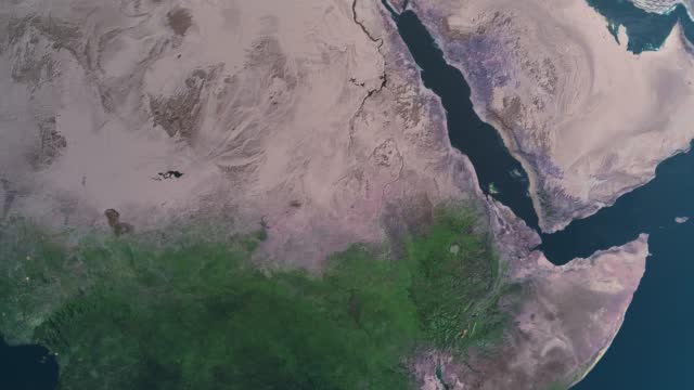
An Earth zoom satellite view to northern Africa and surrounding countries.
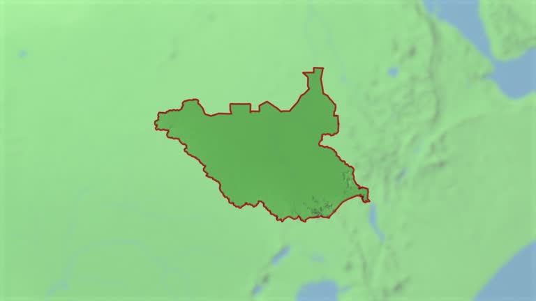
map with label then with out label

Epic photo real animation, World Map Credits To NASA : https://visibleearth.nasa.gov/images/57752/blue-marble-land-surface-shallow-water-and-shaded-topography
Sudan, Sudan flag, Sudan map, Clouds, Sudan abstrack
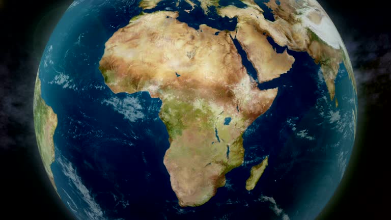
Earth zoom to Africa. Imagery courtesy of NASA.
tracking to AFRICA SOUTH SUDAN from World Map

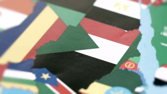
This detailed world map features the borders of each country, creatively overlaid with their respective national flags. A comprehensive and visually striking representation of the global nations in a single frame, ideal for educational resources, geographic illustrations, and presentations. Credit: https://www.nasa.gov/topics/earth/images

tracking to AFRICA CHAD from World Map

Zoom in to the map of Sudan with text, textless, and with a flag

Explore the world! With this stunning animation, travel from space to any country in the blink of an eye. Orbit the Earth and then pass through the clouds for a mesmerizing entrance to your chosen country. With the alpha channel transition, you have the freedom to add any content you want to the end of your video.

Highlighted dark map of countries, zooming in from the space through a 4K photo real animated globe, with a panoramic view consisting of Africa, West Europe and USA. Epic spinning world animation, Realistic planet earth, highlight, satellite, aerial

Experience the most captivating way to explore the world with our Space to Earth Zoom Animation! This animation, prepared in 4K resolution and 60 FPS fluency, offers you a breathtaking visual experience.
World map set of all countries, Map resolution: 22000 x 11000 pixel, Epic photo real animation, World Map Credits To NASA : https://visibleearth.nasa.gov

Explore the world! With this stunning animation, travel from space to any country in the blink of an eye. Orbit the Earth and then pass through the clouds for a mesmerizing entrance to your chosen country. With the alpha channel transition, you have the freedom to add any content you want to the end of your video.

Zoom in on a monochrome map , 4K highly quality, dark theme world map, night and monochromatic styling
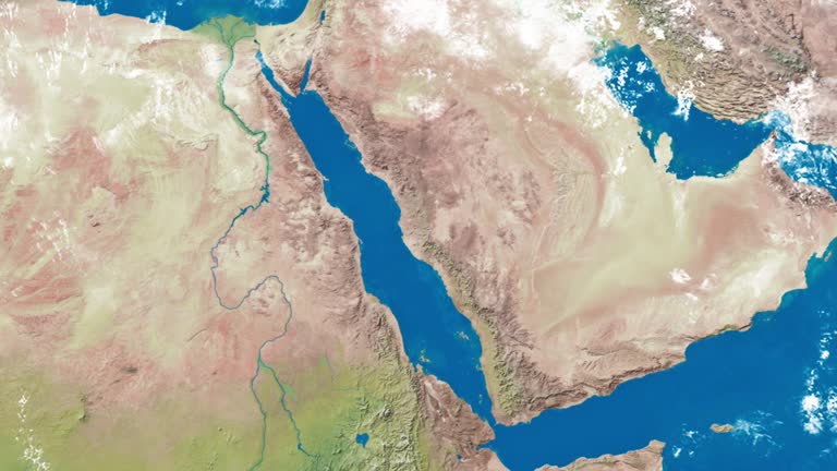
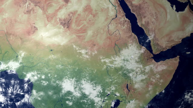
An Earth zoom satellite view to the Red Sea and surrounding countries.

Animation of the Earth with bright connections. Aerial, maritime, ground routes and country borders. Africa.

Animation of the Earth with bright connections and city lights.

tracking to Sudan with pin

Ultra Realistic Earth zoom to Africa. 4K.

Animation of the Earth with bright connections. Africa.

Orbiting over Africa 4K 3D animation

Americas, Europe, Turkey, Country - Geographic Area, 4K Resolution

High quality video of zoom to the country of Sudan from space * Full HD * Duration: 0:20

Explore the world! With this stunning animation, travel from space to any country in the blink of an eye. Orbit the Earth and then pass through the clouds for a mesmerizing entrance to your chosen country. With the alpha channel transition, you have the freedom to add any content you want to the end of your video.
tracking to Sudan Borders with National Flag on World Map

Animation of the Earth with bright connections. Aerial, maritime, ground routes and country borders. Africa. Red.

3d flag waving first 15 sec on the modern background with map , second 15 sec on the green screen background .

map with label then with out label

Zoom in on a monochrome map , 4K highly quality, dark theme world map, night and monochromatic styling
South Sudan - Juba zoom in from space.

tracking to The Central African Republic with National Flag

Animation of the Earth with bright connections and city lights. 2 shots in 1 file. Locked and dolly.

tracking to The Central African Republic with Pin

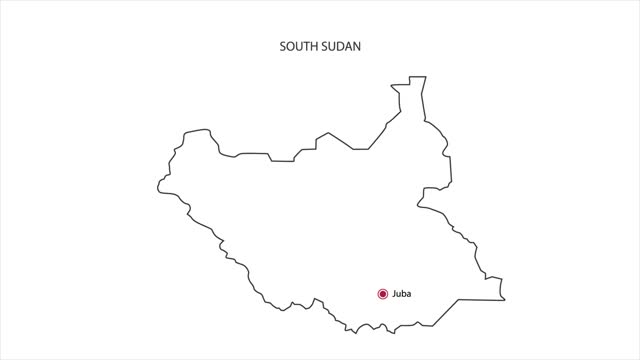
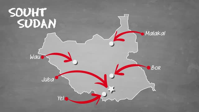
Mobile Vertical Resolution 1080x1920 Pixels, South Sudan 3D Map Intro on White Background, Multi Purpose Background Useful for Politics, Elections, Travel, News and Sports Events

tracking to Eritrea with National Flag

World map set of all countries, Map resolution: 22000 x 11000 pixel, Epic photo real animation, World Map Credits To NASA : https://visibleearth.nasa.gov/images/57752/blue-marble-land-surface-shallow-water-and-shaded-topography

South Sudan Country Digital Intro Opener Animation, Suitable for Patriotic Programs, Tourism, Presentations

World map set of all countries, Map resolution: 22000 x 11000 pixel, Epic photo real animation, World Map Credits To NASA : https://visibleearth.nasa.gov
View on the globe. Zooming in on the Republic of the Sudan.

Animation of the Earth with bright connections. 3 shots in 1 life. Africa. Red.

SOUTH SUDAN YEI ZOOM IN FROM SPACE

Animation of the Earth with bright connections and city lights. Africa. 2 shots in 1 file. Locked.