
Images
Browse 4,100+ syria capital city stock photos and images available, or start a new search to explore more stock photos and images.

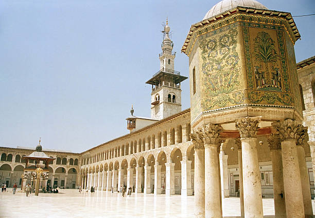
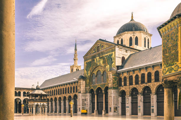
Aerial view of the Umayyad Mosque in Damascus.

Damascus, Syria - September 29, 2024: Building of the Central National Bank of Syria in Damascus

View of a densely packed urban community with stone buildings against a rugged mountain landscape, featuring vibrant greenery and a water fountain in the foreground.
Our creative library is free of AI-generated contentChoose your visuals with confidence knowing our creative library is free from AI-generated content, so your searches only return safe, high-quality visuals you can trust.

Sunny urban park with lush greenery and a modern building rising against a clear sky, creating a blend of architecture and nature.

Clear weather view of a historic bell tower adorned with a cross, surrounded by stone structures and lush foliage, ideal for themes relating to history, religion, and architecture.

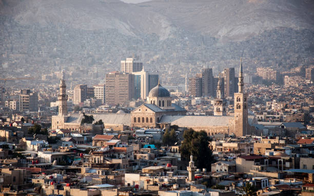
Damascus Syria Cityscape with Omayyad Mosque

Flag of Syria in front of a clear blue sky

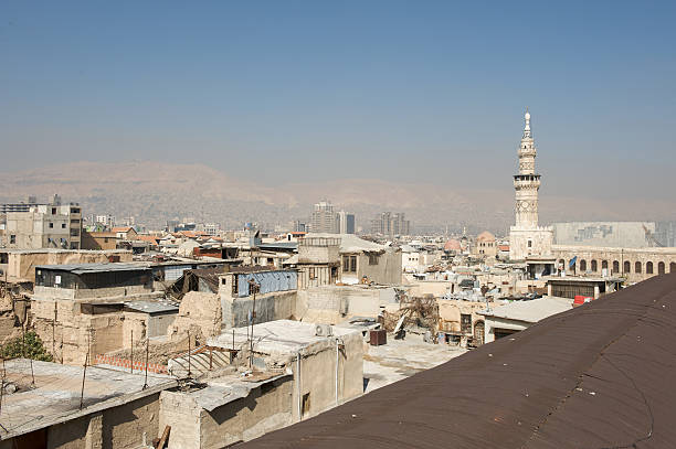
Overhanging roof providing shelter for pedestrians and businesses of the Old City in Damascus, Syria, with the tower of the Umayyad Mosque. This image was taken on a sunny Winter morning.

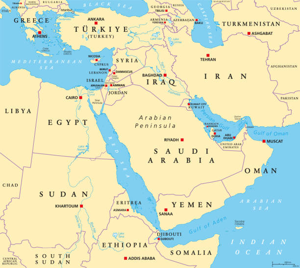
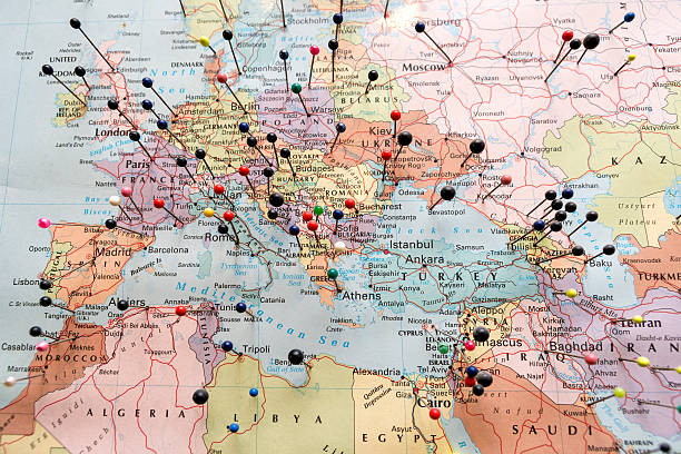
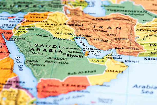
The Middle East, political map with capitals and international borders. Geopolitical region encompassing the Arabian Peninsula, the Levant, Turkey, Egypt, Iran and Iraq. Formerly called Near East.

day panoramic view of the Umayyad mosque during a sunset. showing the Islamic architecture and Islamic art in this holy place in Damascus Syria.


National flag of Syria waving during protest with European architecture in the background

A shot of the horizon of a neighborhood cityscape showing the old buildings and residencies of Damascus with a mosque minaret in the middle of the shot

Syria on the world map. Shot with light depth of field focusing on the country.

Jerusalem , Israel - May 20, 2012: Right wing Israeli men dance on Jerusalem day in front of Damascus gate before marching through the Arab quarter of Jerusalem old city, Jerusalem day marks the anniversary of Israel capturing the eastern part of the city during the 1967 Middle east war

Damascus,Syria - August 03,2010 : Damascus, Syria,people around the mall.Pre-war Damascus,Syria.People sit around in a central square in Damascus. Ruins of ancient roman structures can be seen.

Damascus, Syria – May 25, 2008: Damascus, Syria. May 25th 2008 Aerial view of the Syrian capital, Damascus, from mount Qasyun, Syria.

Eastern Mediterranean Political Map with capitals national borders, important cities, rivers and lakes. English labeling and scaling. Illustration.
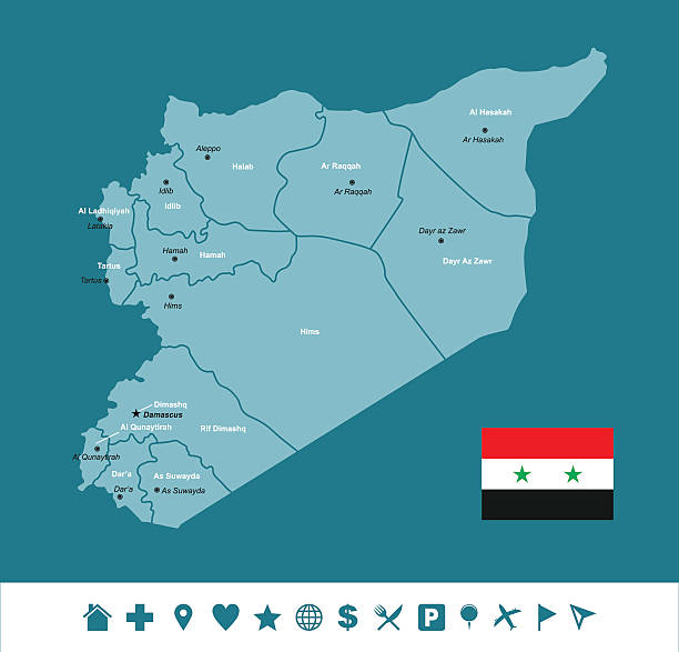
Vector map of Syria with Infographic icons
Empty Dark Gray Map of Middle East Asia - illustration

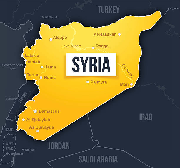
Syria map concept with major cities, waterways and country borders. EPS 10 file. Transparency effects used on highlight elements.

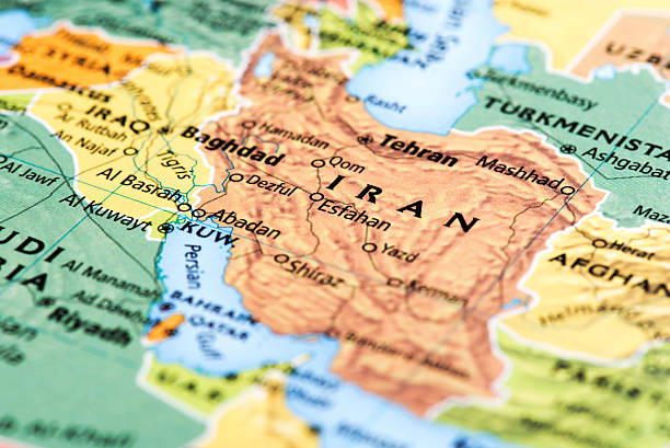
Map of Iran. Detail from the World Atlas.

Near Bent Jbail, Lebanon aa February 28, 2013: Surface to Surface rockets pointing south (toward Israel) on the roadside from Qana to Bent Jbail in Hezbollah controlled South Lebanon.

Syria - detailed map with regions and cities of the country. Flag and Globe. Vector illustration

Syria. Damascus. The Azem Palace - fragment of courtyard served as the haramlik (reserved for family and women)
Exterior of Omayad mosque in ancient City of Damascus (Syrian Arab Republic) after war ended in 15.02.2020

Wide shot of the city and Mount of Qasioun mountain in Damascus, Syria, 30/12/2019
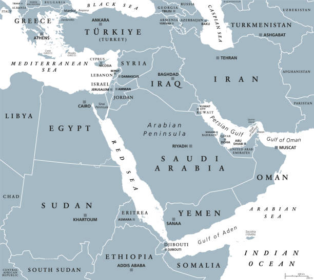
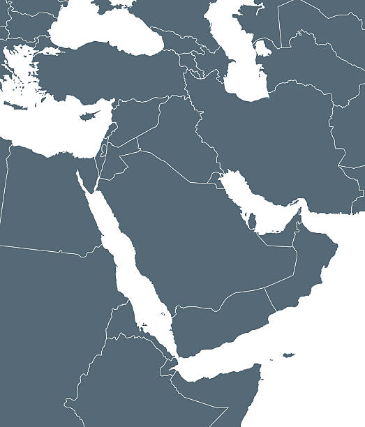
The Middle East, gray political map with capitals and international borders. Geopolitical region encompassing the Arabian Peninsula, the Levant, Turkey, Egypt, Iran and Iraq. Also called Near East.

London, UK - October 8, 2011: A group of Syrian nationals converged in London\'s Trafalgar Square, as part of a larger Stop the War gathering, using the occasion to draw attention to the growing civil unrest in their home country.

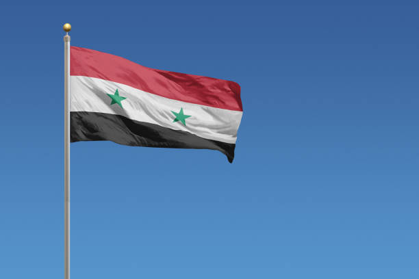
The National flag of Syria blowing in the wind in front of a clear blue sky

At sunrise, Damascus is a golden colour in Winter as seen in image 1327030576, but 2 hours 20 minutes later in this image, the golden light has gone. With Jabal Qasioun (Mount Qasioun) towering over the city, Damascus (in Arabic pronounced "Dimashq") is one of most scenic Middle East cities. Every residence has their own satellite dish on the roof. This image was taken mid-Winter.


A "Refugees welcome" banner hanging on Madrid's town hall building.

Turkish Flag waving on the wall


A night time street scene with focus on safety Police tape in Arabic. Spoken in Algeria, Bahrain, Comoros, Chad, Djibouti, Egypt, Eritrea, Iraq, Israel, Jordan, Kuwait, Lebanon, Libya, Mauritania, Morocco, Oman, Qatar, Saudi Arabia, Somalia, Sudan, Syria, Tunisia, United Arab Emirates, Yemen, Palestine, and Western Sahara
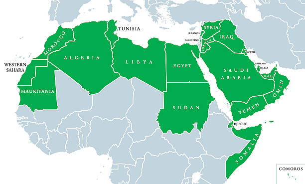
Arab World political map, also called Arab nation, consists of twenty-two arabic-speaking countries of the Arab League. All nations in green color, plus Western Sahara and Palestine. English labeling.
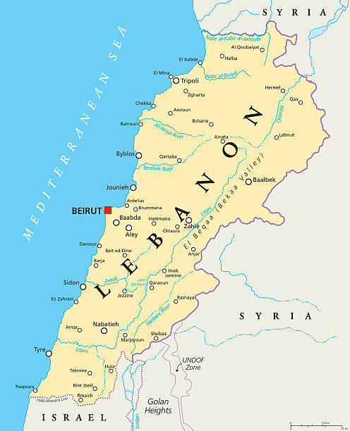
Lebanon political map with capital Beirut, national borders, important cities, rivers and lakes. English labeling and scaling. Illustration.

Turkey political map with capital Ankara, national borders and neighbor countries. Republic in Eurasia. Gray illustration with English labeling on white background. Vector.

the flag of Palestine on the mountain on the background of the houses in the city. Middle Eastern architecture.
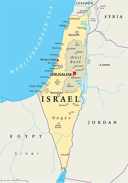
Israel political map with capital Jerusalem, national borders, important cities, rivers and lakes. English labeling and scaling. Illustration.


Inner courtyard of a palace in Dimashq Damascus
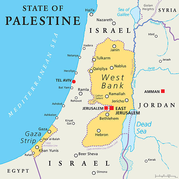
State of Palestine with designated capital East Jerusalem, claiming West Bank and Gaza Strip. Political map with borders and important places. Most areas are occupied by Israel. English labeling.

"Old street in Damascus, Syria. Unidentified persons."
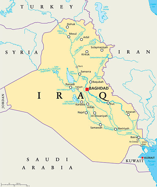
Iraq political map with capital Baghdad, national borders, important cities, rivers and lakes. Also called Mesopotamia, the land between Tigris and Euphrates. English labeling. Illustration.
of69Next