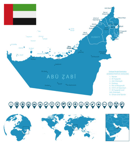
Vector maps of UAE with variable specification and icons
Browse 940+ united arab emirates map dubai abu dhabi stock photos and images available, or start a new search to explore more stock photos and images.
Vector maps of UAE with variable specification and icons

3D map of United Arab Emirates isolated on a blank and gray background, with a dropshadow. Vector Illustration (EPS10, well layered and grouped). Easy to edit, manipulate, resize or colorize.

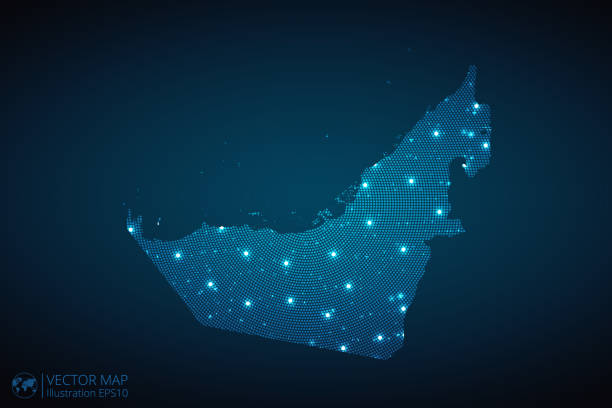
Map of United Arab Emirates made with round blue dots on a blank background. Original mosaic illustration. Vector Illustration (EPS10, well layered and grouped). Easy to edit, manipulate, resize or colorize. Please do not hesitate to contact me if you have any questions, or need to customise the illustration. http://www.istockphoto.com/portfolio/bgblue

Map of United Arab Emirates isolated on a blank background with a black outline and shadow. Vector Illustration (EPS file, well layered and grouped). Easy to edit, manipulate, resize or colorize. Vector and Jpeg file of different sizes.

Colorful United Arab Emirates political map with clearly labeled, separated layers. Vector illustration.
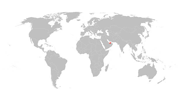
grey vector world map with indication of United Arab Emirates

United Arab Emirates map abstract geometric mesh polygonal light concept with glowing contour lines countries and dots on dark background. Vector illustration EPS10

United Arab Emirates - Highly detailed editable political map with labeling.

Map of United Arab Emirates - Vector illustration

Map of United Arab Emirates for your own design. Three maps with editable stroke included in the bundle: - One black map on a white background. - One line map with only a thin black outline in a line art style (you can adjust the stroke weight as you want). - One map on a blank transparent background (for change background or texture). The layers are named to facilitate your customization. Vector Illustration (EPS file, well layered and grouped). Easy to edit, manipulate, resize or colorize. Vector and Jpeg file of different sizes.

http://s017.radikal.ru/i404/1110/87/2c00b7bbd3ec.jpg
United arab emirates map icon, geography blank concept, isolated graphic background vector illustration .

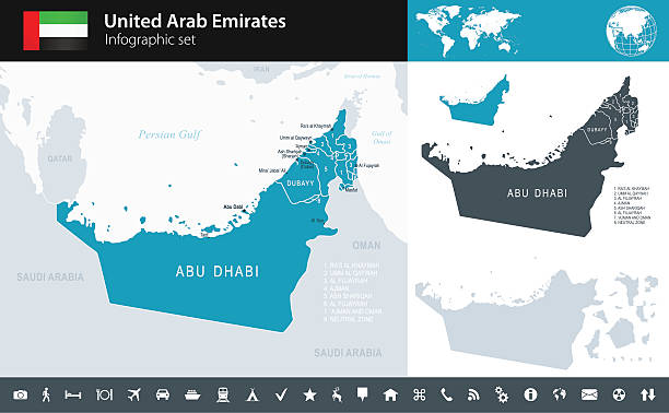
Map of United Arab Emirates with a big set of infographic elements. This large selection of modern elements includes charts, pie charts, diagrams, demographic graph, people graph, datas, time lines, flowcharts, icons... (Colors used: red, green, turquoise blue, black). Vector Illustration (EPS10, well layered and grouped). Easy to edit, manipulate, resize or colorize. Please do not hesitate to contact me if you have any questions, or need to customise the illustration. http://www.istockphoto.com/portfolio/bgblue
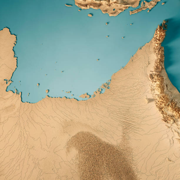
3D Render of a Topographic Map of the United Arab Emirates. All source data is in the public domain. Color texture: Made with Natural Earth. http://www.naturalearthdata.com/downloads/10m-raster-data/10m-cross-blend-hypso/ Relief texture: GMTED2010 data courtesy of USGS. URL of source image: https://topotools.cr.usgs.gov/gmted_viewer/viewer.htm Water texture: World Water Body Limits: Humanitarian Information Unit HIU, U.S. Department of State http://geonode.state.gov/layers/geonode%3AWorld_water_body_limits_polygons Boundaries: Humanitarian Information Unit HIU, U.S. Department of State (database: LSIB) http://geonode.state.gov/layers/geonode%3ALSIB_10

Map of United Arab Emirates - Vector illustration

Persian Gulf region, political map. Also Arabian Gulf, a mediterranean Sea in West Asia, located between Iran and Arabian Peninsula, connected to the Gulf of Oman in the east by the Strait of Hormuz.

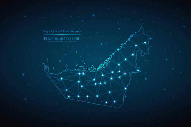
Map of United Arab Emirates created with a mesh of thin bright blue lines and glowing dots, isolated on a dark blue background. Conceptual illustration of networks (communication, social, internet, ...). Vector Illustration (EPS10, well layered and grouped). Easy to edit, manipulate, resize or colorize.

Vector isolated simplified colorful illustration with silhouette mainland of United Arab Emirates (UAE) and emirates borders with names. White background
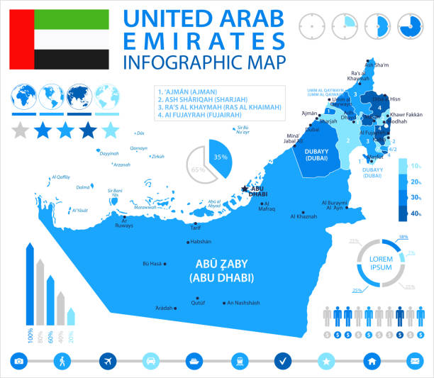
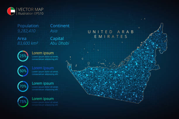
Map of United Arab Emirates - Infographic Vector illustration
United Arab Emirates - detailed blue country map with cities, regions, location on world map and globe. Infographic icons. Vector illustration

Map of United Arab Emirates in vintage style. Beautiful illustration of antique map on an old textured paper of sepia color. Old realistic parchment with a compass rose, lines indicating the different directions (North, South, East, West) and a frame used as scale of measurement.Vector Illustration (EPS10, well layered and grouped). Easy to edit, manipulate, resize or colorize. Please do not hesitate to contact me if you have any questions, or need to customise the illustration. http://www.istockphoto.com/portfolio/bgblue
United Arab Emirates Map infographics vector template with abstract geometric mesh polygonal light concept on blue background. Template for diagram, graph, presentation and chart. Vector illustration EPS10

Credit: https://www.nasa.gov/topics/earth/images Take a virtual trip to the United Arab Emirates today and enhance your understanding of this beautiful land. Get ready to be captivated by the geography, history, and culture of the United Arab Emirates.

Strait of Hormuz, gray political map. Waterway between Persian Gulf and Gulf of Oman. Strategically very important choke point, with Iran to the north and UAE and Oman exclave Musandam to the south.

UAE on the world map. Shot with light depth of field focusing on the country.

Map of United Arab Emirates sketched and isolated on a blank background. The map is gray with a black outline. Vector Illustration (EPS file, well layered and grouped). Easy to edit, manipulate, resize or colorize. Vector and Jpeg file of different sizes.

Map of United Arab Emirates with a realistic paper cut effect isolated on white background. Vector Illustration (EPS10, well layered and grouped). Easy to edit, manipulate, resize or colorize. Please do not hesitate to contact me if you have any questions, or need to customise the illustration. http://www.istockphoto.com/portfolio/bgblue/

UAE national day banner for independence day. Flag of United Arab Emirates and modern geometric abstract design. Red green black theme. Country name in Arabic calligraphy. Dubai landmarks. Vector.

United Arab Emirates map created with a mesh of thin black lines and a light shadow, isolated on a blank background. Conceptual illustration of networks (communication, social, internet, ...). Vector Illustration (EPS10, well layered and grouped). Easy to edit, manipulate, resize or colorize.
Abstract map of United Arab Emirates geometric mesh polygonal network line, structure and point scales on dark background. Vector illustration eps 10.
United Arab Emirates Map radial dotted pattern in futuristic style, design blue circle glowing outline made of stars. concept of communication on dark blue background. Vector illustration EPS10

Map of United Arab Emirates for your own design. With space for your text and your background. Four maps included in the bundle: - One black map. - One blank map with only a thin black outline (in a line art style). - One mosaic map. - One white map with a thin black outline. The 4 maps are isolated on a blank background (for easy change background or texture).The layers are named to facilitate your customization. Vector Illustration (EPS10, well layered and grouped). Easy to edit, manipulate, resize or colorize.
United Arab Emirates flag - flat collection. Flags of different shaped twelve flat icons. Vector illustration set
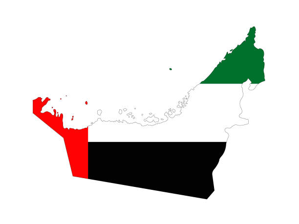
vector illustration of United Arab Emitares flag and map
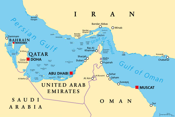
Strait of Hormuz, political map. Waterway between Persian Gulf and Gulf of Oman, a strategically extremely important choke point, with Iran to the north and UAE and Oman exclave Musandam to the south.

Striped Map of United Arab Emirates. Vector abstract United Arab Emirates map with gray diagonal lines. Vector illustration EPS10
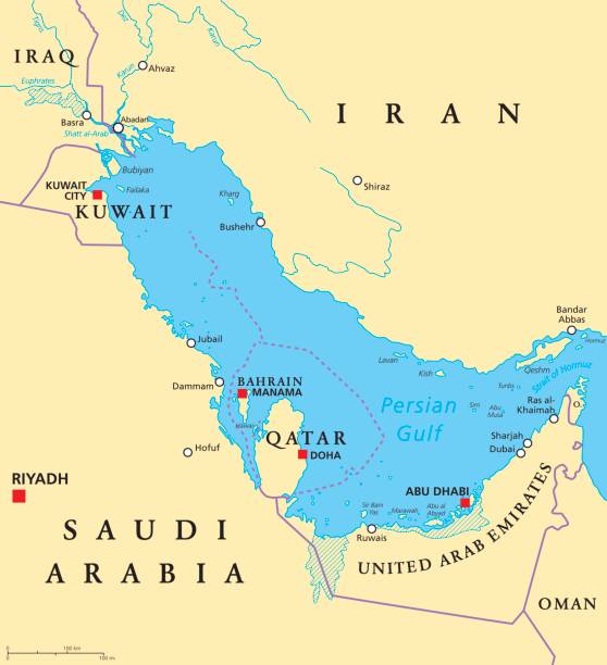
Persian Gulf region countries political map. Capitals, borders, cities and rivers. Iran, Iraq, Kuwait, Qatar, Bahrain, United Arab Emirates, Saudi Arabia, Oman. Illustration. English labeling. Vector.

United Arab Emirates Map Mandala with Colorful Details Textured Vector Design Template on White Background. Vector illustration EPS10.

United Arab Emirates - Highly detailed editable political map with labeling. Organized vector illustration on seprated layers.
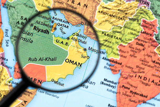
Map of Oman. Detail from the World Atlas. Selective Focus.

United Arab Emirates map geometric mesh polygonal light. Business wireframe mesh spheres from flying debris blue structure style. Vector illustration EPS10

United Arab Emirates map and flag - highly detailed vector illustration
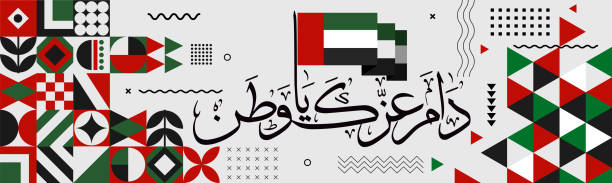
UAE national day banner for independence day anniversary. Flag of united Arab emirates & modern geometric retro abstract design. Red green black theme. "Long live my country" in arabic calligraphy.
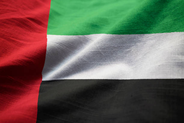
Closeup of Ruffled United Arab Emirates Flag, United Arab Emirates Flag Blowing in Wind

Map of United Arab Emirates folded with design elements, isolated on white background.