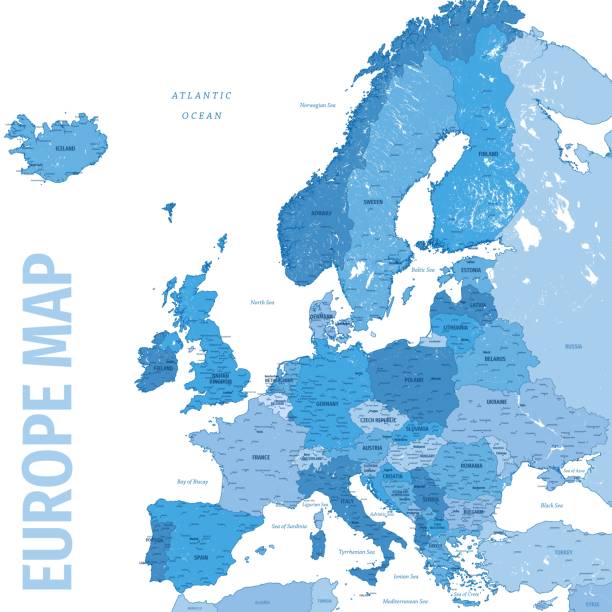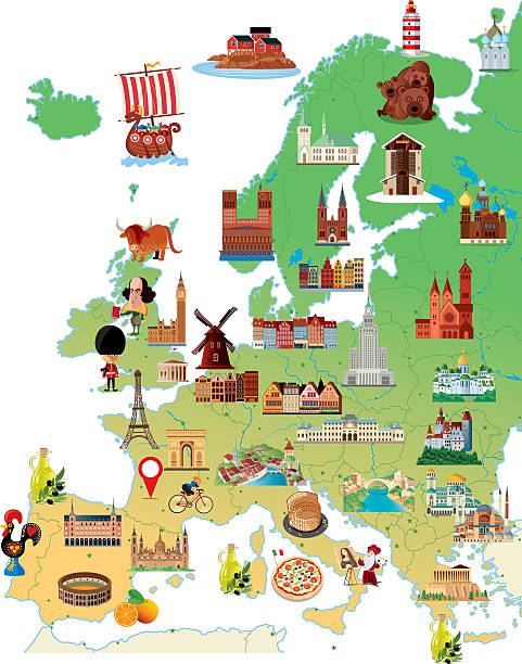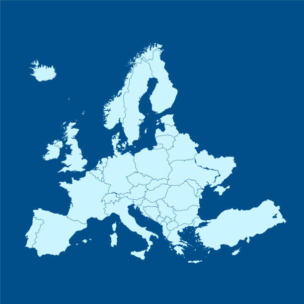
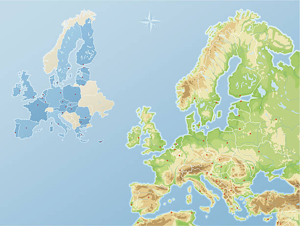
vector of the Europe map
Browse 3,500+ albania map europe stock illustrations and vector graphics available royalty-free, or start a new search to explore more great stock images and vector art.
vector of the Europe map

vector of the Europe map

vector of the Europe map
vector of the Europe map
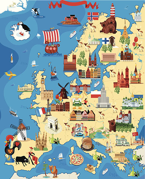
Highly detailed map of Europe for your design and product.
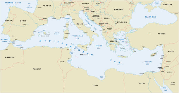
Mediterranean sea vector map
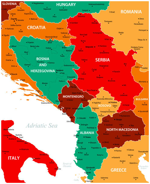
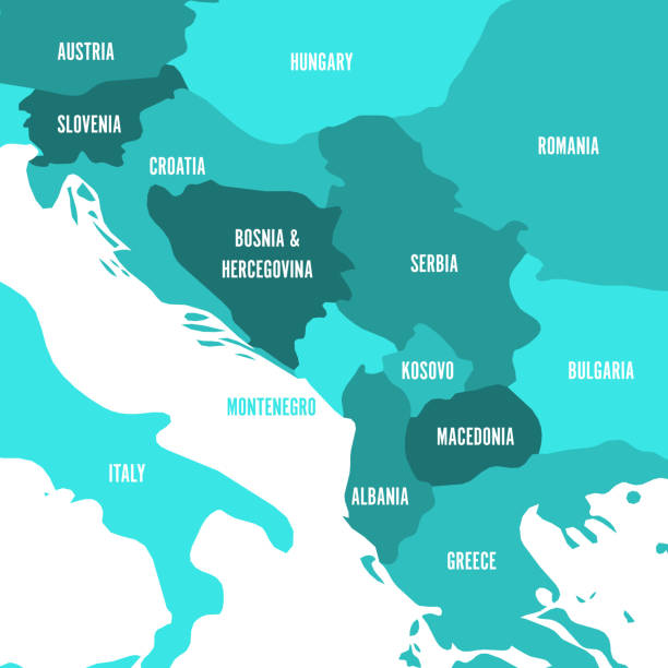
Central Balkan political map with borders. Southeastern countries on the Balkan Peninsula in Europe from Croatia to Greece. Gray illustration on white background. English labeling. Vector.
Highly detailed vector map of Central Europe with states, capitals and big cities.
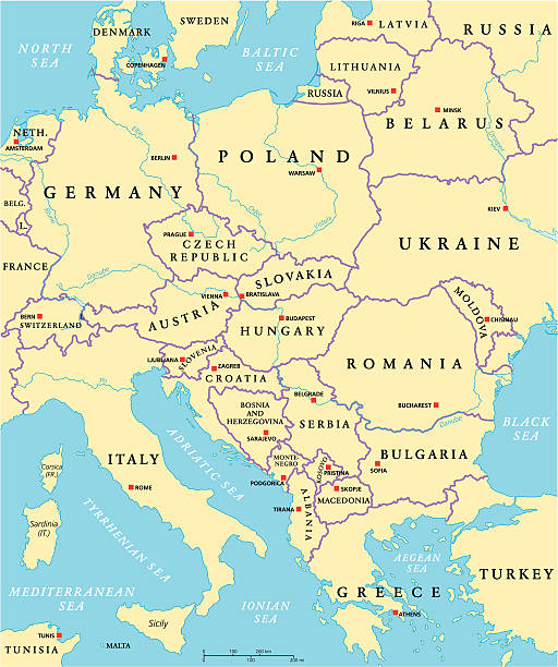
Central Europe Political Map with capitals, national borders, rivers and lakes. English labeling and scaling. Illustration.

RED CMYK color detailed flat stencil map of the European country of RUSSIA on transparent background

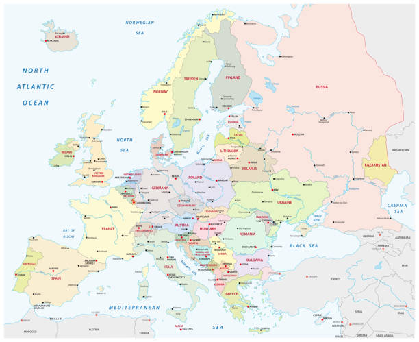
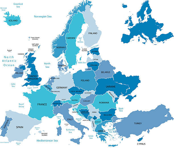
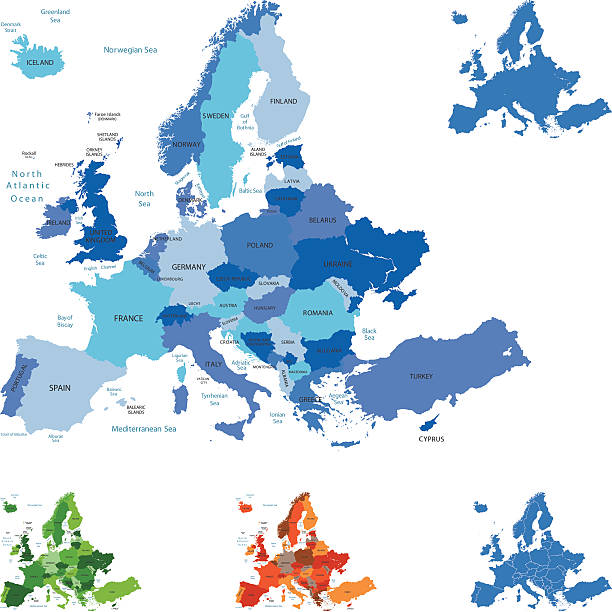
Europe Political Map and Roads. Detailed vector illustration of Europe Map.

vector of the Europe map

vector of the Europe map

vector of the Europe map

vector of the Europe map

Southeast Europe Region. Map of countries of Balkan Peninsula. Vector illustration.

vector of the Europe map

vector of the Europe map
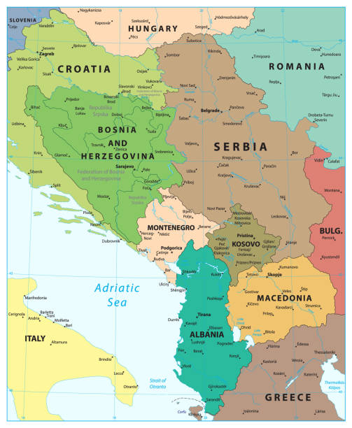
Central Balkan Region Map. Vector illustration.
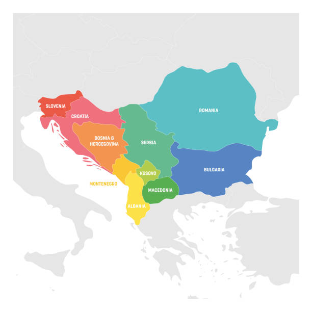
Southeast Europe Region. Colorful map of countries of Balkan Peninsula. Vector illustration.
Reduced topography and political map of the European Union EU
http://dikobraz.org/map_2.jpg

Simple flat color map of US federal state of NEW JERSEY
Highly detailed map of Europe for your design and products.

vector of the Europe map

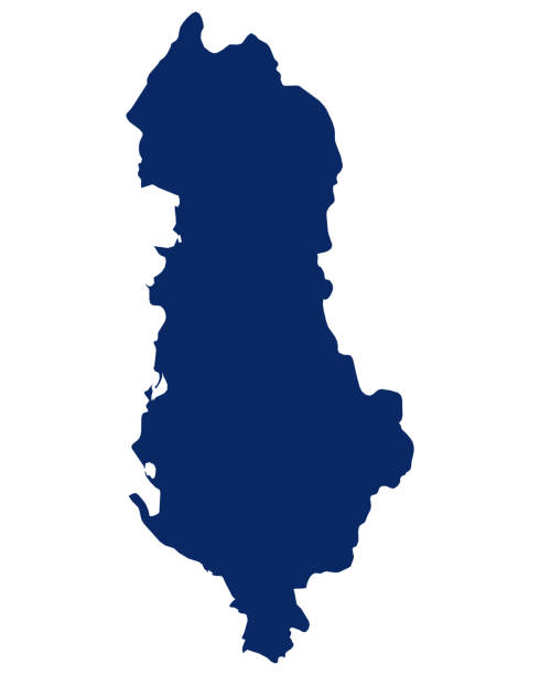
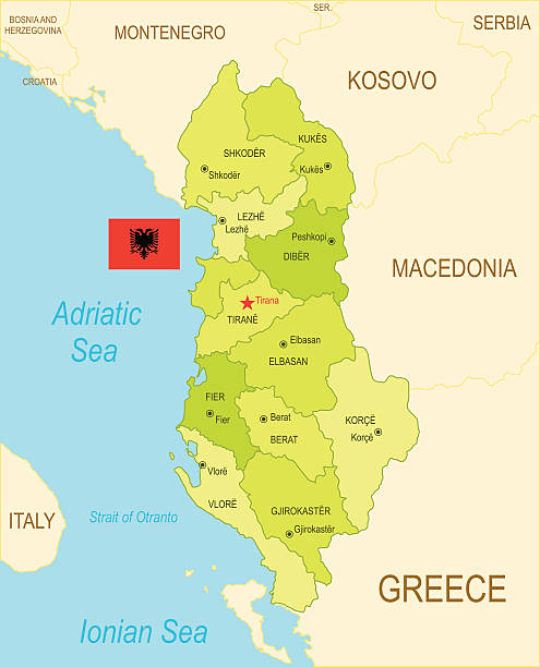
Albania Vector Map with Sea, Lakes, Rivers, National flag and Geographical Borders Map was found: http://legacy.lib.utexas.edu/maps/europe/txu-oclc-309296182-albania_pol_2008.jpg Created in Adobe Illustrator with splines 05-07-2020
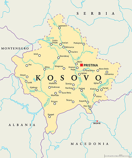
Kosovo political map with capital Pristina, national borders, important cities, rivers and lakes. English labeling and scaling. Illustration.

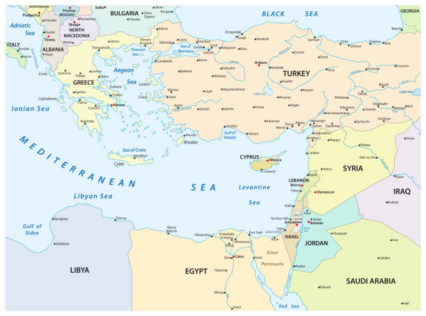
Greece, the Hellenic Republic, political map. Country in Southeast Europe on the southern tip of the Balkan peninsula, with capital Athens. Bordered by the Aegean, Ionian, and the Mediterranean Sea.

Macedonia region, political map. Region of the Balkan Peninsula in Southeast Europe. Part of Greece, North Macedonia, Bulgaria, Albania, Kosovo and Serbia. English labeling. Illustration. Vector.
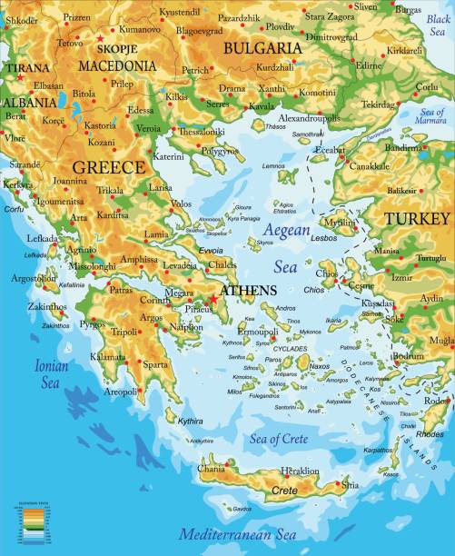
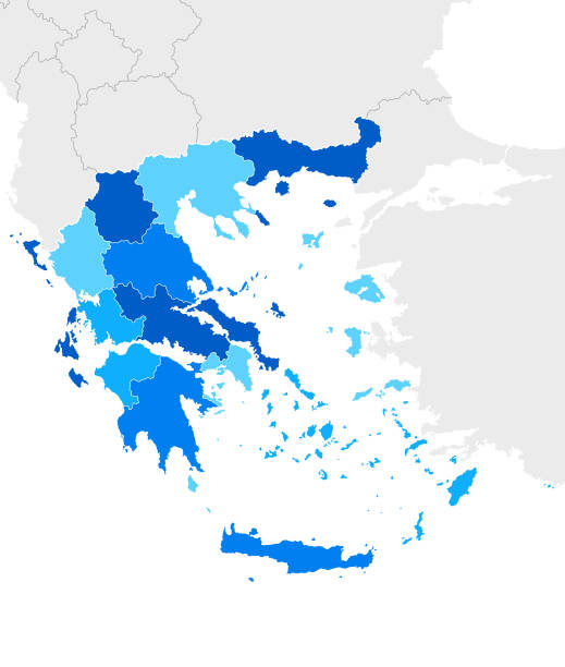
Highly detailed physical map of Greece in
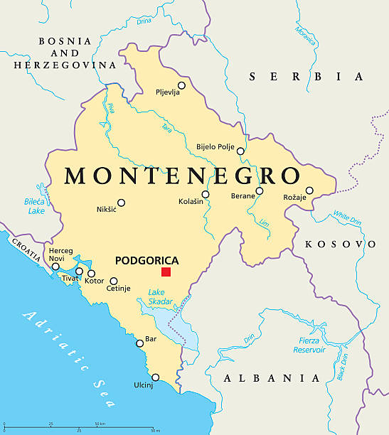
Montenegro political map with capital Podgorica, national borders, important cities, rivers and lakes. English labeling and scaling. Illustration.
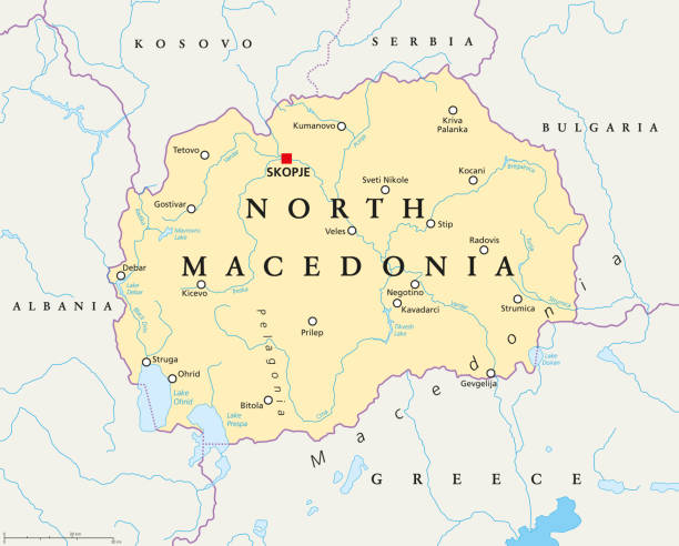
North Macedonia political map with capital Skopje, borders, important cities, rivers and lakes. Former Yugoslav Republic of Macedonia, renamed in February 2019. English labeling. Illustration. Vector.
Political map of Balkans - States of Balkan Peninsula. Four shades of turquoise blue vector illustration,

Simple flat color map of US federal state of LOUISIANA

North Atlantic Treaty Organization, NATO, member countries highlighted by blue in world political map. 29 member states since June 2017.

Mediterranean sea Map - Vintage Detailed Vector Illustration
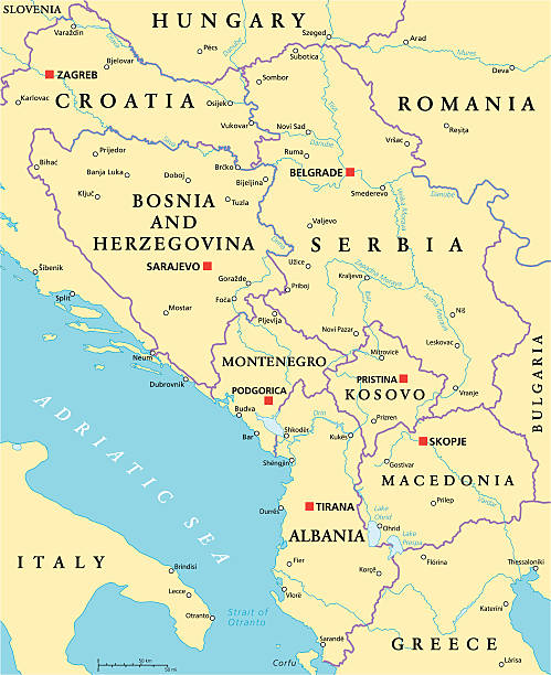
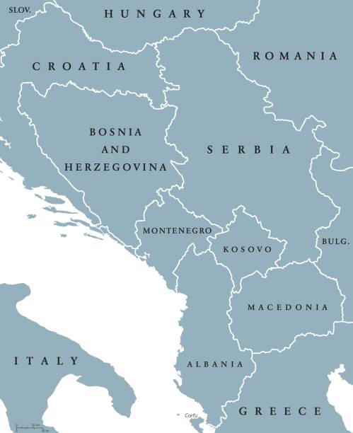
Central Balkan Political Map formed by Bosnia and Herzegovina, Serbia, Montenegro, Kosovo, Albania and Macedonia. With capitals, national borders, important cities, rivers and lakes. English labeling and scaling.

Flag of world. Vector icons set