Colorful panoramic ocean scenery. Hand-drawn vector illustration.
Browse 270+ galapagos-islands-national-park stock illustrations and vector graphics available royalty-free, or start a new search to explore more great stock images and vector art.
Colorful panoramic ocean scenery. Hand-drawn vector illustration.
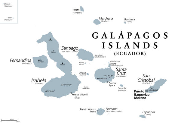
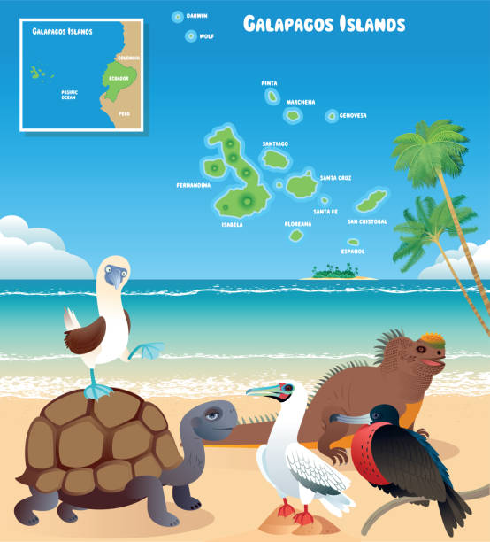
Galapagos Islands, Ecuador, gray political map, with capital Puerto Baquerizo Moreno. Archipelago of volcanic islands on either side of equator in Pacific Ocean with a large number of endemic species.
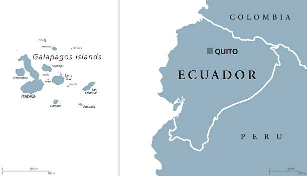
Ecuador political map with capital Quito and the Galapagos Islands in the Pacific Ocean. Republic in South America. Gray illustration with English labeling on white background. Vector.

Highly detailed physical map of Galapagos islands in vector format,with all the relief forms,regions and big cities.
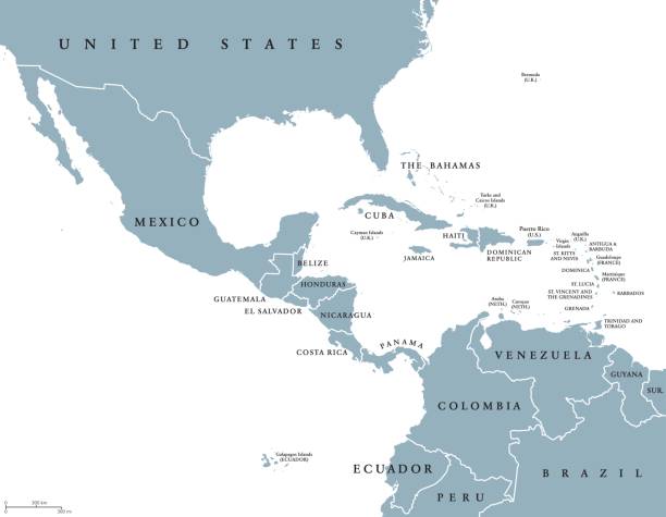
Middle America political map with borders and English labeling. Countries of southern North America, the nations of Central America and the Caribbean. Gray illustration on white background. Vector.

South America countries political map with national borders. Continent surrounded by Pacific and Atlantic Ocean. English labeling. Illustration.

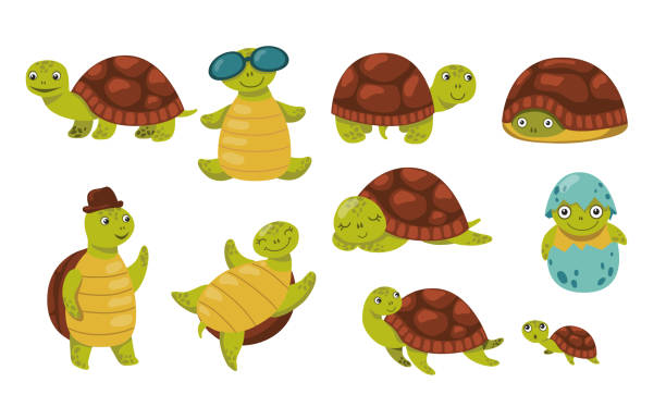
Set of tortoise and turtle - vector illustration. EPS8

Giant tortoises in the Galápagos Islands. Vintage etching circa 19th century.
Middle America political map with capitals and borders. Mid-latitudes of the Americas region. Mexico, Central America, the Caribbean and northern South America. Illustration. English labeling. Vector.
The Americas, single states, political map with national borders. Caribbean, North, Central and South America. Different colored countries with English country names. Illustration over white. Vector.
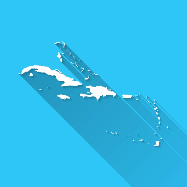
White map of Caribbean isolated on a blue background with a long shadow effect and in a flat design style. Vector Illustration (EPS10, well layered and grouped). Easy to edit, manipulate, resize or colorize.
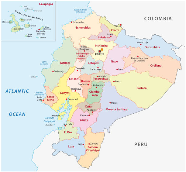
Ecuador administrative and political vector map

Map of South America showing the route taken by Charles Darwin around the world on the Second Voyage of the HMS Beagle. This is the first map of a series of three connecting maps. Part two Africa, Part three Southeast Asia. Vintage etching circa 19th century.
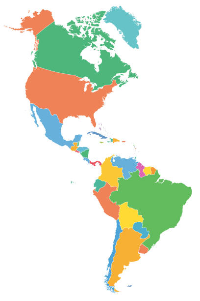
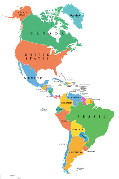
The Americas, political map with single states in different colors. Countries of the Caribbean, of North, Central and South America. Silhouettes. Isolated illustration on white background. Vector.

map of pacific islands 1855 - hawaii, new zealand, fiji, samoa, marquesas, galapagos

The Beagle laid ashore in Santa Cruz on the Galapagos Islands - Scanned 1880 Engraving

Galapagos Islands, Ecuador, with isolated islands easy to ungroup. Detalied political vector map in blue tones.

Map of Galapagos Islands in a trendy vintage style. Beautiful retro illustration with old textured paper and light rays in the background (colors used: blue, green, beige and black for the outline). Vector Illustration (EPS10, well layered and grouped). Easy to edit, manipulate, resize or colorize.

Galapagos Islands Map - Scanned 1880 Engraving

Vector Map of Ecuador with Major Cities, Galapagos Islands & Equator Line – Editable Illustration

Map of Caribbean in a trendy vintage style. Beautiful retro illustration with old textured paper (colors used: blue, green, beige and red). Vector Illustration (EPS10, well layered and grouped). Easy to edit, manipulate, resize or colorize. Vector and Jpeg file of different sizes.

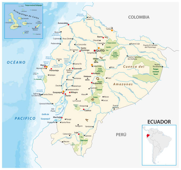
Highly detailed physical map of Ecuador,in vector format,with all the relief forms,regions and big cities.
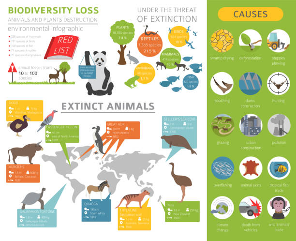
Global environmental problems. Biodiversiry loss infographic. Plants and animals destruction. Vector illustration
Sea lion icon - Simple Vector Illustration
Vector Galapagos Islands and Iguana https://maps.lib.utexas.edu/maps/americas/txu-pclmaps-oclc-785902207-ecuador_pol-2011.jpg
Map of Galapagos Islands isolated on white background. Includes 9 buttons with a flat design style for your design, in different colors (red, orange, yellow, green, blue, purple, gray, black, white, line art), each icon is separated on its own layer. Vector Illustration (EPS10, well layered and grouped). Easy to edit, manipulate, resize or colorize.
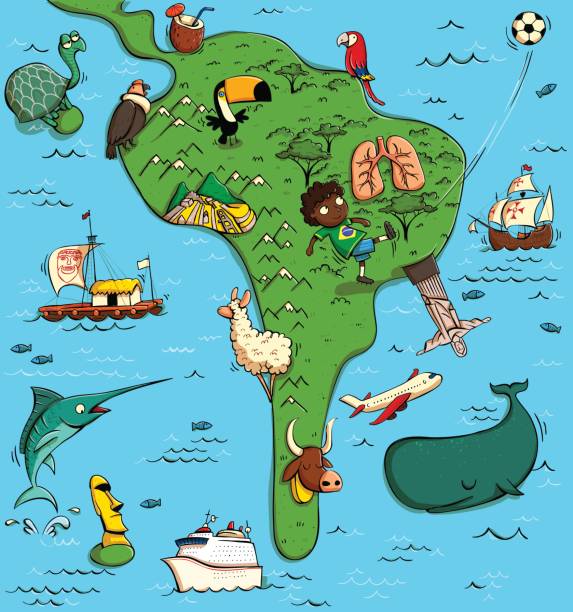
Illustrated Map of South America. With funny and typical objects, people, activities, animals, plants, history etc. Illustration in eps10 vector, continent on separate layer.

Map of Caribbean in a trendy vintage style. Beautiful retro illustration with old textured paper and light rays in the background (colors used: blue, green, beige and black for the outline). Vector Illustration (EPS10, well layered and grouped). Easy to edit, manipulate, resize or colorize.
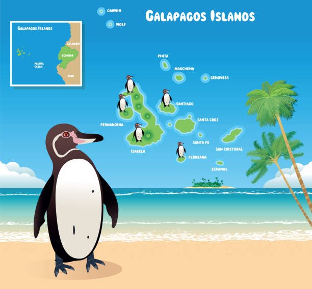
Vector Galapagos Penguin and Galapagos Islands https://maps.lib.utexas.edu/maps/americas/txu-pclmaps-oclc-785902207-ecuador_pol-2011.jpg
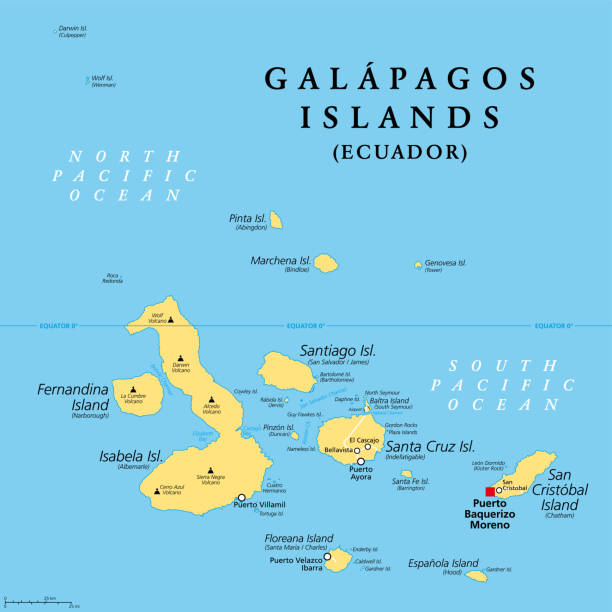
Galapagos Islands, Ecuador, political map, with capital Puerto Baquerizo Moreno. Archipelago of volcanic islands on either side of equator in Pacific Ocean known for a large number of endemic species.
Cute funny turtle set. Adorable cartoon character walking, hatching, hiding, relaxing, sleeping. Flat vector illustration for animals or wildlife concept, books for children design

Vector outline map of Galapagos islands of Ecuador
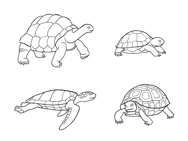
Set of tortoise and turtle in outlines - vector illustration. EPS8
Map of Caribbean isolated on white background. Includes 9 buttons with a flat design style for your design, in different colors (red, orange, yellow, green, blue, purple, gray, black, white, line art), each icon is separated on its own layer. Vector Illustration (EPS10, well layered and grouped). Easy to edit, manipulate, resize or colorize.
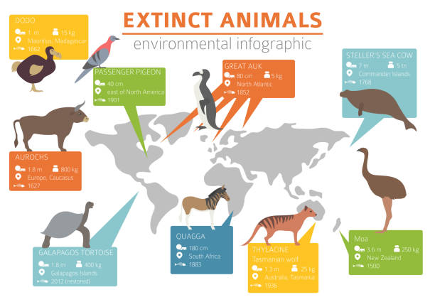
Global environmental problems. Biodiversiry loss infographic. Plants and animals destruction. Vector illustration

Map of Galapagos Islands cut out on a blank white paper with a blue background. Modern and trendy paper cutout effect. Vector Illustration (EPS file, well layered and grouped). Easy to edit, manipulate, resize or colorize. Vector and Jpeg file of different sizes.

Political map of South America with all countries and national borders. Blue outline illustration on white background and english scaling.

Map of Caribbean for your own design. Three maps with editable stroke included in the bundle: - One black map on a white background. - One line map with only a thin black outline in a line art style (you can adjust the stroke weight as you want). - One map on a blank transparent background (for change background or texture). The layers are named to facilitate your customization. Vector Illustration (EPS file, well layered and grouped). Easy to edit, manipulate, resize or colorize. Vector and Jpeg file of different sizes.
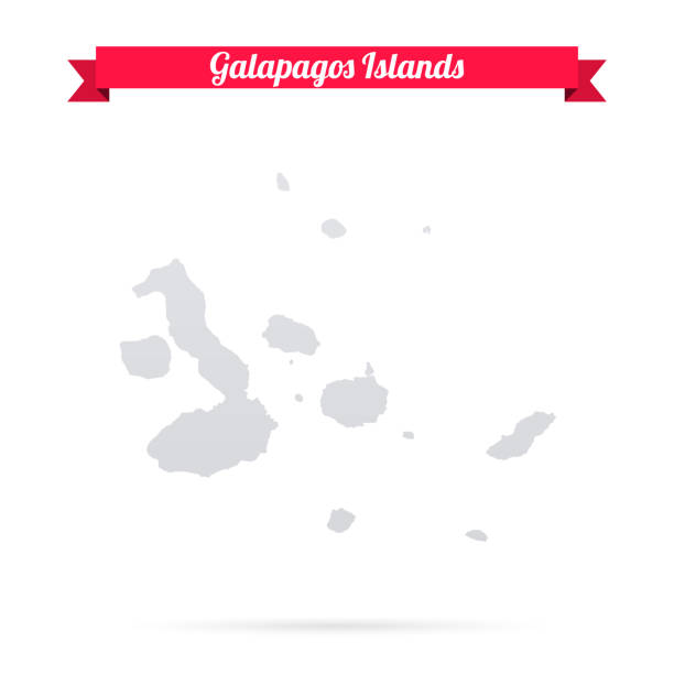
Map of Galapagos Islands isolated on a blank background and with his name on a red ribbon. Vector Illustration (EPS10, well layered and grouped). Easy to edit, manipulate, resize or colorize. Vector and Jpeg file of different sizes.

White map of Caribbean isolated on a trendy color, a blue green background and with a dropshadow. Vector Illustration (EPS10, well layered and grouped). Easy to edit, manipulate, resize or colorize.

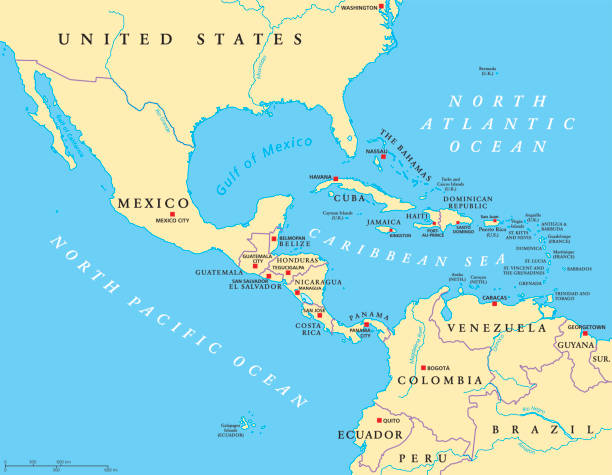
Latin America political map with capitals, national borders, rivers and lakes. Countries from northern border of Mexico to southern tip of South America, including the Caribbean. English labeling.

Map of Galapagos Islands for your own design. Three maps with editable stroke included in the bundle: - One black map on a white background. - One line map with only a thin black outline in a line art style (you can adjust the stroke weight as you want). - One map on a blank transparent background (for change background or texture). The layers are named to facilitate your customization. Vector Illustration (EPS file, well layered and grouped). Easy to edit, manipulate, resize or colorize. Vector and Jpeg file of different sizes.

Map of Ecuador - Highly Detailed Vector illustration

Marine iguana, exotic reptile, engraving. Vector illustration with lines in black ink isolated on a white background in a hand drawn style.
Frigatebird black line icon. Pictogram for web page, mobile app, promo.

One Marine Iguana (Amblyrhynchus cristatus), lizard, a reptile lives on Galápagos Islands, Ecuador. Woodcut illustration published 1887. Original edition is from my own archives. Copyright has expired and is in Public Domain.

Ecuador country detailed editable map with regions cities and towns, roads and railways, geographic sites. Vector EPS-10 file

Map of Caribbean with a coronavirus warning tape (COVID-19, 2019-nCoV) isolated on a gray background. The map is white with a long shadow effect and in a flat design style. Conceptual image: coronavirus outbreak on the territory, coronavirus detected, closing of borders, area under control, stop coronavirus, quarantined area, spread of the disease, virus alert, danger zone, confined space. Vector Illustration (EPS10, well layered and grouped). Easy to edit, manipulate, resize or colorize.

White map of Galapagos Islands isolated on a gray background with a long shadow effect and in a flat design style. Vector Illustration (EPS10, well layered and grouped). Easy to edit, manipulate, resize or colorize.

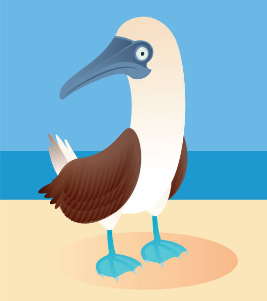
Vector Illustration of Sula Bird in Hand Drawn Style, Tropical Seabird from Galapagos Islands.

Map of Caribbean sketched and isolated on a blank background. The map is gray with a black outline. Vector Illustration (EPS file, well layered and grouped). Easy to edit, manipulate, resize or colorize. Vector and Jpeg file of different sizes.

Vector Galapagos Islands and Iguana https://maps.lib.utexas.edu/maps/americas/txu-pclmaps-oclc-785902207-ecuador_pol-2011.jpg

Map of Galapagos Islands with a cell of the novel coronavirus (COVID-19, 2019-nCoV) in the center of a red viewfinder. White map isolated on a blue green background. (colors used: blue, green, red and black). Conceptual image: coronavirus detected, closing of borders, area under control, stop coronavirus, defeat the virus, quarantined area, spread of the disease, coronavirus outbreak on the territory, virus alert, danger zone, confined space. Vector Illustration (EPS10, well layered and grouped). Easy to edit, manipulate, resize or colorize.