Illustrations
Browse 190+ lake ontario map stock illustrations and vector graphics available royalty-free, or start a new search to explore more great stock images and vector art.

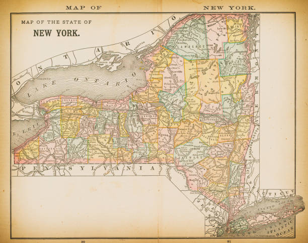
19th century map of New York. Published in New Dollar Atlas of the United States and Dominion of Canada. (Rand McNally & Co's, Chicago, 1884).

Map from the Complete Handy Atlas of the World - 1898

Toronto Canada Area Vector Map. All source data is in the public domain. Made with Natural Earth. http://www.naturalearthdata.com/about/terms-of-use/
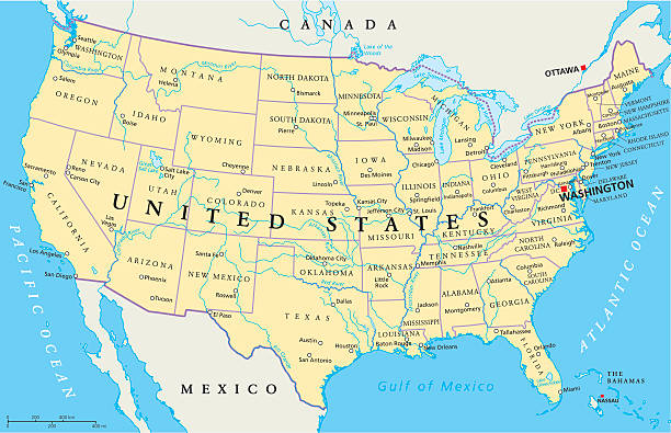
United States of America Political Map with capital Washington, national borders, most important cities, rivers and lakes. Map with single states, their borders and capitals, except Hawaii and Alaska. English labeling and scaling.
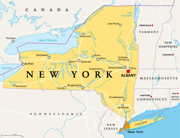
New York State (NYS), political map, with capital Albany, borders, important cities, rivers and lakes. State in the Northeastern United States of America. English labeling. Illustration. Vector.
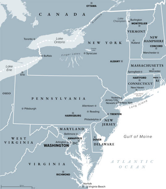
Mid-Atlantic region of the United States, gray political map. The overlap between the Northeastern and Southeastern states, including Delaware, D.C., Maryland, New Jersey, New York and Pennsylvania.


Vector Blue Wave Pattern Map of Lake Ontario, One of the Great Lakes of North America. Wavy Line Pattern Silhouette of Lake Ontario.

Vintage illustration Old Map of Province of Ontario, Canada, details of Niagara Falls, 1890s, 19th Century

Mid-Atlantic region of the United States, political map. Located in the overlap between Northeastern and Southeastern states, including Delaware, D.C., Maryland, New Jersey, New York and Pennsylvania.
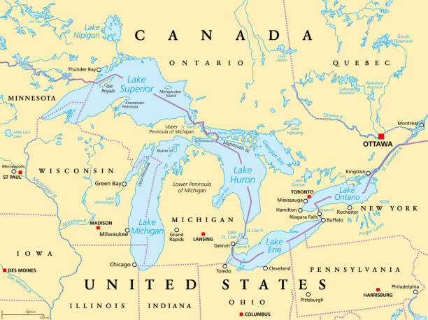
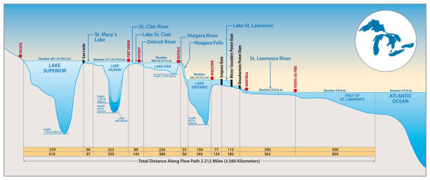
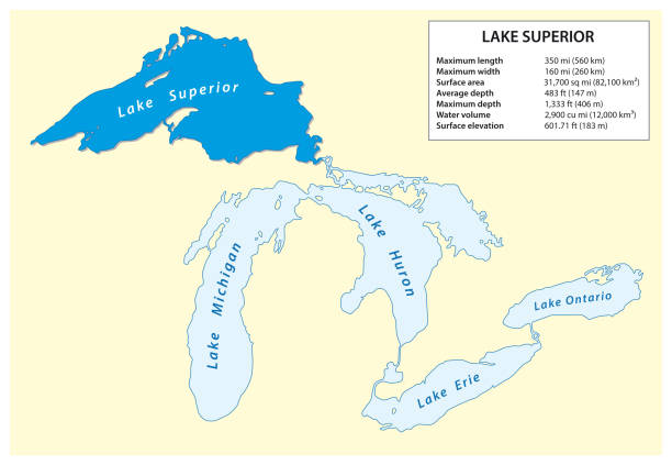
Great Lakes of North America political map. Lakes Superior, Michigan, Huron, Erie and Ontario. Series of large interconnected freshwater lakes on or near the border of Canada and of the United States.


United States, rivers and lakes, political map. The main stems of the longest rivers, and the largest lakes of the United States of America, with the Great Lakes of North America. Illustration. Vector


Vector Vertical Lines Pattern Map of Lake Ontario, One of the Five Great Lakes of North America. Striped Simple Silhouette of Lake Ontario. Lifeguard, Watercraft Icons.

Canada Political Map with capital Ottawa, national borders, important cities, rivers and lakes. English labeling and scaling. Illustration.

Toronto ON City Vector Road Map Blue Text. All source data is in the public domain. Statistics Canada. Used Layers: Road Network and Water.

Great Lakes of North America, political map. Lake Superior, Michigan, Huron, Erie and Lake Ontario. A series of large interconnected freshwater lakes on or near the border of Canada and United States.

Quebec City Windsor Corridor, political map. Most densely populated and heavily industrialized region of Canada. The region extends between Quebec City in the northeast and Windsor, Ontario. Vector.

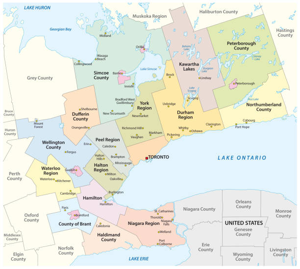
toronto administrative and political vector map

Map of Great Lakes and Fruits https://maps.lib.utexas.edu/maps/united_states/united_states_wall_2002.jpg

Ontario, southernmost province of Canada, political map. Located in Central Canada, the most populous province of the country with capital Toronto, and home of the national capital Ottawa. Vector

Vintage engraving of a Antique damaged map of Dominion of Canada in the 19th Century, 1873
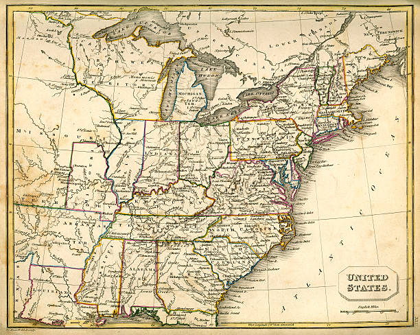
Vintage map of the United States of America from 1837

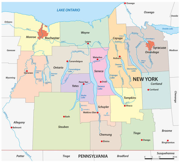
Finger Lakes region in New York State, in the United States, political map, with most important cities. Group of eleven long, narrow, roughly south-north lakes, located directly south of Lake Ontario.

"Highly detailed vector map of New York State, United States. File was created on January 24, 2012. The colors in the .eps-file are ready for print (CMYK). Included files: EPS (v8) and Hi-Res JPG."

Map of Great Lakes and forest Map https://maps.lib.utexas.edu/maps/united_states/united_states_wall_2002.jpg
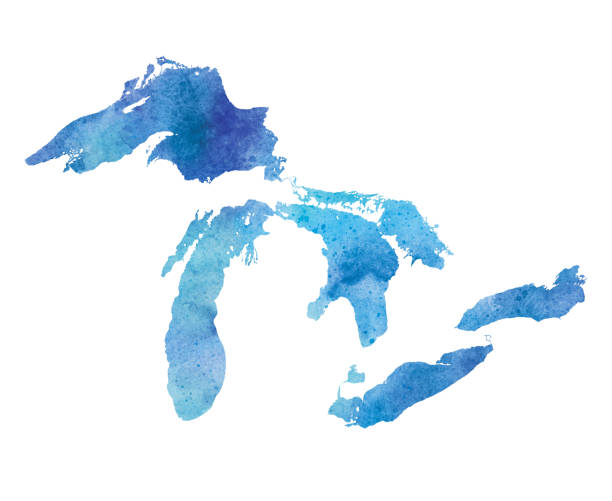
Great Lakes Watercolor Map. Raster illustration.
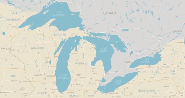
A detailed map of the Great Lakes region. Includes major highways, cities, rivers and lakes. Each state is separate and grouped for easy color changes. Other elements are also grouped and separate. Includes an extra-large JPG so you can crop in to the area you need.

Hamilton ON City Vector Road Map Blue Text. All source data is in the public domain. Statistics Canada. Used Layers: Road Network and Water.
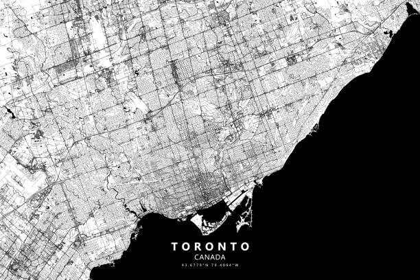
Poster Style Topographic / Road map of Toronto, Ontario, Canada. Original map data is open data via © OpenStreetMap contributors. All maps are layered and easy to edit. Roads are editable stroke.
Information vector map of Lake Superior in North America.

Quebec City Windsor Corridor, gray political map. Most densely populated and heavily industrialized region of Canada. The region extends between Quebec City in the northeast and Windsor, Ontario.
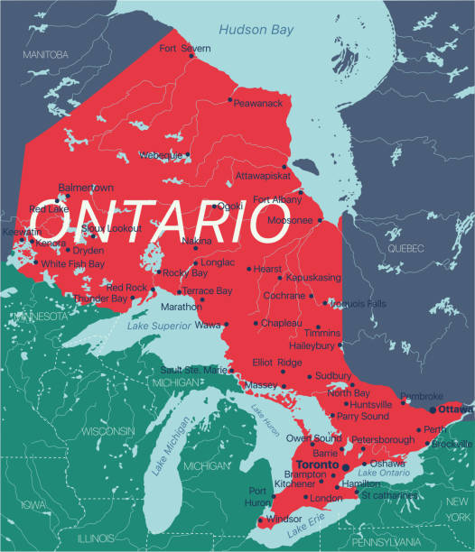
Ontario province vector editable map of the Canada with capital, national borders, cities and towns, rivers and lakes. Vector EPS-10 file
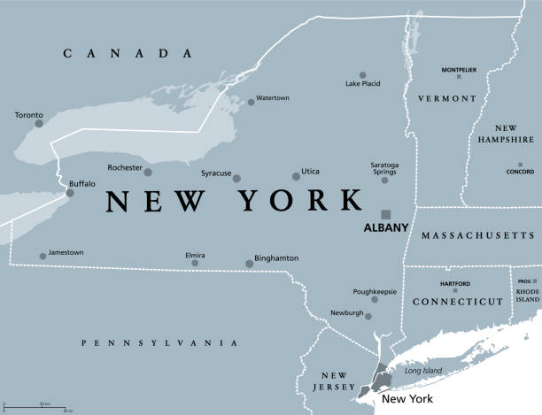
New York State (NYS), gray political map, with capital Albany, borders and important cities. State in Northeastern United States of America. English labeling. Illustration on white background. Vector.


Finger Lakes region in New York State, United States, gray political map, with most important cities. Group of eleven long, narrow, roughly south-north lakes, located directly south of Lake Ontario.
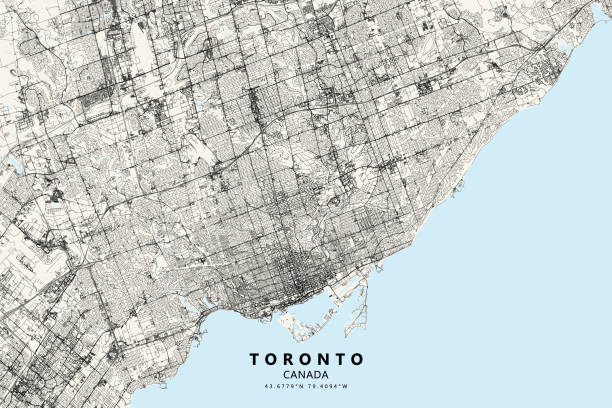
Poster Style Topographic / Road map of Toronto, Ontario, Canada. Original map data is open data via © OpenStreetMap contributors. All maps are layered and easy to edit. Roads are editable stroke.

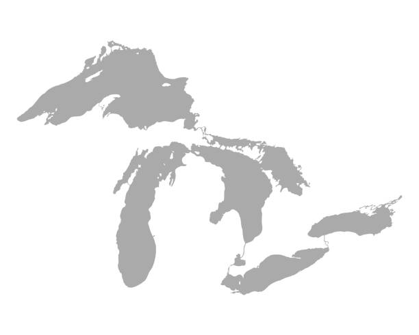
Great Lakes of North America, gray political map. Lakes Superior, Michigan, Huron, Erie and Ontario. Series of large interconnected freshwater lakes, on or near the border of Canada and United States.

Rochester NY City Vector Road Map Blue Text. All source data is in the public domain. U.S. Census Bureau Census Tiger. Used Layers: areawater, linearwater, roads.


Image map of lake Ontario. One of the Great Lakes

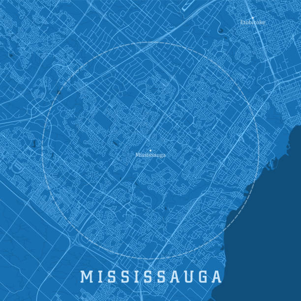
Mississauga ON City Vector Road Map Blue Text. All source data is in the public domain. Statistics Canada. Used Layers: Road Network and Water.

toronto administrative and political vector neighborhood map
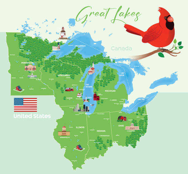
Great Lakes Forest Map and Cardinal Birds https://maps.lib.utexas.edu/maps/united_states/united_states_wall_2002.jpg
Vector illustration of a blue outlined Great Lakes icon.


Vintage illustration Old antique map of North Eastern United States of America, USA, New York, Pennsylvania, Vermont, Massachusetts, Rhode Island, Connecticut, 1890s, 19th Century

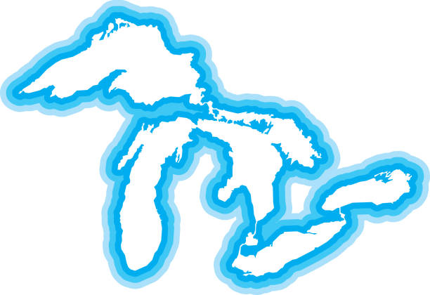
Vector silhouette of the Great Lakes in white with a drop shadow.

United States of America Political Map with capital Washington, national borders, most important cities, rivers and lakes, except Hawaii and Alaska. English labeling and scaling.

Information vector map of Lake Michigan in North America.

Vector illustration of a blue Great Lakes icon in flat style.

Topographic map of the Northeastern United States. Lithograph, published in 1897.
of4Next