
Illustrations
Marseille Map stock illustrations
Browse 460+ marseille map stock illustrations and vector graphics available royalty-free, or start a new search to explore more great stock images and vector art.
Most popular

High quality Map Marseille City. vector illustration

City map of Marseille, Provence, France. Lithograph, published in 1897.


Antique illustration of Map of Marseille 1898


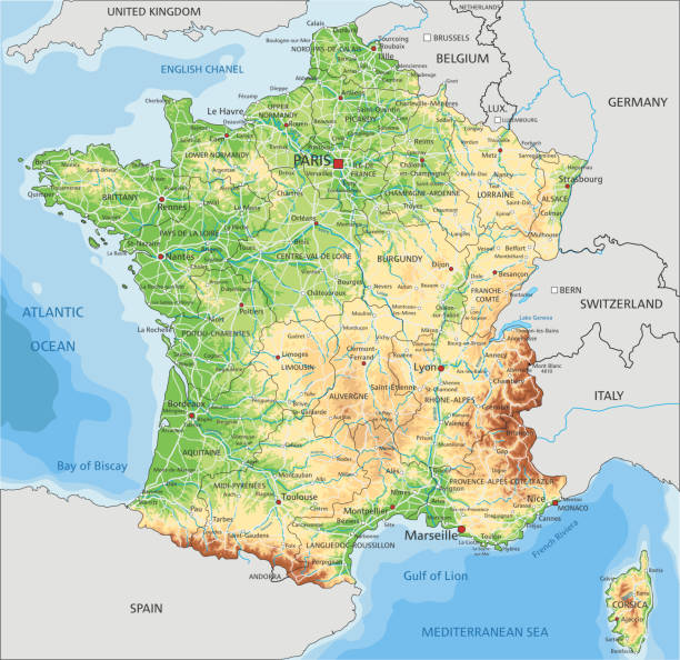
High detailed France physical map with labeling. Organized vector illustration on seprated layers.
Map of France - Vintage Vector illustration


Cartoon style France Marseille sightseeing vector map. Summer vacation postcard illustration

Map of France - Vector illustration

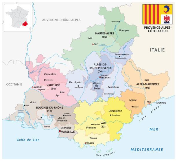
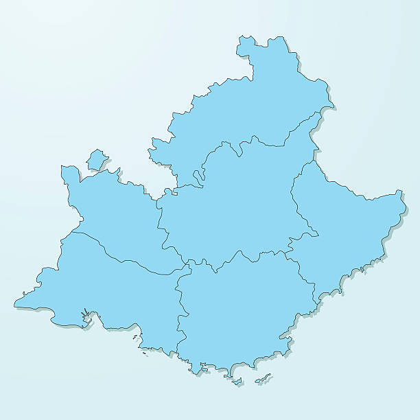
Map of Provence-Alpes-Cote d'Azur for your own design. Three maps with editable stroke included in the bundle: - One black map on a white background. - One line map with only a thin black outline in a line art style (you can adjust the stroke weight as you want). - One map on a blank transparent background (for change background or texture). The layers are named to facilitate your customization. Vector Illustration (EPS file, well layered and grouped). Easy to edit, manipulate, resize or colorize. Vector and Jpeg file of different sizes.

France seaside Marseille city road map. Navigation street tourism vector illustration

High Quality map of Marseille is a city of France, with borders of districts

Antique map of Marseille France Original edition from my own archives Source : "Meyers Konversationslexikon Band 11" 1897

Vector maps of the France with variable specification and icons The urls of the reference files are (country, continent, world map and globe): http://www.lib.utexas.edu/maps/europe/france_admin91.jpg http://www.lib.utexas.edu/maps/world_maps/time_zones_ref_2011.pdf - The illustration was completed April 23, 2016 and created in Corel Draw - 1 layer of data used for the detailed outline of the land


Map of Marseille France 1896 Original edition from my own archives Source : Brockhaus 1896
Detailed map of France with pointers.

France on the world map. Shot with light depth of field focusing on the country.

Marseille France City Map in Retro Style. Outline Map. Vector Illustration.

Southern France coastline, gray political map. Southernmost part of France, bordering the Mediterranean Sea. Map with part of Occitania, Provence, French Riviera, Corsica, and most important cities.
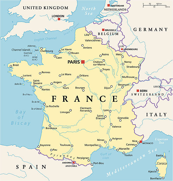
France Political Map with capital Paris, national borders, most important cities and rivers. English labeling and scaling. Illustration.

Southern France coastline, political map. Southernmost part of France, that border the Mediterranean Sea. Map with part of Occitania, Provence, French Riviera, Corsica, and with most important cities.
Empty Dark Gray Map of the France - illustration The urls of the reference files are (country, continent, world map and globe): http://www.lib.utexas.edu/maps/europe/france_admin91.jpg http://www.lib.utexas.edu/maps/world_maps/time_zones_ref_2011.pdf - The illustration was completed April 11, 2016 and created in Corel Draw - 1 layer of data used for the detailed outline of the land

Marseilles France City Map in Retro Style in Golden Color. Outline Map. Vector Illustration.

Map from La Premiere Annee de Geographie by P. Foncin - Paris 1887

Detailed road vector map of France and colorful map pointers. All layers are separated and clearly labeled.
Hand drawn map of France. Concept of travel. Colored vector illustartion. Country symbols and landmarks on the map.

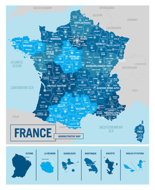
France administrative blue-green map with country flag and location on a globe. Vector illustration

France political isometric map divide by state colorful outline simplicity style. Vector illustration.

Metropolitan France, political map with capital Paris. Area of European France, which is geographically in Europe, compromising the mainland, Corsica and nearby French islands in the Atlantic Ocean.

Map of Provence-Alpes-Cote d'Azur sketched and isolated on a blank background. The map is gray with a black outline. Vector Illustration (EPS file, well layered and grouped). Easy to edit, manipulate, resize or colorize. Vector and Jpeg file of different sizes.
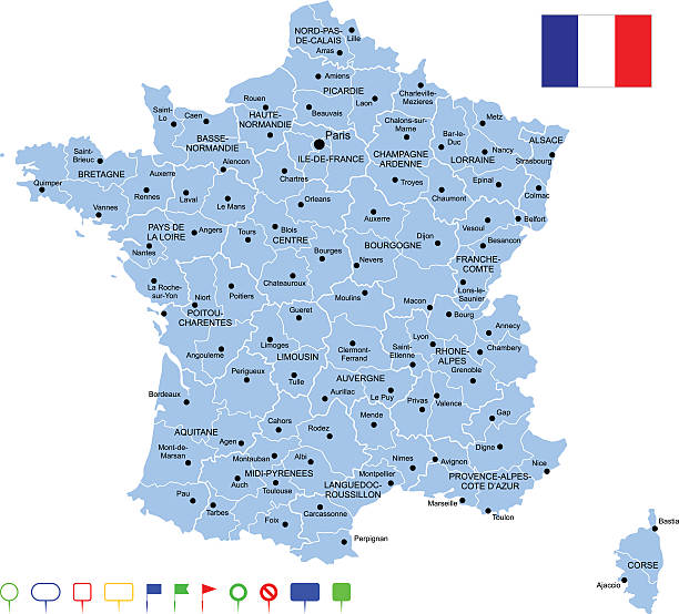
"Detailed vector map of France with administrative divisions. File was created on October 18, 2012. The colors in the .eps-file are ready for print (CMYK). Included files: EPS (v8) and Hi-Res JPG (5600aa aaa 5246 px)."

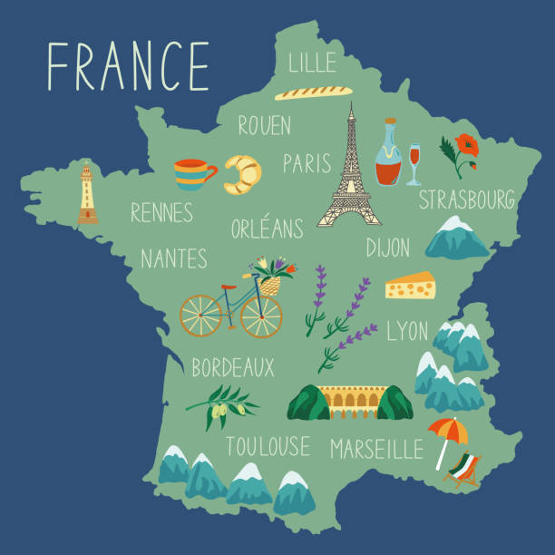
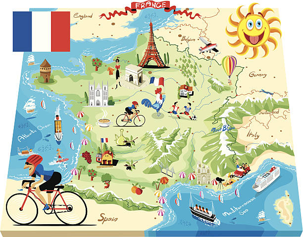
Stylized map of France. Vector illustration. French symbols, cheese, croissant, wine, bicycle, harmonic, mountains and other landmarks. Travel to France.
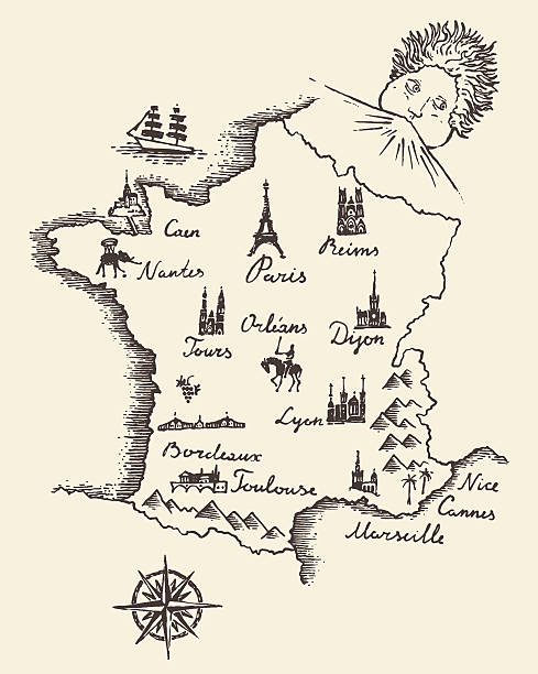
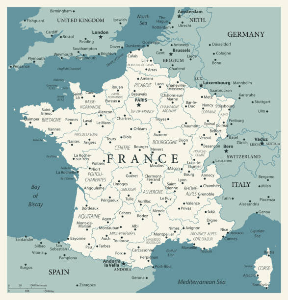
Old school style map of France vintage retro design engraved vector illustration sketch

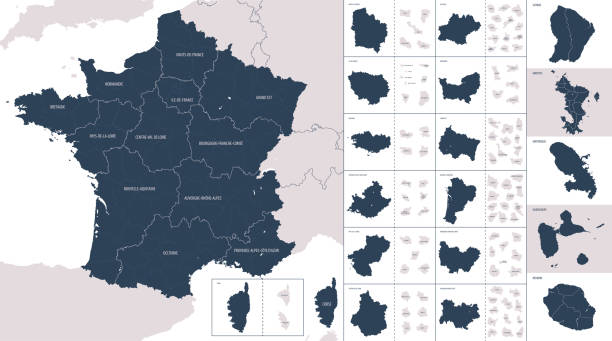
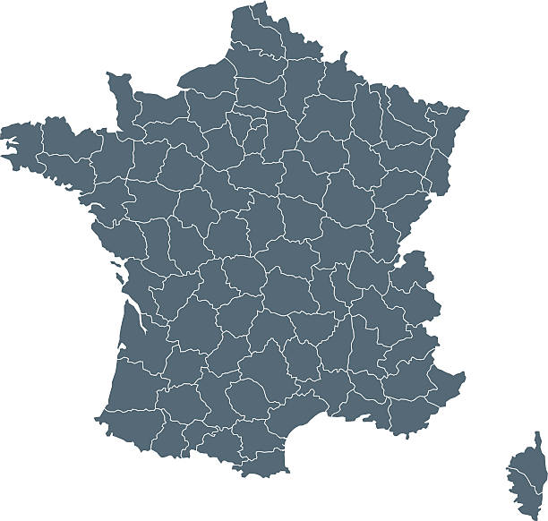
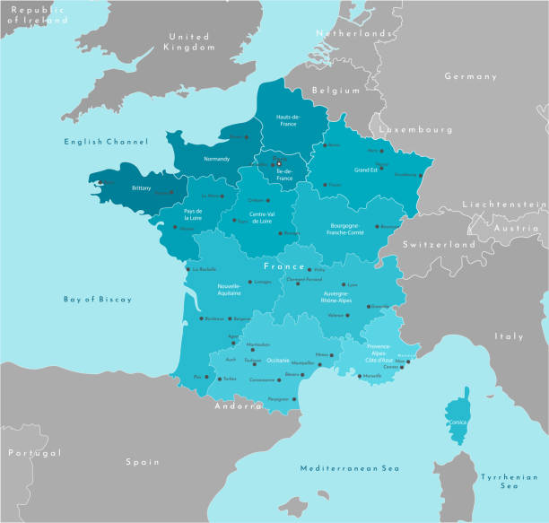
France - detailed map with regions and cities of the country. Vector illustration.
Vector maps of France with variable specification and icons


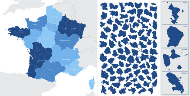
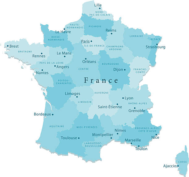
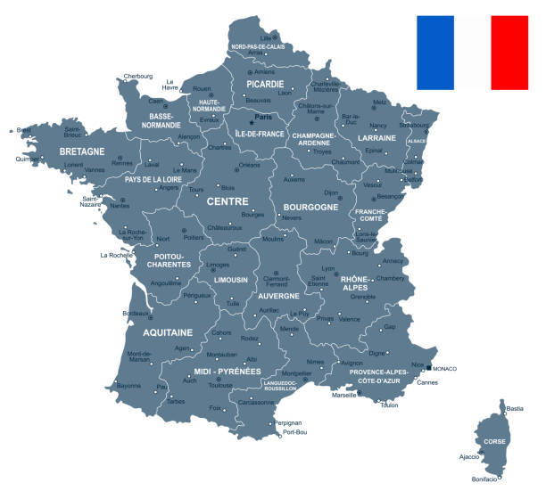
France, political map. Regions of Metropolitan France. French Republic with capital Paris and 13 administrative regions on the mainland of Europe and their prefectures. English. Illustration. Vector.

Vector modern illustration. Simplified geographical map of France and neighboring countries. Blue background of Mediterranean sea. Names of the cities and provinces

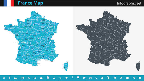
France - detailed blue country map with cities, regions, location on world map and globe. Infographic icons. Vector illustration
France map and flag - vector illustration


High detailed France road map with labeling. Organized vector illustration on seprated layers.

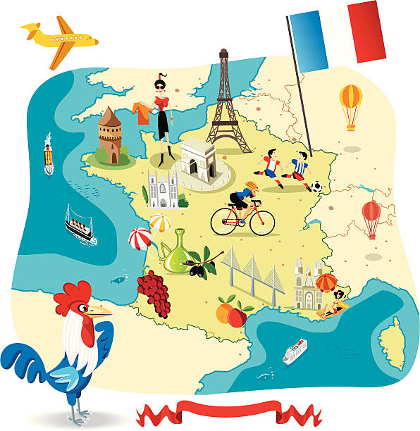
Stylized map of France. Vector illustration. French symbols, cheese, croissant, wine, bicycle, harmonic, mountains and other landmarks. Travel to France.

Metropolitan France silhouette, political map with capital Paris and large cities. Area of European France, geographically in Europe, compromising the mainland, Corsica and nearby French islands.
Next