Detailed map of France with navigation icons.
Browse 460+ marseille map stock illustrations and vector graphics available royalty-free, or start a new search to explore more great stock images and vector art.
Detailed map of France with navigation icons.

Map of Provence-Alpes-Cote d'Azur created with a thin black outline and light rays. Trendy and modern illustraion isolated on a blank background. Vector Illustration (EPS10, well layered and grouped). Easy to edit, manipulate, resize or colorize.
France political map divide by state colorful outline simplicity style. Vector illustration.

High detailed France physical map. Organized vector illustration on seprated layers.

Map of France and flag - highly detailed vector illustration

Highly detailed physical map of France in vector

Highly detailed vector map of France. File was created on August 30, 2011. The colors in the .eps-file are ready for print (CMYK). Included files: EPS (v8) and Hi-Res JPG.

Vector maps of France with variable specification and icons

Map of the France - illustration The urls of the reference files are (country, continent, world map and globe): http://www.lib.utexas.edu/maps/europe/france_admin91.jpg http://www.lib.utexas.edu/maps/world_maps/time_zones_ref_2011.pdf - The illustration was completed April 15, 2016 and created in Corel Draw - 1 layer of data used for the detailed outline of the land

Vector maps of the France with infographic elements The urls of the reference files are (country, continent, world map and globe): http://www.lib.utexas.edu/maps/europe/france_admin91.jpg http://www.lib.utexas.edu/maps/world_maps/time_zones_ref_2011.pdf - The illustration was completed April 24, 2016 and created in Corel Draw - 1 layer of data used for the detailed outline of the land

3d map of cities and roads in Europe. Countries and their neighbors.
France flag - flat collection. Flags of different shaped twelve flat icons. Vector illustration set

Travel Map of France https://maps.lib.utexas.edu/maps/europe/france.gif
High detailed France road map with labeling. Organized vector illustration on seprated layers.

France road and highway map. Organized vector illustration on seprated layers.
Vector isolated modern illustration. Simplified geographical map of France (Mainland region). Blue shape, whie background. Names of big french cities and regions.

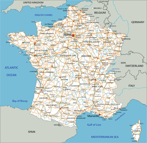
Detailed vector map of France, including main cities, roads, rivers and lakes. The colors in the .eps-file are ready for print (CMYK). Included files are EPS (v10) and Hi-Res JPG (4922 x 4922 px).
France - Blue Sketch Map. Stylized Simple Outline Map, Icon. Vector Illustration.
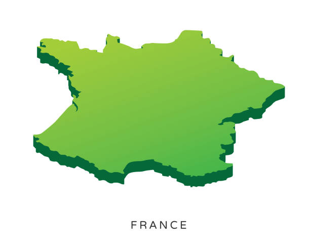
France isolated country map illustration in isometric view.

Vector map of France with infographic icons

Political map of France with national borders, cities and rivers

Vector map of France, including main cities, rivers and lakes. The colors in the .eps-file are ready for print (CMYK). Included files are EPS (v10) and Hi-Res JPG (4922 x 4922 px).
Toulouse is France. City icon in lines. The vector in the flat.

Map of Marseille - France 1840

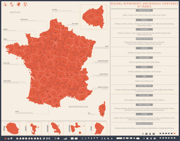
France Map - Detailed Info Graphic Vector Illustration

Map of France - Vintage Vector illustration

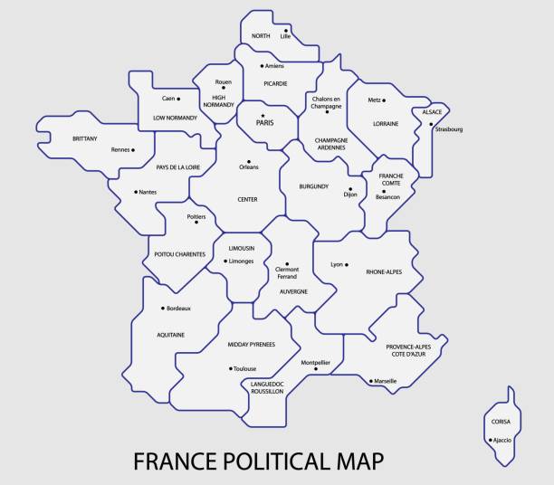
France, gray political map. Regions of Metropolitan France. French Republic, capital Paris, administrative regions and prefectures on the mainland of Europe. English. Illustration over white. Vector.

High detailed France physical map. Organized vector illustration on seprated layers.

Map of France - Vector illustration

Detailed map of France.

Map of France and flag - highly detailed vector illustration

France Map - Vintage Detailed Vector Illustration
Blue Map of the France and Navigation Icons The urls of the reference files are (country, continent, world map and globe): http://www.lib.utexas.edu/maps/europe/france_admin91.jpg http://www.lib.utexas.edu/maps/world_maps/time_zones_ref_2011.pdf - The illustration was completed April 21, 2016 and created in Corel Draw - 1 layer of data used for the detailed outline of the land

detailed map of the France with cities

Detailed map of France with flag, border of regions and country. Purple, yellow, green. Vector illustration

France Map - Vintage Detailed Vector Illustration
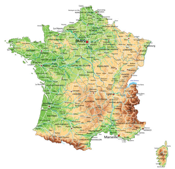
High detailed France physical map with labeling. Organized vector illustration on seprated layers.

http://s017.radikal.ru/i404/1110/87/2c00b7bbd3ec.jpg

France map and flag - vector illustration
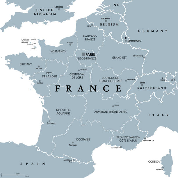
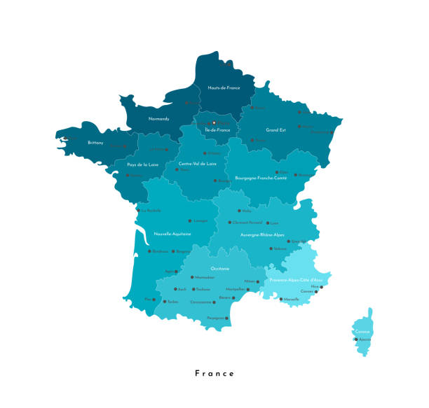
France, metropolitan regions, gray political map. French Republic with capital Paris and administrative regions on the mainland of Europe and their prefectures. English labeling. Illustration. Vector.

Map of France - Vector illustration
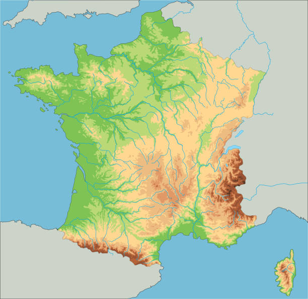
High detailed France physical map. Organized vector illustration on seprated layers.

Detailed map of France.

Map of France - high details vector illustration