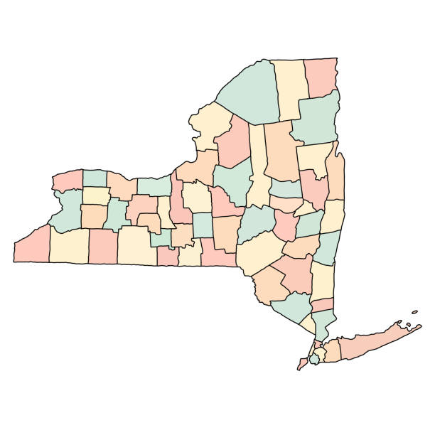
Detailed state-county map of New York.
Browse 200+ new york counties map stock illustrations and vector graphics available royalty-free, or start a new search to explore more great stock images and vector art.
Detailed state-county map of New York.
New York state county map. Eps file contains separate layers with county name, boundaries and layer with counties.

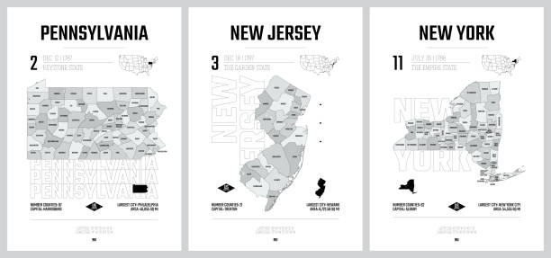
New York State counties, gray political map. New York, a state of the Northeastern United States, one of the Mid-Atlantic states, subdivided into 62 counties. Map with boundaries and county names.

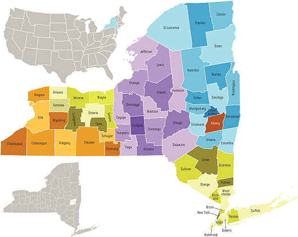
New York, U.S. state, subdivided into 62 counties, multi colored political map with capital Albany, borders and county names. State in the New England region of the United States. The Empire State.
"Highly-detailed New York county map. Each county is in a separate labeled layer. All layers have been alphabetized for easy manipulation, recoloring or other use. (see image below -- note: labels only available in AICS2 and AI10 files)"

New York State subdivided into 62 counties, outline map. State of the Northeastern United States, one of the Mid-Atlantic states, nicknamed The Empire State. Map with boundaries and county names.

Vector outline map of New York state divided into counties

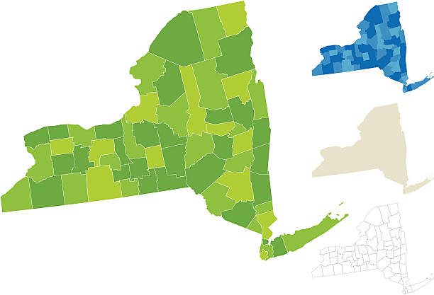
Highly-detailed New York county map. Each county is in it's own separate labeled layer. County names are in a separate layer and can be easily adjusted or removed as well. All layers have been alphabetized for easy manipulation, recoloring or other use.

new york state outline administrative and political vector map in black and white

Detailed map of New York with surroundings, provinces and capital
Detailed map of New York with capital and navigation icon.
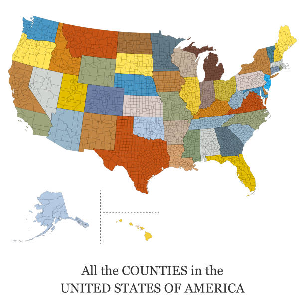
Vector illustration of a map of all the counties in the United States of America
Vector illustration of a map of all the counties in the United States of America
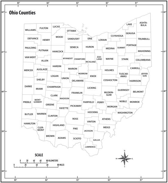
ohio state outline administrative and political vector map in black and white
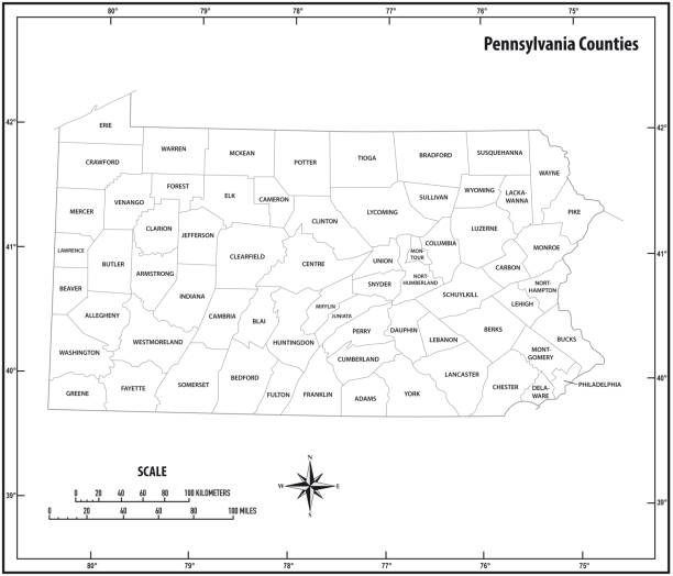
pennsylvania state outline administrative and political vector map in black and white.

Georgia counties, gray political map. State in the Southeastern region of the United States, subdivided into 159 counties. Nicknamed Peach State, and Empire State of the South. Map with county names.

New Hampshire state counties, gray political map. New Hampshire, a state in the New England region of the Northeastern United States, subdivided into 10 counties. Map with boundaries and county names.

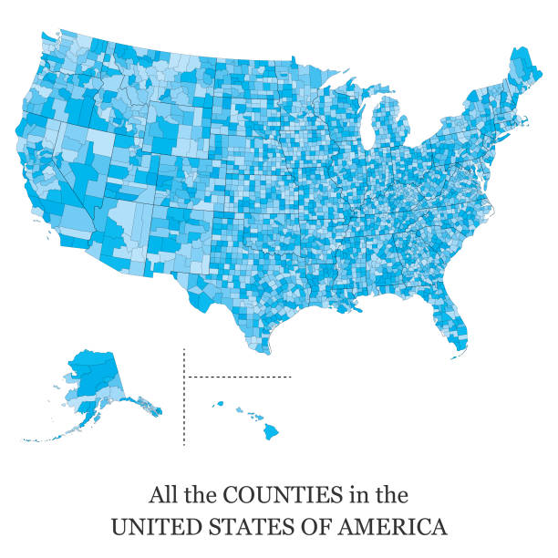
Vector illustration of a map of all the counties in the United States of America

Detailed outline map of New York with capital

Vector illustration of a map of all the counties in the United States of America
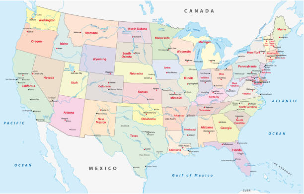
Administrative and political vector map of the United States of America
Set of New york map shape, united states america. Flat concept icon symbol vector illustration .

Vector illustration of a map of all the counties in the United States of America
New york map shape, united states of america. Flat concept icon symbol vector illustration .

Vector illustration of a map of all the counties in the United States of America

Georgia, U.S. state, subdivided into 159 counties, multi colored political map with capital Atlanta, borders and county names. State in the Southeastern region of the United States. The Peach State.

Vector outline map of New York state of the United States

Vector illustration of a map of all the counties in the United States of America
New york map shape, united states of america. Flat concept icon symbol vector illustration .

Neon map of New York against black background.

Vector illustration of a map of all the counties in the United States of America

Map of New York County in New York state on white background. single County map highlighted by black colour on New york map .

Vector illustration of a map of all the counties in the United States of America

Vector illustration of a map of all the counties in the United States of America

Vector illustration of a map of all the counties in the United States of America

Vector illustration of a map of all the counties in the United States of America

New York State counties, political map. New York, a state of the Northeastern United States, one of the Mid-Atlantic states, is subdivided into 62 counties. Map with boundaries and county names.