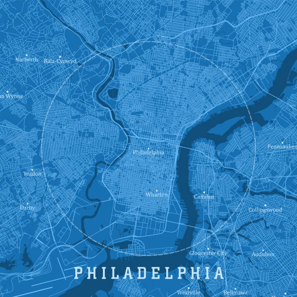
Philadelphia PA City Vector Road Map Blue Text. All source data is in the public domain. U.S. Census Bureau Census Tiger. Used Layers: areawater, linearwater, roads.
Browse 610+ philadelphia map stock illustrations and vector graphics available royalty-free, or search for greater philadelphia map or philadelphia map vector to find more great stock images and vector art.
Philadelphia PA City Vector Road Map Blue Text. All source data is in the public domain. U.S. Census Bureau Census Tiger. Used Layers: areawater, linearwater, roads.
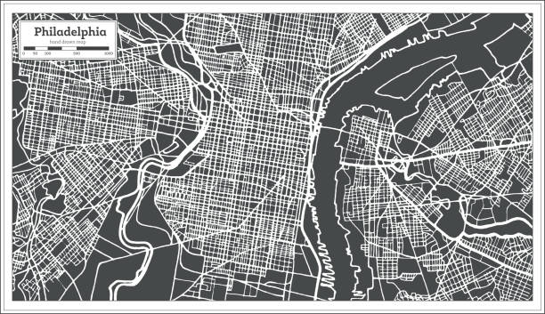
Philadelphia Pennsylvania USA Map in Retro Style. Vector Illustration. Outline Map.
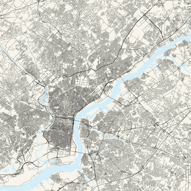
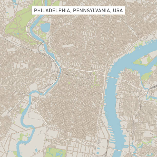
Topographic / Road map of Philadelphia, Pennsylvania. Original map data is public domain sourced from www.census.gov/

map of the city of philadelphia 1882 - overlay with a couple of vintage paper textures
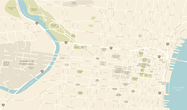
A map of downtown Philadelphia, including the University of Pennsylvania. Includes roads, highways, parks and points of interest, all on separate layers. An extra-large JPG is included so you can crop in to the area you need.
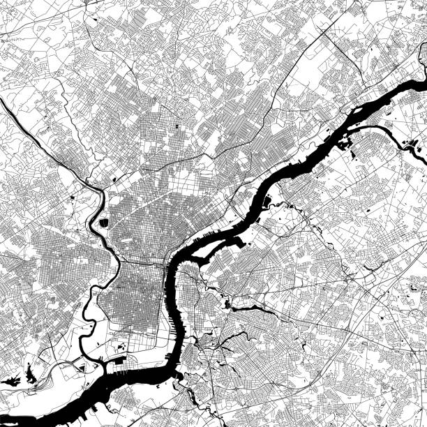
Topographic / Road map of Philadelphia, Pennsylvania. Original map data is public domain sourced from www.census.gov/
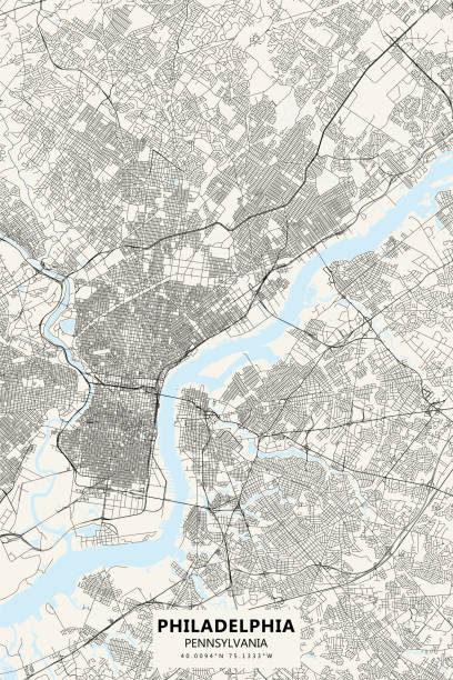
Vector Illustration of a City Street Map of Philadelphia, Pennsylvania, USA. Scale 1:60,000. All source data is in the public domain. U.S. Geological Survey, US Topo Used Layers: USGS The National Map: National Hydrography Dataset (NHD) USGS The National Map: National Transportation Dataset (NTD)

PA Philadelphia County Vector Map Green. All source data is in the public domain. U.S. Census Bureau Census Tiger. Used Layers: areawater, linearwater, cousub, pointlm.

Philadelphia PA Map of Central City 1899

Encyclopedia Britannica 9th Edition New York Charles Scribners and Sons 1885 Vol XVIII
Poster Style Topographic / Road map of Philadelphia, Pennsylvania. Original map data is public domain sourced from www.census.gov/
Illustrated map of the state of Pennsylvania in United States with cities and landmarks. Editable vector illustration
pennsylvania road vector map

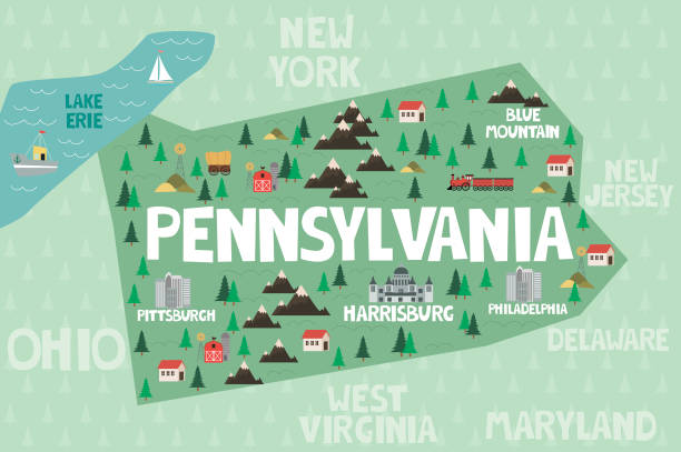
Cartoon Map of Pennsylvaniahttps://maps.lib.utexas.edu/maps/united_states/fed_lands_2003/pennsylvania_2003.pdfhttps://maps.lib.utexas.edu/maps/world_maps/world_physical_2015.pdf

Camden NJ City Vector Road Map Blue Text. All source data is in the public domain. U.S. Census Bureau Census Tiger. Used Layers: areawater, linearwater, roads.

Philadelphia PA City Vector Road Map Blue Horizontal. All source data is in the public domain. U.S. Census Bureau Census Tiger. Used Layers: areawater, linearwater, roads.

Historical city map of Philadelphia, Pennsylvania, USA. Wood engraving, published in 1897.

Philadelphia and environs Map 1899

Map of the city of Philadelphia, USA

Philadelphia Pennsylvania USA Map in Black and White Color. Vector Illustration. Outline Map.

Vintage map of Philadelphia, PA, United States. - See lightbox for more

Philadelphia USA City Map in Retro Style in Golden Color. Outline Map. Vector Illustration.

Vintage illustration Old antique map of Philadelphia, Pennsylvania, USA, Delaware river, 1890s, 19th Century
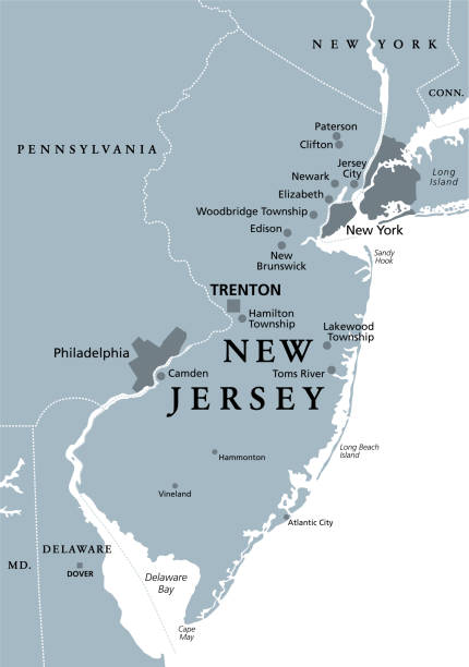
New Jersey, NJ, gray political map with capital Trenton. State in the Mid-Atlantic region of the Northeastern United States of America. The Garden State. Illustration on white background. Vector.

Topographic / Road map of Paris, France. Original map data is open data via © OpenStreetMap contributors

NJ Camden Camden Vector Road Map. All source data is in the public domain. U.S. Census Bureau Census Tiger. Used Layers: areawater, linearwater, roads, rails, cousub, pointlm, uac10.
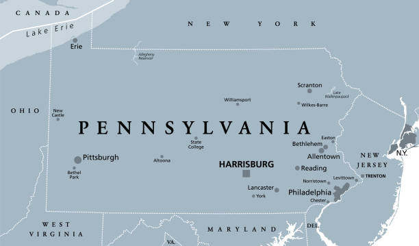
Pennsylvania, PA, gray political map. The Commonwealth of Pennsylvania, a state in the Northeastern United States of America with capital Harrisburg. Keystone State. Quaker State. Illustration. Vector
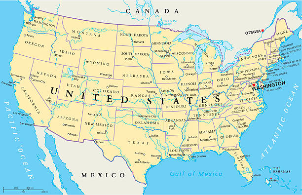
United States of America Political Map with capital Washington, national borders, most important cities, rivers and lakes. Map with single states, their borders and capitals, except Hawaii and Alaska. English labeling and scaling.
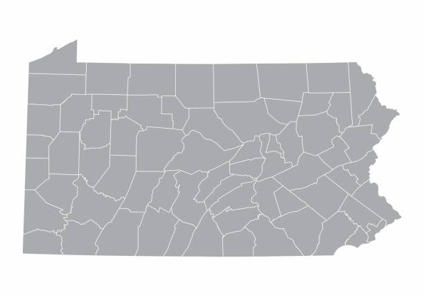
A gray Map of Pennsylvania and its counties
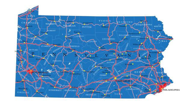
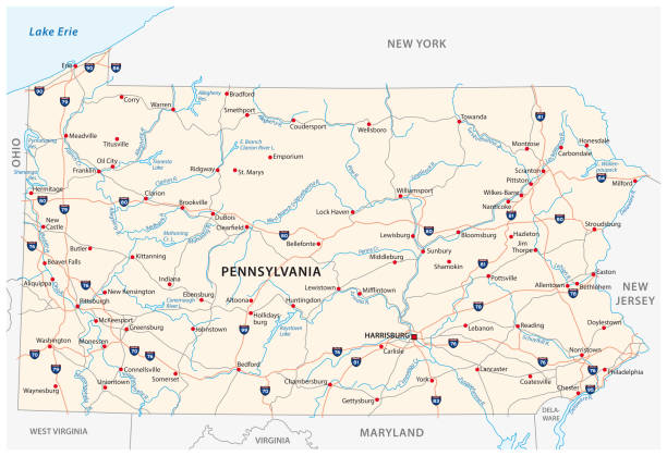
Detailed map of Pennsylvania state,in vector format,with county borders,roads and major cities.
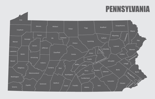
Map of the state of Pennsylvania and its counties

Map of the state of Pennsylvania

Pennsylvania counties, gray political map. Commonwealth of Pennsylvania, a state of the Mid-Atlantic and Northeastern United States, subdivided into 67 counties. Map with boundaries and county names.
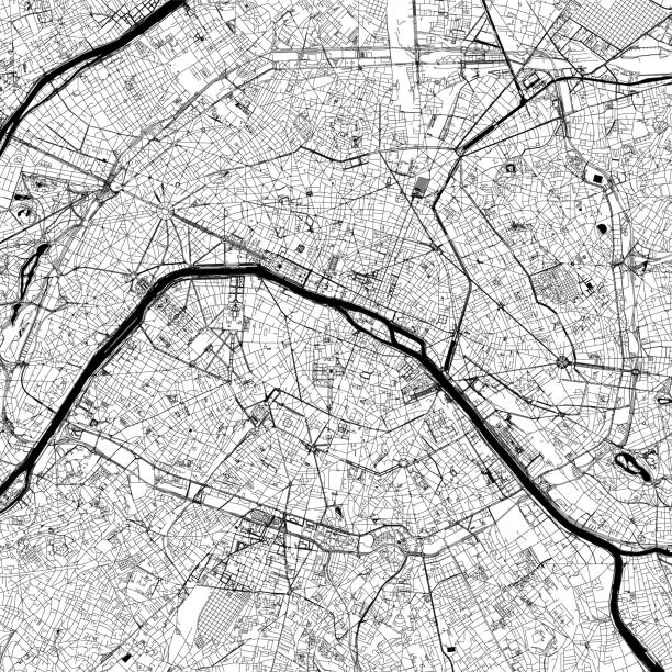
Topographic / Road map of Paris, France. Original map data is open data via © OpenStreetMap contributors
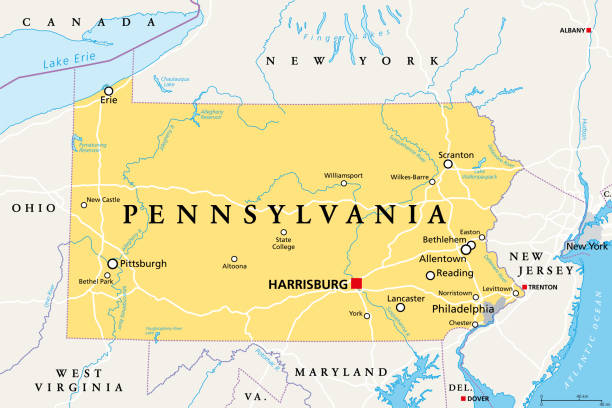
Pennsylvania, PA, political map. Officially the Commonwealth of Pennsylvania. State in the northeastern United States of America. Capital Harrisburg. Keystone State. Quaker State. Illustration. Vector

vector illustration of Pennsylvania map
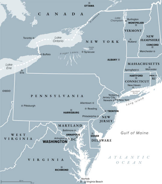
Mid-Atlantic region of the United States, gray political map. The overlap between the Northeastern and Southeastern states, including Delaware, D.C., Maryland, New Jersey, New York and Pennsylvania.
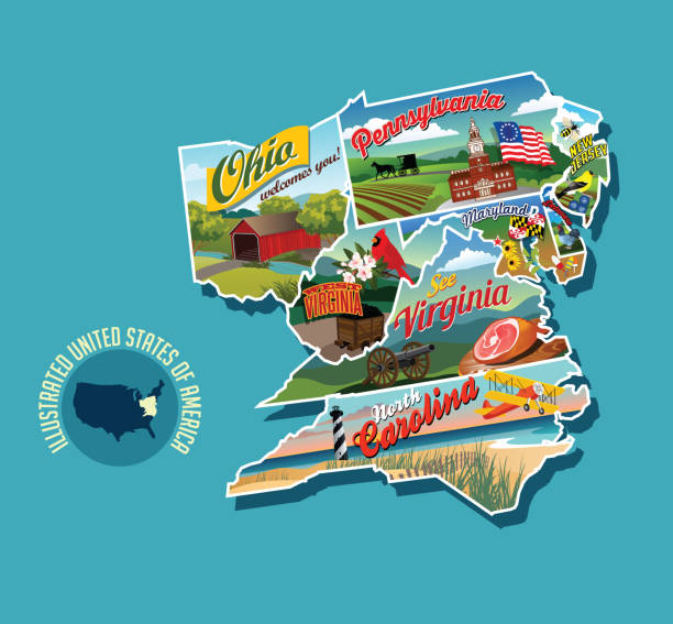
Illustrated pictorial map of eastern United States. Includes Pennsylvania, New Jersey, West Virginia, Virginia, North Carolina, Delaware and Maryland. Vector Illustration.

Mid-Atlantic region of the United States, political map. Located in the overlap between Northeastern and Southeastern states, including Delaware, D.C., Maryland, New Jersey, New York and Pennsylvania.

Map from Physical Geography by R. S. Tarr - The MacMillan Company - London 1898

Stage. Fingerprint and stripes pattern. American states maps.

Colton and Fitch's Introductory School Geography - New York: Sheldon and Company 1871
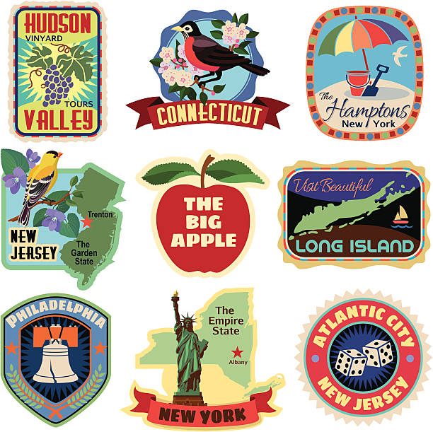
Vector New York metropolitan area travel stickers.

Harper's School Geography, New York, Harper's and Brothers, 1881.

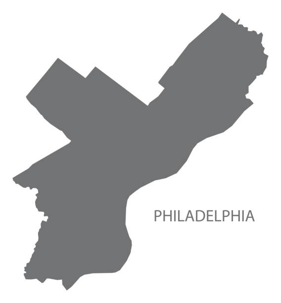
Map of Philadelphia County - Pennsylvania for your own design. Three maps with editable stroke included in the bundle: - One black map on a white background. - One line map with only a thin black outline in a line art style (you can adjust the stroke weight as you want). - One map on a blank transparent background (for change background or texture). The layers are named to facilitate your customization. Vector Illustration (EPS file, well layered and grouped). Easy to edit, manipulate, resize or colorize. Vector and Jpeg file of different sizes.