Images
Algarve Map Pictures, Images and Stock Photos
Browse 240+ algarve map stock photos and images available, or start a new search to explore more stock photos and images.
Most popular


Portugal road vector map
Highly detailed vector map of the Portuguese Republic (Portugal). File was created on June 29, 2011. The colors in the .eps-file are ready for print (CMYK). Included files: EPS (v8) and Hi-Res JPG.

Detailed map of Portugal.
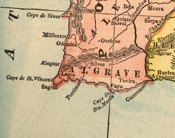
vintage maop of the algarve

Portugal wine regions vector map

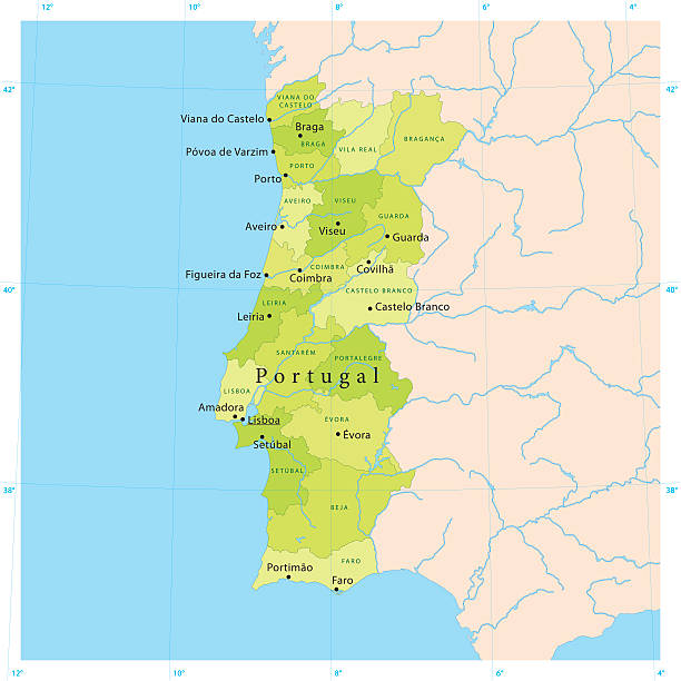
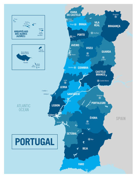
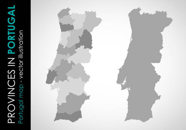
Portugal administrative and political vector map

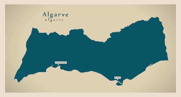
Algarve Portugal Map in grey


Portugal Map - Detailed Info Graphic Vector Illustration


Portugal Map - High Detailed Vector Illustration


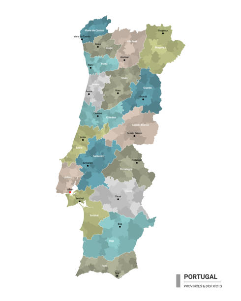
colorful map of Portugal (districts on separate layers)


Faro Portugal City Map in Retro Style in Golden Color. Outline Map. Vector Illustration.


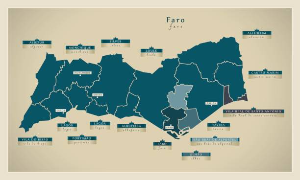
city map silhouette of Faro District in Portugal on white background

Portugal Map - Vintage Detailed Vector Illustration

3D Render of a Topographic Map of Portugal. All source data is in the public domain. Color texture: Made with Natural Earth. http://www.naturalearthdata.com/downloads/10m-raster-data/10m-cross-blend-hypso/ Boundaries Level 0: Humanitarian Information Unit HIU, U.S. Department of State (database: LSIB) http://geonode.state.gov/layers/geonode%3ALSIB7a_Gen Relief texture and Rivers: SRTM data courtesy of USGS. URL of source image: https://e4ftl01.cr.usgs.gov//MODV6_Dal_D/SRTM/SRTMGL1.003/2000.02.11/ Water texture: SRTM Water Body SWDB: https://dds.cr.usgs.gov/srtm/version2_1/SWBD/

Paper map of roads and location of Portugal, taken from an angular point of view, color photo, focus on the name of the city, view from below blurry background.

european country Portugal and districts in details
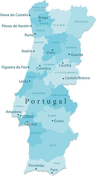
"Detailed vector map of Portugal with administrative divisions. File was created on November 21, 2012. The colors in the .eps-file are ready for print (CMYK). Included files: EPS (v8) and Hi-Res JPG (3328aa aaa 5600 px)."

Portugal map and flag - vector illustration
Portugal vector map with major cities and rivers
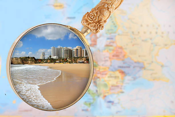
Looking in on a popular beach in southern Portugal, Praia da Rocha, Algarve

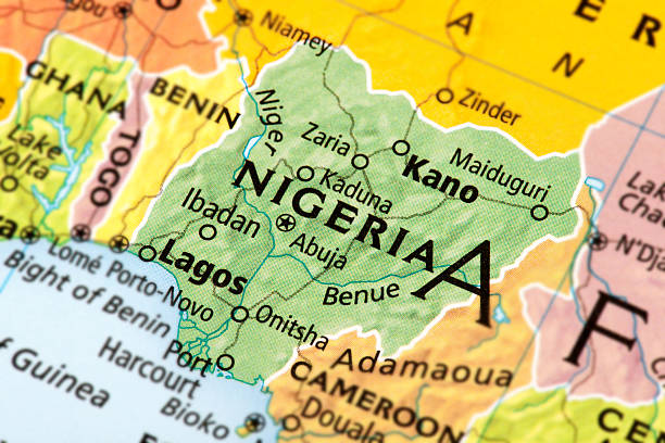
Map of Nigeria. A detail from the World Map.

Vector isolated illustration of simplified administrative map of Portugal. Borders and names of the regions. Colorful blue khaki silhouettes.

silhouette map of Faro District in Portugal on white background

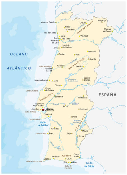
Highly detailed physical map of Portugal,in vector format,with all the relief forms,regions and big cities.
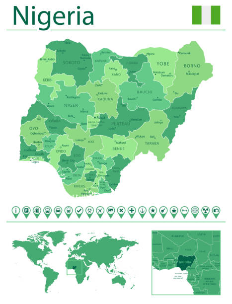
Detailed map of Nigeria with country flag and location on world map. Vector illustration

Vector maps of Portugal with variable specification and icons

Vector map of Portugal with infographic elements

Detailed map of Portugal.

Algarve on an old 1790's map. Algarve is the southernmost region of mainland Portugal. Selective focus and Canon EOS 5D Mark II with MP-E 65mm macro lens.

Portugal map and flag - vector illustration

Very detailed Portugal map - easy to edit.

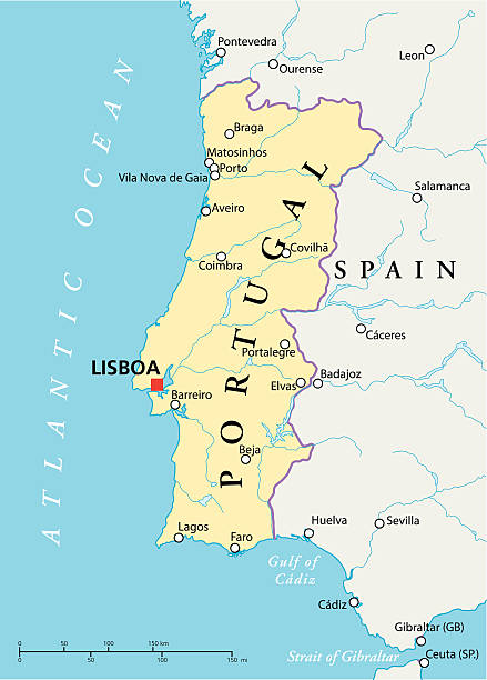
Political map of Portugal with capital Lisbon, national borders, most important cities, rivers and lakes. Vector illustration with English labeling and scaling.

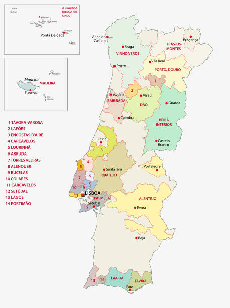
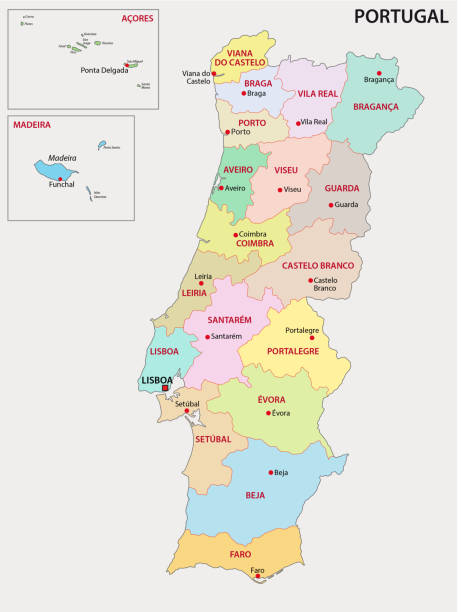
Districts of Portugal. Map of regional country administrative divisions. Colorful vector illustration.


Portugal Map - Vintage Detailed Vector Illustration


Portugal infographic map and flag - vector illustration

3d map of cities and roads in Europe. Countries and their neighbors.


Nigeria - country map and flag located on globe, world map. 3D Vector illustration

Old sailing ship anchored off the coast of Portugal. Travel concept

Districts of Portugal. Map of regional country administrative divisions. Colorful vector illustration.

Portugal - Retro Vector Map
Next