Drone Footage
Browse 800+ amazon rainforest from above stock photos and images available, or start a new search to explore more stock photos and images.
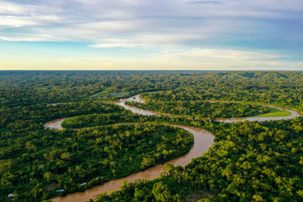
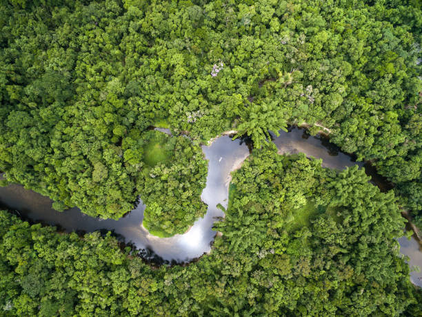
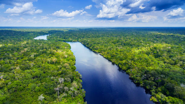
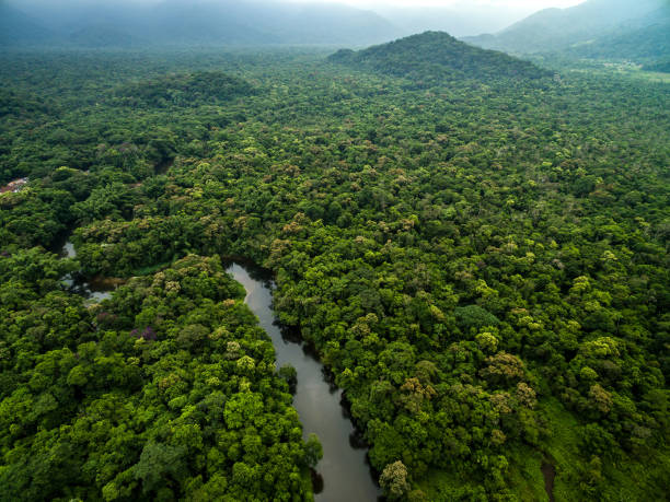
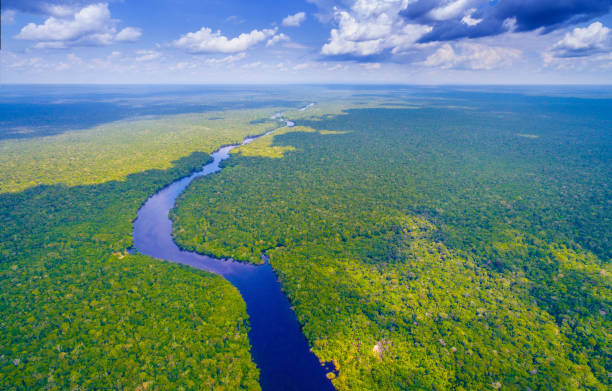
Aerial view over a tropical forest with a river in the amazon rainforest

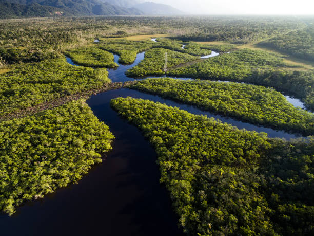
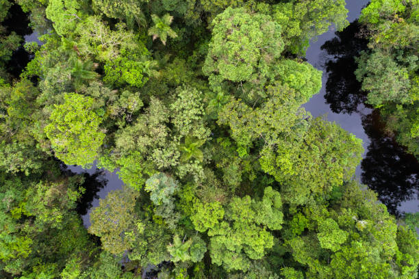
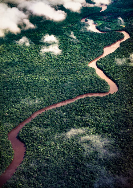
Aerial view of an area of dense amazon rainforest in Brazil, showing only the treetops.

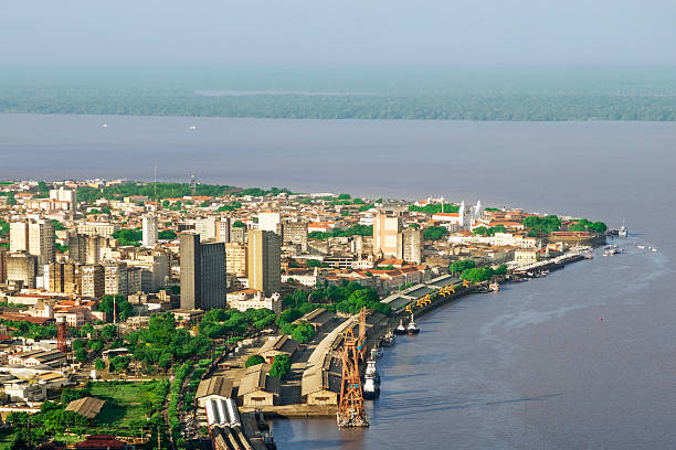
Aerial view of the Amazon river with forest and houses on the banks. Combú Island, near the city of Belém Pará

3D Render of a Topographic Map of the Amazon Rainforest. All source data is in the public domain. Color texture: Made with Natural Earth. http://www.naturalearthdata.com/downloads/10m-raster-data/10m-cross-blend-hypso/ Relief texture and rivers: GMTED 2010 data courtesy of USGS. URL of source image: https://topotools.cr.usgs.gov/gmted_viewer/viewer.htm Water texture: SRTM Water Body SWDB: https://dds.cr.usgs.gov/srtm/version2_1/SWBD/

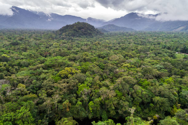
Aerial view of rainforest. Amazon rainforest near Manaus
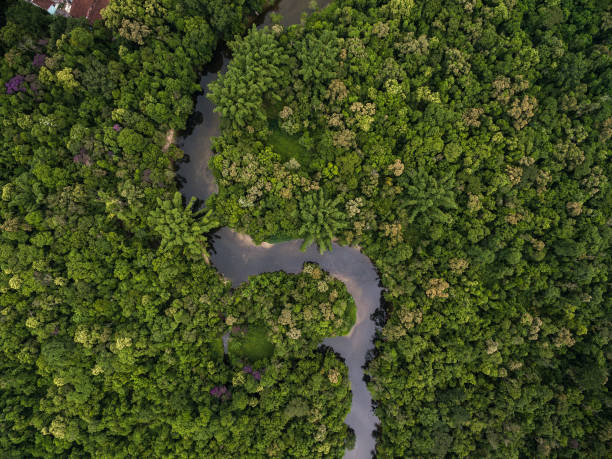
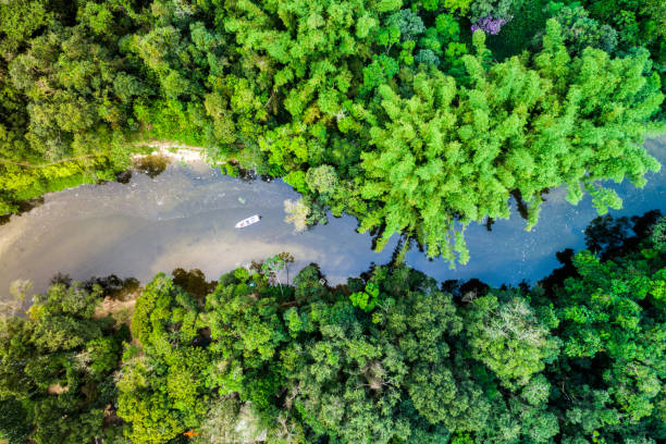
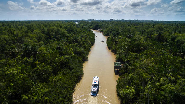
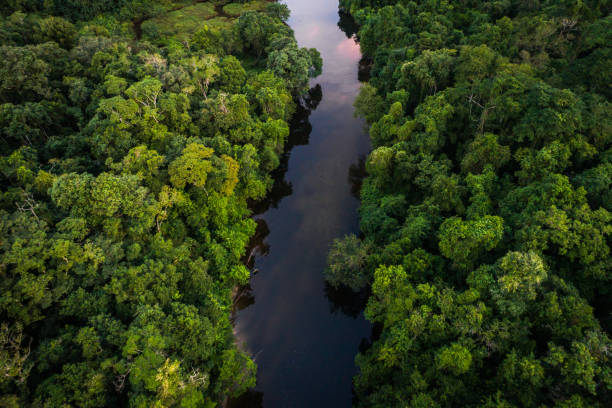
Drone view of the riparian zone in Xingu river, Amazon rainforest, Brazil

Ecology concept: aerial view of the earth surrounded by a healthy forest. Computer generated. Subtle grain texture added. Earth's maps courtesy of http://www.shadedrelief.com
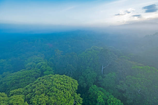
Looking Down on the Amazon Rainforest Canopy in the Morning Mist near Alta Floresta, Brazil

3D Render of a Topographic Map of Brazil. Version with Country Boundaries.All source data is in the public domain.Color texture: Made with Natural Earth. http://www.naturalearthdata.com/downloads/10m-raster-data/10m-cross-blend-hypso/Relief texture: NASADEM data courtesy of NASA JPL (2020). URL of source image: https://doi.org/10.5067/MEaSUREs/NASADEM/NASADEM_HGT.001Water texture: SRTM Water Body SWDB:https://dds.cr.usgs.gov/srtm/version2_1/SWBD/Boundaries Level 0: Humanitarian Information Unit HIU, U.S. Department of State (database: LSIB)http://geonode.state.gov/layers/geonode%3ALSIB7a_Gen

Ecology concept: Brazil shaped forest viewed from above. Computer generated, and lit with global radiosity. Subtle grain texture added.

Aerial shot of Kaieteur Falls and the Potaro River, Kaieteur National Park, Potaro-Siparuni region, Essequibo territory, Guyana. Kaieteur Falls are considered the largest single-drop waterfall in the world. The Essequibo region is the subject of a dispute between Guyana and Venezuela.

Harvesting acai native from Amazon, in a traditional way. At the field, workers climb the acai palm trees tying their feet with an artisanal artifact known as "peconha", which helps them to reach the bunches to be cut. Then, threshing and scavenging operations are carried out, which consist, respectively, of releasing the fruits from the bunches and selecting them according to color or maturation stage. The fruits are packed in straw baskets, called "rasas" or "paneiros", and transported in boats to the place of sale. This entire shoot was carried out in Piquiarana-Miri river, located in Abaetetuba city (Para state), one of the most important producers of acai in the brazilian Amazon.

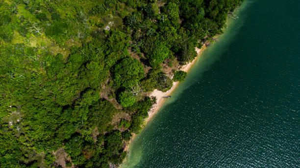
Top-down aerial view of a person paddling a canoe on a calm river, surrounded by dense green trees and palm trees, with a small dock and a bridge visible near the water’s edge.

3D Render of a Topographic Map of the Amazon Rainforest. All source data is in the public domain. Color texture: Made with Natural Earth. http://www.naturalearthdata.com/downloads/10m-raster-data/10m-cross-blend-hypso/ Relief texture and rivers: GMTED 2010 data courtesy of USGS. URL of source image: https://topotools.cr.usgs.gov/gmted_viewer/viewer.htm Water texture: SRTM Water Body SWDB: https://dds.cr.usgs.gov/srtm/version2_1/SWBD/

Rainforest aerial photograph in the surrounding area of the city of Manaus, Amazon state, Brazil.

Beautiful close of of distinct tree species: a nature background

"Ecology concept: Loop shaped forest viewed from above. Computer generated, and lit with global radiosity. Subtle grain texture added."

Scolopendra gigantea - Peruvian giant yellow-leg centipede also known as Amazonian giant centipede

Plane view of the tropical jungle in South America

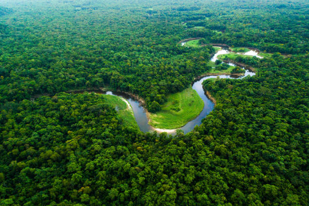
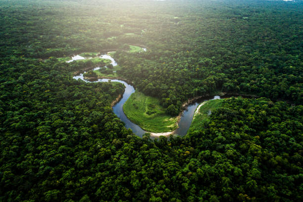
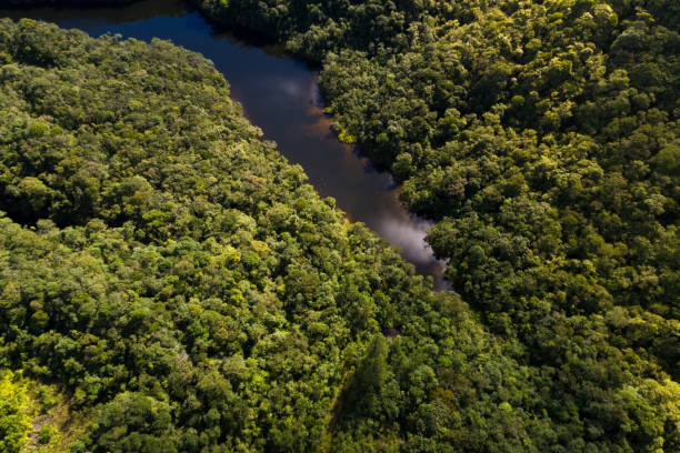
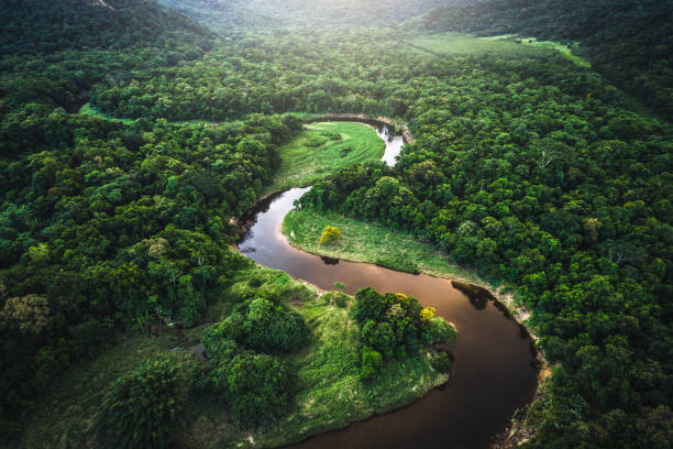
Aerial view of an area of dense amazon rainforest in Brazil, showing the forest and some stretches of rivers.

Aerial shot of Amazonian rainforest in the Potaro-Siparuni region, Essequibo territory, Guyana. The Essequibo region is the subject of a dispute between Guyana and Venezuela.
Aerial view of river in the rain forest, Amazonas state, Venezuela