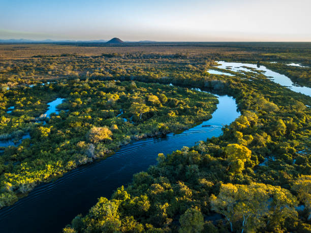
Miranda River photographed in Corumbá, Mato Grosso do Sul. Pantanal Biome. Picture made in 2017.
Browse 4,500+ cerrado forest stock photos and images available, or start a new search to explore more stock photos and images.
Miranda River photographed in Corumbá, Mato Grosso do Sul. Pantanal Biome. Picture made in 2017.

Riparian Zone/ciliary forest surrounding a water course in brazilian savanna (cerrado), Mato Grosso, Brazil.
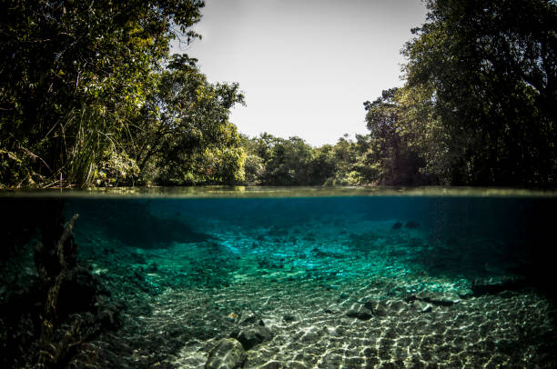
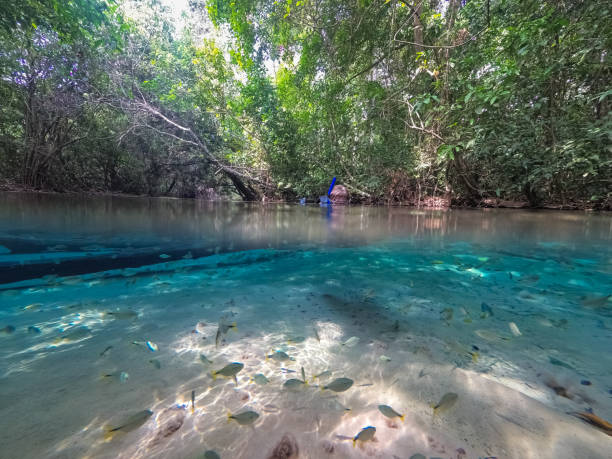
View of the river floor and the 'cerrado' vegetation at Bonito in Mato Grosso do Sul state, Brazil
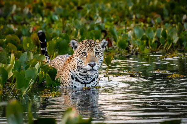
Jaguar looking at camera, tail up, in a bed of water hyacinths in the back and side, water with reflections and motion, dusk mood

Biomes in Brazil, map of 6 ecosystems with natural vegetation. Amazonia (rainforest), Caatinga (scrub), Cerrado (savanna), Mata Atlantica (Atlantic Forest), Pampa (grassland), and Pantanal (wetland).

3D Render of a Topographic Map of Brazil. Version with Country Boundaries. All source data is in the public domain. Color texture: Made with Natural Earth. http://www.naturalearthdata.com/downloads/10m-raster-data/10m-cross-blend-hypso/ Relief texture: NASADEM data courtesy of NASA JPL (2020). URL of source image: https://doi.org/10.5067/MEaSUREs/NASADEM/NASADEM_HGT.001 Water texture: SRTM Water Body SWDB: https://dds.cr.usgs.gov/srtm/version2_1/SWBD/ Boundaries Level 0: Humanitarian Information Unit HIU, U.S. Department of State (database: LSIB) http://geonode.state.gov/layers/geonode%3ALSIB7a_Gen

In September, a record number of fires broke out across Brazil, creating a dark, smoke-filled sky throughout the month. In the capital, Brasília, several parks and protected areas suffered severe fires. These photo depict the worst day of fires in history to date.

In September, a record number of fires broke out across Brazil, creating a dark, smoke-filled sky throughout the month. In the capital, Brasília, several parks and protected areas suffered severe fires. These photo depict the worst day of fires in history to date.

The Serra da Canastra National Park is one of the most important Brazilian national parks, created in 1972 through decree 70.355 of 1972. Within the park is located the historical source of the São Francisco River, in the municipality of São Roque de Minas
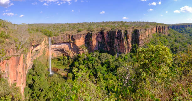
Beautiful Bridal Veil, Veu Da Noiva waterfall in Chapada Dos Guimaraes National Park, Cuiaba, Mato Grosso, Brazil, South America
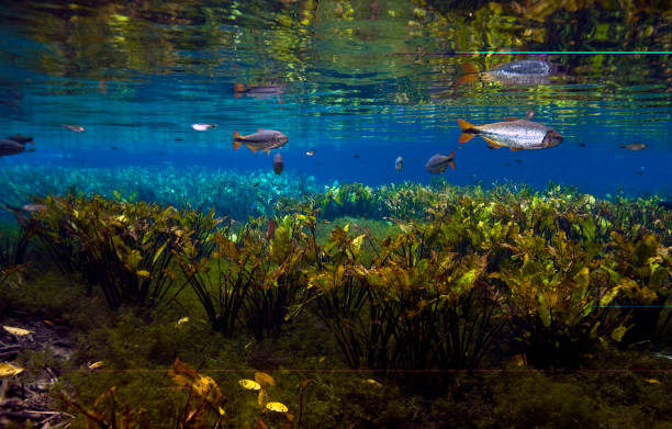
Piraputanga fish in aquario natural bonito mato grosso do sul pantanal brasil

Aerial view of native Buriti palm in the middle of the Amazon rainforest. Buritizal.

3D Render of a Topographic Map of Brazil. All source data is in the public domain. Color texture: Made with Natural Earth. http://www.naturalearthdata.com/downloads/10m-raster-data/10m-cross-blend-hypso/ Relief texture: NASADEM data courtesy of NASA JPL (2020). URL of source image: https://doi.org/10.5067/MEaSUREs/NASADEM/NASADEM_HGT.001 Water texture: SRTM Water Body SWDB: https://dds.cr.usgs.gov/srtm/version2_1/SWBD/ Boundaries Level 0: Humanitarian Information Unit HIU, U.S. Department of State (database: LSIB) http://geonode.state.gov/layers/geonode%3ALSIB7a_Gen

Address of The Sun Way, in Chapada dos veadeiros, Goias, Brazil

River and trees with beautiful light

The Chapada Diamantina is a wonderful natural scenario that offers magnificent views to tourists
Photo taken in a rare refuge of endangered bird species in the amazon region

Jaguar looking at camera, tail up, in a bed of water hyacinths in the back and side, water with reflections and motion, dusk mood

Beautiful landscape with hills, bushes, plateaus, and a cloudy sky in a nature conservation area

Top of hill sandstone rock eroded hole by rain and wind. View of valley at other side from the top.

Bird landing on tree during a sunny day at Jalapao National Park, in the State of Tocantins, Brazil

Mother and baby perching in a tree fork, looking at camera, in a leafy tree in a sunny day

Jaguar looking attentive at the camera, green defocused background

Casca D'Anta Waterfall, Serra da Canastra

Moon Valley in Chapada dos Veadeiros National Park in Goias, Brazil

Moon Valley in Chapada dos Veadeiros National Park in Goias, Brazil

Relaxed funny position against green natural background

Walking on a green meadow against forest background, Pantanal Wetlands

mountain landscape at Chapada dos Veadeiros National Park in Goias, Brazil.

Aerial view of the cerrado biome in the Chapada dos Guimarães National Park, in Mato Grosso.

View from Mirante da Janela in Chapada dos Veadeiros National Park in Goias, Brazil