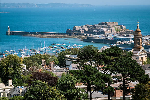
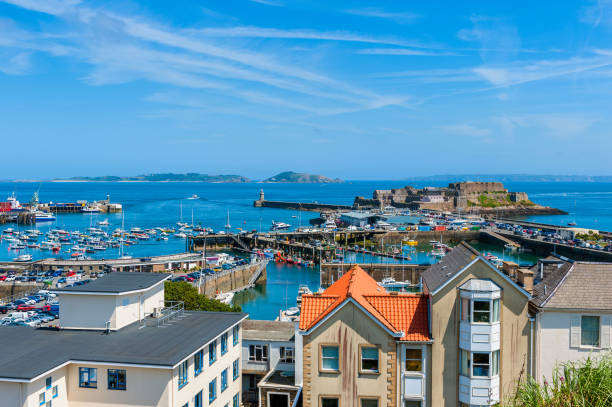
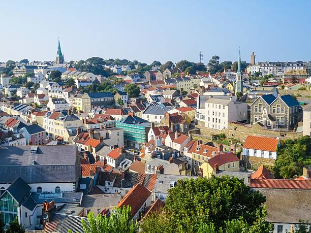
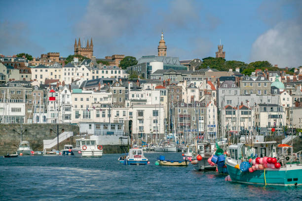
Harbour and Skyline of Saint Peter Port, Guernsey, Channel Islands, UK.
Browse 3,400+ guernsey channel islands stock photos and images available, or search for jersey channel islands or belfast ireland to find more great stock photos and pictures.
Harbour and Skyline of Saint Peter Port, Guernsey, Channel Islands, UK.

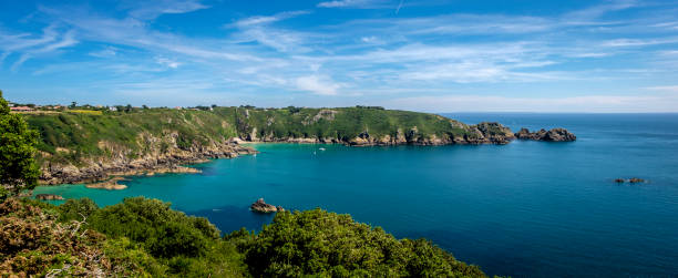
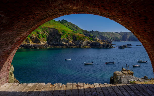
Le Petit Port, Moulin Houet Bay, Guernsey, Channel Islands
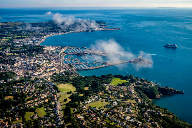
High angle view over Harbor of Saint Peter Port, Guernsey, Channel Islands, UK. The Islands of Herm and Sark are visible in the distance.
View of the Saint Peter Port at sunrise. Bailiwick of Guernsey, Channel Islands

Aerial view Fort grey, built in 1804 to defend the west coast of Guernsey. wonderful beach with white sand and turquoise water and fisher boats
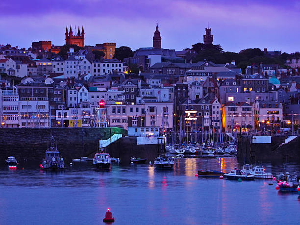
Victoria Marina and The Quay, St. Peter Port, Guernsey, Channel Islands at dawn
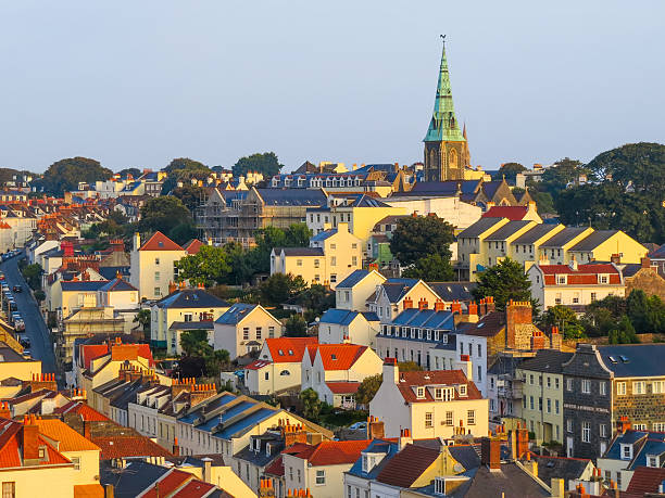
Aerial view of the Saint Peter Port at sunrise. Bailiwick of Guernsey, Channel Islands

Sunrise St Peter Port Harbour

View of St Peter Port, Guernsey from the water. Other boats in the harbour, people sat round the harbour and the town centre behind. Logos removed from buildings and cars. People too small to be recognisble. Good copy space.

Aerial View on Guernsey, Channel Islands, UK on summer morning.
Aerial view of the Saint Peter Port, Bailiwick of Guernsey, Channel Islands
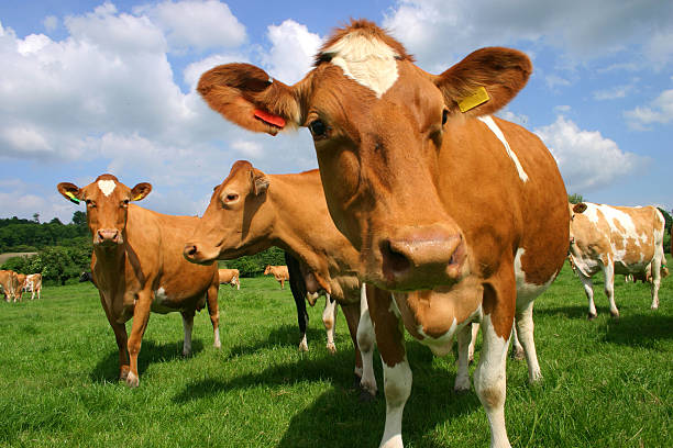
A group of Guernsey cows in pasture photographed at close quarters
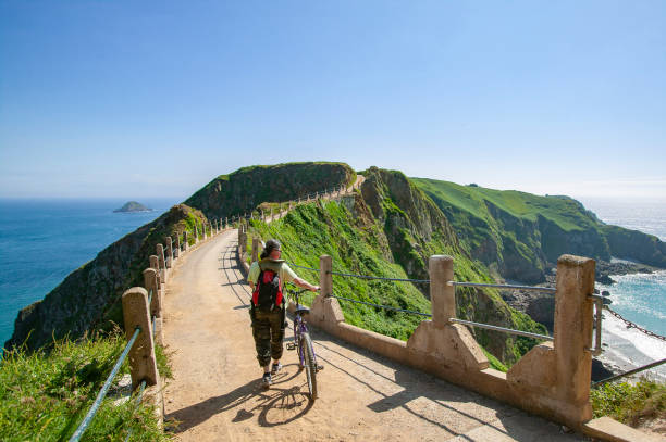
young woman with bicycle on scenic country road on Sark Island, Guernsey, Channel Islands, UK

young womanat scenic view point on Sark Island, Guernsey, Channel Islands, UK

La Rousse Tower at Le Grand Havre, Guernsey, Channel Islands

scenic country road on Sark Island, Guernsey, Channel Islands, UK
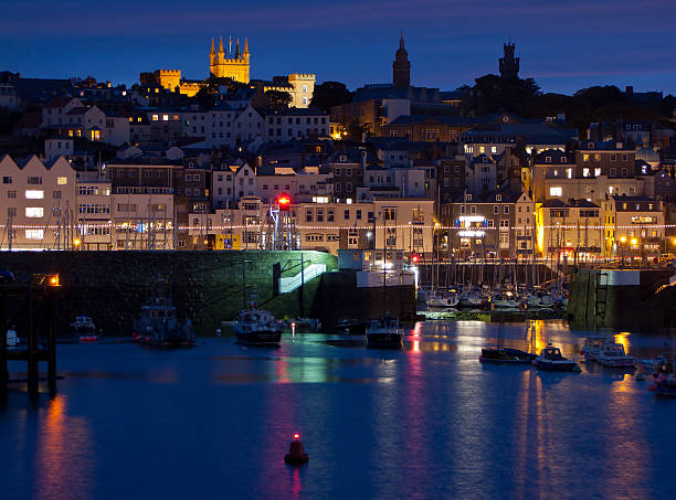
Victoria Marina and The Quay, St. Peter Port, Guernsey, Channel Islands at dawn

Ireland and United Kingdom political map with capitals Dublin and London and with national borders. Gray illustration of British Isles with English labeling and scaling on white background.
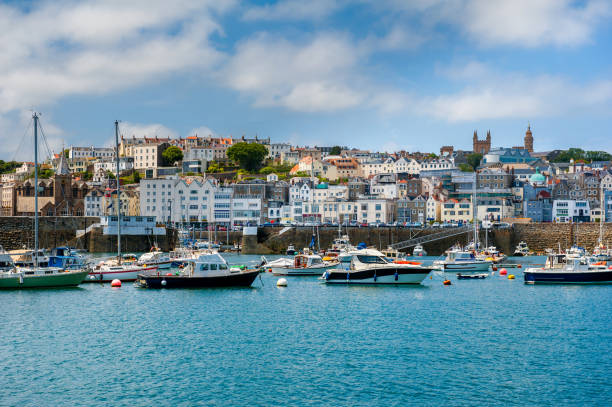
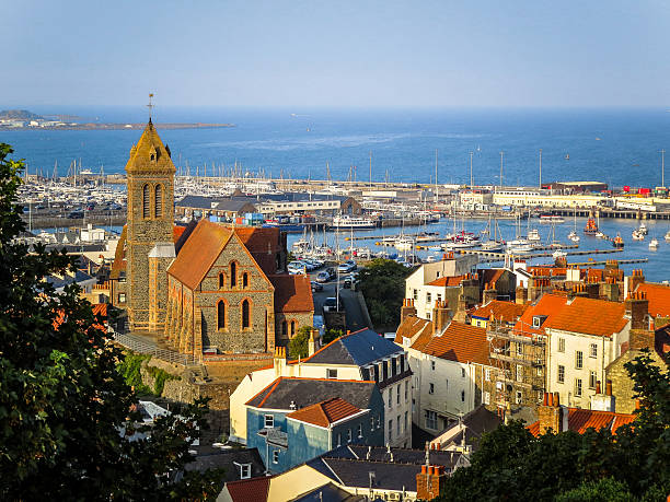
Saint Peter Port, Guernsey, Channel Islands, UK.

The sunrise in St Peter Port, Guernsey

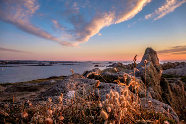
Longis beach in the summer sun in Alderney.

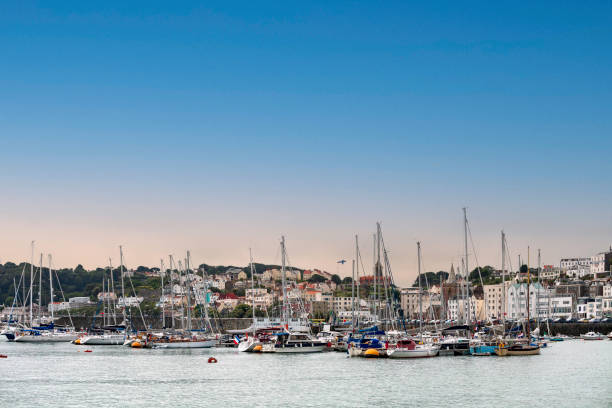
Yachts and small boats moored in a small rustic harbour the sky and clouds tinged by the first glow of a setting sun
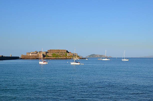
Castle Cornet is a large island castle in Guernsey. It is part of the breakwaters of St Peter Port's harbour. People/logos too small to be recognisable. Herm Islandin the background.
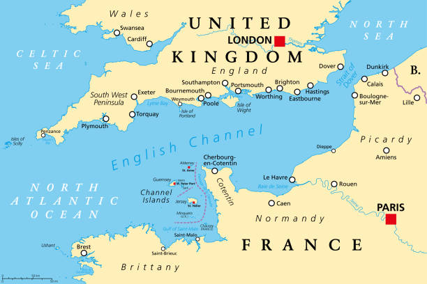
English Channel political map. Also British Channel. Arm of Atlantic Ocean separates Southern England from northern France and link to North Sea by Strait of Dover. Busiest shipping area in the world.
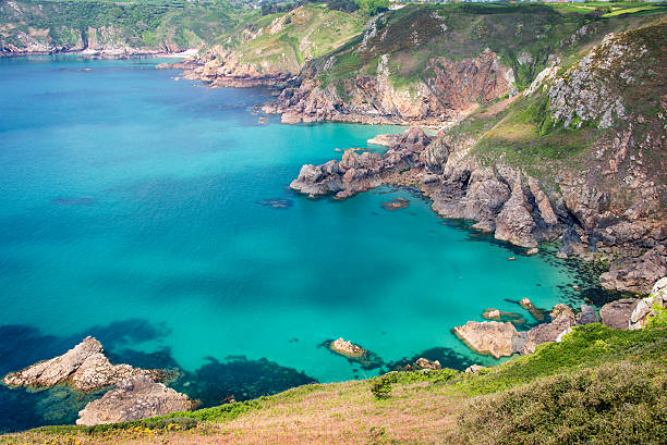
Saints Bay Harbour, a beautiful beach cove surrounded by jagged rocky cliffs.

Channel Islands, political map. The Crown Dependencies Bailiwick of Guernsey and Bailiwick of Jersey, an archipelago in the English Channel, off the coast of France. Remnants of the Duchy of Normandy.

Northern France, political map. Coastline of France and United Kingdom along the English Channel, and along Bay of Biscay, with the Channel Islands. Coasts of Hauts-de-France, Normandy and Brittany.

Little Chapel is possibly the smallest chapel in the world

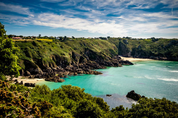
Guernsey beach Fermain bay channel Islands. Guernsey coastline with sea, beach, cliffs and boat. Island, UK, Europe
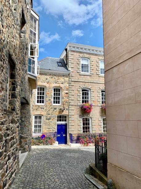
A street scene in the centre of St. Peter Port, Guernsey, Channel Islands.

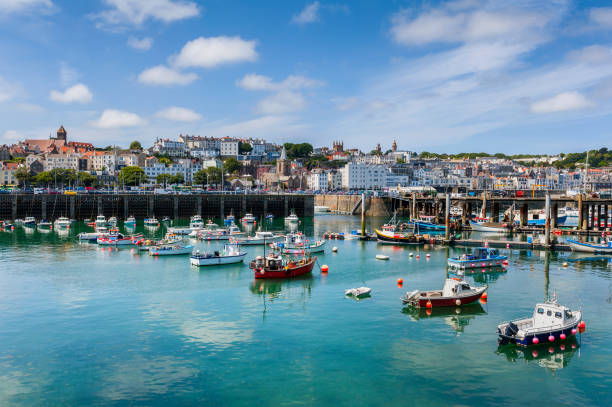
St. Peter Port, Guernsey -August 6, 2018: Saint Peter Port is the capital of Guernsey as well as the main port. It's also considered one of Europes prettiest harbour towns.
Harbor and cityscape of St.Peter Port on Guernsey Island, Channel Islands, UK
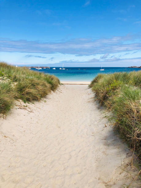
Sandy path to Braye Beach in Alderney, Channel Islands

United Kingdom countries and Ireland political map. England, Scotland, Wales, Northern Ireland, Guernsey, Jersey, Isle of Man and their capitals in different colors. Illustration on white background.

Ancient watchtower on the seacoast of Guernsey Island. Bailiwick of Guernsey, Channel Islands