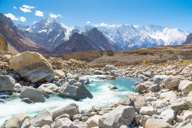
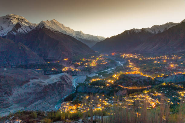
Fascinating view of Phandar valley during autumn season in the Ghizer district, Gilgit-Baltistan region of Pakistan
Browse 3,300+ hindu kush range stock photos and images available, or search for hinduism to find more great stock photos and pictures.
Fascinating view of Phandar valley during autumn season in the Ghizer district, Gilgit-Baltistan region of Pakistan

Evening view of Hindukush or Hindu kush mountain ridge, Tahikistan and Afghanistan, Wakhan corridor, Pamir highway or pamirskij trakt

A horizontal landscape view of Gilgit River passing through agricultural fields, trees, houses and mountains of Phander Valley situated in Ghizer, Gilgit Baltistan, Pakistan.

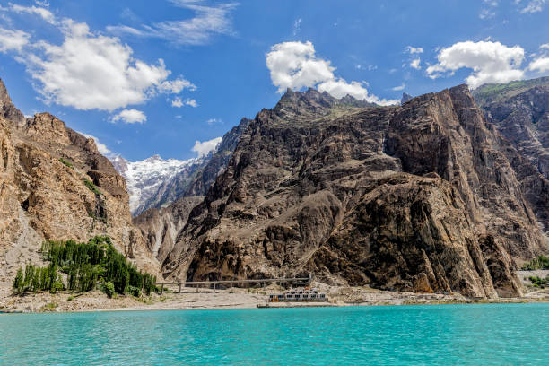
Khunjerab Pass, the highest border crossing in the world between Pakistan and China, taken in August 2019, post processed in HDR

Sayyad, Khulm district, Balkh province, Afghanistan: mud brick town by the Aybak river, on the foot-hills of the mountains.

"Landi Kotal, Pakistan - May 9, 2006 - Two Pakistani men (on the left a Pakistani soldier) looking over the mountains at the Pakistan-Afghanistan border. The mountain in the background are in Afghanistan"

bamiyan, buddha, statue, bamyan, afghanistan, taliban, hindu kush, islamic, muslim, afghan, unesco
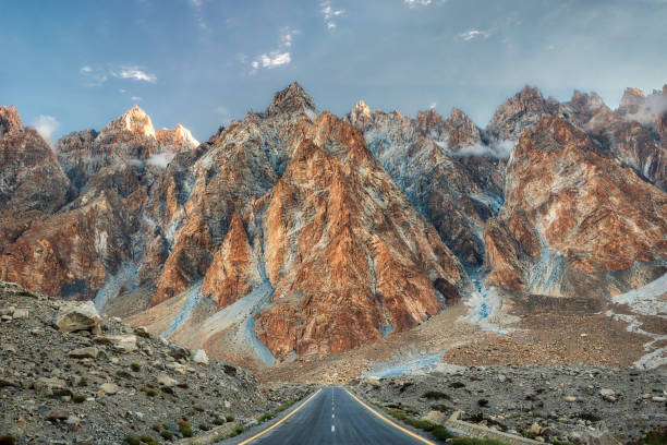
Passu Cones in Northern Pakistan, taken in August 2019, post processed in HDR

Mazar-i-Sharif, Balkh province, Afghanistan: mosque with silver dome, city rooftops and mountains in the background.
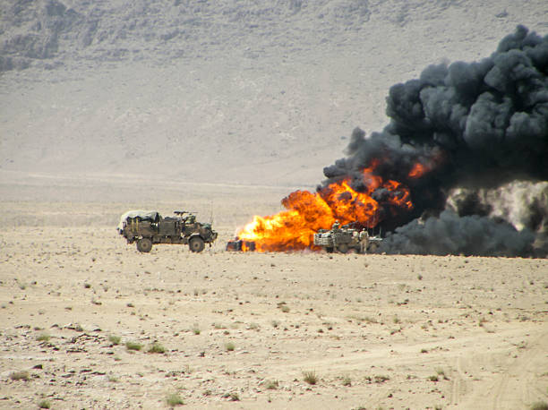
Military vehicles inspecting destroyed vehicle

The Baba Mountain range of the Hindu Kush between Kabul and Kandahar in Afghanistan

view of the Pakistani Karakorum mountains, K2 and Nanga Parbat. Clouds partly hide mountains, valleys and glaciers.

"3D render and image composing: Topographic Map of Pakistan. Including country borders, rivers and accurate longitude/latitude lines. Very high resolution available! High quality relief structure!Relief texture and satellite images courtesy of NASA. Further data source courtesy of CIA World Data Bank II database.Related images:"
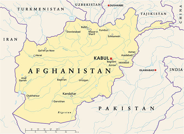
Political map of Afghanistan with capital Kabul, national borders, most important cities, rivers and lakes. Illustration with English labeling and scaling.

Scenic view of Katpana Desert in Northern Pakistan on the background of Karakoram mountains
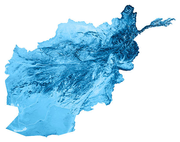
3D render and image composing: Topographic Map of Afghanistan. Isolated on White. High resolution available! High quality relief structure!

3D Render of a Topographic Map of Afghanistan. All source data is in the public domain. Color texture: Made with Natural Earth. http://www.naturalearthdata.com/downloads/10m-raster-data/10m-cross-blend-hypso/ Relief texture: NASADEM data courtesy of NASA JPL (2020). URL of source image: https://doi.org/10.5067/MEaSUREs/NASADEM/NASADEM_HGT.001 Water texture: SRTM Water Body SWDB: https://dds.cr.usgs.gov/srtm/version2_1/SWBD/ Boundaries Level 0: Humanitarian Information Unit HIU, U.S. Department of State (database: LSIB) http://geonode.state.gov/layers/geonode%3ALSIB7a_Gen

Along dirt track with weapons in mountainous Helmand

Khunjerab Pass, the highest border crossing in the world between Pakistan and China, taken in August 2019, post processed in HDR

Takht-i-Bahi, Pakistan - 30 Mar 2021: Takht-i-Bahi buddhist monastery in Mardan, Pakistan

Snow-capped peaks of the Hindu-Kush Mountains. Wakhan Corridor, on the border of Tajikistan and Afghanistan. Travels in Asia. Panorama landscape.
Panoramic view from Attabad lake, Karakoram highway passing through tunnel and bridge and high mountains

"3D render and image composing: Topographic Map of Afghanistan. Including country borders, rivers and accurate longitude/latitude lines. High resolution available! High quality relief structure!Relief texture and satellite images courtesy of NASA. Further data source courtesy of CIA World Data Bank II database.Related images:"
This is beautiful autumn in the late morning in Hunza valley , along Karakoram highway ,northern of Pakistan

Political map of Pakistan with capital Islamabad, national borders, most important cities, rivers and lakes. Illustration with English labeling and scaling.
view of the Pakistani Karakorum mountains, K2 and Nanga Parbat. Clouds partly hide mountains, valleys and glaciers.

3D render and image composing: Topographic Map of Pakistan. Isolated on White. Very high resolution available! High quality relief structure!

The Baba Mountain range of the Hindu Kush between Kabul and Kandahar in Afghanistan
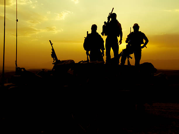
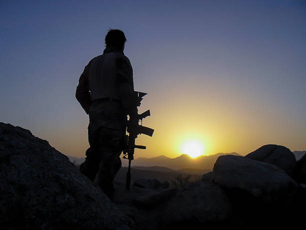
Silhouette of 3 soldiers at sunset with weapons

Evening view of hindukush or hindu kush mountain ridge, Tahikistan and afghanistan, view from Pamir highvay or pamirskij trakt
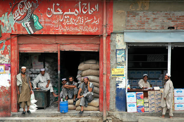
Landi Kotal, Khyber Pass, Khyber Pakhtunkhwa / Pakistan - Aug 16 2005: Local Muslim men outside two stores in Landi Kotal, Pakistan. One shop advertises Coca Cola. Landi Kotal is on the Khyber Pass.

Soldiers on mission in Helmand Afghanistan mountains

Bahrain town in Swat Valley, Pakistan in October 2022, a few months after Pakistan’s worst flooding in a decade caused by climate change. Swat is the country’s most popular tourist destination and is often called the Switzerland of Asia. There is a ski resort, and a plenty of ruins of an ancient civilization of Ghandara Kingdom. Swat houses of numerous Buddhist sites, which makes Swat one of an important destinations for Buddhist pilgrimage. The image shows a street full of damaged shops and restaurant, with building skeletons just like a war zone. The road is covered with boulders and stones brought by the torrential monsoon rain mixed with melted glacier. There is still leftover water on the road and with a beautiful greenish mountain and blue sky in the background.

Scenic view of Katpana Desert in Northern Pakistan on the background of Karakoram mountains

Baltit Fort in Karimabad, northern Pakistan, taken in August 2019, post processed in HDR

Driving past explosion in Helmand Afghanistan on mission

Selfie of young Caucasian man paramotor flying over Katpana Desert in Northern Pakistan

panjshir, valley, mujahideen, taliban, afghanistan, kapisa, hindu kush, afghan, middle east, islam
© 2025 iStockphoto LP. The iStock design is a trademark of iStockphoto LP. Browse millions of high-quality stock photos, illustrations, and videos.
Do Not Sell or Share