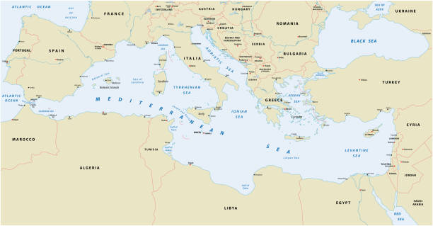
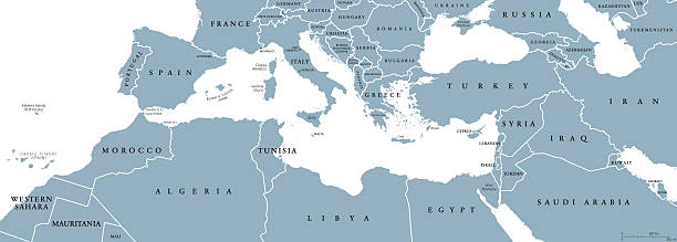
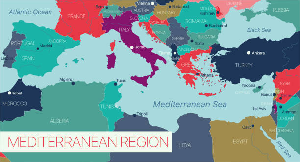
Mediterranean Basin Political Map. South Europe, North Africa and Near East with capitals, national borders, rivers and lakes. English labeling and scaling. Illustration.
Mediterranean Basin Political Map. South Europe, North Africa and Near East with capitals, national borders, rivers and lakes. English labeling and scaling. Illustration.
Mediterranean Basin political map. Mediterranean region, also Mediterranea. Lands around Mediterranean Sea. South Europe, North Africa and Near East. Gray illustration with English labeling. Vector.
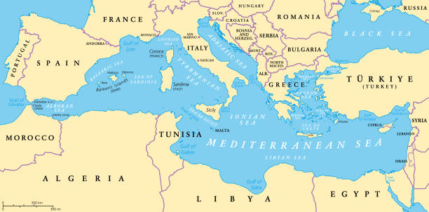
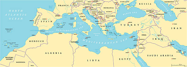
The Mediterranean Sea, political map with subdivisions, straits, islands and countries. Connected to the Atlantic Ocean, surrounded by the Mediterranean Basin, almost completely enclosed by land.
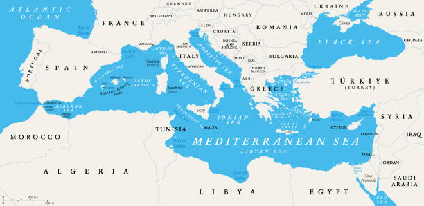
The Mediterranean Sea subdivisions, political map with straits, countries and the Black Sea. Connected to the Atlantic Ocean, surrounded by the Mediterranean Basin, almost completely enclosed by land.
Highly detailed vector map of Mediterranean with states, capitals and big cities.

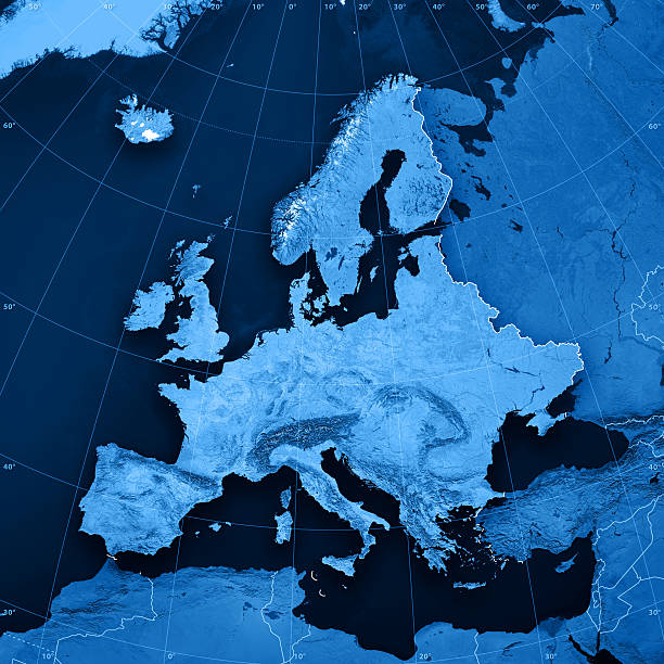
3D Render of a Topographic Map of Europe. Lambert Conformal Conic Projection. All source data is in the public domain. Color texture and Water: Made with Natural Earth. http://www.naturalearthdata.com/downloads/10m-raster-data/10m-cross-blend-hypso/ http://www.naturalearthdata.com/downloads/10m-physical-vectors/ Relief texture: GMTED 2010 data courtesy of USGS. URL of source image: https://topotools.cr.usgs.gov/gmted_viewer/viewer.htm
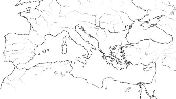
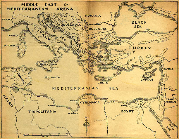
MEDITERRANEAN REGION: South Europe (Spain, French Riviera, Côte d’Azur, Provence, Italy, Balkans, Greece), Asia Minor (Turkey, Black Sea), Near East (Levant, Syria), North Africa (Lower Egypt, Libya, Tunisia, Morocco). -- Geographic Map with coastline, islands, main rivers (detailed geodesic chart).
3D render and image composing: Topographic Map of Europe. Including rivers and accurate longitude/latitude lines. High resolution available! High quality relief structure!Relief texture and satellite images courtesy of NASA. Further data source courtesy of CIA World Data Bank II database.Note: This image is perfectly congruent to the image

3D Render of a Topographic Map of Europe, India and Middle East. All source data is in the public domain. Color and Water texture: Made with Natural Earth. http://www.naturalearthdata.com/downloads/10m-raster-data/10m-cross-blend-hypso/ http://www.naturalearthdata.com/downloads/110m-physical-vectors/ Relief texture: GMTED 2010 data courtesy of USGS. URL of source image: https://topotools.cr.usgs.gov/gmted_viewer/viewer.htm
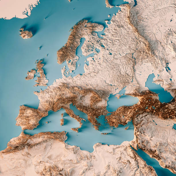
3D Render of a Topographic Map of Europe, including the region to the Ural mountains in the east and the northern part of Africa in the south. All source data is in the public domain. Color texture: Made with Natural Earth. http://www.naturalearthdata.com/downloads/10m-raster-data/10m-cross-blend-hypso/ Relief texture: GMTED2010 data courtesy of USGS. URL of source image: https://topotools.cr.usgs.gov/gmted_viewer/viewer.htm Water texture: HIU World Water Body Limits: http://geonode.state.gov/layers/?limit=100&offset=0&title__icontains=World%20Water%20Body%20Limits%20Detailed%202017Mar30
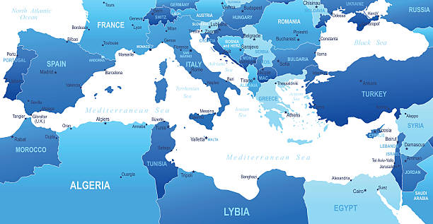
Highly detailed vector map of Mediterranean with states, capitals and big cities
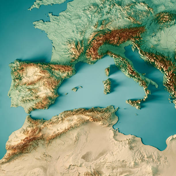
3D Render of a Topographic Map of the western Mediterranean Sea region. All source data is in the public domain. Color texture and Rivers: Made with Natural Earth. http://www.naturalearthdata.com/downloads/10m-raster-data/10m-cross-blend-hypso/ http://www.naturalearthdata.com/downloads/10m-physical-vectors/ Relief texture: SRTM data courtesy of USGS. URL of source image: https://e4ftl01.cr.usgs.gov//MODV6_Dal_D/SRTM/SRTMGL1.003/2000.02.11/ Water texture: HIU World Water Body Limits: http://geonode.state.gov/layers/?limit=100&offset=0&title__icontains=World%20Water%20Body%20Limits%20Detailed%202017Mar30

Southern France coastline, political map. Southernmost part of France, that border the Mediterranean Sea. Map with part of Occitania, Provence, French Riviera, Corsica, and with most important cities.

Map of Mediterranean I have used http://legacy.lib.utexas.edu/maps/world_maps/world_physical_2015.pdf

from out-of-copyright 1898 book "Blackie's Modern Cyclopedia of Universal Information".

Mediterranean Sea Region countries political map with national borders. South Europe, North Africa and Near East with national borders. English labeling and scaling. Illustration.

Tunisia with surrounding region as seen from Earth's orbit in space. 3D illustration with highly detailed planet surface and clouds in the atmosphere. Elements of this image furnished by NASA..

Highly detailed vector map of Mediterranean with states, capitals and big cities.
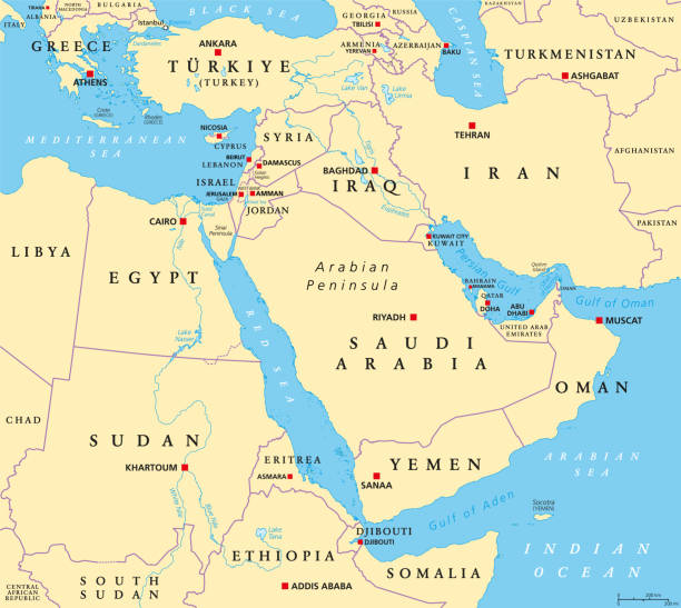
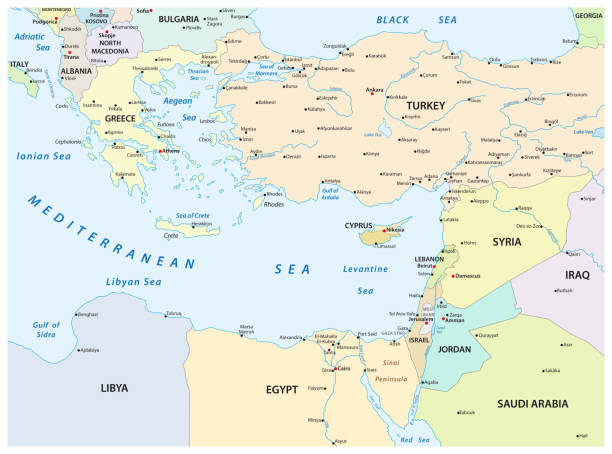
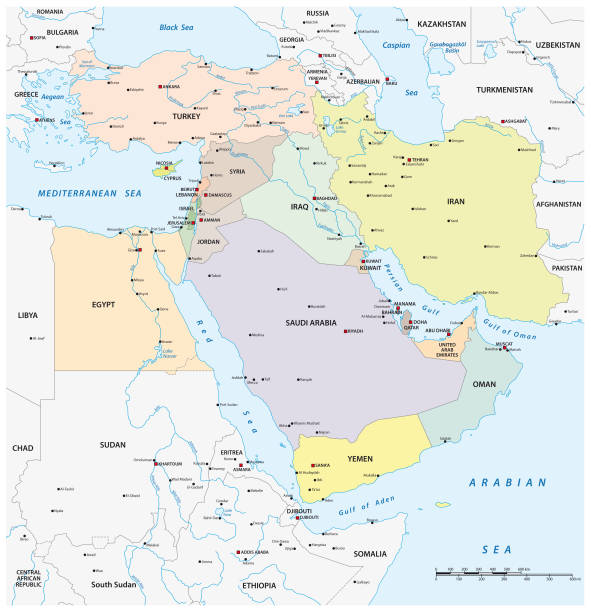
The Middle East, political map with capitals and international borders. Geopolitical region encompassing the Arabian Peninsula, the Levant, Turkey, Egypt, Iran and Iraq. Formerly called Near East.
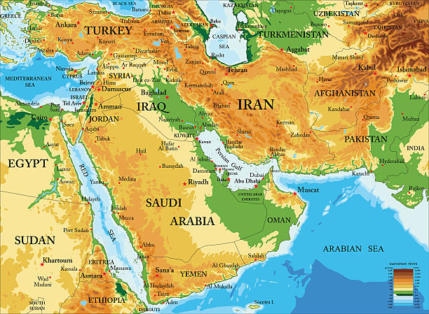
Highly detailed physical map of Middle East in vector format,with all countries, major cities and all the relief forms .
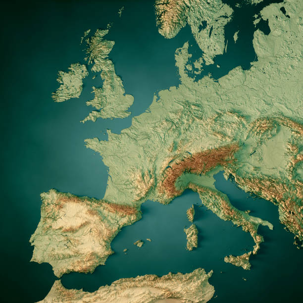
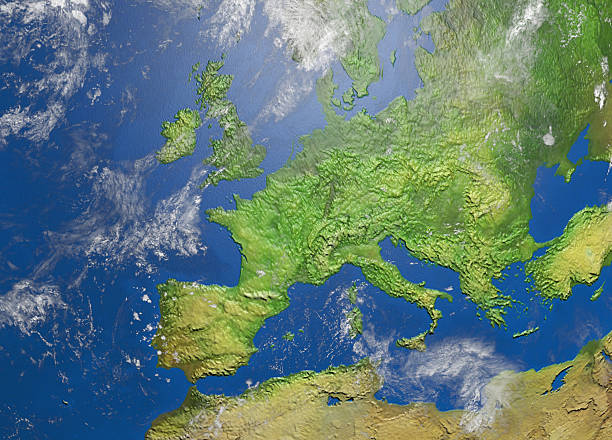
3D Render of a Topographic Map of Western Europe. All source data is in the public domain. Color texture and Water: Made with Natural Earth. http://www.naturalearthdata.com/downloads/10m-raster-data/10m-cross-blend-hypso/ http://www.naturalearthdata.com/downloads/10m-physical-vectors/ Relief texture: GMTED 2010 data courtesy of USGS. URL of source image: https://topotools.cr.usgs.gov/gmted_viewer/viewer.htm
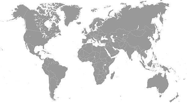
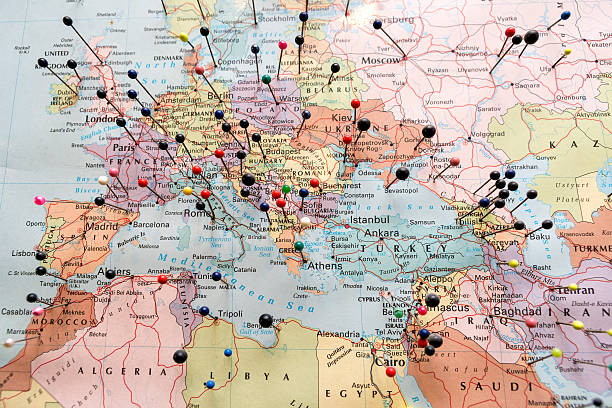
High Detailed World Map and Travel Icons - borders, countries and cities - vector illustration
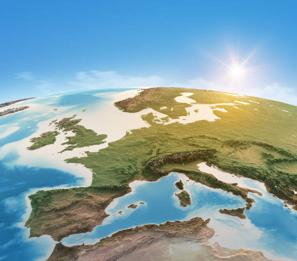
Physical map of Planet Earth, focused on Western Europe. Satellite view, sun shining on the horizon. 3D illustration (Blender software), elements of this image furnished by NASA (https://eoimages.gsfc.nasa.gov/images/imagerecords/147000/147190/eo_base_2020_clean_3600x1800.png)
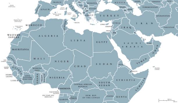
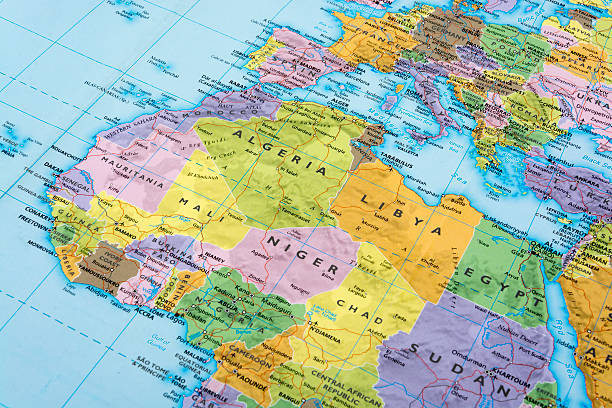
North Africa and Middle East political map with countries and borders. English labeling. Maghreb, Mediterranean, West and Central Asian countries. Gray illustration on white background. Vector.

3D Render of a Topographic Map of the Eastern Mediterranean Sea region. All source data is in the public domain. Color texture and Rivers: Made with Natural Earth. http://www.naturalearthdata.com/downloads/10m-raster-data/10m-cross-blend-hypso/ http://www.naturalearthdata.com/downloads/10m-physical-vectors/ Relief texture: SRTM data courtesy of USGS. URL of source image: https://e4ftl01.cr.usgs.gov//MODV6_Dal_D/SRTM/SRTMGL1.003/2000.02.11/ Water texture: HIU World Water Body Limits: http://geonode.state.gov/layers/?limit=100&offset=0&title__icontains=World%20Water%20Body%20Limits%20Detailed%202017Mar30
Mediterranian sea region detailed editable map with countries capitals. Vector EPS-10 file

Eastern Mediterranean Political Map with capitals national borders, important cities, rivers and lakes. English labeling and scaling. Illustration.

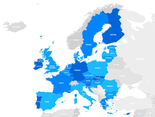
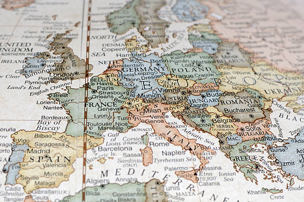
Europe, gray political map. Continent and part of Eurasia, located in the Northern Hemisphere, with about 50 sovereign states. Map with borders and English country names. Gray illustration over white.
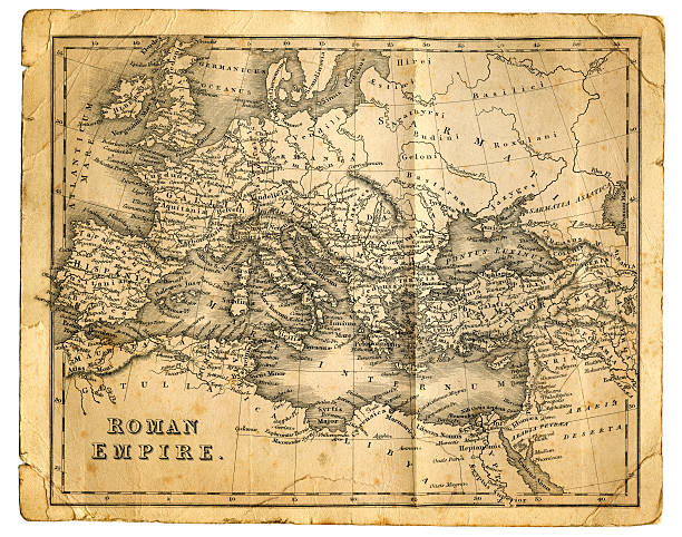
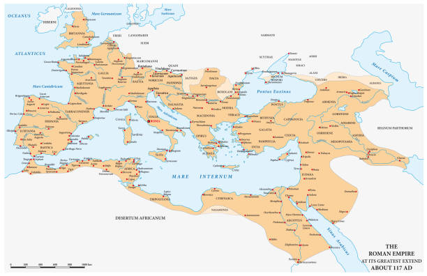
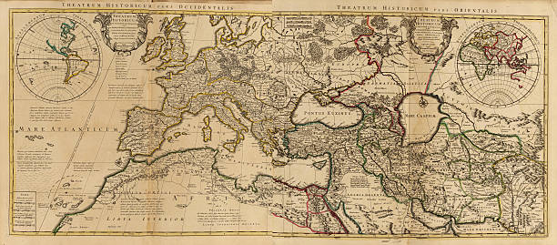
"Very detailed vintage map from 1827, showing the Roman Empire at its greatest extent. Photo by D Walker"

3D Render of a Topographic Map of Europe, India and Middle East. All source data is in the public domain. Color and Water texture: Made with Natural Earth. http://www.naturalearthdata.com/downloads/10m-raster-data/10m-cross-blend-hypso/ http://www.naturalearthdata.com/downloads/110m-physical-vectors/ Relief texture: GMTED 2010 data courtesy of USGS. URL of source image: https://topotools.cr.usgs.gov/gmted_viewer/viewer.htm
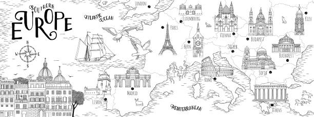
Hand drawn map of Southern Europe with selected capitals and landmarks, vintage web banner

North Africa and Middle East political map with most important capitals and international borders. Maghreb, Mediterranean, West and Central Asian countries. Illustration with English labeling. Vector
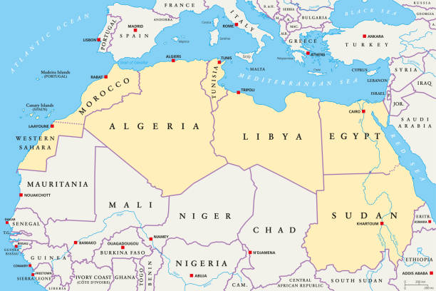
North Africa region, political map. Yellow colored area, with capitals and borders. Collective term for a group of Mediterranean countries on African continent. English labeling. Illustration. Vector.
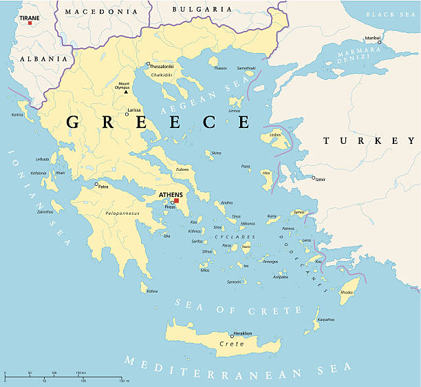
Political map of Greece with the capital Athens, national borders, most important cities, rivers and lakes. With english labeling and scale.
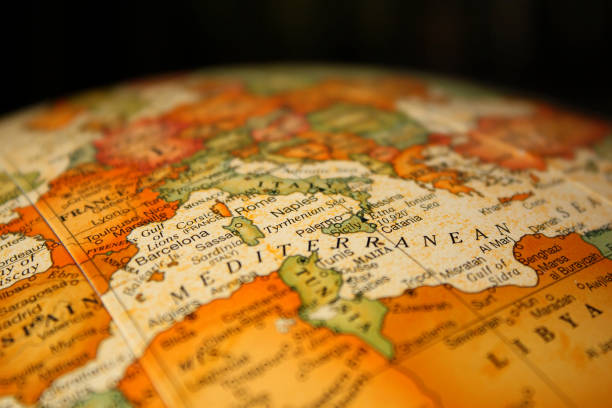
A close-up/macro photograph of Europe from a desktop globe. Adobe RGB color profile.

"Highly detailed map of Mediterranean Europe with border, coastline and compass. There are 20 named layers, with each country on its own layer. All elements are seperate and can be edited or customised to your needs."
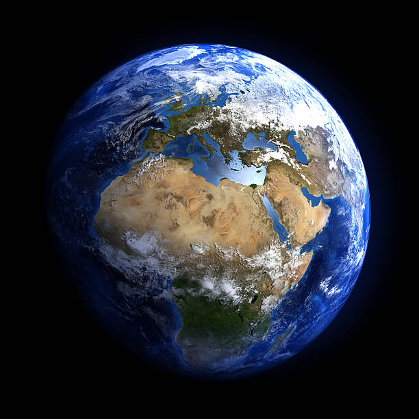
Extremely detailed image, including elements furnished by NASA. Other orientations available.