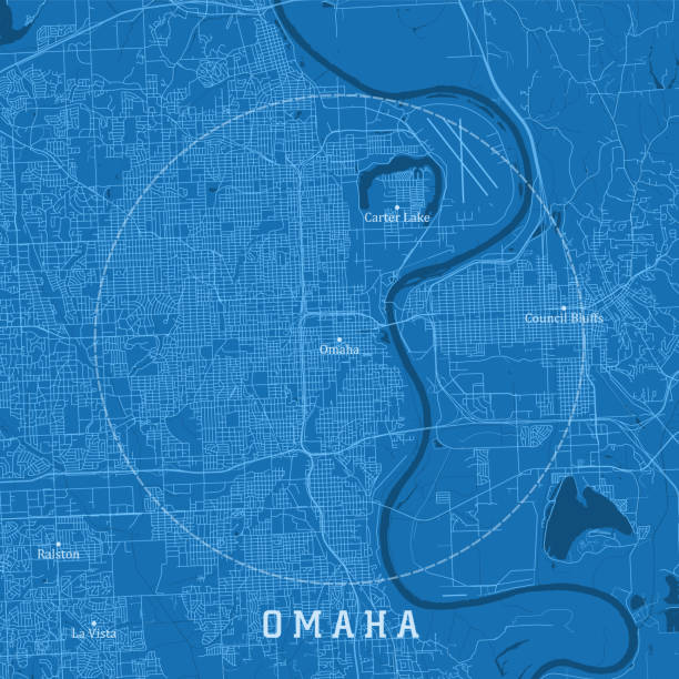
Omaha NE City Vector Road Map Blue Text. All source data is in the public domain. U.S. Census Bureau Census Tiger. Used Layers: areawater, linearwater, roads.
Browse 370+ omaha map stock photos and images available, or search for nebraska to find more great stock photos and pictures.
Omaha NE City Vector Road Map Blue Text. All source data is in the public domain. U.S. Census Bureau Census Tiger. Used Layers: areawater, linearwater, roads.
Poster Style Topographic / Road map of Omaha, Nebraska, USA. Original map data is open data via © OpenStreetMap contributors. All maps are layered and easy to edit. Roads have editable stroke.
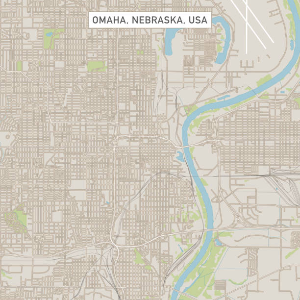
Topographic / Road map of Omaha, Nebraska, USA. Original map data is open data via © OpenStreetMap contributors. All maps are layered and easy to edit. Roads have editable stroke.

"A red pushpin pointing to Omaha, Nebraska on a map."
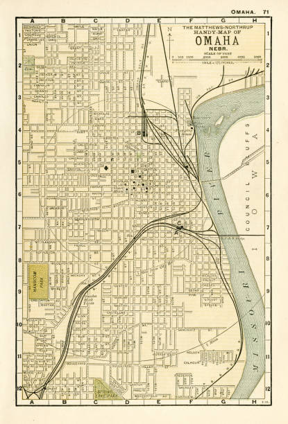
Map from the Complete Handy Atlas of the World - 1898
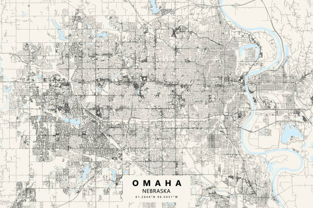
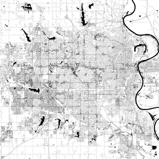
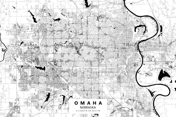
Vector Illustration of a City Street Map of Omaha, Nebraska, USA. Scale 1:60,000. All source data is in the public domain. U.S. Geological Survey, US Topo Used Layers: USGS The National Map: National Hydrography Dataset (NHD) USGS The National Map: National Transportation Dataset (NTD)
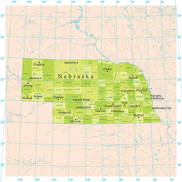
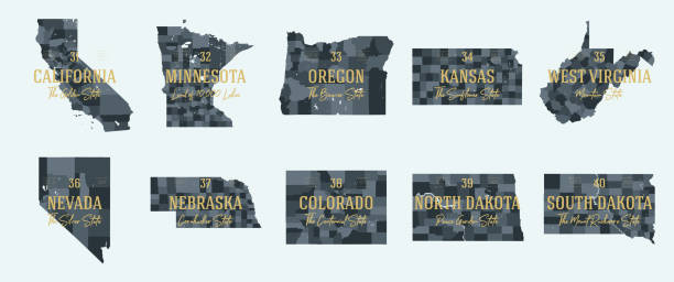
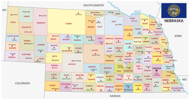
Detailed vector map of the US State of Nebraska with administrative divisions. The colors in the .eps-file are ready for print (CMYK). Included files are EPS (v10) and Hi-Res JPG (4924 x 4924 px).

Road map of Nebraska, US American federal state. Editable highly detailed transportation map of Nebraska with highways and interstate roads, rivers and cities vector illustration

Push pin indicating position of Omaha, Nebraska on a generic map. Surrounding area slightly blurred leaving Omaha in focus.

All elements were drawn in a vector graphics editor and design program. Elements and layers are well organized, separable, detachable and easy to use and edit. Map data is in the public domain, available from the United States Census Bureau via census.gov
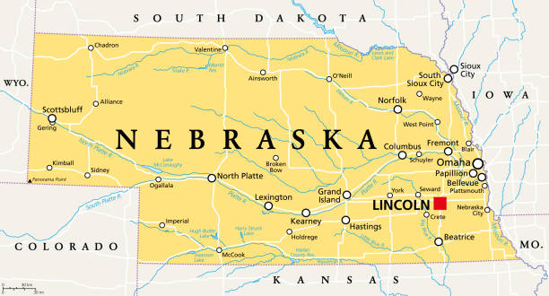
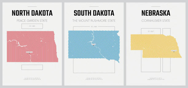
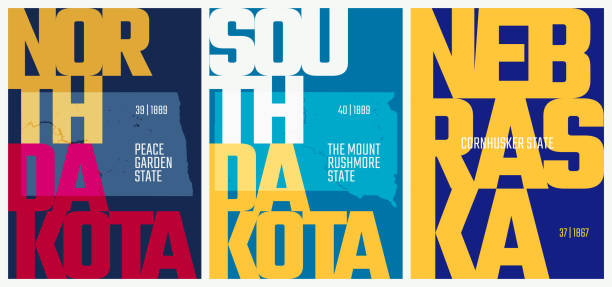
Nebraska, NE, political map with the capital Lincoln and the largest city Omaha. Triply landlocked State in the Midwestern subregion of the United States of America, nicknamed Cornhusker State. Vector

Map of Nebraska created with a mesh of thin bright blue lines and glowing dots, isolated on a dark blue background. Conceptual illustration of networks (communication, social, internet, ...). Vector Illustration (EPS10, well layered and grouped). Easy to edit, manipulate, resize or colorize.
Iowa, state of USA - solid black silhouette map of country area. Simple flat vector illustration.
nebraska road vector map with flag.
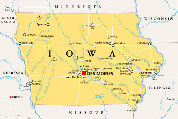
Iowa, IA, political map, with the capital Des Moines and most important cities, rivers and lakes. State in the Midwestern region of the United States of America, nicknamed The Hawkeye State. Vector.

Map of Nebraska, South Dakota and Kansas State in USA. Detail from the World Map.
nebraska administrative and political vector map with flag.
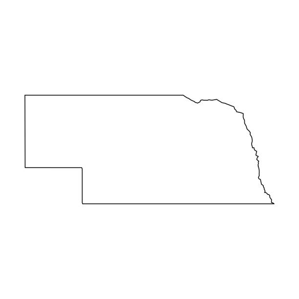
Nebraska, state of USA - solid black outline map of country area. Simple flat vector illustration.
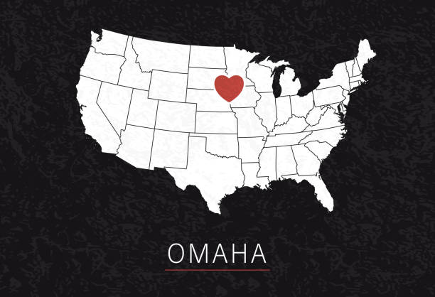
Love Omaha Picture. Map of United States with Heart as City Point. Vector Illustration

vector illustration of Nebraska map
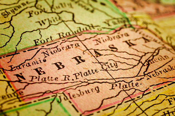
Nebraska on a 1880's map. Nebraska is a state that lies in both the Great Plains and the Midwestern United States. Its state capital is Lincoln. Its largest city is Omaha, which is on the Missouri River. Selective focus and Canon EOS 5D Mark II with MP-E 65mm macro lens.

Topographic / Road map of Omaha, Nebraska, USA. Original map data is open data via © OpenStreetMap contributors. All maps are layered and easy to edit. Roads have editable stroke.
Poster Style Topographic / Road map of Omaha, Nebraska, USA. Original map data is open data via © OpenStreetMap contributors. All maps are layered and easy to edit. Roads have editable stroke.

Map of Nebraska State in USA.
Nebraska map shape, united states of america. Flat concept icon symbol vector illustration .
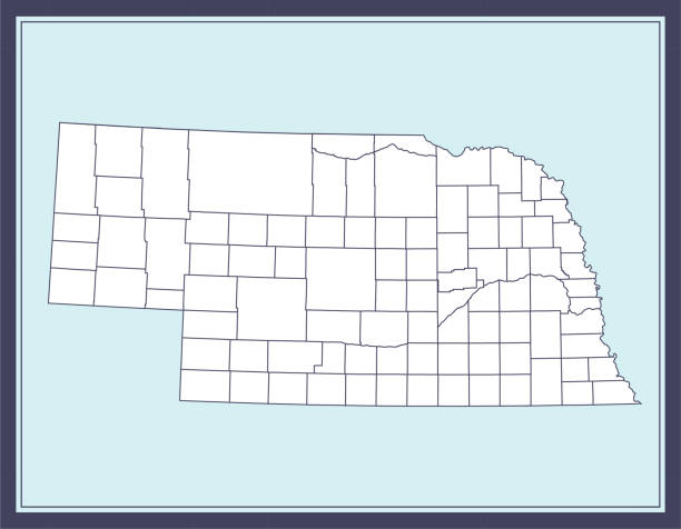
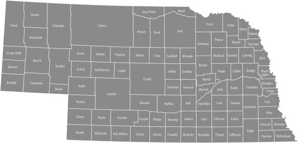
Printable counties map of Nebraska state of United States of America. The map is accurately prepared by a map expert.
Nebraska map shape, united states of america. Flat concept icon symbol vector illustration .

black outline of Nebraska map- vector illustration

Map of Nebraska cut out on a blank white paper with a blue background. Modern and trendy paper cutout effect. Vector Illustration (EPS file, well layered and grouped). Easy to edit, manipulate, resize or colorize. Vector and Jpeg file of different sizes.

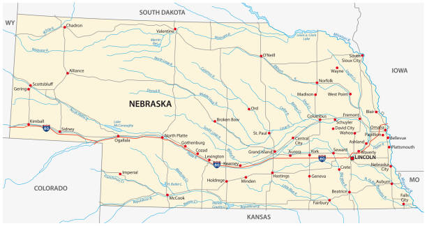
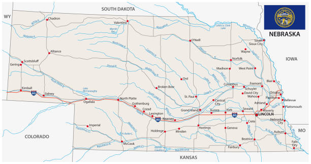
A vintage-style map of Nebraska with freeways, highways and major cities. Shoreline, lakes and rivers are very detailed. Includes an EPS and JPG of the map without roads and cities. Texture, compass, cities, etc. are on separate layers for easy removal or changes.
Nebraska map shape, united states of america. Flat concept icon symbol vector illustration .

Maps of Nebraska created with round dots and square dots, isolated on a white and blank background. Modern and trendy mosaic illustrations in different halftone styles. Vector Illustration (EPS file, well layered and grouped). Easy to edit, manipulate, resize or colorize. Vector and Jpeg file of different sizes.

Detailed map of Nebraska with pointers.

Poster Style Topographic / Road map of Omaha, Nebraska, USA. Original map data is open data via © OpenStreetMap contributors. All maps are layered and easy to edit. Roads have editable stroke.
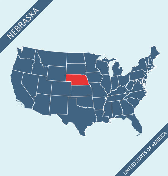
Highly detailed map of United States of America with highlighted state of Nebraska for web banner, mobile, smartphone, iPhone, iPad applications and educational use. The map is accurately prepared by a map expert.

Map of South Dakota and Nebraska States in USA. Detail from the World Map.

vector illustration of Nebraska maps

White map of Nebraska isolated on a gray background with a long shadow effect and in a flat design style. Vector Illustration (EPS10, well layered and grouped). Easy to edit, manipulate, resize or colorize.

Detailed vector map of the US State of Nebraska with administrative divisions. The colors in the .eps-file are ready for print (CMYK). Included files are EPS (v10) and Hi-Res JPG.

Map of Nebraska in a trendy vintage style. Beautiful retro illustration with old textured paper and a black long shadow (colors used: blue, green, beige and black). Vector Illustration (EPS10, well layered and grouped). Easy to edit, manipulate, resize or colorize.

Nebraska. Vector silhouette state. Nebraska map with text script. Nebraska shape state map for poster, t-shirt, tee, souvenir. Vector outline Isolated illustratuon on a white background.
© 2025 iStockphoto LP. The iStock design is a trademark of iStockphoto LP. Browse millions of high-quality stock photos, illustrations, and videos.
Do Not Sell or Share